


7 locations
Add Location
 Full Listing
Show more
Hike
Added on 15 Mar 2017
Full Listing
Show more
Hike
Added on 15 Mar 2017
 Full Listing
Show more
Hike
Added on 2 Feb 2017
Full Listing
Show more
Hike
Added on 2 Feb 2017
 Full Listing
Show more
Sled
Added on 10 Nov 2016
Full Listing
Show more
Sled
Added on 10 Nov 2016
 Full Listing
Show more
Sled
Added on 10 Nov 2016
Full Listing
Show more
Sled
Added on 10 Nov 2016
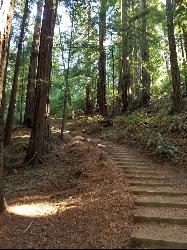
Muir Woods National Monument
Mill Valley, California
1.9 miles W of Mill Valley, CaliforniaMuir Woods National Monument is one of the great natural cathedrals of California, a hushed grove of ancient coast redwoods tucked into a fog-cooled canyon just 12 miles north of the Golden Gate Bridge near Mill Valley. Part of the Golden Gate National Recreation Area, its 554 acres protect 295 acres of old-growth redwood forest, where wooden footpaths wind between towering trees, many of them 600 to 800 years old and soaring up to 250 feet, along the banks of Redwood Creek. It is a genuinely awe-inspiring place, and one of the most beloved parks in the Bay Area.
The forest is the whole experience. Walking beneath these giants, in the cool green light filtering through the canopy with the creek murmuring alongside, is unlike anywhere else so close to a major city. The park offers about six miles of trails, from easy half-hour loops to more challenging routes that climb out of the canyon and connect with Mount Tamalpais State Park. The Main Trail is paved and wheelchair-accessible for its first mile, running level alongside Redwood Creek, which makes the heart of the grove reachable for just about any age or ability.
The single most important thing to know before visiting is that reservations are required. Because parking and the shuttle are limited and the park is enormously popular, you must reserve a parking spot or a shuttle seat in advance; you cannot simply drive up and get in. There is also an entrance fee (children are free), a standard national-park charge. Booking ahead through the official reservation system is non-negotiable, and it's the difference between a magical morning and being turned away at the road.
Muir Woods is open 365 days a year and opens at 8 a.m., and the early birds are rewarded: the first hours bring the best light for photos, the quietest trails, and the classic redwood-forest fog before the crowds arrive. It gets genuinely busy by midday, so an early reservation is the move.
The coastal climate means it's cool and often damp year-round, even when the rest of the Bay Area is warm, so layers and a rain shell are wise in any season. The paved main loop is stroller- and wheelchair-friendly; the connecting trails into the hills are steeper and rougher.
Come with warm layers, comfortable shoes, a camera, and, above all, a reservation made in advance. For a walk among 800-year-old giants in a fog-wrapped canyon minutes from San Francisco, Muir Woods is a bucket-list experience that fully earns its fame.
12.1 mi
 Full Listing
Show more
Hike, Horseback
Added on 14 Mar 2017
Full Listing
Show more
Hike, Horseback
Added on 14 Mar 2017
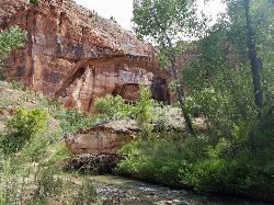
Escalante River
Escalante, Utah
1.2 miles E of Escalante, UtahThe Escalante River is the wild green thread running through the heart of the Grand Staircase-Escalante National Monument, and hiking it is one of the signature experiences of southern Utah's slickrock country. Rather than following a trail beside the water, here the river largely is the trail: you wade, splash and hike in and out of the water through a stunning sandstone canyon near the towns of Escalante and Boulder, in a landscape of towering walls, hanging gardens and desert solitude.
The most popular introduction is the day hike to Escalante Natural Bridge, a moderate walk of about 4.4 miles round trip with only modest elevation gain. It's an easy, family-friendly sampler of the canyon that packs in a remarkable amount: the impressive 130-foot-high Escalante Natural Bridge, a skyline arch, Ancestral Puebloan (Anasazi) ruins, a petroglyph panel, and the mouth of a narrow tributary canyon. The trail crosses the Escalante River four times, and most of the year the water is only ankle-deep at the crossings.
For those wanting more, the full Escalante River Trail is a roughly 15-mile point-to-point backpacking route, a genuine canyon immersion where the river is your path for miles, wading through pools and around cottonwood groves deep in the monument's backcountry. It's a classic Colorado Plateau backpack for those prepared for wet feet and route-finding.
The river crossings are the thing to respect: while usually shallow, the Escalante can run much deeper and faster during spring runoff and after summer thunderstorms, when flash flooding is a genuine danger in these narrow canyons, so checking the weather and flow before entering the canyon is essential. April through November is the practical season, with spring and fall the most pleasant and summer bringing heat and monsoon storms.
This is remote desert canyon country with little shade and no services once you leave the trailhead, so ample water and sun protection matter. Between wading a living river through Ancestral Puebloan history to a 130-foot natural bridge, the Escalante River offers one of the most distinctive and rewarding hikes on the entire Colorado Plateau.
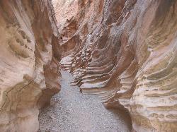
Little Wild Horse & Bell Canyon
Green River, Utah
44.7 miles SW of Green River, UtahThis HIKERS ONLY loop trail is about 8 miles, with a 700 ft elevation gain. People often only hike the Little Wild Horse part, which is a 3.3 mile one way section of the trail. It's a relatively easy trail, for all ages. The LIttle Wild Horse trail is a slot canyon set in the red rock sandstone of Southern Utah and winds its way through the San Rafael Swell. Its twisty and turny and beautiful. The Bell canyon section is actually the easier trail, but not nearly as interesting. Crowds and rain can be a problem, so be respectful and watch the weather. Rain and snow runoff are very dangerous in slot canyons.
Be aware that during the wet season water can pool, so be prepared to maybe get a little wet.
Cherry Hill Park
Orem, Utah
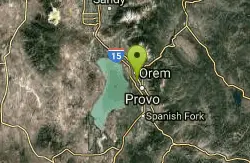
2.3 miles S of Orem, UtahJust south of Cherry Hill Elementary, this is a small hill for small children great and moms who are looking to avoid a well populated hill. The hill is to the south of the playground and most easily reached from the parking lot off W 1800 S.
Rock Canyon Park
Provo, Utah
2.6 miles NE of Provo, UtahRock Canyon Park is Provo's premier sledding destination, a large, beloved city park at the base of the Wasatch Mountains in northeastern Provo, right up against the peaks and kitty-corner to Brigham Young University. When the snow falls, this becomes the number-one sledding spot in Utah Valley by local acclaim, a big, bowl-shaped park with slopes for every level, from gentle runs for little kids to steeper pitches for the adrenaline seekers.
The park's shape is its secret. As the largest park in Provo, it offers numerous hills and levels of intensity in one place, and its natural bowl-like contours turn into fantastic sledding slopes once the snow arrives. That variety is the appeal: families can spread out, with younger children on the mellow slopes and older kids and adults chasing speed on the bigger hills, all in the same visit and all within sight of each other.
Practicalities are easy. There's plenty of parking, no entrance fee, and the park is open daily from 7 a.m. to 11 p.m., with restrooms and playgrounds on site that come in handy on a snow day. Set against the dramatic backdrop of the Wasatch and the mouth of Rock Canyon, it's a genuinely scenic place to spend a winter afternoon.
Standard sledding caution applies. Speeds build quickly on packed or icy snow, and the steeper hills in particular deserve a clear runout and an adult keeping watch on younger sledders; with a mix of slopes in one park, it's worth steering little kids to the gentler runs and checking where a fast hill lets out. Helmets are never a bad idea on the bigger pitches.
Winter obviously depends on the snow, with the best runs coming the morning after a fresh fall before the slopes get skied out and glazed; the park is a green city park the rest of the year, popular for its trails, fields and the nearby Rock Canyon hiking. Mornings are quieter than afternoons on a good snow day.
Dress for the cold in waterproof layers and good boots, bring your own sled or tube. With free access, ample parking, a range of slopes for every age and a spectacular mountain setting, Rock Canyon Park earns its reputation as the go-to sledding hill in Provo and one of the best in all of Utah Valley.
3.0 mi
 Full Listing
Show more
Hike, Swim
Added on 1 Aug 2016
Full Listing
Show more
Hike, Swim
Added on 1 Aug 2016
Lionhead Natural Water Slide
Coolin, Idaho
20.0 miles N of Coolin, IdahoHidden in the old-growth forest near Priest Lake in Idaho's far north, the Lionhead Natural Water Slide is one of the most delightfully unique adventures in the state — a long, naturally polished granite chute that sends sliders careening down the rock on a thin sheet of icy mountain water. Often called Idaho's only natural water slide, it's a bucket-list summer thrill for those willing to hike in and brave the cold.
The journey is part of the magic. From the Lionhead area at the north end of Priest Lake, the Lion's Head Creek Trail runs about 3 miles round trip (with a few hundred feet of climbing), winding through stunning stands of ancient cedars, past creeks and small waterfalls, and across a chilly mountain stream before emerging above the slides. Bring shoes you don't mind soaking, because you'll cross water along the way.
The slide itself is a roughly 100-foot ramp of water-smoothed granite. The local tradition is to ride it seated on a plastic garbage bag (some add a little foam padding), leaning back and letting the rushing water carry you down the rock face into the small pool at the bottom. It's exhilarating, icy, and a whole lot of fun.
Be careful — this is a real natural feature, not an engineered ride, and people do get hurt here. Most years see one or two broken bones. The single most important rule: stay off the slide during spring runoff and any time the water is high or fast, when the current can flush sliders over the top and into the rocks below. Wait for mid-to-late summer when flows drop, scout the run before you commit, go feet-first, and remember that cold water and hard rock leave little margin for error.
Time your visit for July through early September, when the water has mellowed and the forest is at its best. Pack your garbage bag, sturdy wet-ready shoes, a towel, and a sense of adventure, and Lionhead will reward you with a one-of-a-kind ride that northern Idaho does better than anywhere else.
1.9 mi
 Full Listing
Show more
Hike
Added on 14 Aug 2015
Full Listing
Show more
Hike
Added on 14 Aug 2015
Terraced Falls
Grant Village, Yellowstone National Park
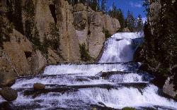
23.2 miles SW of Grant Village, Yellowstone National ParkTerraced Falls is a hidden gem in Yellowstone's remote Cascade Corner — the wild, waterfall-rich southwest region of the park — where the Fall River plunges more than 150 feet through a dramatic series of six rocky “terraces” into a deep canyon. Far from the crowded boardwalks of the park's interior, this quiet trail rewards hikers with one spectacular cascade after another in a peaceful forest setting.
The hike is a delight, and surprisingly easy for the scenery it delivers: about 4 miles round trip, following beautiful Cascade Creek and then the Fall River as they tumble through a string of frothy waterfalls (none huge on their own, but each lovely) on the way to the grand finale at Terraced Falls. The trail ambles gently through the forest, never far from the sound of rushing water.
Getting there is part of the adventure, since Cascade Corner is reached not through the park's main entrances but via Grassy Lake Road from the Flagg Ranch area near the south entrance. Plan to drive roughly 10–11 miles on a gravel national-forest road (most passenger cars can manage it slowly) to the Cascade Canyon trailhead. Note the road may be closed early in the season due to high water, so it's best from summer into fall.
This is true Yellowstone backcountry: carry bear spray and be bear aware, bring plenty of water, stay back from the slippery canyon rims and powerful water, and pack out everything. There are no services out here, so come self-sufficient. For hikers willing to venture to Yellowstone's quiet corner, Terraced Falls offers a string of stunning waterfalls and a kind of solitude that's hard to find anywhere else in the park.
×


