


Bald Eagle State Park Beach
Howard
Camp, Canoe, Hike, Kayak, and Swim
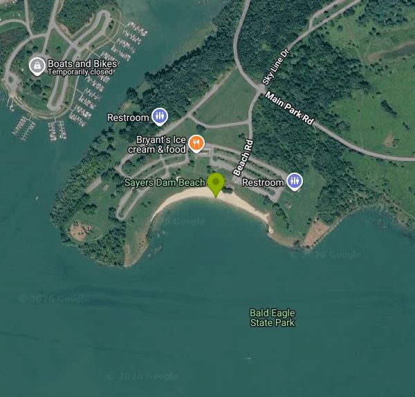
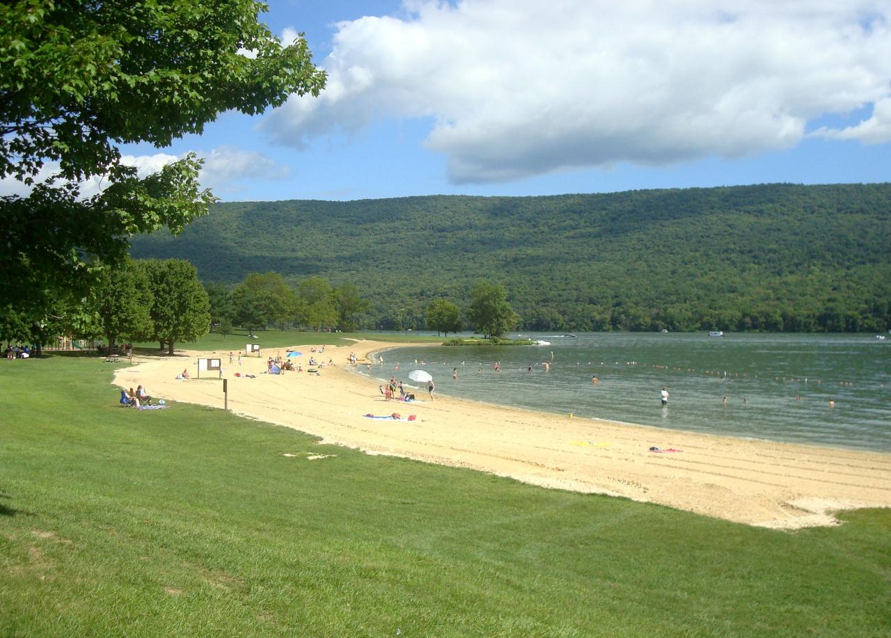
Bald Eagle State Park Beach is the public swimming beach on Foster Joseph Sayers Lake, the 1,730-acre reservoir at the heart of Bald Eagle State Park in Centre County, Pennsylvania. The Pennsylvania Department of Conservation and Natural Resources (DCNR) runs the park's recreation areas in cooperation with the U.S. Army Corps of Engineers, which finished Foster Joseph Sayers Dam on Bald Eagle Creek in 1969 for flood control. The beach sits on the northwest shore about a mile northeast of the borough of Howard, looking across the water at the long wooded ridge of Bald Eagle Mountain.
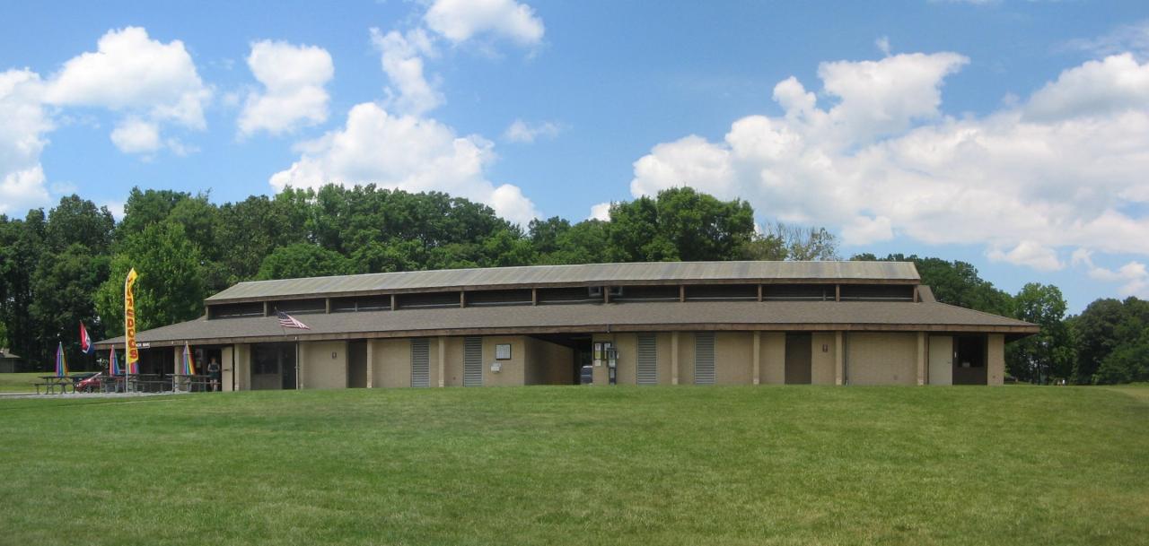
The park lies along PA 150 between Milesburg and Lock Haven. Coming on I-80 from the west, take Exit 158 at Milesburg and follow PA 150 north for about 10 miles. From the east, take Exit 178 to US 220 north, then PA 150 south for about 13 miles. Inside the park, Main Park Road leads to Beach Road, which ends at the beach parking lots. The park office is at 149 Main Park Road, Howard (814-625-2775). Restrooms and a beach house with changing rooms stand on the lawn just behind the sand.
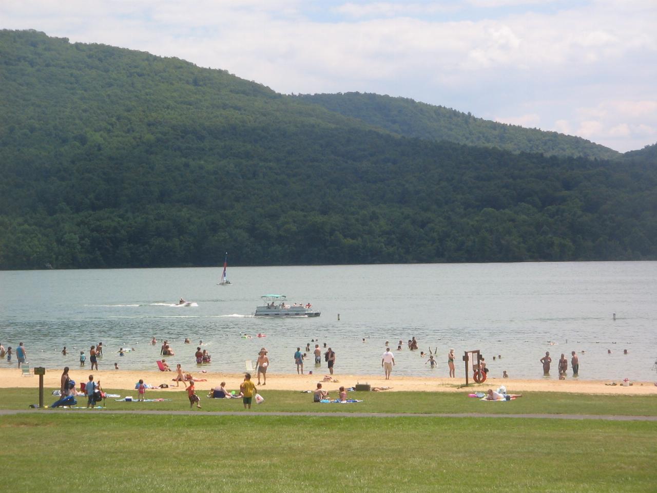
DCNR describes the beach as 1,200 feet of sand and turf. In practice it is a strip of sand that curves around a low point, backed by a wide mowed lawn where most people set up blankets and chairs. A buoy line marks off the swimming area in the shallows. This is a reservoir, so there is no current to fight, but it is untreated lake water with a soft lake bottom past the sand. The swimming area is open 8:00 a.m. to sunset from Memorial Day to Labor Day unless posted otherwise, and it is a swim-at-your-own-risk beach, which means no lifeguards. Children 10 and under must be with someone at least 14 years old. Tubes, noodles and air mattresses are allowed. Pets are not allowed in the swimming area, and smoking (e-cigarettes included) is banned on the beach and in the water, with designated smoking spots nearby.
It costs nothing to swim here. DCNR charges no entrance or day-use fees at any Pennsylvania state park, so parking and beach use are free. The park is open every day from sunrise to sunset. Fees only apply to extras such as campsites, cottages and reserved picnic pavilions.
Know the hazards before you go. Sayers is a flood-control lake, so the Corps raises and lowers the water through the year, and heavy rain has closed the park's boat launches before. Powerboats with unlimited horsepower run on the lake at speeds up to 45 mph, so stay inside the buoys. With no lifeguards, watch kids closely.DCNR asks swimmers not to swallow lake water, to stay out when they are sick, and to shower before and after. Pennsylvania posts harmful algal bloom advisories at affected lakes, so read the signs at the beach before getting in. The nearest hospital is in Lock Haven, about 13 miles north on PA 150.
The beach is the center of the park's main day-use area. The Beach Picnic Area next door has pavilions and a playground, and the marina just to the west rents boats in summer. Kayaks, canoes, paddleboards and sailboats all use the 8-mile-long lake, which has six boat launches. Anglers go after bass, crappie, yellow perch and channel catfish. About 14.5 miles of trails cross the park, and the Russell P. Letterman Campground, with 94 sites, is less than a mile from the beach. There is also a rustic campground and the Nature Inn.
More Information
Bald Eagle State Park | Department of Conservation and Natural Resources| Commonwealth of Pennsylvan
Adventure awaits at Bald Eagle State Park in central Pennsylvania. 149 Main Park Road Howard, PA 16841-3508 814-625-2775 baldeaglesp@pa.gov
https://www.pa.gov/agencies/dcnr/recreation/where-to-go/state-parks/find-a-park/bald-eagle-state-parkBoating at Bald Eagle State Park | Department of Conservation and Natural Resources| Commonwealth of
♿ The 1,730-acre FJ Sayers Lake is a key feature of Bald Eagle State Park, and is popular for boating with:
https://www.pa.gov/agencies/dcnr/recreation/where-to-go/state-parks/find-a-park/bald-eagle-state-park/boatingCorps Lakes Gateway: Pennsylvania - Foster Joseph Sayers Dam
An official website of the United States government Here's how you know
https://corpslakes.erdc.dren.mil/visitors/projects.cfm?Id=E117050Hiking at Bald Eagle State Park | Department of Conservation and Natural Resources| Commonwealth of
14.5 miles of trails A network of hiking trails guides hikers through a variety of habitats that offer scenic views and wildlife watching opportunities. Additional unnamed extension trails lead to rec...
https://www.pa.gov/agencies/dcnr/recreation/where-to-go/state-parks/find-a-park/bald-eagle-state-park/hikingState Park Prices | Department of Conservation and Natural Resources| Commonwealth of Pennsylvania
There are no entrance fees or day use fees for any state park in Pennsylvania.
https://www.pa.gov/agencies/dcnr/recreation/where-to-go/state-parks/state-park-pricesState Parks Series: Bald Eagle State Park has a plethora of outdoor recreation to choose from - The
HOWARD — When you think of state parks, if you’re from Clinton or Centre County, there’s a good chance you’re thinking of Bald Eagle State Park. While it is far from the only park in the region, it is the largest, at 5,900 acres. Several notable annual events take place at the park — Punkin’ […]
https://www.lockhaven.com/news/outdoors/2026/05/state-parks-series-bald-eagle-state-park-has-a-plethora-of-outdoor-recreation-to-choose-from/Stay the Night at Bald Eagle State Park | Department of Conservation and Natural Resources| Commonwe
Bald Eagle State Park offers both modern and rustic camping experiences.
https://www.pa.gov/agencies/dcnr/recreation/where-to-go/state-parks/find-a-park/bald-eagle-state-park/staySwimming at Bald Eagle State Park | Department of Conservation and Natural Resources| Commonwealth o
♿ Bald Eagle State Park has a 1,200-foot-long sand and turf beach which includes:
https://www.pa.gov/agencies/dcnr/recreation/where-to-go/state-parks/find-a-park/bald-eagle-state-park/swimmingBe courteous, informed, and prepared. Read trailhead guidelines, stay on the trail, and don't feed the wildlife.
Read More
- Plan Ahead and Prepare
- Travel & camp on durable surfaces
- Dispose of waste properly
- Leave what you find
- Minimize campfire impacts
- Respect wildlife
- Be considerate of other visitors
Directions
From Howard
- Head south on Georgia Ave NW toward Florida Ave NW (259 ft)
- Turn left onto Florida Ave NW (0.1 mi)
- Turn right onto 6th St NW (0.7 mi)
- Turn left onto M St NW (0.2 mi)
- Turn right onto 4th St NW (253 ft)
- Continue straight onto I-395 S (1.4 mi)
- Keep right to stay on I-395 S, follow signs for Richmond (1.3 mi)
- Keep right to stay on I-395 SEntering Virginia(0.8 mi)
- Take exit 10C for George Wash Mem Pkwy toward Memorial BridgeEntering District of Columbia(0.2 mi)
- Merge onto George Washington Mem PkwyEntering Virginia(10.3 mi)
- Take the exit onto I-495 N toward MarylandEntering Maryland(4.0 mi)
- Slight left onto I-270 N (31.4 mi)
- Take exit 32 to merge onto I-70 W toward HagerstownEntering Pennsylvania(76.7 mi)
- Take the US-30 E exit toward I-70 W/
Harrisburg/ McConnellsburg/ New Stanton/ Pennsylvania Turnpike (312 ft) - Turn right onto US-30 E/
S Main St (0.2 mi) - Turn right onto the I-70 ramp to Harrisburg/
New Stanton/ I-76 Toll road(397 ft) - Continue onto I-70 WToll road(1.5 mi)
- Take the exit onto I-70 W/
I-76 W toward Pittsburgh Toll road(15.8 mi) - Take exit 146 toward Altoona/
Johnstown Toll road(0.3 mi) - Turn left onto Business 220 N (0.3 mi)
- Turn left onto the I-99/
US-220 ramp to US-30/ Cumberland/ Altoona (0.2 mi) - Merge onto I-99 N/
US-220 N via the ramp to Altoona (61.2 mi) - Take exit 61 toward US-322 W/
Philipsburg/ Port Matilda (0.3 mi) - Turn right onto US-220 ALT S/
N High St (0.5 mi) - Turn left onto US-220 ALT N/
E Plank Rd Continue to follow US-220 ALT N(18.7 mi) - Continue onto PA-150 N (8.3 mi)
- Turn right onto Main Park Rd (0.6 mi)
- Turn right onto Schencks Grove Dr (410 ft)
- Continue onto Beach Rd (407 ft)
 The curving sand beach and roped swim area on Foster Joseph Sayers Lake, with Bald Eagle Mountain ac courtesy of Beyond My Ken↗ (CC BY-SA 4.0↗)
 Swimmers in the shallows off the beach at Bald Eagle State Park on a summer afternoon. courtesy of User:Ruhrfisch↗ (CC BY-SA 4.0↗)
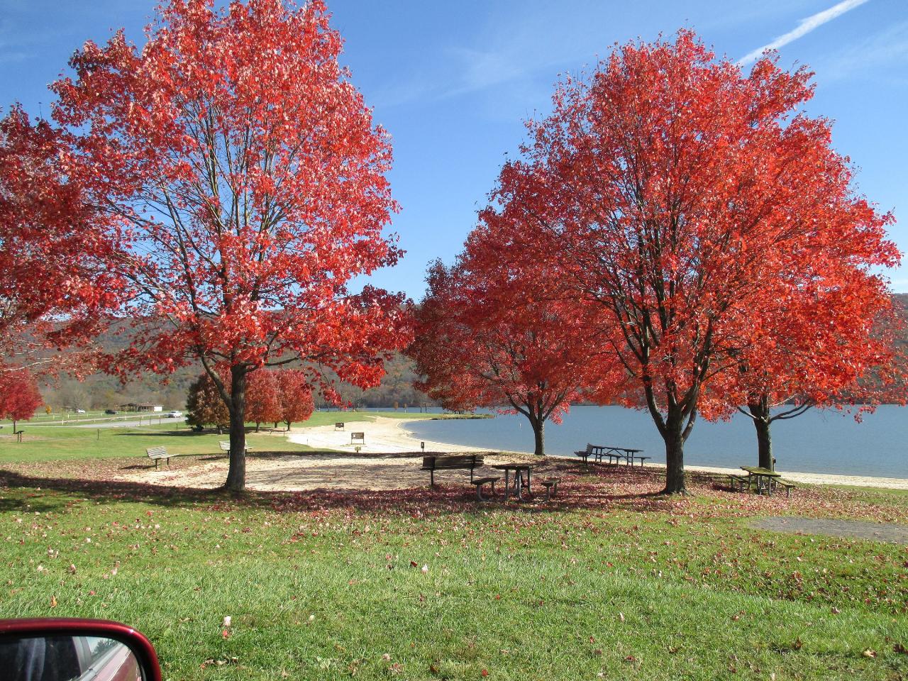
 Red maples and picnic tables on the lawn behind the beach in October. courtesy of Georgie lennon8705↗ (CC BY-SA 4.0↗)
 The beach house with changing rooms and restrooms behind the swimming beach. courtesy of User:Ruhrfisch↗ (CC BY-SA 4.0↗)

Other Swimming Holes, Hiking Trails, Canoeing Areas, and Kayaking Areas Nearby
Black Moshannon State Park
Philipsburg
22.8 miles WA free, unguarded sand beach on the tea colored water of 250 acre Black Moshannon Lake, high on the Allegheny Plateau east of Philipsburg. Open mid-May to mid-September, swim at your own risk, with the color coming from the surrounding sphagnum bog rather
Camp, Canoe, Hike, Kayak, Swim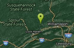
Pine Creek Area
Cross Fork, Pennsylvania
24.5 miles NESwim near Cross Fork, Pennsylvania
Swim
Eleven Foot Hole
Beavertown, Pennsylvania
24.6 miles SESwim near Beavertown, Pennsylvania
Swim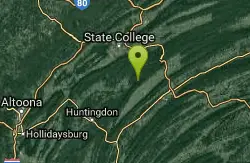
Greenwood Furnace State Park
Huntingdon, Pennsylvania
26.8 miles SSwim near Huntingdon, Pennsylvania
Swim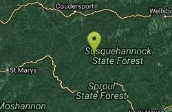
Hammersley Hole
Renovo, Pennsylvania
35.4 miles NA serious 12-mile round-trip hike in Pennsylvania backcountry to a small cascade and a deep mid-summer swimming hole in the remote Hammersley Fork creek.
Swim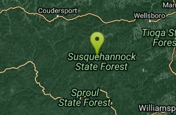
Ole Bull State Park
Cross Fork, Pennsylvania
35.6 miles NSwim near Cross Fork, Pennsylvania
Swim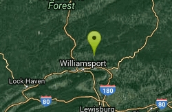
Loyalsock Creek Area
Forksville, Pennsylvania
43.4 miles NESwim near Forksville, Pennsylvania
Swim
Parker Dam State Park
Penfield
46.3 miles WA 20 acre CCC built lake in the Clearfield County woods with a real sand beach, five feet deep at the buoy line, open late May to mid September and free to use. No lifeguards, boat rentals next door, and the 1985 tornado scar a short walk away.
Camp, Canoe, Hike, Kayak, Mountain Bike, Swim
Lyman Run State Park Beach
Galeton
48.6 miles NA free 300-foot sand beach on 45-acre Lyman Run Lake in Potter County, open 8 AM to sunset from the Friday before Memorial Day to mid-September, with no lifeguard on duty.
Camp, Canoe, Hike, Kayak, Swim
Galeton
Galeton, Pennsylvania
48.9 miles NSwim near Galeton, Pennsylvania
Swim
Rockrun Area
Carregal do Sal, Viseu
49.5 miles NESwimming holes in beautiful Rock Run Creek in Tidaghton State Forest, Pennsylvania — a serene natural spot where bathing suits may be optional.
SwimNearby Campsites
Black Moshannon State Park
Philipsburg
22.8 miles WA free, unguarded sand beach on the tea colored water of 250 acre Black Moshannon Lake, high on the Allegheny Plateau east of Philipsburg. Open mid-May to mid-September, swim at your own risk, with the color coming from the surrounding sphagnum bog rather
Camp, Canoe, Hike, Kayak, Swim
Parker Dam State Park
Penfield
46.3 miles WA 20 acre CCC built lake in the Clearfield County woods with a real sand beach, five feet deep at the buoy line, open late May to mid September and free to use. No lifeguards, boat rentals next door, and the 1985 tornado scar a short walk away.
Camp, Canoe, Hike, Kayak, Mountain Bike, Swim
Lyman Run State Park Beach
Galeton
48.6 miles NA free 300-foot sand beach on 45-acre Lyman Run Lake in Potter County, open 8 AM to sunset from the Friday before Memorial Day to mid-September, with no lifeguard on duty.
Camp, Canoe, Hike, Kayak, Swim


