


Blue Hole Mill Creek
Elizabethton, Tennessee
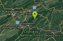
| GPS: |
36°26'10.3"N 82°4'36.1"W Maps | Directions |
| State: | Tennessee |
Swim
More Information
- Plan Ahead and Prepare
- Travel & camp on durable surfaces
- Dispose of waste properly
- Leave what you find
- Minimize campfire impacts
- Respect wildlife
- Be considerate of other visitors
Directions
From Elizabethton, Tennessee
- Head south toward E Elk Ave (171 ft)
- Exit the traffic circle onto E Elk Ave (0.1 mi)
- Turn left onto US-19E N/US-321 NContinue to follow US-19E N(0.5 mi)
- Exit onto TN-91 N toward Shady Valley/Stoney Creek (10.1 mi)
- Turn left onto National Forest 202/Panhandle RdDestination will be on the left(1.2 mi)

Other Swimming Holes Nearby
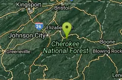
Laurel Fork
Hampton, Tennessee
11.8 miles SSwim near Hampton, Tennessee
Swim
Twisted Falls / Compression Falls
Butler, Tennessee
15.3 miles SSwim near Butler, Tennessee
Swim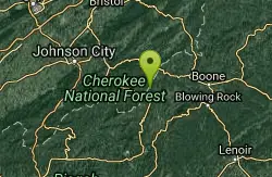
Elk River Falls
Elk Park, North Carolina
17.1 miles SSwim near Elk Park, North Carolina
Swim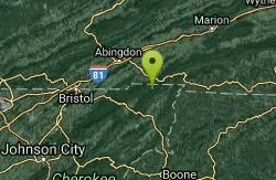
Backbone Rock
Shady Valley, Tennessee
18.2 miles NESwim near Shady Valley, Tennessee
Swim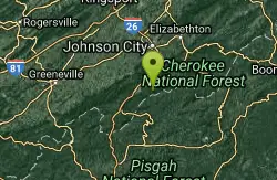
Rock Creek
Unicoi, Tennessee
25.8 miles SWCreek is fed into man-made concrete-bottom stream-fed pool. This from a visitor in 2010:"There is a sandy beach with stone and concrete stairs down to the pool. There is a short...
Swim
Elk Shoals
West Jefferson, North Carolina
36.2 miles ESwim near West Jefferson, North Carolina
Swim
Cedar Creek Falls
Honaker, Virginia
36.4 miles NAlso known as "Big Falls". This description from a fan:" The falls are normally warm on a sunny day due to the creek being exposed to the sun most of it's winding path. The hole is...
Swim
Wilson Creek Area
Collettsville, North Carolina
36.7 miles SEIn the Wilson Creek area are numerous waterfalls and swimming holes. Most require short or longer hikes; take some time and effort to find but all area gems. A new edition of the...
Swim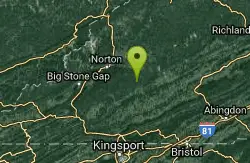
Little Stony Falls Area
Dungannon, Virginia
36.9 miles NWLarge pool at bottom of 25 foot falls, with rocks around. Bathing suits: Unknown (probably optional)
Swim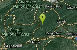
Linville Gorge Area
Marion, North Carolina
38.4 miles SDeep gorge with swimming holes in the Linville River at the bottom. IT TAKES SOME DRIVING ON ROUGH ROADS AND HIKING STEEP TRAILS (some poorly maintained) DOWN INTO THE GORGE (AND...
Swim
Horse Creek Campground
Chuckey, Tennessee
39.5 miles SWHorse Creek Campground is a popular day use and camping location in the Horse Creek Recreation Area. This beautiful spot in the Cherokee National Forest is a great location to connect with nature...
Camp, Swim 6.6 mi
Devil's Bathtub
Duffield, Virginia
41.1 miles NWThe Devil's Fork Loop Trail is a difficult hike that has become popular because of it's unique water features. The trail is 7.2 rocky miles with several steep areas. Along the hike there are...
Hike, Swim
Old Forge Campground
Bethany, Tennessee
41.4 miles SWOld Forge Campground and Recreation Area is a small campsite perfect for campers looking for a primitive experience. Old Forge is located on the beautiful Jennings Creek in the Cherokee National...
Camp, Hike, Swim
Mount Mitchell Area
Trinity, North Carolina
44.2 miles SNice family swimming place right by N. F. campgrounds in the South Toe River (cold) in the Pisgah N. F... Fees: Yes This site is closed seasonally.
Camp, SwimNearby Campsites
Horse Creek Campground
Chuckey, Tennessee
39.5 miles SWHorse Creek Campground is a popular day use and camping location in the Horse Creek Recreation Area. This beautiful spot in the Cherokee National Forest is a great location to connect with nature...
Camp, Swim
Old Forge Campground
Bethany, Tennessee
41.4 miles SWOld Forge Campground and Recreation Area is a small campsite perfect for campers looking for a primitive experience. Old Forge is located on the beautiful Jennings Creek in the Cherokee National...
Camp, Hike, Swim
Mount Mitchell Area
Trinity, North Carolina
44.2 miles SNice family swimming place right by N. F. campgrounds in the South Toe River (cold) in the Pisgah N. F... Fees: Yes This site is closed seasonally.
Camp, Swim


