


Brandy Park
Woodruff

Canoe, Kayak, and Swim
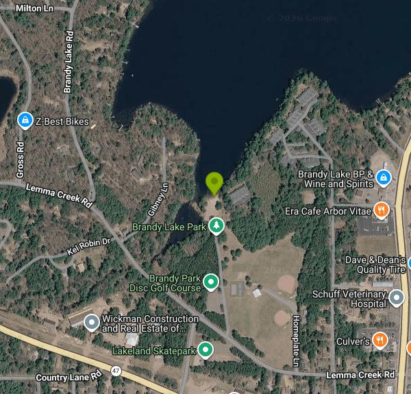
Brandy Park, sometimes listed as Brandy Lake Park or Brandy Lake Beach, is a town park on the south shore of Brandy Lake in the Town of Arbor Vitae, Vilas County, just over the line from the community of Woodruff. The Town of Woodruff and the Town of Arbor Vitae own it together and run it through the Brandy Park Commission, which splits a small yearly budget between the two towns. The swim beach is a short strip of sand on the north edge of the park, facing out onto a 113-acre lake that the Wisconsin DNR manages for fishing and swimming.
The park sits north of State Highway 47 and west of US Highway 51, on Lemma Creek Road. From the Woodruff business district it is about a kilometer north. Inside the park, Brandy Beach Road leads to a small paved lot right behind the sand, and a paved walkway also runs from the main shelter down to the beach parking area, so you can park by the ballfields and walk over if the beach lot is full. The towns state that anyone can use the park and its pavilion free of charge. There is no entry fee, no sticker and no residents-only rule posted. The only charges are for reserving the pavilion for a private event ($100 for nonprofit groups, $250 for for-profit events, plus a $100 deposit), booked through the commission president.
The beach has a pier, a changing house and restrooms, with a shoreline picnic area with tables and grills next to it. State survey notes describe Brandy Lake as a moderately fertile drainage lake with slightly acidic, light brown water of low to moderate clarity, and a bottom of mostly sand with some gravel and muck. The lake reaches 44 feet at its deepest, so expect the bottom to drop off once you are past the shallows near shore. It is still water with no current. Like other lakes this far north, it is coldest in June and warmest from mid-July into August. The town does not mention lifeguards, so plan on swimming without one and keep a close eye on children.
The DNR's water record lists Brandy Lake as not impaired. The lake does see motorboats and anglers going after musky, walleye, largemouth bass and northern pike. A public concrete boat ramp is on the lake's southeast side, a few hundred meters from the beach, so stay inside the swim area near the pier. As on any warm-weather lake, skip a swim after heavy rain or if the water looks scummy or green, and check with the towns if you are unsure.
The rest of the park is set up for a full day out. It has two fenced baseball fields, a lighted soccer field, tennis and pickleball courts, two sand volleyball courts, a basketball court, a skate park, a playground and a wooded disc golf course. A large shelter has grills and picnic tables. In winter the park has an ice-skating rink. Paddlers can launch a canoe or kayak from shore or from the nearby DNR ramp and explore the lake, including a small wooded DNR islet near the east end.
More Information

- Plan Ahead and Prepare
- Travel & camp on durable surfaces
- Dispose of waste properly
- Leave what you find
- Minimize campfire impacts
- Respect wildlife
- Be considerate of other visitors
Directions
From Woodruff
- Head northwest on US-221 N/
N Main St toward S 285 Continue to follow US-221 NPass by Circle K (on the left)(8.7 mi) - Turn left to merge onto I-26 W toward AshevilleParts of this road may be closed at certain times or daysEntering North Carolina(64.2 mi)
- Continue onto I-26 WMay be closed at certain times or days(3.5 mi)
- Take exit 31B on the left for I-40 W/
US-74 toward Canton/ Knoxville (0.8 mi) - Merge onto I-40/
US-74 W Continue to follow I-40Entering Tennessee(79.2 mi) - Keep left to stay on I-40 (24.8 mi)
- Take exit 393 for I-640 W/
US-25W N toward I-75 N/ Lexington (0.4 mi) - Continue onto I-640 W/
US-25W N (6.6 mi) - Take exit 3A for I-75 N toward Lexington (0.6 mi)
- Continue onto I-75 NEntering Kentucky(171 mi)
- Keep left to continue on I-64 W, follow signs for Frankfort/
Louisville (55.5 mi) - Take exit 19B for I-265 N/
KY-841 N/ Gene Snyder Fwy toward 19B (0.3 mi) - Merge onto I-265/
KY-841 E/ Gene Snyder Fwy Continue to follow I-265Toll roadEntering Indiana(19.1 mi) - Take exit 34A to merge onto I-65 N toward Indianapolis (106 mi)
- Keep right to stay on I-65 N, follow signs for Chicago (147 mi)
- Take exit 259A to merge onto I-80 W/
I-94 W/ US-6 W toward Chicago Continue to follow I-80 WToll roadEntering Illinois(19.5 mi) - Continue straight onto I-294 NToll road(26.3 mi)
- Take exit 31 for I-294 N toward I-290 W/
Rockford/ O'Hare/ Chicago Toll road(0.1 mi) - Take the ramp to I-290 WToll road(0.4 mi)
- Take the ramp to I-290 WToll road(0.3 mi)
- Continue onto Exit 31 (signs for I-290 W/
US-20/ Rockford/ IL-64) (0.6 mi) - Merge onto I-290 W (14.0 mi)
- Take the I-90 W/
IL-62/ Algonquin Rd exit (0.9 mi) - Slight right to merge onto I-90 WToll road(14.4 mi)
- Keep left to stay on I-90 WToll roadEntering Wisconsin(133 mi)
- Take exit 108A-108B for I-39 N toward Wausau (0.8 mi)
- Continue onto I-39 N (103 mi)
- Continue onto US-51 N (73.3 mi)
- Turn left onto Lemma Creek Rd (0.3 mi)
- Turn right onto Brandy Beach Rd (0.2 mi)


Other Swimming Holes, Canoeing Areas, and Kayaking Areas Nearby

Torpy Park
Minocqua
2.0 miles STorpy Park is the Town of Minocqua's free downtown beach on Minocqua Lake, a small sand swim beach with no lifeguards, plus restrooms, picnic shelters, a playground and public piers.
Swim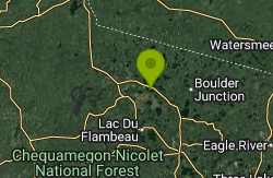
Little Star Park
Manitowish Waters
16.2 miles NWFree town-maintained beach on the east shore of Little Star Lake in Manitowish Waters, with a buoyed swim area, picnic tables and a carry-in launch. No state park sticker is required.
Canoe, Kayak, Swim
Silver Lake Beach
Eagle River
22.4 miles EThe City of Eagle River's free public beach on small, clear Silver Lake, with a sandy, gently sloping swim area, a playground and a beach house concession stand just northeast of downtown. No lifeguards.
Swim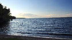
Lake Gogebic State Park
Marenisco
38.8 miles NA buoyed swim beach on Big Bear Bay at the southwest end of Lake Gogebic, the U.P.'s largest inland lake, in a DNR state park near Marenisco. A Michigan Recreation Passport is required for vehicles.
Camp, Canoe, Hike, Kayak, Swim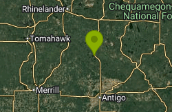
Summit Lake County Park
Summit Lake
43.8 miles SEFree county beach on the east shore of Summit Lake off Highway 45 in northern Langlade County, with a roped swim area, sandy bottom, picnic areas and a playground. No lifeguard, and no pets anywhere in the park.
Canoe, Kayak, Swim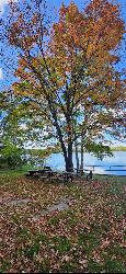
Lake Ottawa Recreation Area
Iron River
46.6 miles EOttawa National Forest swim beach on deep, clear Lake Ottawa, 5 miles southwest of Iron River, with a sand bottom, buoyed swim area and no lifeguards. Day use costs $5 per vehicle from May 15 to October 15.
Camp, Canoe, Hike, Kayak, SwimNearby Campsites
Lake Gogebic State Park
Marenisco
38.8 miles NA buoyed swim beach on Big Bear Bay at the southwest end of Lake Gogebic, the U.P.'s largest inland lake, in a DNR state park near Marenisco. A Michigan Recreation Passport is required for vehicles.
Camp, Canoe, Hike, Kayak, Swim
Lake Ottawa Recreation Area
Iron River
46.6 miles EOttawa National Forest swim beach on deep, clear Lake Ottawa, 5 miles southwest of Iron River, with a sand bottom, buoyed swim area and no lifeguards. Day use costs $5 per vehicle from May 15 to October 15.
Camp, Canoe, Hike, Kayak, Swim


