


Lake Ottawa Recreation Area
Iron River
Camp, Canoe, Hike, Kayak, and Swim
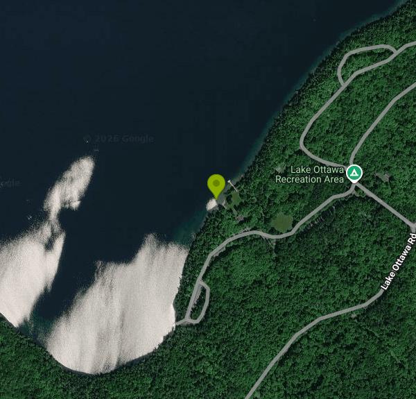
Lake Ottawa Recreation Area is a U.S. Forest Service site on the Iron River Ranger District of the Ottawa National Forest, about 5 miles southwest of Iron River in Michigan's western Upper Peninsula. The swim beach sits in the day use area on the shore of Lake Ottawa, a deep, clear, cold-water lake surrounded mostly by national forest land. The day use area shares the site with a 32-site campground, a boat launch and a group of log and fieldstone buildings put up by the Civilian Conservation Corps in the late 1930s.
From Iron River, head west on US 2, turn south on M-73, and after about three quarters of a mile turn west onto Lake Ottawa Road. Follow it roughly 4 miles to the recreation area. The Forest Service rates the site as reachable by passenger car. The Forest Service lists a large parking lot by the day use building, a separate lot at the boat landing (handy if you are carrying a canoe or kayak), and only three spaces inside the campground, so day visitors should use the day use lot, which is a short walk from the water.
The swim area is a sandy beach with a natural sand bottom, marked off from the rest of the lake by a buoy line. Lake Ottawa is far deeper than most lakes nearby (the Forest Service puts its depth at about 90 feet), so expect cool water well into summer and stay inside the buoys unless you are a strong swimmer. There are no lifeguards; the forest says plainly that none of its beaches are guarded. Swimming here is a July and August activity for most people, and the campground runs from late May through September 30.
Day use is not free. From May 15 through October 15, the Forest Service charges $5 per vehicle per day, or $30 per vehicle for a season pass covering Lake Ottawa and the forest's other fee lakes. Interagency Senior and Access passes are accepted, and registered campers do not pay the day use fee. The day use area and boat launch stay open all year with reduced services, though snow can limit winter access. The site is run for the Forest Service by a concessionaire, Camp Host LLC, reachable at (906) 661-8870.
Check conditions before you go. The CCC day use building by the beach, which normally offers flush toilets and a fireplace, has been closed at times for repairs, and the Lake Ottawa Pavilion has been closed for rehabilitation work. Flush toilets and drinking water are still available in the campground. The lake holds invasive rusty crayfish, so clean and drain boats and gear before moving to another lake. Bass fishing is catch and release only, with no bass kept.
Beyond the beach there is a large lawn with picnic tables and grills, an athletic field, and the boat ramp. The Ge-Che Trail, about 9 miles of dirt trail through hardwood forest, starts from both the campground and the boat landing. Anglers come for walleye, northern pike, lake trout and panfish, and the short Stateline-Mile Post Zero Trail, which leads to the historic Michigan-Wisconsin boundary marker on the Brule River, is in the same area.
More Information
Federal Register :: Notice of Proposed New Fee Sites; Federal Lands Recreation Enhance
The Ottawa National Forest is proposing new recreation fee sites. The Ottawa's proposal includes: A $100 day use fee for Clark Lake and Lake Ottawa group picnic buildings; a $5 daily or $30 annual fee for Black River picnic area and the Lake Ottawa day use area; and a $400 day use option for...
https://www.federalregister.gov/documents/2016/09/27/2016-23254/notice-of-proposed-new-fee-sites-federal-lands-recreation-enhancement-act-title-viii-pub-l-108-447Lake Ottawa Campground, Ottawa National Forest - Recreation.gov
Explore Lake Ottawa Campground in Ottawa National Forest, Michigan with Recreation.gov. Planning a trip to the Lake Ottawa Campground? Watch for Alerts at the top of the page for any Alerts regarding this facility. Lake Ottawa Campground is in
https://www.recreation.gov/camping/campgrounds/10047120Lake Ottawa Pavilion, Ottawa National Forest - Recreation.gov
Explore Lake Ottawa Pavilion in Ottawa National Forest, Michigan with Recreation.gov. Planning a trip to the Lake Ottawa Pavilion? Watch for Alerts at the top of the page for any Alerts regarding this facility. The Lake Ottawa Pavilion, lo
https://www.recreation.gov/camping/campgrounds/273784Lake Ottawa, Michigan boat ramp and access | How's Your River
Public boat ramp and water access at Lake Ottawa on Lake Ottawa in Michigan. Map, directions, nearby USGS conditions, and amenities.
https://www.howsyourriver.com/access_sites/lake-ottawaOttawa National Forest | Iron River Ranger District | Forest Service
Iron River is located in Iron County, in the western portion of Michigan's Upper Peninsula, just seven miles from the Wisconsin border. The border is shared with the Nicolet National Forest. The Iron River Ranger District is 138,000 acres in size. Recreation opportunities include two camping for fee campgrounds and two rustic campgrounds. Three wilderness areas are located on adjacent districts. The area's climate is truly unique for each season of the year. The weather is summarized as follows: 31 inches of average annual precipitation, 68 inches of snowfall, an average of 62 frost-free days, 59-degree F. average temperature May through September, and long cold winters.Four-season recreation is Iron County's claim to fame. 2,175 lakes and 902 miles of streams offer unlimited challenges for both warm and cold-water fishing. Three rivers on the district have recently been designated as recreational rivers under the Wild and Scenic rivers Act. Northern hardwoods, pine, balsam fir, and spruce cover 80% of the county. More whitetail deer Boone and Crockett entries have been taken from the forests of Iron County than any other Michigan county. Add to this, the title of woodcock capital of the world and one cannot find any better small and big game hunting anywhere in the Midwest.When winter arrives, it's no time to rest. 212 miles of snowmobile trails connect to a vast system of trails throughout upper Michigan and northern Wisconsin. The Iron River District, in cooperation with Covenant Point Bible Camp, grooms and maintains a Nordic ski trail, and Ski Brule, a major ski resort, is just minutes from town. Contact the District Office
https://www.fs.usda.gov/r09/ottawa/recreation/iron-river-ranger-districtOttawa National Forest | Lake Ottawa Recreation Area | Forest Service
Lake Ottawa Recreation area is in a beautiful forested northwoods setting located 5 miles southwest of Iron River, MI, on the Iron River Ranger District. Located in the general area is Lake Ottawa, Brule Lake, Hagerman Lake, Brule River, Bass Lake, the Historic Mile Post Zero/Treaty Tree, The Ge-Che Trail, and miles of hiking trails. Lake Ottawa Campground is 95% surrounded by National Forest System Lands and offers a pavilion with two stone fireplaces and original log picnic tables, and two log toilet buildings, which were constructed by the CCC in the late 1930's. A pressurized water system and sewage dump station is located in the campground. Adjacent to the campground is the CCC era , Lake Ottawa Day Use Facility with flush toilets, picnic areas, and a boat launch.Fish Your National Forests: This site can be accessed by passenger car; fish available include, Lake trout, bass (Catch and release only, no possession allowed), walleye, panfish; Types of fishing available include shore, motorized boat, float tube, fly, spin, bait, ice; and boat launch available. Be sure to reference the latest Michigan fishing guide.
https://www.fs.usda.gov/r09/ottawa/recreation/lake-ottawa-recreation-areaOttawa National Forest | Water Activities | Forest Service
The Ottawa National Forest, located in Michigan's Upper Peninsula, is home to over 2,000 miles of streams, including 300 miles of designated National Wild and Scenic Rivers. Canoeing and kayaking are favorite pastimes of local area residents and visitors alike. View a map that shows some of our most popular river trail segments.Paint National Wild and Scenic River Federal Register Notice:
https://www.fs.usda.gov/r09/ottawa/recreation/opportunities/water-activitiesBe courteous, informed, and prepared. Read trailhead guidelines, stay on the trail, and don't feed the wildlife.
Read More
- Plan Ahead and Prepare
- Travel & camp on durable surfaces
- Dispose of waste properly
- Leave what you find
- Minimize campfire impacts
- Respect wildlife
- Be considerate of other visitors
Directions
From Iron River
- Head south on N 4th Ave toward W Adams St (121 ft)
- Turn right onto US-2 W/
W Adams St (1.4 mi) - Turn left onto M-73 S (0.8 mi)
- Turn right onto Lake Ottawa Rd (4.1 mi)
- Turn right (0.1 mi)
- Turn left (0.2 mi)
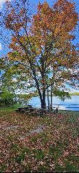
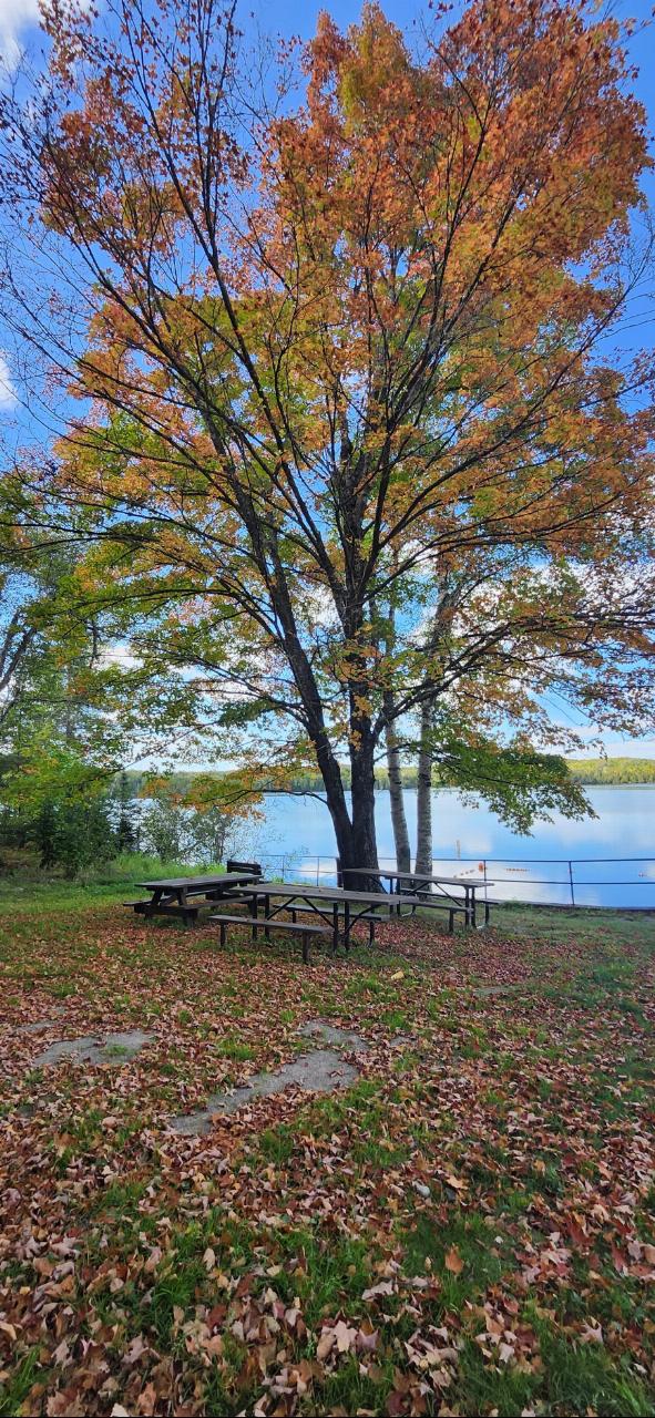
 Picnic tables under a maple in fall color at the Lake Ottawa day use area, with the lake and swim ar courtesy of usfs_Eastern_Region↗ (Public domain↗)
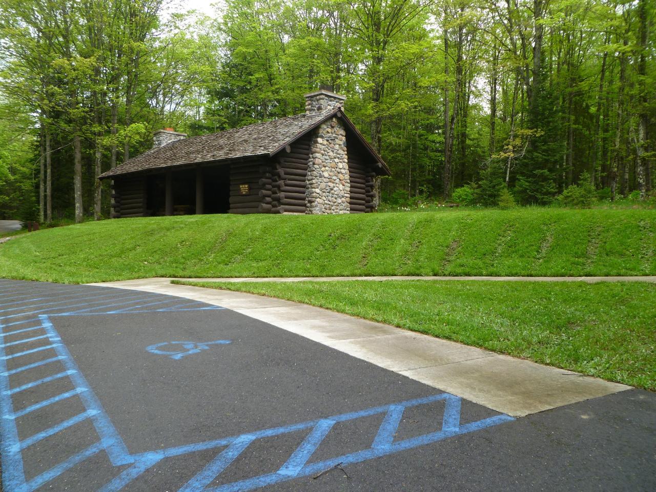
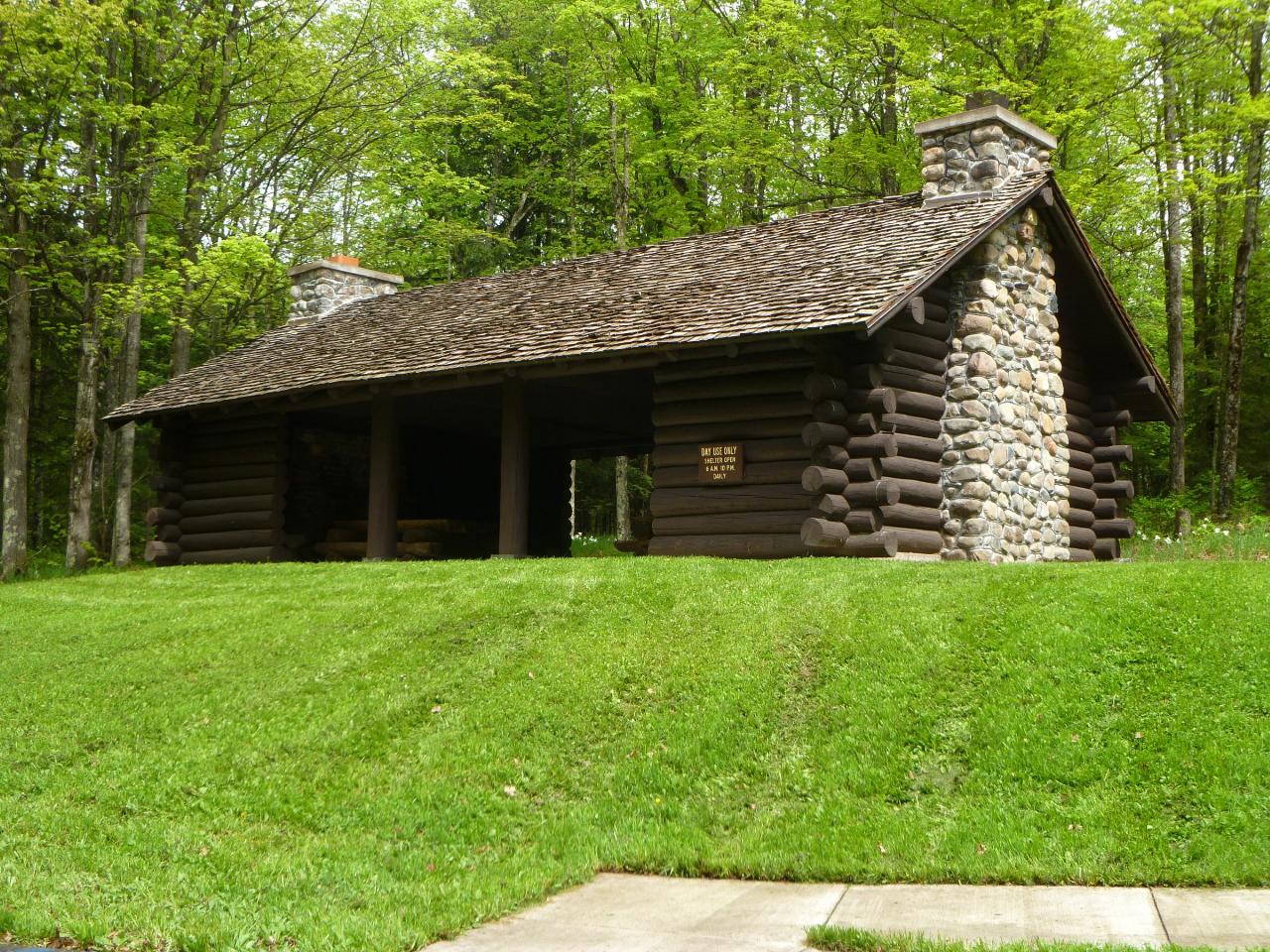 Parking and the walkway up to the log picnic shelter at Lake Ottawa. courtesy of usfs_Eastern_Region↗ (Public domain↗)
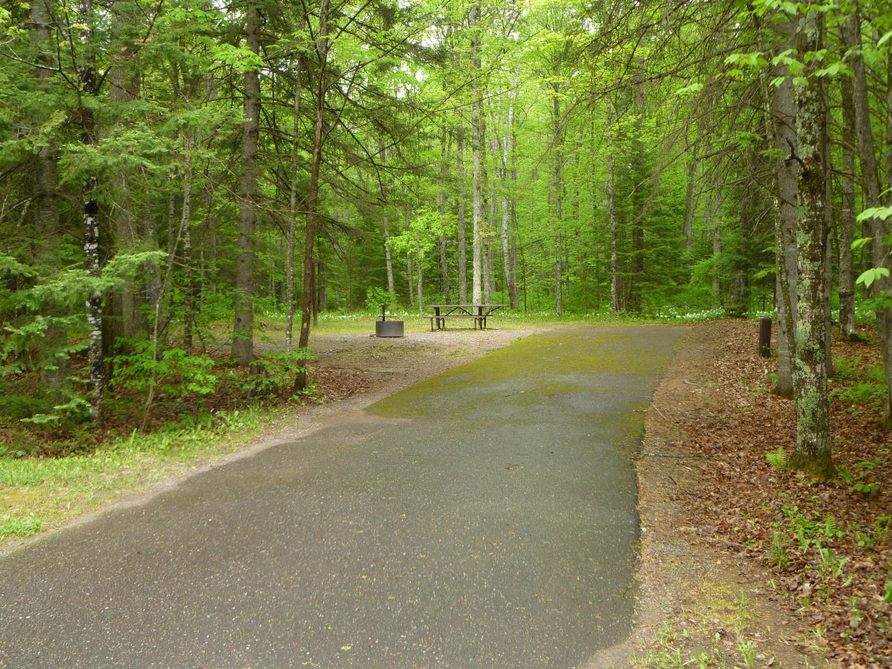
 A paved campsite spur among the pines and birch in Lake Ottawa Campground. courtesy of usfs_Eastern_Region↗ (Public domain↗)
Other Swimming Holes, Hiking Trails, Canoeing Areas, and Kayaking Areas Nearby

Silver Lake Beach
Eagle River
25.2 miles SWThe City of Eagle River's free public beach on small, clear Silver Lake, with a sandy, gently sloping swim area, a playground and a beach house concession stand just northeast of downtown. No lifeguards.
Swim
Lake Antoine Park
Iron Mountain
39.5 miles SEA free, sandy county swim beach on the east shore of Lake Antoine just northeast of Iron Mountain, with a wheelchair-accessible mat to the water, picnic grounds and a campground. No lifeguards.
Camp, Canoe, Kayak, Swim
Lake Gogebic State Park
Marenisco
46.3 miles NWA buoyed swim beach on Big Bear Bay at the southwest end of Lake Gogebic, the U.P.'s largest inland lake, in a DNR state park near Marenisco. A Michigan Recreation Passport is required for vehicles.
Camp, Canoe, Hike, Kayak, Swim
Brandy Park
Woodruff
46.7 miles WFree town beach on the south shore of Brandy Lake, run jointly by Woodruff and Arbor Vitae, with a sandy swim area, pier, changing house and restrooms.
Canoe, Kayak, Swim
Torpy Park
Minocqua
47.6 miles WTorpy Park is the Town of Minocqua's free downtown beach on Minocqua Lake, a small sand swim beach with no lifeguards, plus restrooms, picnic shelters, a playground and public piers.
SwimNearby Campsites
Lake Antoine Park
Iron Mountain
39.5 miles SEA free, sandy county swim beach on the east shore of Lake Antoine just northeast of Iron Mountain, with a wheelchair-accessible mat to the water, picnic grounds and a campground. No lifeguards.
Camp, Canoe, Kayak, Swim
Lake Gogebic State Park
Marenisco
46.3 miles NWA buoyed swim beach on Big Bear Bay at the southwest end of Lake Gogebic, the U.P.'s largest inland lake, in a DNR state park near Marenisco. A Michigan Recreation Passport is required for vehicles.
Camp, Canoe, Hike, Kayak, Swim


