


Breaks Interstate Park Area
Haysi, Virginia

| Address: | 724 Commission Cir, Haysi, VA 24256, USA |
| GPS: |
37°17'13.4"N 82°17'46.2"W Maps | Directions |
| State: | Kentucky |
| Trails/Routes: | 0.3-1.5 mi |
Restrooms Picnic Tables Lakes Rivers Trails Ponds Bicycles Fishing State Park
Camp, Canoe, Hike, Horseback, Kayak, Mountain Bike, and Swim
Breaks Interstate Park Area is a state park that straddles the line between Kentucky and Virginia, and is known as The Grand Canyon of the South. While the spectacular river canyon views are reminiscent of the famous canyon, the lush green trees make the views here entirely unique.
Entry to the state park is $2 per vehicle per day.
Visitors can enjoy the views of the river canyon by taking a scenic drive with short hikes to the viewpoints, or take the challenge of hiking the full trail. With over 20 miles of total hiking trails there are plenty of remote spots to explore.
In addition to the miles of hiking trails, there is a specific mountain biking trail available near Beaver Pond. The almost mile long out and back trail is a difficult level that makes a good challenge. Many of the other trails in the park are open to mountain biking, almost 12 miles of trails in total ranging from moderate to difficult depending on the route you choose. Bike rentals are available at the park for riders who do not wish to bring their own.
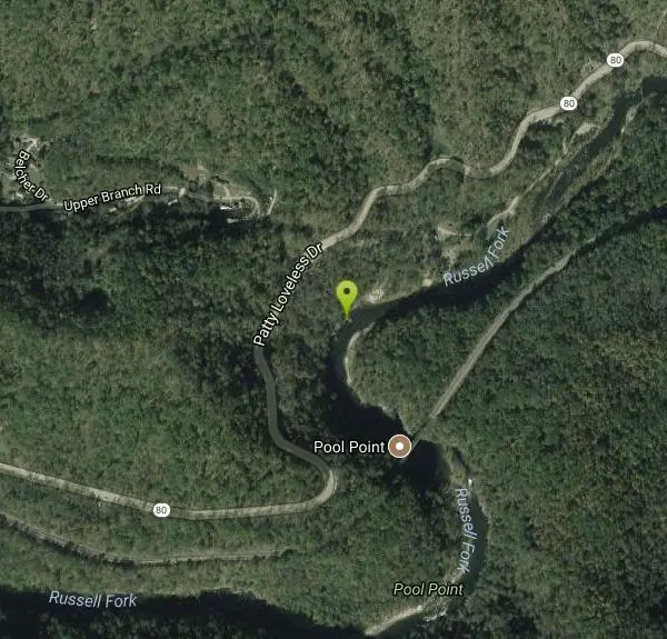
After the miles of exertion on a hot day, visitors can enjoy the swimming features available in the park. Swimming can be done in the Water Park on Laurel Lake or in one of the natural swimming holes found on Russel fork river. The water park includes water slides, a splash pad, basketball and volleyball areas. The water park has an additional entry fee of $6 to $8 a person on weekdays and $8 to $10 a person on weekends. The natural swimming holes are available at no extra charge. Pool Point being the most popular and accessible spot for swimming. The low cliffs in this area make for incredible views and exciting diving. Visitors should exercise caution when swimming on the river and only swim in approved areas.
Breaks Interstate Park has 138 campsite available range in their accommodations. Some places are simple places to pitch tents, others have electric hookups and restrooms, and still others have full RV hookups, making this perfect no matter your desired camping experience. The campgrounds are wooded, providing beautiful views and shade for campers.
For visitors looking for more unique activities the park offers boat rentals, guided horseback riding tours, an affordable golf course and white water rafting. These activities are available at an extra cost. Canoes, peddle boats and john boats are available for rental at Laurel lake from late spring through early fall. White water rafting is available Saturdays and Sundays in October. The rapids vary from a class two up to a very challenging class six.
More Information
swimmingholes.org Kentucky swimming Holes and Hot Springs rivers creek springs falls hiking camping
THE web site for beautiful, natural places for a cool dip or hot soak.
https://www.swimmingholes.org/ky.htmlNever modify trail features. Ride trails when they're dry enough that you won't leave ruts. Speak up when you see others on the trail and always yield to hikers, horses, and others coming uphill. Always ride on the established trail.
Read MoreBe courteous, informed, and prepared. Read trailhead guidelines, stay on the trail, and don't feed the wildlife.
Read More- Plan Ahead and Prepare
- Travel & camp on durable surfaces
- Dispose of waste properly
- Leave what you find
- Minimize campfire impacts
- Respect wildlife
- Be considerate of other visitors
Directions
From Haysi, Virginia
- Head southeast on Haysi Main St/
Main St toward Bridge St Continue to follow Main St(1.2 mi) - Continue onto VA-80 W/
VA-83 E Continue to follow VA-80 W(7.1 mi) - Turn left onto State Rte 702 (0.4 mi)
- Turn right onto State Rte 734 (154 ft)
- Turn left onto Commission CirDestination will be on the right(0.2 mi)


Other Mountain Bike Trails, Swimming Holes, Hiking Trails, Canoeing Areas, Horseback Trails, and Kayaking Areas Nearby

Pool Point
Elkhorn City, Kentucky
1.6 miles WA long rope swing, 25-ft-deep river pools, and a famous high rail bridge draw cliff divers and swimmers to this scenic Kentucky swimming hole at Breaks Interstate Park.
Canoe, Dive, Hike, Kayak, Swim
Ratliff Hole
Elkhorn City, Kentucky
8.1 miles NWA secluded calm pool with beautiful rock cliffs on the Russell Fork River at Breaks Interstate Park — great for fishing, canoeing, and kayaking along with swimming.
Swim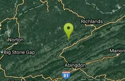
Cedar Creek Falls
Honaker, Virginia
26.1 miles SEAlso known as 'Big Falls' — a sun-warmed swimming hole with a 50-foot-wide pool roughly 10 feet deep at the base of the falls, with a safe jump spot on the eastern end.
Swim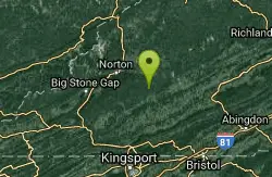
Little Stony Falls Area
Dungannon, Virginia
30.3 miles SA large pool beneath a 25-foot waterfall, framed by sunning rocks, makes Little Stony Falls a relaxed and likely clothing-optional destination in the Virginia mountains.
Swim 6.6 mi
Devil's Bathtub
Duffield, Virginia
38.2 miles SWA 7.2-mile rocky loop through Devil's Fork's extremely cold crystal-clear swimming holes, culminating in the famous Devil's Bathtub — a deep waterfall pool beneath steep rippled cliffs.
Hike, Swim


