


Buford Beach
Hardy
Canoe, Kayak, and Swim
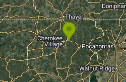
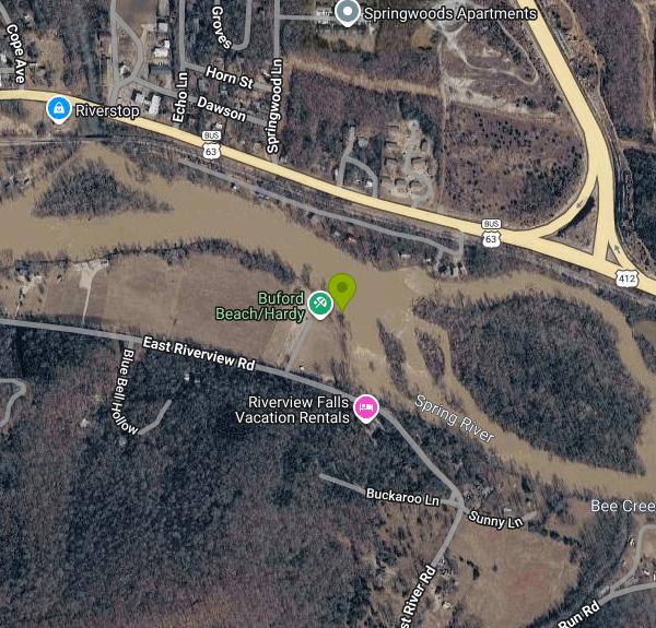
Buford Beach is a small City of Hardy park on the south bank of the Spring River, less than a mile downstream (east) of downtown Hardy in Sharp County, Arkansas. The city describes it as a public access recreational park off Riverview Road with river access for swimming, fishing and kayaking, plus a boat ramp. On OpenStreetMap the same parcel is labeled Walter Norman "Buck" Memorial Garden / Buford Beach. The name goes back to George Gillespie Buford, a Memphis physician who got stranded in Hardy by a train breakdown in 1908, bought land on Wahpeton Hill and built summer cottages there, which is how Hardy's river tourism got started.
To get there, follow East Riverview Drive (Highway 342) east out of downtown Hardy and turn north onto Beach Road, a short dead-end lane that ends at a small paved parking lot beside the park. A baseball field sits next to the park. The boat ramp is at the north end of the riverbank and a row of picnic tables runs along the water just south of it, so the drive from the lot to the shoreline is only a few dozen yards.
The swim area is the open riverbank between the ramp and the picnic tables. Don't expect sand. The shore is rock and gravel, with several easy places to step into shallow water where kids can wade, and deeper, faster water out toward the middle of the channel. The Spring River is fed by Mammoth Spring roughly 16 miles upstream, which pushes out about 9 million gallons an hour, so the water stays near 58 degrees all year and the level holds steady through summer. That makes for a cold first plunge even in July. There are no lifeguards and no marked swim zone. The riffles and rapids through this stretch can move faster than they look, so life jackets for children and weak swimmers are a good idea.
The City of Hardy lists no entry or parking fee for Buford Beach, and none has turned up in any other source, so treat it as free. The city does not post hours. The city's park page says restrooms are "coming soon," so plan on none being open. Hardy's other riverside parks, Loberg Park and the Hardy RV Park, have restrooms a short drive back toward town.
Watch the river level before you go. The Spring River can rise quickly after heavy rain on its Missouri and Arkansas watershed; the March 2008 flood crested above 22 feet and forced evacuations in Hardy, and the 1982 flood reached 29 feet. The USGS gage at the Spring Street Bridge in Hardy, just upstream of the park, posts current height and flow online. The upper Spring River between Mammoth Spring and Hardy is one of Arkansas's busiest float and tubing runs, and summer weekends bring heavy crowds and a party scene that has led the Arkansas Game and Fish Commission to step up patrols on peak days. Expect canoes, kayaks and tubes drifting past or pulling out here on busy days.
Beyond swimming, the park has a small playground, a grassy lawn and shaded picnic tables along the bank. Anglers fish the same water for stocked rainbow and brown trout along with bass, walleye and catfish, and paddlers use the ramp to put in or take out. Downtown Hardy's shops and restaurants are less than a mile west.
More Information
Buford Beach/Hardy, United States - ALL You Need To Know
Learn about and discover Buford Beach/Hardy, Hardy, Arkansas, United States. - we have over 100 categories of data including activities, parking, photos, attractions, hotels, and restaurants.
https://sandee.com/united-states/arkansas/hardy/buford-beachhardySpring on the Spring
It’s breakfast time at the Olde Stonehouse Bed & Breakfast Inn on Main Street in Hardy, and innkeeper Vickie Rice is talking about the town she fell in love with after moving to Arkansas from Ohio.Indeed, Hardy has its charms.The homemade biscuits are hot, the eggs are cooked perfectly and I listen intently as Rice talks. She serves on the Hardy City Council and the Hardy Advertising & Promotion Commission, and she’s determined to find replacements for several restaurants that have closed in rec
https://www.rexnelsonsouthernfried.com/post/spring-on-the-springSpring River at Spring Street Bridge at Hardy, AR - USGS Water Data for the Nation
Discover water data collected at monitoring location USGS-07069305, located in Sharp County, Arkansas and find additional nearby monitoring locations.
https://waterdata.usgs.gov/monitoring-location/07069305/Spring River has become a primary economic artery in the Arkansas Ozarks, rowdy tourists still an is
The train broke down, and it prompted Memphis physician George Buford and his wife to take a walk. Their train was stranded in Hardy, an insignificant way station located in...
https://talkbusiness.net/2016/10/spring-river-has-become-a-primary-economic-artery-in-the-arkansas-ozarks-rowdy-tourists-still-an-issue/
- Plan Ahead and Prepare
- Travel & camp on durable surfaces
- Dispose of waste properly
- Leave what you find
- Minimize campfire impacts
- Respect wildlife
- Be considerate of other visitors
Directions
- Get directions on Google Maps
Other Swimming Holes, Canoeing Areas, and Kayaking Areas Nearby
Spring River
Mammoth Spring, Arkansas
6.1 miles NWSwim near Mammoth Spring, Arkansas
Swim
Old Davidsonville State Park
Walnut Ridge, Arkansas
25.9 miles SESwim near Walnut Ridge, Arkansas
Swim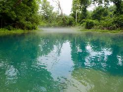
Greer Crossing, Eleven Point River
Alton
34.2 miles NGreer Crossing is the Forest Service access on the Eleven Point River where Highway 19 crosses, ten miles north of Alton. Greer Spring joins just upstream and more than doubles the flow, so the water runs cold, clear and green, day use is free, and campin
Camp, Canoe, Hike, Kayak, Swim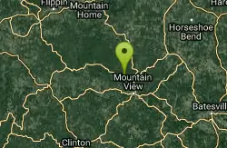
Ozark National Park
Walnut Ridge, Arkansas
45.9 miles SWSwim near Walnut Ridge, Arkansas
Swim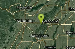
Crowleys Ridge State Park
Paragould, Arkansas
48.7 miles ESwim near Paragould, Arkansas
Swim


