Burro Pass
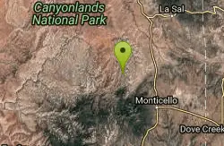
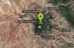
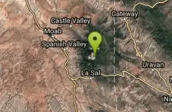
La Sal, Utah
| Address: | ~Forest Rd 0240, La Sal, UT 84530, USA |
| GPS: |
38°29'37.2"N 109°13'16.6"W Maps | Directions |
| State: | Utah |
| Trail Length: | 15.00 miles |
| MTB Difficulty: | Intermediate |
| Trail Type: | Loop |
| MTB Trail Type: | Singletrack |
Mountain Bike
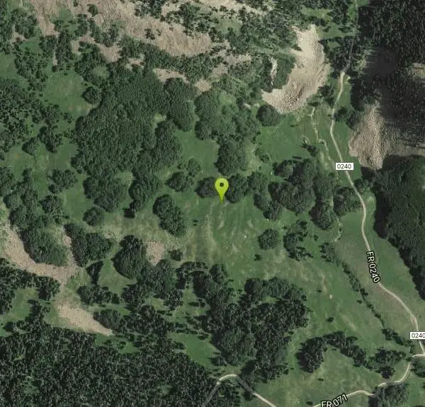
The Burro Pass trail climbs straight up from the road, gaining over a thousand vertical feet in a mile and a half. The top of Burro Pass is almost above treeline, sitting just below several gorgeous mountain tops. The top of the pass (over 11,000 feet above sea level) marks the official beginning of The Whole Enchilada descent, which drops 7,000 vertical feet all the way down to the green river.After you pass the top of the pass, the bottom drops out of the trail, descending as steeply as it climbed before. Rocks, roots, and creek crossings abound... hang on to your helmet! And prepare to shred!Lower down the trail mellows, flowing through the trees and eventually feeding into the Dry Creek trail. To continue The Whole Enchilada route, ride past the campground, down the gravel road, and pick up the Hazard County trail. Courtesy of Singletracks.com
Never modify trail features. Ride trails when they're dry enough that you won't leave ruts. Speak up when you see others on the trail and always yield to hikers, horses, and others coming uphill. Always ride on the established trail.
Read More- Plan Ahead and Prepare
- Travel & camp on durable surfaces
- Dispose of waste properly
- Leave what you find
- Minimize campfire impacts
- Respect wildlife
- Be considerate of other visitors
Directions
From La Sal, Utah
- Head east on UT-46 E (3.6 mi)
- Slight left onto 2 Mile Rd/FR0208 (4.6 mi)
- Turn left onto Dark Canyon Lake Rd/FR 0129Continue to follow Dark Canyon Lake Rd(2.3 mi)
- Turn right to stay on Dark Canyon Lake Rd (5.0 mi)
- Turn right at Geyser Pass Rd (0.6 mi)
- Continue straight (0.8 mi)
- Slight left toward Forest Rd 0242/FR0242 (469 ft)
- Continue onto Forest Rd 0242/FR0242Continue to follow Forest Rd 0242(1.3 mi)
- Turn right onto FR 4721 (0.4 mi)
- Turn right at the 1st cross street onto FR 0129 (0.6 mi)
- Turn right onto FR 071/Geyser Pass Rd (1.2 mi)
- Turn left onto Forest Rd 0240 (0.4 mi)
Other Mountain Bike Trails Nearby
LaSal Backside Singletrack
Moab, Utah
2.8 miles SPart of Moab's world-class Whole Enchilada network on the backside of the La Sal Mountains — serious climbs, technical sections, and most riders take a shuttle to enjoy the epic descent into town.
Mountain Bike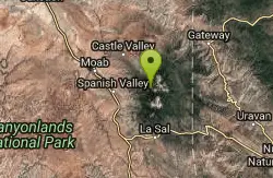
Moonlight Meadows & Clark Lake
Moab, Utah
2.9 miles WA former cow trail turned mountain bike route through green meadows and aspen groves near Moab, ending at a small pond and campground — often shared with cattle in summer.
Mountain Bike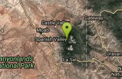
Hazard County
Moab, Utah
3.9 miles NWA super-fast downhill with cool features, bermed turns, great views, and hairpin turns through the scrub brush — one of Moab's most fun trails.
Mountain Bike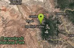
The Whole Enchilada
Moab, Utah
8.5 miles NWA technically diverse epic mountain bike ride starting at 10,000 feet and descending through forests, aspen lands, creeks, open prairie, and gnarly Porcupine singletrack all the way to the Colorado River.
Mountain Bike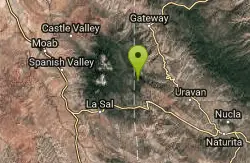
Paradox Trail
Paradox, Colorado
10.2 miles EA trail connecting Tabeguache and Kokopelli's Trails mostly via jeep and forest roads — a long tough climb out of Paradox Valley rewarded by dramatic scenery changes.
Mountain Bike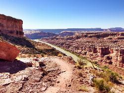
Porcupine Rim
Moab, Utah
12.2 miles NWOne of Moab's most dramatic and challenging trails, winding from technical climbs through trees and slickrock to 360-degree canyon views and close-up Colorado River scenery.
Mountain Bike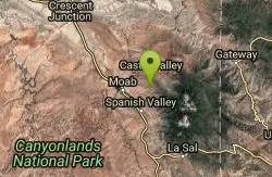
UPS And LPS
Moab, Utah
12.2 miles NWA Moab classic linking Kokopelli, UPS, and LPS trails for technical sections, steep drops, exposed areas, and great Castle Valley views — with Porcupine Rim as a natural finale.
Mountain Bike
Flat Pass
Moab, Utah
14.0 miles WA rugged Moab jeep route with 1,000 feet of climbing in the first four miles and 1,500 feet of descending over the last six, with ledges, deep sand, and slickrock throughout.
Mountain Bike
24 Hours Of Moab Race Course
Moab, Utah
14.3 miles WSandy singletrack through sandstone arch formations and great trailside views near Moab — former 24 Hours of Moab race course connecting to the Colorado River via Hunter Canyon Rim or Pritchette Canyon.
Mountain Bike
Pipe Dream
Moab, Utah
16.2 miles WClassic Moab singletrack skirting the foothills below the cliffs — grade reversals, steep sections, tight corners, and sweeping views of the valley, Arches, and the La Sal Mountains.
Mountain Bike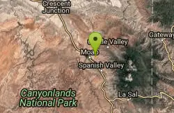
Fins n Things
Moab, Utah
16.6 miles WA varied double-track loop off Sand Flats Road near Slickrock, rolling over sandstone fins with sand traps, canyon views, and easy camp access near Moab.
Mountain Bike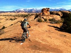
Slickrock Trail
Moab, Utah
17.2 miles WMoab's famous Slickrock Trail offers insanely good grip on dotted-line routes through steep, rocky terrain — with smaller loops for less experienced riders.
Mountain Bike
Slickrock
Moab, Utah
17.4 miles WAmerica's most famous mountain bike trail delivers a unique slickrock experience in the Moab desert — short steep climbs and descents on solid rock, plan 3–4 hours and go early to beat the heat.
Mountain Bike
Moab Brand Trails
Moab, Utah
18.4 miles WA great introduction to Moab mountain biking — ride the Bar M, Bar B, Rockin' A, and Circle O loop counter-clockwise through red rock terrain with painted-rock signs to guide the way.
Mountain Bike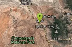
Klonzo Area
Moab, Utah
19.2 miles WAll-singletrack intermediate riding with new trails, fun named loops like Wahoo and Dunestone, and slabrock areas just west of Moab — support the Moab Trails Alliance.
Mountain Bike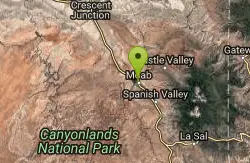
Prospector
Moab, Utah
19.3 miles WIntermediate singletrack cut into a Moab hillside with tight switchbacks, short steep climbs, rocky and sandy sections, and a higher line for extra challenge.
Mountain Bike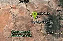
Moab Rim
Moab, Utah
20.2 miles WA 3-mile slickrock connector to Hidden Valley with views of the Colorado River, Moab Valley, and the sandstone fins of Behind the Rocks — a shared-use route for experienced riders.
Mountain Bike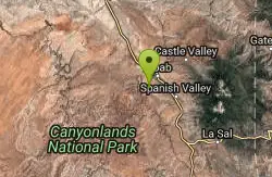
Hymasa
Moab, Utah
20.4 miles WA fully rideable singletrack climb bypassing the Amasa Back 4x4 route, with moderate grades, a few technical sections, and classic breath-taking Moab views the whole way up.
Mountain Bike
Amasa Back Trail
Moab, Utah
20.4 miles WA steady, rewarding climb up Amasa Back with sandstone ledges and technical spots, cresting a ridge to views over the Colorado River 1,000' below before a wild descent.
Mountain Bike
Pothole Arch Trail
Moab, Utah
20.4 miles WOut-and-back singletrack from Amasa Back to Pothole Arch, mixing slickrock and singletrack with great views and a connection to Rockstacker.
Mountain Bike