


Cedar River Campground
Stephenson, Michigan

| GPS: |
45°29'59.0"N 87°22'59.1"W Maps | Directions |
| State: | Michigan |
Camp and Horseback
Sites available on a first-come, first-serve basis. No reservations. 18 sites for tent and small trailer use, 4 of which are walk-in sites for tent camping only. Rustic campground includes vault toilets and potable water from well hand pump. Boat Launch, Canoeing, Fishing, Hiking, Mountain Biking, Off-Road Vehicle Trails/Routes, Rustic Site, Watchable Wildlife
8 miles - hike, ski, bike, camp. Boat Launch: A carry-down launching area. Site does not have an improved ramp and is suitable for car-top boats and canoes only. It has parking available within 150 feet of the launching area; the site is signed. Toilets available. 15 parking spaces available at the access site. Operated by Escanaba Management Unit Forest Mineral Fire Management Division.
More Information
Visit Upper Peninsula Michigan
Visit Upper Peninsula Travel and Recreation Association for information on lodging, hotels, skiing, fishing, camping and family activities.
https://www.uptravel.com/
- Plan Ahead and Prepare
- Travel & camp on durable surfaces
- Dispose of waste properly
- Leave what you find
- Minimize campfire impacts
- Respect wildlife
- Be considerate of other visitors
Directions
From Stephenson, Michigan
- Head east on Mill St toward US-41 N (190 ft)
- Turn left at the 1st cross street onto US-41 N (6.8 mi)
- Turn right onto Co Rd 366 (10.6 mi)
- Turn right onto Co Rd 551Destination will be on the right(1.9 mi)
8 miles N of Cedar River (town) via M-35 & Co Rd 551

Nearby Campsites
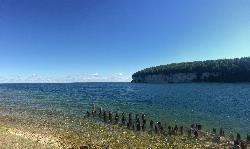
Fayette Historic State Park
Garden
37.5 miles EA buoyed Lake Michigan swim beach on Big Bay de Noc at the south end of Fayette Historic State Park, next to the picnic area, a short drive from the restored 1800s iron town. Recreation Passport required for vehicles.
Camp, Canoe, Hike, Kayak, Swim
Lake Antoine Park
Iron Mountain
38.6 miles NWA free, sandy county swim beach on the east shore of Lake Antoine just northeast of Iron Mountain, with a wheelchair-accessible mat to the water, picnic grounds and a campground. No lifeguards.
Camp, Canoe, Kayak, Swim


