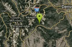
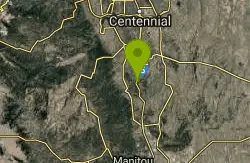
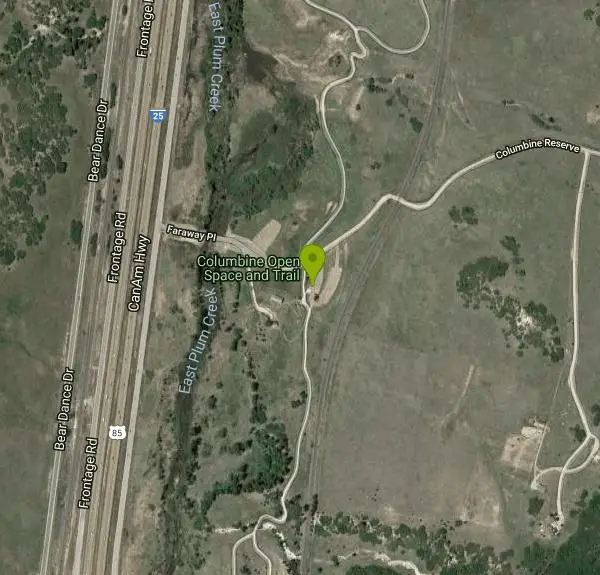
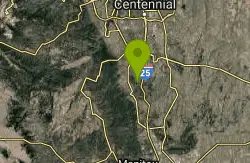
Columbine Open Space
Castle Rock, Colorado
| Address: | ~2 Faraway Pl, Castle Rock, CO 80104, USA |
| GPS: |
39°16'55.1"N 104°53'34.7"W Maps | Directions |
| State: | Colorado |
| Trail Length: | 3.00 miles |
| MTB Difficulty: | Easiest |
| Trail Type: | Lariat |
| MTB Trail Type: | Greenway |
Mountain Bike
There are two lollipop loops from the parking lot. Both are very much beginner trails. The South loop is a one mile ride and the North loop is One and a half miles. Both have moderate climbs (240 feet total) and descents. The trails are packed gravel and wide. The condition of the gravel has deteriorated somewhat. The South loop is in better shape than the North. Doing both loops is a nice 2 1/2 mile ride with some easy climbs. I wouldn't go out of my way to ride here but it is right off the interstate and near the Dawson's Butte and Rhyolite Regional Park (Quarry Mesa) trails. Courtesy of Singletracks.com
More Information
Add ResourceNever modify trail features. Ride trails when they're dry enough that you won't leave ruts. Speak up when you see others on the trail and always yield to hikers, horses, and others coming uphill. Always ride on the established trail.
Read More- Plan Ahead and Prepare
- Travel & camp on durable surfaces
- Dispose of waste properly
- Leave what you find
- Minimize campfire impacts
- Respect wildlife
- Be considerate of other visitors
Directions
From Castle Rock, Colorado
- Head north on Cantril St toward Third St (92 ft)
- Turn left at the 1st cross street onto Third St (0.1 mi)
- Turn left at the 2nd cross street onto Perry St (0.6 mi)
- Turn right onto Plum Creek Pkwy (0.1 mi)
- Turn left onto S Wilcox St (6.0 mi)
- Turn left onto Faraway Pl (0.1 mi)
- Continue straight onto Columbine Reserve (427 ft)
- Turn rightDestination will be on the left(151 ft)
Other Mountain Bike Trails Nearby
Dawson's Butte
Castle Rock, Colorado
1.7 miles NWA simple, hard-to-get-lost loop through ponderosa forest and open meadows, just over 5 miles with about 300 feet of elevation — run it counter-clockwise for the better downhill.
Mountain Bike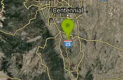
Phillip S. Miller Park
Castle Rock, Colorado
6.0 miles NA 220-acre mountain bike trail system in Castle Rock featuring twisting singletrack, 200-step stair climbs, impressive overlook views, and rewarding quick downhills.
Mountain Bike
Memmen Ridge Open Space
Castle Rock, Colorado
6.4 miles NA peaceful, close-to-town trail at Memmen Ridge Open Space near Castle Rock with great views and good trails — a nice option for a relaxed ride.
Mountain Bike
Greenland Open Space
Larkspur, Colorado
7.3 miles SA lollipop-shaped trail through Larkspur's Greenland Open Space — mostly doubletrack, about 500 feet of elevation gain, and a dry surface that makes it rideable even in winter.
Mountain Bike
Lincoln Mountain
Larkspur, Colorado
10.7 miles SETwo lollipop loops on Douglas County Open Space — one climbing Lincoln Mountain and one on the Palmer Divide — with wide singletrack, some rocky sections, and views throughout.
Mountain Bike
Devil's Head Stretch
Sedalia, Colorado
12.5 miles NWMoto-carved berms, chutes, dips, and rollers on a multi-use trail shared heavily with dirt bikes on weekends — best ridden on a quiet weekday after a good rain firms things up.
Mountain Bike
Bayou Gulch Bike Park
Parker, Colorado
13.5 miles NEA dedicated bike park near Parker with a beginner loop, an intermediate loop, and three intermediate flow trails — a great place to build skills.
Mountain Bike
Glendale Open Space Trail
Castle Rock, Colorado
14.5 miles NA 160-acre open-space trail in Castle Rock winding through chokecherry shrubs, Gambel oak, and grasslands with views of Pikes Peak and the Front Range — plus a five-acre off-leash dog area.
Mountain Bike
Highlands Point
Highlands Ranch, Colorado
17.0 miles NA roller-coaster mix of narrow and wide singletrack climbs through open trails and private HR terrain to Highlands Point, where summit markers point out Devil's Head Peak, Mt. Evans, and Chatfield.
Mountain Bike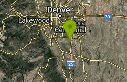
Bluffs Regional Park Trail
Lone Tree, Colorado
17.0 miles NA 2.7-mile crushed-gravel loop with two scenic overlooks — great for a quick lunchtime spin or an easy family ride on dirt.
Mountain Bike
North Fork
Littleton, Colorado
17.3 miles NWA smooth, nearly rock-free machine-made singletrack running along the mountainside from South Platte River — gradual climbing on Hummingbird leads to a flowing North Fork descent.
Mountain Bike
East-West Regional Trail
Littleton, Colorado
17.6 miles NThe first leg of the East-West Regional Trail near Littleton winds through grasslands, oak bluffs, and open space with moderate climbing, some singletrack sections, and multi-use access for hiking, riding, and horses.
Mountain Bike
Colorado Trail: Waterton To South Platte
Littleton, Colorado
18.0 miles NWSeventeen miles of the Colorado Trail from Waterton Canyon to South Platte, with sweet singletrack, forested sections, rocky climbs, and only about 460 miles left to Durango.
Mountain Bike
Indian Creek Loop
Littleton, Colorado
18.0 miles NW17 miles of off-road trail with significant climbing and route-finding along the Colorado Trail from Waterton Canyon to the Indian Creek Loop — bring a detailed map near Littleton.
Mountain Bike
Colorado Trail
Littleton, Colorado
18.0 miles NWEpic Colorado singletrack with killer views and lung-busting elevation — detours around six wilderness areas are required, but day trip routes and connecting trails abound.
Mountain Bike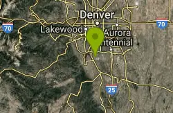
Plum Creek Park
Littleton, Colorado
18.3 miles NA short, slightly downhill beginner singletrack at Plum Creek Park in Littleton — sandy, with a few small turns, great for practice or learning the basics.
Mountain Bike
Colorado Trail: Buffalo Creek To Lost Creek Wilderness Boundary
Pine, Colorado
19.9 miles WA beautiful point-to-point Colorado Trail ride from FR 550 through Buffalo Creek to the Lost Creek Wilderness boundary — bikes must turn back at the wilderness line.
Mountain Bike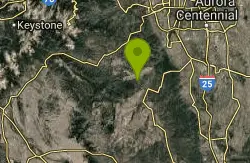
Chair Rocks
Pine, Colorado
19.9 miles WA seldom-used trail through the Buffalo Creek burn area with smooth tread, gentle hills, endless singletrack, rock formations, wildlife, and expansive mountain vistas.
Mountain Bike
Colorado Trail: Green Mountain
Pine, Colorado
19.9 miles WSweet, smooth singletrack with a great mix of climbs and descents through beautiful scenery — described as the Front Range's answer to the Tsali trails.
Mountain Bike
Colorado Trail: Morrison Creek / Lunar Loop
Pine, Colorado
20.0 miles WA loop through burned-out forest and open terrain climbing about 800 feet, with Morrison Creek singletrack connecting the Shingleman trail — more exposed than the Green Mountain option.
Mountain Bike