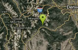
Highlands Point
Highlands Ranch, Colorado
| Address: | ~10585 Mountain Vista Ridge, Highlands Ranch, CO 80126, USA |
| GPS: |
39°31'16.2"N 104°57'50.9"W Maps | Directions |
| State: | Colorado |
| Trail Length: | 10.00 miles |
| MTB Difficulty: | Beginner |
| Trail Type: | Network |
| MTB Trail Type: | Singletrack |
Mountain Bike
The section of trails at Highlands Point can be accessed from Mountain Vista High School or via the East-West Regional trail parking lot on Griggs rd. Note that all but two of these trails are gated for HR residents only. Trail is accessed by taking the paved bike path in back of Mountain Vista HS until it turns to gravel, then just follow that up the hill. The first trail on the right and ahead are the East-West Regional Trail, open to everyone. Continuing straight up the hill, the first trail on the left is the Metro Districts Big-Dry trail, also open to everyone. You can turn left or continue straight up the gravel path to the top (Highlands Point) and continue on the East-West Regional trail to the Griggs rd. parking lot. The view at the top of Highlands Point is excellent, markers point out Devil's Head Peak, Mt. Evans, Chatfield, etc. The gated trails off to the left and right provide access to approx 7mi of private HR trails. Trail builders built large "bumps" every 100ft or so on some sections to prevent erosion. Overall, a mixture of narrow and wide singletrack, great views, along with intervals of short uphill and downhill sections make this a really fun trail with a roller coaster feel to it. Courtesy of Singletracks.com
Never modify trail features. Ride trails when they're dry enough that you won't leave ruts. Speak up when you see others on the trail and always yield to hikers, horses, and others coming uphill. Always ride on the established trail.
Read More- Plan Ahead and Prepare
- Travel & camp on durable surfaces
- Dispose of waste properly
- Leave what you find
- Minimize campfire impacts
- Respect wildlife
- Be considerate of other visitors
Directions
From Highlands Ranch, Colorado
- Head south on S Crestmore Way toward Montrose Way (0.3 mi)
- Turn right onto Windsor Way (0.1 mi)
- Turn left onto E Highlands Ranch Pkwy (1.0 mi)
- Turn right at the 2nd cross street onto Clairton Dr (0.3 mi)
- Turn left onto S Clairton St (0.1 mi)
- Turn left at the 2nd cross street onto Wyecliff Way (0.2 mi)
- Turn left onto Ridgefield Ln (0.1 mi)
- Turn right onto Summit View Pkwy (1.2 mi)
- Turn rightDestination will be on the left(174 ft)

Other Mountain Bike Trails Nearby
Plum Creek Park
Littleton, Colorado
2.3 miles WThis is the shortest single track ever but it is a good trail for beginners and practice for the big stuff. It is a little sandy and slightly downhill. There ar5e a few small turns but...
Mountain Bike
East-West Regional Trail
Littleton, Colorado
2.6 miles NE-- "This is the first leg of the East-West Regional Trail that will connect Chatfield State Park with the Town of Parker. The trail winds through grasslands and oak bluffs including...
Mountain Bike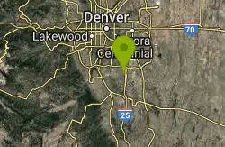
Bluffs Regional Park Trail
Lone Tree, Colorado
4.2 miles EThis is a multi-use trail made of crushed gravel. There are no technical features at all, but it is good for a lunchtime lap or for a couple of laps after work. It's also good for...
Mountain Bike
Glendale Open Space Trail
Castle Rock, Colorado
5.4 miles SEAdjacent to I-25, the 160-acre property has native chokecherry and wild plum shrubs along an intermittent stream. The trail winds up into Gambel oak shrubland and onto a grassland plain...
Mountain Bike
Colorado Trail: Waterton To South Platte
Littleton, Colorado
7.2 miles W*Note: Waterton Canyon will be closed for for two extended periods in 2010 and 2011: 8/2/2010 - 12/3/2010 and 2/28/2011 - 12/31/2011. Alternate access to the first section of the...
Mountain Bike
Indian Creek Loop
Littleton, Colorado
7.2 miles WThe first and last 6 miles of this trail are on the gravel road that goes through Waterton Canyon, meaning your total off-road trail distance will be about 17 miles (29 miles total)....
Mountain Bike
Colorado Trail
Littleton, Colorado
7.4 miles WAmazing singletrack, killer views, and lung busting elevation - what more could you ask for? Portions of the Colorado Trail are off limits to bikes so you'll need to detour around each...
Mountain Bike
Dirt Jumps
Littleton, Colorado
7.6 miles NWthese jumps are under the first set of tress you'll see. There are some good jumps in there i wouldn't make the trip if you live farther then 5 miles.
Mountain Bike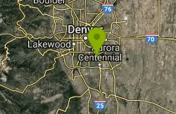
Cherry Creek
Denver, Colorado
7.9 miles NEAlthough technically, this is a bike path, there are extended sections of singletrack that dart in and out of it with some surprisingly technical spots. For maximum...
Mountain Bike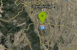
Phillip S. Miller Park
Castle Rock, Colorado
11.4 miles SPark at the Miller Activity Center parking lot (or start on sidewalk just off the Plum Creek Parkway entrance) and join the trail at the base of the "mini incline" stairs (200 steps to...
Mountain Bike
Ken Caryl Valley
Littleton, Colorado
11.9 miles NWSingle Track linked togather with a couple short road segments
Mountain Bike
Devil's Head Stretch
Sedalia, Colorado
12.2 miles SWDevil's Head Stretch is a multi-use trail that is full of moto-carved rollers, berms, dips, chutes, and off-shoots. It is densely populated with dirt-bikes on the weekends.This trail...
Mountain Bike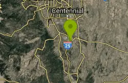
Memmen Ridge Open Space
Castle Rock, Colorado
12.2 miles SEThis is a very nice close to town peaceful trail with great views and good trails.
Mountain Bike
North Fork
Littleton, Colorado
13.5 miles SWThis is a new machine-made singletrack, that largely runs on the side of mtn's. Can be done either as out/back, with folks usually starting at the bottom next to the South Platte...
Mountain Bike
Bayou Gulch Bike Park
Parker, Colorado
13.9 miles SEThis is a bike park. There are two "loop" tracks, one beginner and one intermediate, as well as 3 intermediate flow trails.
Mountain Bike
Bear Creek Lake Park
Lakewood, Colorado
14.4 miles NWThis is a good trail system to ride when the foothills and mountains are covered in snow. Located just to the south of Green Mountain, it provides a close-in alternative for riders to...
Mountain Bike
5-Parks
Morrison, Colorado
14.8 miles NWLink up of several parks above Morrison.
Mountain Bike
Green Mountain
Lakewood, Colorado
15.1 miles NWThis park has three parking areas. The loop is the same from all. From any trailhead, begin a clockwise loop in the park. On the south-east sides of the park, this loop maintains fairly...
Mountain Bike
Colorado Trail: South Platte To Buffalo Creek
Conifer, Colorado
15.2 miles WThe initial climb out of the parking lot is by far the hardest part of this section of the Colorado Trail. Within the past several years, a re-routed portion of trail was created and...
Mountain Bike
Hayden Green Mountain Park
Lakewood, Colorado
15.4 miles NWWith more than 2,400 acres of open space, William Frederick Hayden Park on Green Mountain is the second largest park in Lakewood. The park features a challenging network of multi-use trails. The...
Mountain Bike