


Cummins Falls
Cookeville, Tennessee

| GPS: |
36°14'57.8"N 85°34'18.1"W Maps | Directions |
| State: | Tennessee |
Swim

- Plan Ahead and Prepare
- Travel & camp on durable surfaces
- Dispose of waste properly
- Leave what you find
- Minimize campfire impacts
- Respect wildlife
- Be considerate of other visitors
Directions
From Cookeville, Tennessee
- Head north on S Dixie Ave toward E Broad St (1.1 mi)
- Turn left onto W 12th St (1.2 mi)
- Continue onto TN-290 W/Gainesboro GradeContinue to follow TN-290 W(6.6 mi)
- Turn right onto Cummins Mill Rd (2.0 mi)

Other Swimming Holes Nearby
Wartrace Creek Recreation Area
Gainesboro
13.5 miles NWA Corps of Engineers day-use park on Cordell Hull Lake west of Gainesboro, with a buoyed sand swim beach, boat ramp and playground. Entry is $5 per vehicle.
Canoe, Kayak, Swim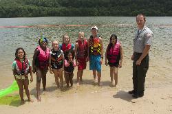
Defeated Creek Day Use Area
Carthage
19.2 miles WA Corps of Engineers swim beach on the south shore of Cordell Hull Lake, with a $5 per vehicle day use fee and a gentle sand and gravel entry beside the Defeated Creek boat ramp. The Bearwaller Gap trailhead and the Corps campground are next door.
Camp, Hike, Kayak, Swim
Carmac Falls
Smithville, Tennessee
23.9 miles SWCLOSED. This is on private property and is only accessible to guests of Evins Mill. See details below.
Swim
Rock Island State Park
Rock Island, Tennessee
30.3 miles SSwim near Rock Island, Tennessee
Swim
Fall Creek Falls State Park
Pikeville, Tennessee
42.5 miles SSwim near Pikeville, Tennessee
Swim
Goochie Ford
Readyville, Tennessee
44.8 miles SWSwim near Readyville, Tennessee
Swim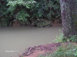
Temple Hill Area
Butler, Kentucky
46.4 miles NA slow, deep, cool swimming hole on the Skaggs River with a small sandy beach near the Happy Hollow Bridge — a perfect summer spot for relaxing in the water all year.
Swim
Ozone Falls
Rockwood, Tennessee
49.7 miles SESwim near Rockwood, Tennessee
Swim


