


Eagle Rest
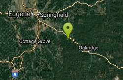
Lowell, Oregon
Canoe, Hike, and Mountain Bike
Just west of the Tooth Rock Viaduct, there's a one-car sized turnout on the guard rail. Lancaster designed this as part of the original road and he called it the Eagle's Nest. Originally the view here consisted of the river and the small town of Bonneville. Later, it was a good place to watch the early construction of Bonneville Dam. There are several anecdotal tales of collisions when moving cars hit stopped cars here. The original Eagle's Nest was destroyed much later, probably during construction of the second powerhouse at the dam. A new "Eagle's Nest" was constructed as part of the 1996 rebuild to a trail.
More Information
Never modify trail features. Ride trails when they're dry enough that you won't leave ruts. Speak up when you see others on the trail and always yield to hikers, horses, and others coming uphill. Always ride on the established trail.
Read MoreBe courteous, informed, and prepared. Read trailhead guidelines, stay on the trail, and don't feed the wildlife.
Read More- Plan Ahead and Prepare
- Travel & camp on durable surfaces
- Dispose of waste properly
- Leave what you find
- Minimize campfire impacts
- Respect wildlife
- Be considerate of other visitors
Directions
From Lowell, Oregon
- Head east on W Main St toward S Moss St (0.2 mi)
- Turn right at the 2nd cross street onto S Pioneer St (0.7 mi)
- Turn left onto OR-58 E (7.4 mi)
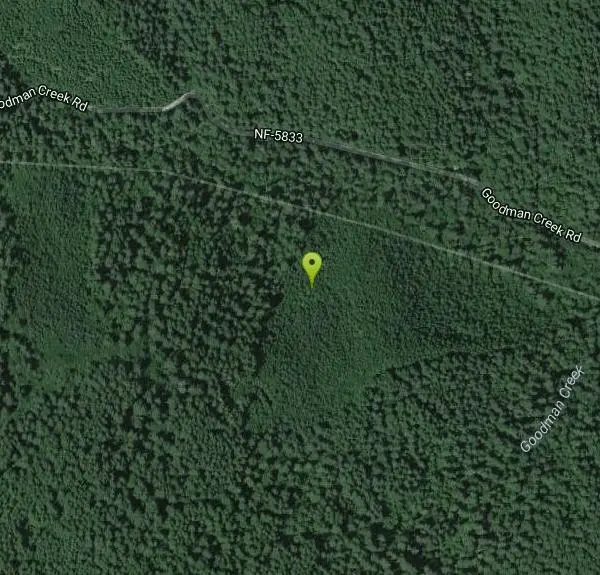
- Turn right onto Goodman Creek Rd/NF-5833 (1.7 mi)
Located near Dexter, Oregon, just west of the Tooth Rock Viaduct.
Other Mountain Bike Trails, Hiking Trails, and Canoeing Areas Nearby

Mount Pisgah
Eugene, Oregon
18.5 miles NWMount Pisgah is a summit in Willamette Valley. It is a popular place for hiking, walking, and trail running because of how close it is to the city of Eugene and Springfield. The non-profit...
Hike
Spencer Butte
Eugene, Oregon
22.5 miles NWIn need of a nearby hiking fix? Spencer Butte is the perfect place to get away from the city of Eugene and into the forest. Spencer Butte is a prominent landmark in Lane County, Oregon. It is...
Hike
Alton Baker Park Canoe Canal & 24/7 Wave
Eugene, Oregon
24.1 miles NW24/7 is a year round wave. On the North side of Alton Baker Park, running parallel to the Wilammette River is the Canoe Canal. About 1 mile down stream of the intake of the canal is a...
Canoe, Kayak
Tamolitch (Blue) Pool
Mount Washington, Oregon
46.2 miles NEThe Tamolitch Pool, also known as the Blue Pool, is the one and only pool of its kind in Oregon. The name "Tamolitch", meaning 'bucket', was given to this gorgeous basin by the...
Hike
Cheadle Lake Trails
Lebanon, Oregon
47.9 miles NCheadle Lake has undergone some recent improvements, and the trails that were until recently clogged with blackberries and assorted brush are now clear and rideable. It's a lot of fun...
Mountain Bike
Lebanon Dikes
Lebanon, Oregon
49.1 miles NThe "Dikes" trails on the east side of Lebanon, Oregon roll along the western bank of the South Santiam River. The trails have existed for many generations, and offer approximately 2.5...
Mountain Bike


