Fort Custer Beach
Augusta
Camp, Canoe, Hike, Kayak, and Swim
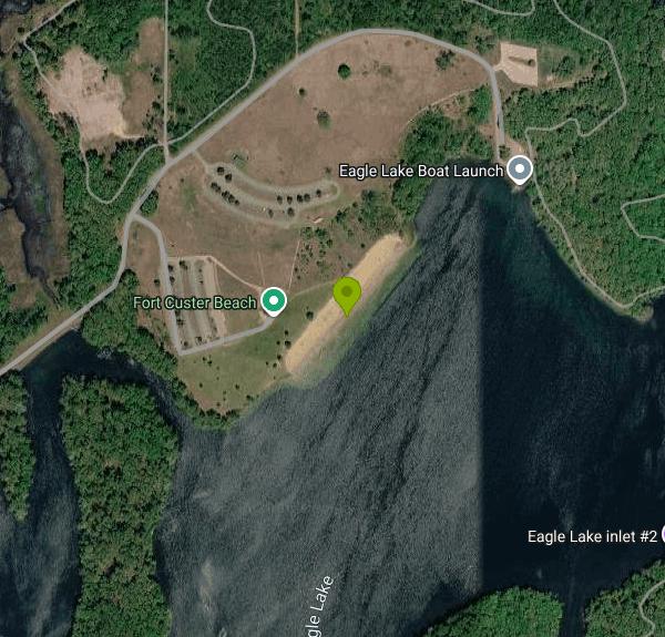
Fort Custer Beach is the public swimming beach on Eagle Lake inside Fort Custer State Recreation Area, a 3,033-acre park run by the Michigan Department of Natural Resources between Kalamazoo and Battle Creek. The beach sits on the north shore of Eagle Lake, one of the park's three lakes, in the day-use area a little under two miles east of the village of Augusta. The land was farmland before the Army took it for Camp Custer, and it passed to the State of Michigan in 1971. Today the shoreline around the beach is wooded hills and patches of restored prairie.
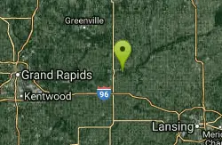
The park entrance is at 5163 Fort Custer Drive, reached from M-96 (Dickman Road) on the Augusta side. Follow the park road to the Eagle Lake day-use area, where parking lots sit just uphill from the beach house and two picnic pavilions. The walk from the car to the sand is short, and the DNR lists an accessible walkway down to the water. The park also lends out a track chair at no cost that can handle sand and shallow water.
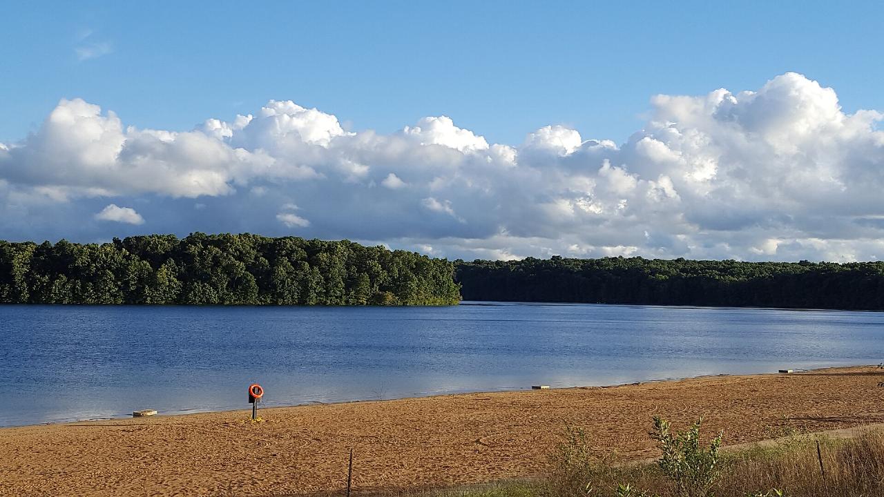
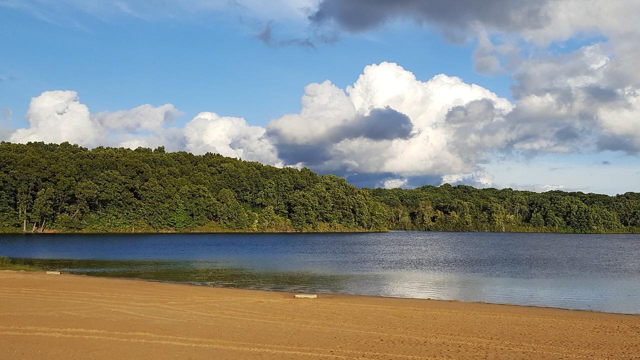
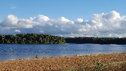
Swimming is inside a buoyed area off a wide, open sand beach. The water stays calm because the whole lake is no-wake, and boats use a separate launch at the lake's northeast corner, away from the swimmers. The DNR does not list lifeguards for this beach, so adults need to watch their own group and stay inside the buoys. The beach house has restrooms, and from May 15 through Sept. 15 Simple Adventures runs a concession there with snacks and kayak, canoe and stand-up paddleboard rentals.
There is no separate charge to swim. What you pay for is vehicle entry: every car needs a Michigan Recreation Passport. For Michigan-registered vehicles it is $15 a year when added to your plate renewal through the Secretary of State, or $20 bought at the park with the $5 convenience fee. Out-of-state vehicles pay $12 for a day pass or $42 for an annual pass. Day-use hours at Michigan state parks are 8 a.m. to 10 p.m. daily. Alcohol is not allowed in the park from April 1 through Labor Day, and pets are not allowed on the designated swim beach or in the swim area.
Kalamazoo County Environmental Health samples the Eagle Lake beach for E. coli from Memorial Day through Labor Day and posts results to the state's BeachGuard system. On July 1, 2026 the county issued a public health advisory after a June 29 sample came back at 348.6 E. coli per 100 mL, over the state limit of 300. A retest came in at 148.9 and the advisory was lifted the next day. Check the county or BeachGuard results after heavy rain before you go in. The park also carries a DNR notice that old explosive hazards from the Camp Custer training years may remain in the ground. If you find something that looks like ordnance, leave it alone, move away and report it.
The beach makes an easy stop on a longer day at Fort Custer. More than 40 miles of trails loop the lakes and are popular with mountain bikers, hikers and horseback riders, and the red trail runs along a peninsula on Eagle Lake. Anglers fish Eagle Lake for bass, bluegill, crappie, pike, walleye and muskie, and a 219-site modern campground sits a short drive from the beach if you want to stay over.
More Information
5 Unexpected Gems You'll Find at Fort Custer Recreation Area in Augusta
Uncover hidden trails and breathtaking landscapes during your visit to Fort Custer Recreation Area.
https://www.discoverkalamazoo.com/blog/post/5-unexpected-gems-youll-find-at-fort-custer-recreation-area-in-augusta/Eagle Lake - Fort Custer RA - Outdoor Michigan
Outdoor activities in michigan
https://outdoormichigan.org/feature/4113Public health advisory issued for Fort Custer's Eagle Lake due to E. coli levels
A Public Health Advisory was issued for the bathing beach on Eagle Lake at Fort Custer Recreation Area on Wednesday.
https://wwmt.com/news/local/fort-custer-eagle-lake-public-health-advisory-e-coli-kalamazoo-county-environmental-health-samples-recreation-area-surface-water-recreationPublic health advisory lifted for Fort Custer's Eagle Lake
A public health advisory has been lifted for Eagle Lake in Fort Custer Recreation Area, according to the Kalamazoo County Environmental Health.
https://wwmt.com/news/local/fort-custer-eagle-lake-public-health-advisory-lifted-body-contact-water-e-coli-samples-public-healthBe courteous, informed, and prepared. Read trailhead guidelines, stay on the trail, and don't feed the wildlife.
Read More
- Plan Ahead and Prepare
- Travel & camp on durable surfaces
- Dispose of waste properly
- Leave what you find
- Minimize campfire impacts
- Respect wildlife
- Be considerate of other visitors
Directions
From Augusta
- Head north on Monte Sano Ave toward Raymond Ave (0.7 mi)
- Turn right onto Walton Wy (128 ft)
- Turn left onto Monte Sano Ave (0.4 mi)
- Turn left onto Wheeler Rd (0.2 mi)
- Turn right onto Berckmans Rd (0.6 mi)
- At the traffic circle, continue straight to stay on Berckmans Rd (1.2 mi)
- Continue onto Alexander Dr (0.9 mi)
- Turn left onto River Watch Pkwy (0.2 mi)
- Take the ramp to Columbia (0.3 mi)
- Merge onto I-20 EEntering South Carolina(5.4 mi)
- Take exit 5 for US-25/
SC-121 toward Edgefield/ Johnston (0.4 mi) - Turn left onto SC-121 N/
US-25 N/ Edgefield Rd (8.3 mi) - Continue onto SC-121 N/
US-25 N/ Edgefield Rd (1.8 mi) - Continue onto US-25 N (3.3 mi)
- Continue straight onto SC-121 N (20.2 mi)
- Turn left onto S Jefferson St (1.9 mi)
- Continue onto SC-39 N (14.4 mi)
- Turn right onto SC-56 (14.3 mi)
- Keep left (0.2 mi)
- Slight left onto SC-56Pass by Bojangles (on the left in 4.3 mi)(4.3 mi)
- Turn right onto SC-56/
SC-56 T N/ SC-72 Truck E/ Springdale Dr (3.9 mi) - Turn right onto SC-56 (1.1 mi)
- Turn left to merge onto I-26 W toward Spartanburg (0.6 mi)
- Keep right to stay on I-26 WEntering North Carolina(87.9 mi)
- Continue onto I-26 W (3.5 mi)
- Take exit 31B on the left for I-40 W/
US-74 toward Canton/ Knoxville (0.8 mi) - Merge onto I-40/
US-74 W Continue to follow I-40Parts of this road may be closed at certain times or daysEntering Tennessee(79.2 mi) - Keep left to stay on I-40 (24.8 mi)
- Take exit 393 for I-640 W/
US-25W N toward I-75 N/ Lexington (0.4 mi) - Continue onto I-640 W/
US-25W N (6.6 mi) - Take exit 3A for I-75 N toward Lexington (0.6 mi)
- Continue onto I-75 NEntering Kentucky(171 mi)
- Take the I-75 N exit toward Georgetown/
Cincinnati (0.5 mi) - Continue onto I-75 NEntering Ohio(74.0 mi)
- Keep left to stay on I-75 N, follow signs for Dayton (110 mi)
- Take exit 110 for US-33 toward St Marys/
Bellefontaine (0.3 mi) - Turn left onto US-33 W (12.8 mi)
- Take the US-33 W exit toward OH-29 E/
St Marys/ Ft Wayne (0.4 mi) - Take the ramp to Ft Wayne (0.1 mi)
- Merge onto US-33 W (10.6 mi)
- Turn right onto US-127 N (10.3 mi)
- Turn left onto Wren-Landeck Rd (2.5 mi)
- Turn right onto Liberty-Union Rd (5.5 mi)
- Turn left onto Lincoln Hwy (1.1 mi)
- Turn right onto Richey Rd (1.1 mi)
- Turn left onto US-30 WEntering Indiana(21.1 mi)
- Take the ramp onto I-469 N/
US-30 W (11.2 mi) - Take exit 31A to merge onto I-69 N toward LansingEntering Michigan(80.7 mi)
- Take exit 38 to merge onto I-94 W (10.5 mi)
- Take exit 98B to merge onto I-194 N/
M-66 N toward Downtown/ Battle Creek (2.9 mi) - Take exit 3 for Dickman Rd/
I-94 Business (0.3 mi) - Turn left onto I-94BL W/
E Dickman Rd Continue to follow E Dickman Rd(3.2 mi) - Continue straight onto M-96 W/
W Dickman Rd (5.7 mi) - Turn left onto Fort Custer Dr (1.2 mi)
- Continue straight (0.9 mi)
- Continue straight (0.9 mi)
- Turn right (0.3 mi)