


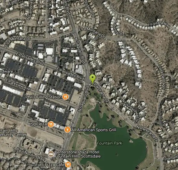
Fountain Park Trail
Fountain Hills, Arizona

| Address: | ~17001-17041 N Panorama Dr, Fountain Hills, AZ 85268, USA |
| GPS: |
33°36'23.1"N 111°42'49.1"W Maps | Directions |
| State: | Arizona |
| Trail Length: | 1.80 miles |
| Elevation Gain: | 200.00 feet |
| Hike Difficulty: | Beginner |
| Trail Type: | Loop |
Pet Friendly
Hike and Mountain Bike
Fountain views, Four Peaks view, desert vegetation, close to coffee! The trail is well groomed and well marked. It parallels some house as you begin to go up the first hill. About 15 minutes and a few switchbacks later you are on the ridgeline. The to West and Southwest is Fountain Hills and the beautiful Fountain Park. To the Northeast lies the great Four Peaks mountain. The views are spectacular. The trail leaves the residential area for a while. It follows the ridgeline and then descends through a series of switchbacks. You will climb another hill and this happens a couple more times along the trail. The trail is almost like a horseshoe in shape in that it ends at another road by a gate into the subdivision you just hiked by. Follow the road down hill towards the Fountain Park for about 1/2 a mile. It intersects with Palisades Boulevard and not too far from the parking lot where you left your car. Great for family hikes and don't forget to stop by and get some coffee (iced) at the Mountain View Coffee Co. Courtesy of AllTrails.com
More Information
Add ResourceNever modify trail features. Ride trails when they're dry enough that you won't leave ruts. Speak up when you see others on the trail and always yield to hikers, horses, and others coming uphill. Always ride on the established trail.
Read MoreBe courteous, informed, and prepared. Read trailhead guidelines, stay on the trail, and don't feed the wildlife.
Read More- Plan Ahead and Prepare
- Travel & camp on durable surfaces
- Dispose of waste properly
- Leave what you find
- Minimize campfire impacts
- Respect wildlife
- Be considerate of other visitors
Directions
From Fountain Hills, Arizona
- Head southeast on E El Lago Blvd toward N northstar Dr (0.6 mi)
- Turn left onto N Saguaro Blvd (0.5 mi)
- Turn right onto N Panorama DrDestination will be on the right(112 ft)
Other Mountain Bike Trails and Hiking Trails Nearby

Fountain Hills Park
Fountain Hills, Arizona
0.4 miles SEFountain Park is a 1.3 mile loop trail located near Phoenix, Arizona ( in Fountain Hills) and is good for all skill levels. The trail is primarily used for hiking and is accessible...
Hike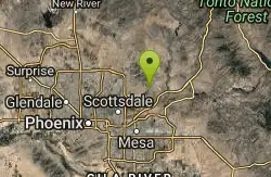
Sunrise Peak via Sunrise Trail
Scottsdale, Arizona
3.2 miles WHike near Scottsdale, Arizona
Hike
Sport Loop
Fountain Hills, Arizona
3.5 miles NMountain Bike near Fountain Hills, Arizona
Mountain Bike
Sonoran Trail Fountain Hills
Fountain Hills, Arizona
3.7 miles NWHike near Fountain Hills, Arizona
Hike
Dixie Mine
Fountain Hills, Arizona
3.8 miles NWMcDowell Mountain Regional Park 16300 McDowell Mountain Park Dr. MMRP Arizona 85255 Ph: 480-471-0173 Fax: 602-372-8507 mcdowellpark@mail.maricopa.gov Mailing...
Hike
Thompsons Peak
Fountain Hills, Arizona
3.8 miles NWHike near Fountain Hills, Arizona
Hike
Coachwhip Trail Loop
Fountain Hills, Arizona
4.3 miles NThe Pemberton Trail is the best known trail in this area and is the arterial backbone connecting other spur trails. Don't just ride Pemberton and feel like you've seen it all. Many...
Mountain Bike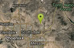
Tonto Pass
Fountain Hills, Arizona
4.4 miles NWTrail starts out as Pemberton loop - counterclockwise. Ride approximately 5.25 miles (430ft climb over this distance). No real technical areas on the way up, some sand and small berms....
Mountain Bike 2.1 mi
Lower Salt River Nature Trail
Fort McDowell, Arizona
5.2 miles SEThe Lower Salt River Nature Trail is a scenic walk to take at the Tonto National Forest. This trail provides stunning views as you walk alongside the Salt River. This rustic trail is older and less...
Camp, Hike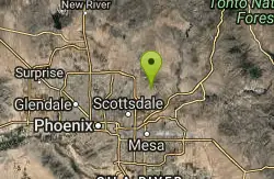
Sunrise
Scottsdale, Arizona
5.7 miles WSweet little loop! Gradual climb with some fun descent and nice views of Scottsdale and Phoenix. Watch out for Cacti and drink lots of water, it's very exposed and the Sun is...
Mountain Bike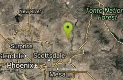
Pemberton Loop
Fort McDowell, Arizona
5.8 miles NThere are many places to start this loop from really as it crosses other trails and the main road twice. The 15 mile loop can be cut in half or about more by either the Tonto Tank tr or...
Mountain Bike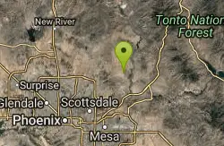
McDowell Mountain Park
Fort McDowell, Arizona
5.8 miles NThis trail is great. It is not as rocky as other Phoenix area trails( ie: Trail 100, National, Estrella Mtn Park). Twisty singletrack on rolling contour. The surface consists of small...
Mountain Bike
Tortoise and Hilltop Trails
Fort McDowell, Arizona
6.1 miles NBe on the lookout for wildlife like jackrabbits and lizards on the initial stretch of trail (Tortoise Trail) and for mountain bikers as this trail joins the Pemberton Trail for a bit as...
Hike
Wagner-Granite-Bluff Trails
Scottsdale, Arizona
6.1 miles NHike and Mountain Bike near Scottsdale, Arizona
Hike, Mountain Bike
Wagner Trail
Scottsdale, Arizona
6.1 miles NWagner Trail is a 2.2 mile, beginner to intermediate loop trail located in the McDowell Sonoran Preserve. The trail is well-marked and easy to follow; this wide, but rugged...
Hike, Horseback, Mountain Bike 1.5 mi
The Saddle
Mesa, Arizona
7.1 miles SSaddle trail is an intermediate mountain biking trail that connects to the greater Hawes trail network. The trail is 1.5-2mi long and it offers beautiful views of the neighboring Salt River and Red...
Hike, Mountain Bike 1.3 mi
Ridge Trail
Mesa, Arizona
7.1 miles SThe trails within the Hawes loop system were originally built by mountain bikers for mountain bikers, so the trails feature fantastic singletrack that twist and turn for miles. Be warned,...
Mountain Bike 7.5 mi
Hawe's Loop
Mesa, Arizona
7.2 miles SMost of the trails in the Phoenix metropolitan area were originally built by mountain bikers, and the Hawe's loop trail system and trail are no exeptions. This trail features fantastic...
Hike, Mountain Bike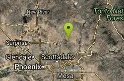
Tom's Thumb, Feldspar, and Marcus Landslide Loop
Scottsdale, Arizona
7.9 miles NWHike near Scottsdale, Arizona
Hike
Tom's Thumb Trail
Scottsdale, Arizona
7.9 miles NWTom's Thumb Trail is a popular trail on the McDowell Sonoran Preserve due to its unique thumb-like granite rock formation. This is a 4.7 out-and-back, intermediate trail because of its 1,200...
Hike, Mountain Bike, Rock ClimbNearby Campsites
Lower Salt River Nature Trail
Fort McDowell, Arizona
5.2 miles SEThe Lower Salt River Nature Trail is a scenic walk to take at the Tonto National Forest. This trail provides stunning views as you walk alongside the Salt River. This rustic trail is older and less...
Camp, Hike
Buckhorn Campground Nature Trail
Apache Junction, Arizona
10.6 miles SECamp and Hike near Apache Junction, Arizona
Camp, Hike


