


Buckhorn Campground Nature Trail
Apache Junction, Arizona

| Address: | ~Nature Trail, Apache Junction, AZ 85120, USA |
| GPS: |
33°28'24.9"N 111°37'12.0"W Maps | Directions |
| State: | Arizona |
| Trail Length: | 0.50 miles |
| Hike Difficulty: | Beginner |
| Trail Type: | Loop |
Pet Friendly
Camp and Hike
More Information
Add ResourceBe courteous, informed, and prepared. Read trailhead guidelines, stay on the trail, and don't feed the wildlife.
Read More- Plan Ahead and Prepare
- Travel & camp on durable surfaces
- Dispose of waste properly
- Leave what you find
- Minimize campfire impacts
- Respect wildlife
- Be considerate of other visitors
Directions
From Apache Junction, Arizona
- Head west on Apache Trail toward S Phelps Dr (0.4 mi)
- Turn right onto N Rennick Dr (0.5 mi)
- Turn left onto W Superstition Blvd (0.4 mi)
- Turn right onto N Ironwood Dr (1.0 mi)
- Turn left onto W Lost Dutchman Blvd (1.0 mi)
- Continue onto E Brown Rd (3.0 mi)
- Turn right onto N Ellsworth Rd (3.3 mi)
- Turn right onto E Usery Park RdPartial restricted usage road(0.4 mi)
- Turn right onto Buckhorn Camp Dr (0.5 mi)
- Turn right onto N McKeighn Dr (371 ft)

Other Hiking Trails Nearby

Moon Rock Loop
Apache Junction, Arizona
0.7 miles SLocated within the larger Usery Mountain Regional Park, the Moon Rock loop is a fast and smooth trail that adds 1.3 miles to the more famous Blevins Trail. Although the Moon Rock loop is not known as...
Hike, Horseback, Mountain Bike 1.7 mi
Levee Trail
Mesa, Arizona
1.1 miles SLocated within the Usery Mountain Regional Park, the Levee trail is named so because it mostly follows the top of levee, running parallel to a large section of the channel trail and a Phoenix...
Hike, Horseback, Mountain Bike
Crismon Wash Trail
Mesa, Arizona
1.5 miles SThe Crismon Wash Trail is 1.8 mile trail that is accessible from the south at the Crismon road trailhead. It is also accessible from the Blevins train to the north. There are several...
Hike, Horseback, Mountain Bike 7.5 mi
Hawe's Loop
Mesa, Arizona
4.3 miles NWMost of the trails in the Phoenix metropolitan area were originally built by mountain bikers, and the Hawe's loop trail system and trail are no exeptions. This trail features fantastic...
Hike, Mountain Bike 1.5 mi
The Saddle
Mesa, Arizona
4.3 miles NWSaddle trail is an intermediate mountain biking trail that connects to the greater Hawes trail network. The trail is 1.5-2mi long and it offers beautiful views of the neighboring Salt River and Red...
Hike, Mountain Bike
Desert Trails Bike Park
Mesa, Arizona
4.7 miles WHike and Mountain Bike near Mesa, Arizona
Hike, Mountain Bike 2.1 mi
Lower Salt River Nature Trail
Fort McDowell, Arizona
5.5 miles NWThe Lower Salt River Nature Trail is a scenic walk to take at the Tonto National Forest. This trail provides stunning views as you walk alongside the Salt River. This rustic trail is older and less...
Camp, Hike
Siphon Draw Trailhead to Flatiron
Apache Junction, Arizona
8.1 miles EThe Siphon Draw Trail up to Flatiron is a beautiful trail within the Lost Dutchman State Park. It is a 5.5 mile, there and back trail near Apache Junction, Arizona. It is a more advanced hike with...
Hike
Riparian Preserve at Water Ranch Trail
Gilbert, Arizona
10.1 miles SWThe Riparian Preserve is an urban park with a series of loop trails surrounding seven ponds stocked with fish and birds. It is located at 2757 E. Guadalupe Road, Gilbert AZ. Several...
Canoe, Hike
Fountain Hills Park
Fountain Hills, Arizona
10.3 miles NWFountain Park is a 1.3 mile loop trail located near Phoenix, Arizona ( in Fountain Hills) and is good for all skill levels. The trail is primarily used for hiking and is accessible...
Hike
Fountain Park Trail
Fountain Hills, Arizona
10.6 miles NWFountain views, Four Peaks view, desert vegetation, close to coffee! The trail is well groomed and well marked. It parallels some house as you begin to go up the first hill. About 15...
Hike, Mountain Bike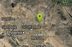
Sunrise Peak via Sunrise Trail
Scottsdale, Arizona
12.0 miles NWHike near Scottsdale, Arizona
Hike
Sonoran Trail Fountain Hills
Fountain Hills, Arizona
14.1 miles NWHike near Fountain Hills, Arizona
Hike
Dixie Mine
Fountain Hills, Arizona
14.1 miles NWMcDowell Mountain Regional Park 16300 McDowell Mountain Park Dr. MMRP Arizona 85255 Ph: 480-471-0173 Fax: 602-372-8507 mcdowellpark@mail.maricopa.gov Mailing...
Hike
Thompsons Peak
Fountain Hills, Arizona
14.1 miles NWHike near Fountain Hills, Arizona
Hike
Tortoise and Hilltop Trails
Fort McDowell, Arizona
16.4 miles NBe on the lookout for wildlife like jackrabbits and lizards on the initial stretch of trail (Tortoise Trail) and for mountain bikers as this trail joins the Pemberton Trail for a bit as...
Hike
Wagner-Granite-Bluff Trails
Scottsdale, Arizona
16.5 miles NWHike and Mountain Bike near Scottsdale, Arizona
Hike, Mountain Bike
Wagner Trail
Scottsdale, Arizona
16.5 miles NWWagner Trail is a 2.2 mile, beginner to intermediate loop trail located in the McDowell Sonoran Preserve. The trail is well-marked and easy to follow; this wide, but rugged...
Hike, Horseback, Mountain Bike
Indian Bend Bike Trail
Scottsdale, Arizona
17.0 miles NWIndian Bend Wash Greenbelt is a urban, concrete paved path, primarily used for biking and walking/jogging, in Scottsdale, Arizona. This point A to point B, 11 mile long trail takes you past parks,...
Hike, Mountain Bike
Tom's Thumb to Bell Pass
Scottsdale, Arizona
18.3 miles NWHike and Mountain Bike near Scottsdale, Arizona
Hike, Mountain Bike


