


Hanging Rock State Park Lake
Danbury
Camp, Hike, and Swim
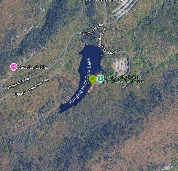
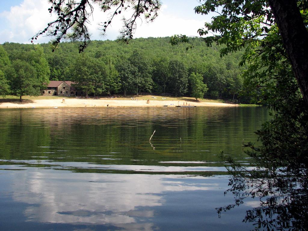
Hanging Rock State Park Lake (listed by the USGS as Hanging Rock Park Lake) is the 12-acre swim lake inside Hanging Rock State Park in Stokes County, a few miles west of Danbury and about 30 miles north of Winston-Salem. The swim beach sits on the east shore of the lake, directly in front of the park's historic stone bathhouse, whose posted address is 2847 Hanging Rock Park Road. From the main entrance on Hanging Rock Park Road, follow the park road past the visitor center to the lake parking lot, which is a short walk from the bathhouse and the sand.
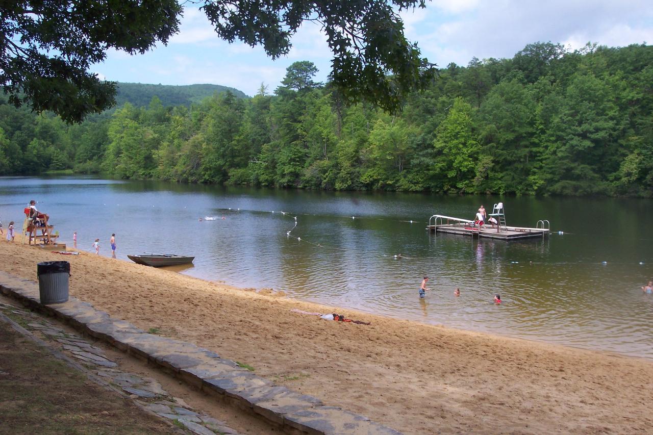
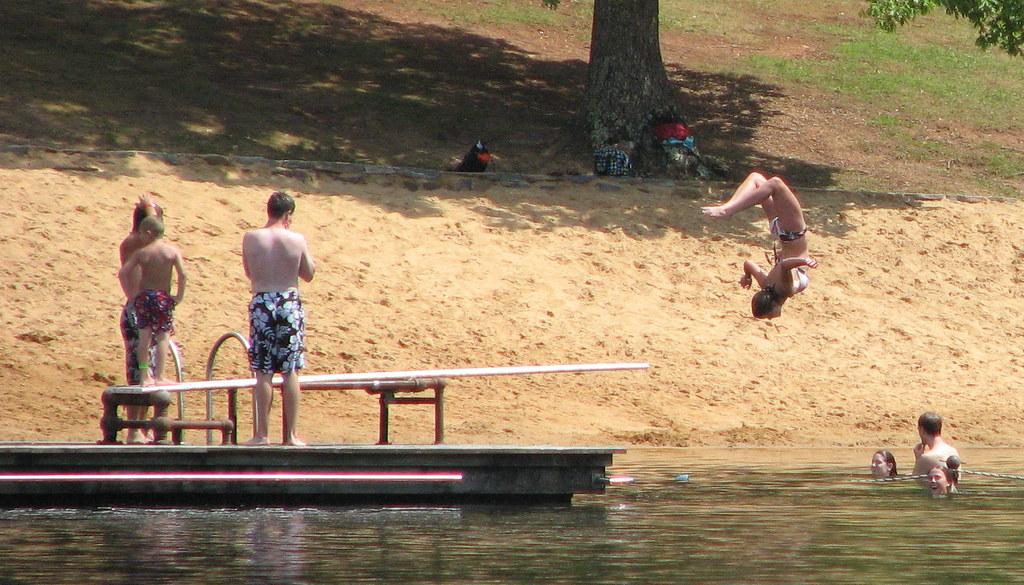
The swimming area is a roped section of the lake off a sandy beach, with a diving platform out in the water and a concession stand next to the bathhouse selling snacks and drinks. The water is dark and cool, and the park itself describes it as chilly, so expect a bracing first plunge even in July. Wooded ridges of the Sauratown Mountains rise around the lake, and there are picnic shelters and tables along the shore. Pets are not allowed on the swim beach.
Swimming is seasonal and supervised. The lake opens on Memorial Day weekend and closes after Labor Day. In 2026 it opened on Saturday, May 23, and the last day of the season was Monday, September 7. The 2026 schedule ran Thursday through Sunday from 10:00 a.m. to 5:30 p.m., closed Monday through Wednesday except on the Memorial Day and Labor Day holidays. The park warns that lake hours can change with staff availability and that the diving platform may close when lifeguard staffing is short, so it is worth calling the visitor center at 336-593-8480 before a long drive. Outside the season the beach is closed to swimming.
Entry to Hanging Rock State Park is free for day use, but the swim beach charges a state park fee: $6.00 for adults and teens 13 and up, $4.00 for children ages 3 to 12, and free for children under 3. There is a free swim window from 5:00 to 5:30 p.m. at the end of each open day. Rental boats are also available from the bathhouse area in season at $10.00 per hour (renters must be at least 16, the last rental goes out at 4:30 p.m., and personal boats are not permitted on the lake).
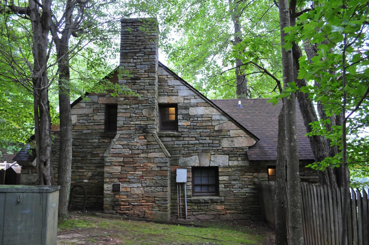
The lake is one of the park's original features. After the Winston-Salem Foundation and a Stokes County committee donated the first 3,096 acres to the state in 1936, the Civilian Conservation Corps built the park's early facilities between 1935 and 1942. The CCC finished the concrete and earthen dam in 1938, creating the lake, and added the sandy beach, a diving tower and the stone bathhouse, completed in 1939 in the rustic style under architect Robert S. Ormand. The bathhouse was listed on the National Register of Historic Places in 1991, and it still anchors the swim beach today.
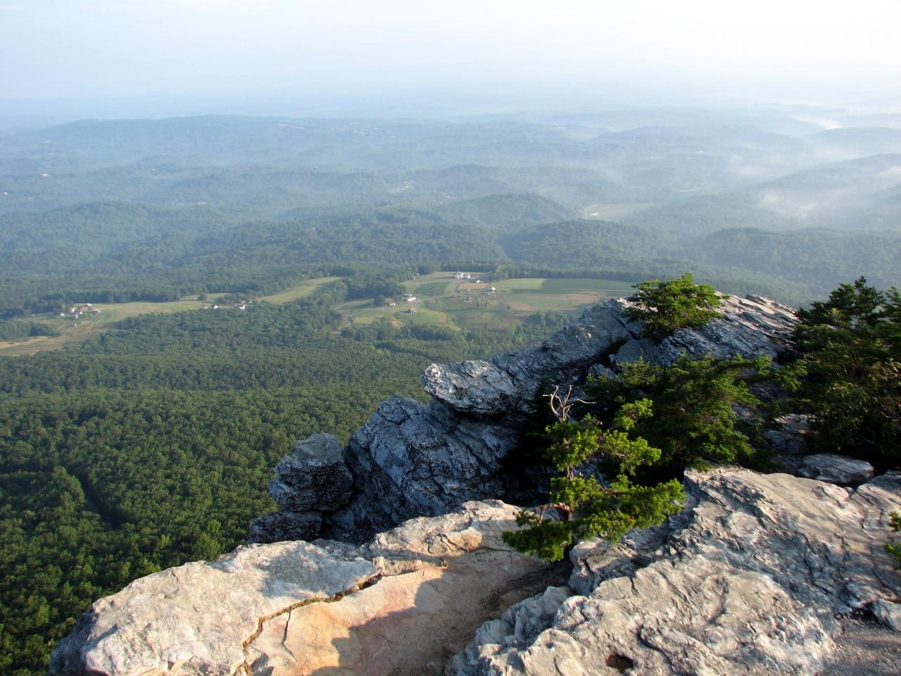
A swim here pairs well with a hike. The visitor center just north of the lake is the starting point for trails to Hidden Falls, Window Falls, the Upper Cascades and the Hanging Rock summit, and Moore's Knob, the highest point in the Sauratown range at 2,579 feet, is reached by the Moore's Wall Loop. The park's vacation cabins sit along the lake's west side. The family campground is closed for roughly a year for construction of new shower houses and campsite improvements, so check the park website before planning an overnight trip.
More Information
Hanging Rock State Park - Clio
Hanging Rock State Park is part of the most easterly mountain ranges in North Carolina, the Sauratown Mountains. The park was dedicated in 1936 on land given to the state by nearby Winston Salem and the Stokes County Committee for Hanging Rock. The site was originally home to the Saura Indians and was a hideout for Loyalist during the American Revolution. Peaks in the Sauratown range in height from 1,700 to 2,500 feet. It is known as the “mountains away from the mountains” because it is not part of the Blue Ridge Mountains. There are a number of other rock formations in the park including Moore's Knob, Moore's Wall, Cook's Wall, Devil's Chimney, and Wolf Rock.
https://theclio.com/entry/13496Hanging Rock State Park - Stokes County - LocalWiki
Hanging Rock State Park is a 9011-acre area located in the eastern most Appalachian Mountains, within a smaller range of mountains called the Sauratown Mountains. Hanging Rock State Park is part of the North Carolina State Park system, supervised by the North Carolina Division of Parks and Recreation.
https://localwiki.org/stokescounty/Hanging_Rock_State_ParkHanging Rock State Park | NCpedia
Established: 1936GPS Coordinates: 36.411906,-80.254122Size: 7,869 acres See also: Exploring North Carolina: North Carolina State Parks, Trails, Lakes
https://www.ncpedia.org/hanging-rock-state-parkHanging Rock State Park: Home | NC State Parks
The Family Campground is closed for campground improvement. The Family Campground will be closed for approximately 10-12 months for the construction of two new shower house facilities and campsite improvement.
https://www.ncparks.gov/state-parks/hanging-rock-state-parkLake Opening Day - North Carolina Department of Natural & Cultural Resources
Lake Opening Day on Saturday May 23rd at 10:00 a.m. Come on out and enjoy the peaceful and chilly waters of the park’s iconic lake! Open 10:00 a.m. to 5:30 p.m., Thursday through Sunday Closed Monday through Wednesday, Exception: May 25th and September 7th Prices: Swiming Adult age 13+, $6.00 Swiming Child 3-12, $4.00 Swiming 0-2, free Boats $10.00 per hour For additional information, contact the park office at 336-593-8480., powered by Concept3D Event Calendar Software
https://events.dncr.nc.gov/event/the-lake-opensNPGallery Asset Detail
Discover and explore a comprehensive library of National Park Service images, video, audio, maps, presentations, documents, and more.
https://npgallery.nps.gov/AssetDetail/NRIS/91001507The Lake's Last Weekend - North Carolina Department of Natural & Cultural Resources
Labor Day Weekend will be the last time the lake is open for swimming and boating for the year. For additional information reach out to hanging.rock@ncparks.gov, powered by Concept3D Event Calendar Software
https://events.dncr.nc.gov/event/the-lakes-last-weekendBe courteous, informed, and prepared. Read trailhead guidelines, stay on the trail, and don't feed the wildlife.
Read More
- Plan Ahead and Prepare
- Travel & camp on durable surfaces
- Dispose of waste properly
- Leave what you find
- Minimize campfire impacts
- Respect wildlife
- Be considerate of other visitors
Directions
From Danbury
- Head west on West St toward Montgomery St (0.6 mi)
- Continue onto Lake Ave (0.6 mi)
- Continue onto Lake Ave Ext (0.1 mi)
- Turn right onto the I-84 W ramp to Newburgh (0.6 mi)
- Merge onto I-84Entering New York(6.4 mi)
- Take exit 68 to merge onto I-684 S toward White Plains (11.0 mi)
- Take exit 5 for Saw Mill Pkwy (1.0 mi)
- Continue onto Saw Mill Pkwy S/
Saw Mill Riv Pkwy S (17.6 mi) - Take the I-287 W ramp to I-87 W/
Albany (0.5 mi) - Merge onto I-287 W via the ramp to I-87 N/
Albany/ Gov Mario M. Cuomo Br Toll road(18.7 mi) - Take exit 15 for I-287/
NJ-17 S toward New Jersey Entering New Jersey(0.6 mi) - Continue onto I-287 S/
NJ-17 S (0.6 mi) - Continue straight onto I-287 S (28.6 mi)
- Keep left to stay on I-287 S (8.2 mi)
- Keep left to stay on I-287 S (0.2 mi)
- Keep left to stay on I-287 S (8.5 mi)
- Take exit 21B to merge onto I-78 W toward Easton PAToll roadEntering Pennsylvania(107 mi)
- Take the exit onto I-81 S toward Harrisburg (18.8 mi)
- Keep right to stay on I-81 SPassing through Maryland, West VirginiaEntering Virginia(289 mi)
- Take exit 143 on the left for I-581 S/
US-220 S toward Airport/ Roanoke (0.4 mi) - Continue onto I-581 S/
US-220 S (6.5 mi) - Continue onto US-220 SPass by McDonald's (on the right in 44.2 mi)(52.3 mi)
- Take the US-58 W/
US-58 BUS E ramp to Martinsville/ Stuart (0.2 mi) - Turn right onto US-58 W (13.6 mi)
- Turn left onto Nettle Ridge Loop (0.2 mi)
- Turn left onto Moorefield Store RdEntering North Carolina(4.8 mi)
- Turn left onto VA Line Road (1.0 mi)
- Turn right onto NC-704 W (0.1 mi)
- Turn left onto Moore Road (3.3 mi)
- Turn left onto NC-8 S (6.2 mi)
- Turn left onto NC-8 S/
NC-89 E (0.7 mi) - Turn right onto Piedmont Springs Rd (0.9 mi)
- Turn right onto Hanging Rock Park Rd (2.7 mi)
 The swimming beach and diving platform on the lake at Hanging Rock State Park courtesy of xwest2↗ (CC BY 2.0↗)
 The 1939 stone bathhouse built by the Civilian Conservation Corps beside the lake
 Looking across the lake toward the far shore and sandy beach on a summer afternoon courtesy of bobistraveling↗ (CC BY 2.0↗)
 Swimmers on the diving platform at the Hanging Rock swim area courtesy of bobistraveling↗ (CC BY 2.0↗)
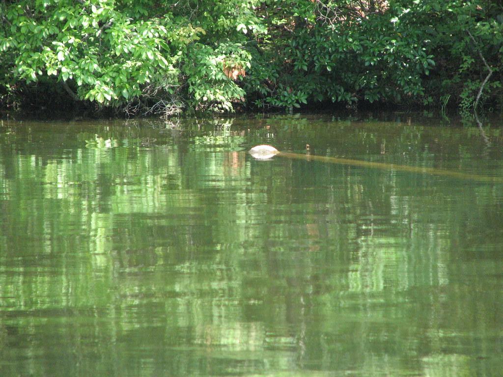
 Summer greenery reflected in the lake's still water courtesy of bobistraveling↗ (CC BY 2.0↗)
 The view from Moore's Knob, the highest point in Hanging Rock State Park courtesy of bobistraveling↗ (CC BY 2.0↗)
Other Swimming Holes and Hiking Trails Nearby
Fairy Stone State Park
Bassett, Virginia
29.4 miles NSwim near Bassett, Virginia
Swim
Bullhole
Woodleaf, North Carolina
43.5 miles SSwim near Woodleaf, North Carolina
Swim
Nantahala Gorge Area
Trinity, North Carolina
45.8 miles SMultiple swimming places — several clothing-optional — near the Nantahala River and Gorge in western North Carolina, ranging from roadside to remote canyon spots.
Swim
Little Uwaharrie River
Trinity, North Carolina
45.8 miles SSwim near Trinity, North Carolina
Swim
Springwood Players Course
Burlington, North Carolina
46.0 miles SEA Blue/Gold course built around a top-flight athletics park, featuring everything from ace runs to the longest hole in the Carolinas, plus a beginner Rookie Run.
Disc Golf, Hike
Goshen Pass Area
Max Meadows, Virginia
47.3 miles NWSwim near Max Meadows, Virginia
Swim
Foster Falls
Max Meadows, Virginia
47.3 miles NWSwim near Max Meadows, Virginia
Swim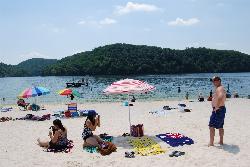
Claytor Lake State Park Swimming Beach
Dublin
49.8 miles NWVirginia's guarded sand beach on the New River impoundment at Claytor Lake State Park, open 10 to 6 from Memorial Day weekend through Labor Day, with a swim platform, a bathhouse and a snack bar.
Camp, Canoe, Hike, Kayak, Swim


