


Hayward City Beach
Hayward
Canoe, Kayak, and Swim
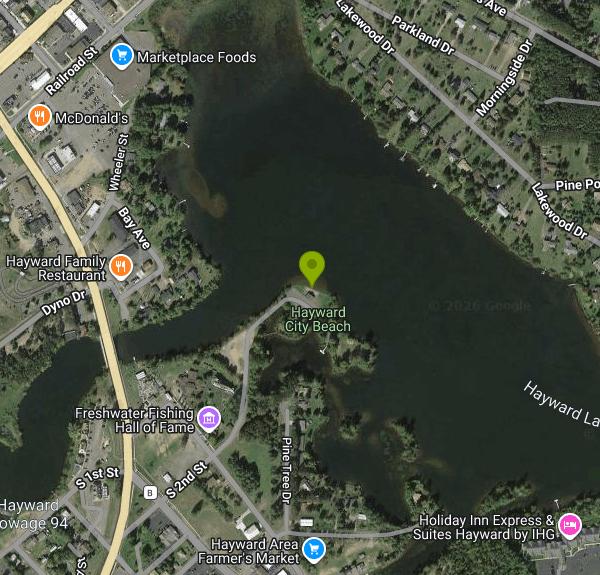
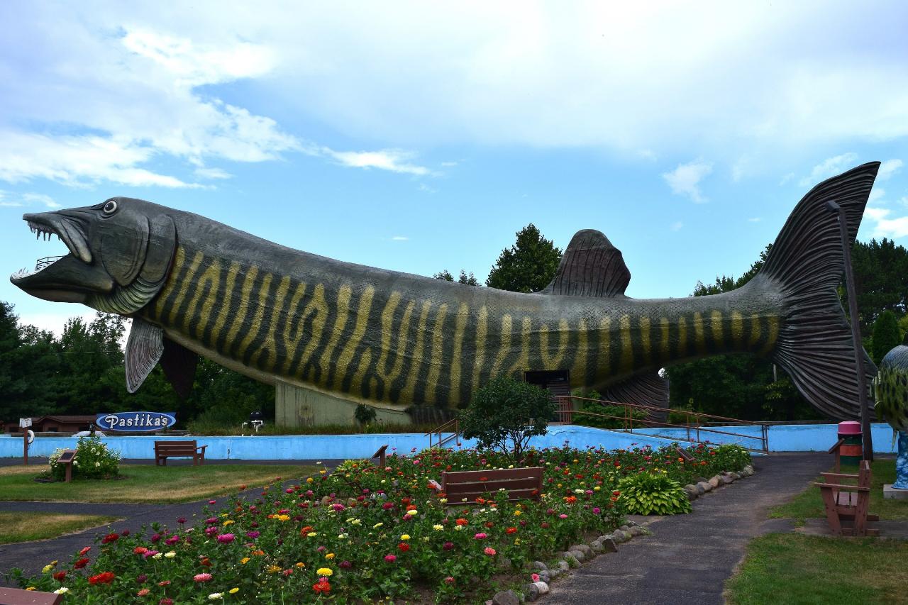
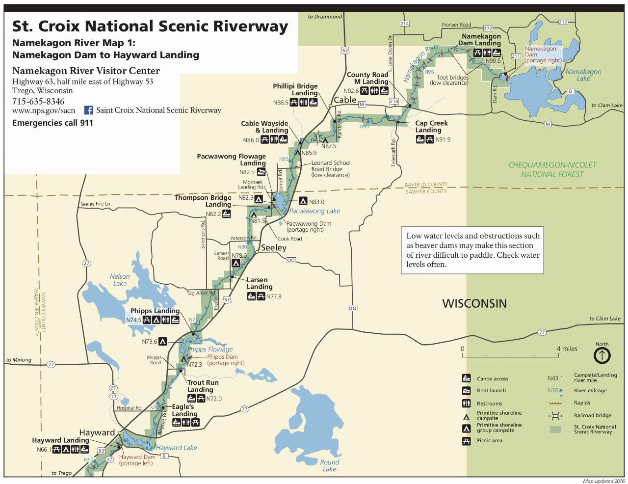
Hayward City Beach occupies a low peninsula on the west side of Lake Hayward, two blocks off South Second Street and directly behind the National Fresh Water Fishing Hall of Fame and its 143-foot walk-through fiberglass muskie. The water is not a natural lake in the usual sense. Lake Hayward is a 191-acre impoundment of the Namekagon River held behind the dam at the north end of downtown, and the Namekagon above and below town is federally protected as part of the Saint Croix National Scenic Riverway. Wisconsin DNR lists the lake at 17 feet maximum depth. A basin that shallow warms early in the season and holds its heat, which is why a town this far north has a swimming beach at all.
The City of Hayward owns and operates the beach. There is no admission charge, no parking sticker, no residency rule and no tribal permit involved. The Lac Courte Oreilles Band of Lake Superior Chippewa reservation begins a few miles south of town, but this park sits inside the city limits and is open to anyone. The posted season runs Memorial Day through Labor Day, daily from 10:00 AM to 8:00 PM. No lifeguard is on duty and the city says plainly that you swim at your own risk. Children under 12 must have an adult with them.
The city posts its beach rules on a sign at the sand and on its parks page: no glass containers, no alcohol, no dogs or other animals on the beach, no radios or bikes on the sand, no flotation devices, no feeding the ducks and geese, and no swimming past the barrels that mark the outer edge of the roped swim area. That last one matters here, because the drop beyond the buoy line is open lake with boat traffic running to the public landing just up the shore.
Facilities are ordinary municipal-park stuff and in good shape: a broad sand beach, picnic tables, a pavilion, a playground, a mowed field behind the sand, restrooms with changing rooms, and a few places to cast from shore. Shore anglers do well on panfish and the occasional northern. Parking is free in the lot off Second Street.
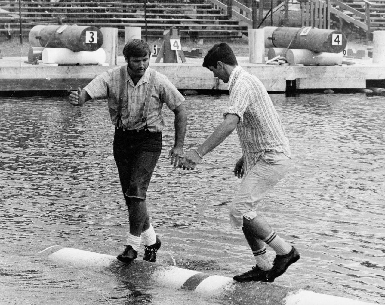
A short walk south along the same shoreline is the Lumberjack Bowl, the old log-holding pond that hosts the Lumberjack World Championships every July and Scheer's Lumberjack Shows through the summer. Swimmers sometimes hear the crowd from the beach.
One caveat on water quality. Wisconsin's state beach monitoring program covers Great Lakes coastal beaches, so Lake Hayward is not in the DNR Beach Health database and no routine E. coli results are published for this beach. Sawyer County Public Health issues general blue-green algae warnings for area lakes in late summer. On a shallow, river-fed impoundment in August, look at the water before you get in and stay out if it looks like spilled paint.
Directions: Highway 27 south to County Highway B, left on B for one block to South Second Street, then left and two blocks to the beach.
More Information
Beaches | Wisconsin DNR
From the cobble beaches of Washington Island, to the gently rolling dunes of Sheboygan, to the soft, sandy beaches of our inland lakes and rivers, beaches are nature's nirvana. Wisconsin's beaches provide wildlife habitat, recreation areas and tourist destinations. Unfortunately, beaches are especially vulnerable to agricultural, urban and industrial land uses, and many of our beaches are showing the effects. We invite you to explore, enjoy and help protect and restore Wisconsin's beaches.
https://dnr.wisconsin.gov/topic/BeachesHit the Beach in Hayward Lakes - Hayward Lakes
The Sawyer County Snowmobile and ATV Alliance and it's volunteers are responsible for building, grooming, & maintaining Sawyer County trails.
https://haywardlakes.com/blog/hit-the-beach-in-hayward-lakes/Lake Hayward Public Beach - Hayward Lakes
Hwy 27 South to Hwy B-Left on B, One Block to S 2nd Street Turn Left on 2nd Street, Two blocks to the City Beach
https://haywardlakes.com/activity/lake-hayward-public-beach/Saint Croix National Scenic Riverway (U.S. National Park Service)
The St. Croix National Scenic Riverway, a unit of the National Park System, was established by the Wild and Scenic Rivers Act in 1968. Relatively free-flowing and unpolluted, the Namekagon and St. Croix rivers flow through some of the most scenic and least developed country in the Upper Midwest.
https://www.nps.gov/sacn/index.htmTop 12 Swimming Beaches in Northwest Wisconsin - Northwest Wisconsin
Summer weather has arrived, and what better place to enjoy it than on one of Northwest Wisconsin’s beautiful lake beaches. We’ve curated a list of our top 12 favorite public spaces to go enjoy a day at the lake. Timm’s Hill County Park Price County After a hike to the top of Timm’s Hill County…
https://northwestwisconsin.com/top-12-swimming-beaches-in-northwest-wisconsin/Wisconsin Lakes
Hayward Lake is a 191 acre lake located in Sawyer County. It has a maximum depth of 17 feet. Visitors have access to the lake from a public boat landing. Fish include Musky, Panfish, Largemouth Bass, Smallmouth Bass, Northern Pike, Trout and Walleye.
https://apps.dnr.wi.gov/lakes/lakepages/LakeDetail.aspx?wbic=2725500
- Plan Ahead and Prepare
- Travel & camp on durable surfaces
- Dispose of waste properly
- Leave what you find
- Minimize campfire impacts
- Respect wildlife
- Be considerate of other visitors
Directions
From Hayward
- Head north on Jackson St toward Mission Blvd (46 ft)
- Continue onto Foothill BlvdPass by Taco Bell (on the right in 1.1 mi)(1.4 mi)
- Slight right onto the ramp to I-580 W (98 ft)
- Merge onto I-580 W via the ramp to Oakland (15.9 mi)
- Take the exit onto I-580 W/
I-80 E toward Berkeley/ Sacramento Continue to follow I-80 EToll road(73.6 mi) - Take the I-80 E exit toward Reno (0.7 mi)
- Continue onto I-80 EEntering Nevada(392 mi)
- Keep left to stay on I-80 EEntering Utah(259 mi)
- Take the exit onto I-15 S/
I-80 E toward Cheyenne/ Las Vegas (3.2 mi) - Take exit 304 for I-80 E toward Cheyenne (0.6 mi)
- Continue onto I-80 EEntering Wyoming(285 mi)
- Take exit 211 for I-80BL/
WY-789 N toward US-287/ Rawlins (0.3 mi) - Turn left onto I-80BL/
WY-789 N (1.7 mi) - Turn left onto US-287 N/
WY-789 N/ 3rd St (signs for Casper-Lander) Continue to follow US-287 N/(44.1 mi)WY-789 N - Continue straight onto WY-220 E (63.6 mi)
- Turn left onto WY-257/
W Belt Lp (7.3 mi) - Continue onto US-20 E/
US-26 (2.6 mi) - Keep left to continue on US-20/
US-26 (0.4 mi) - Turn left to merge onto I-25 N/
US-87 N toward Midwest (20.5 mi) - Take exit 210 toward WY-259 N (0.3 mi)
- Turn right onto WY-259 N (17.9 mi)
- Turn right onto WY-387 E (31.7 mi)
- Turn left onto WY-50 N (51.1 mi)
- Turn right to merge onto I-90 E toward MoorcroftPassing through South DakotaEntering Minnesota(539 mi)
- Take exit 45 for MN-60 toward Windom (0.3 mi)
- At the traffic circle, take the 2nd exit onto MN-60 E/
Oxford St Continue to follow MN-60 EPass by Dairy Queen (Treat) (on the left in 29.3 mi)(29.6 mi) - Continue straight to stay on MN-60 E (0.9 mi)
- Continue onto MN-60 E (64.5 mi)
- Continue onto US-169 NPass by Arby's (on the right in 10.1 mi)(64.7 mi)
- Take the exit onto I-494 E/
MN-5 E (4.8 mi) - Take exit 5A to merge onto I-35W N toward Minneapolis (7.9 mi)
- Keep right to stay on I-35W N, follow signs for I-94 E (1.1 mi)
- Keep left to stay on I-35W N (4.5 mi)
- Keep left to stay on I-35W N (19.9 mi)
- Merge onto I-35 N (37.8 mi)
- Take exit 165 for MN-70 toward Rock Creek/
Grantsburg (0.3 mi) - Turn right onto MN-70 E (1.9 mi)
- Slight right to stay on MN-70 EEntering Wisconsin(8.6 mi)
- Continue onto WI-70 E/
WI-70 Trunk E (19.7 mi) - Turn left onto WI-35 N/
WI-70 E/ WI-70 Trunk E/ 2nd Ave Continue to follow WI-35 N/(2.5 mi)WI-70 E/ WI-70 Trunk E - At the traffic circle, take the 1st exit onto WI-70 E/
WI-70 Trunk E (23.6 mi) - Turn left onto US-63 N/
River St (2.9 mi) - Take the ramp to Superior/
Hayward (0.3 mi) - Merge onto US-53 N/
US-63 N (3.1 mi) - Take the exit toward US-63 (0.3 mi)
- At the traffic circle, take the 1st exit onto US-63 (20.1 mi)
- Turn right onto Nursery Rd (161 ft)
- Continue straight onto Dyno Dr (0.7 mi)
- Turn right onto WI-27 S (0.2 mi)
- Turn left onto S 1st St (292 ft)
- S 1st St turns right and becomes Hall of Fame Dr (367 ft)
- Turn leftPartial restricted usage roadDestination will be on the left(0.2 mi)
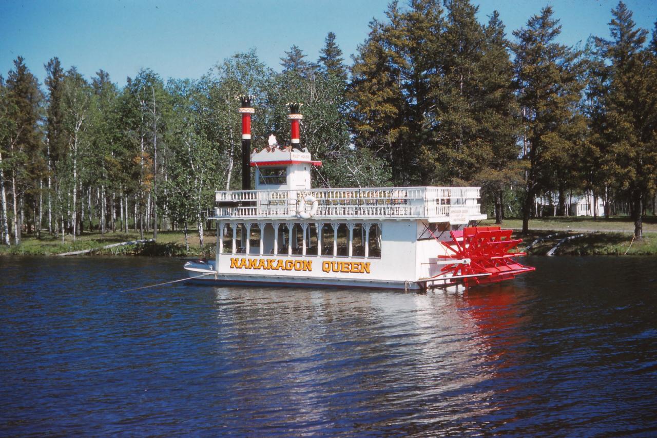
 The excursion boat Namakagon Queen touring Hayward Lake, June 1961. courtesy of TimothyMN↗ (CC BY-SA 4.0↗)
 The 143-foot walk-through muskie at the National Fresh Water Fishing Hall of Fame, the landmark the courtesy of TheCatalyst31↗ (CC BY-SA 4.0↗)
 Logrolling at the Lumberjack World Championships in the Lumberjack Bowl, a bay of Lake Hayward just courtesy of Guywelch2000↗ (CC BY-SA 4.0↗)
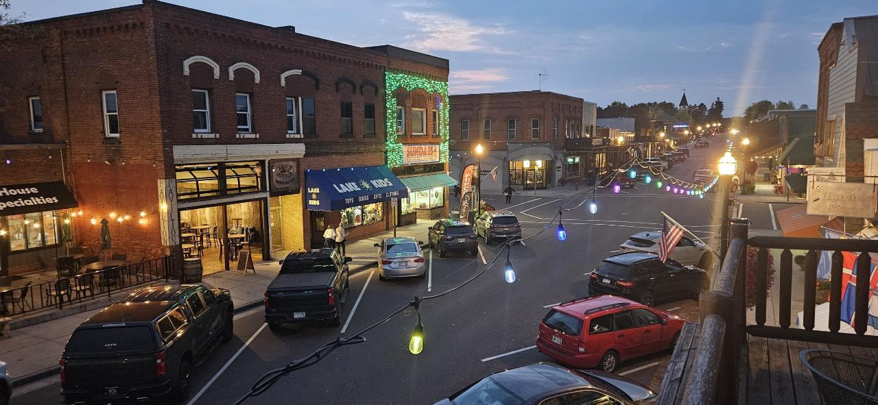
 Downtown Hayward looking north along Main Street, a few blocks from the beach. courtesy of Milonica↗ (CC BY 4.0↗)
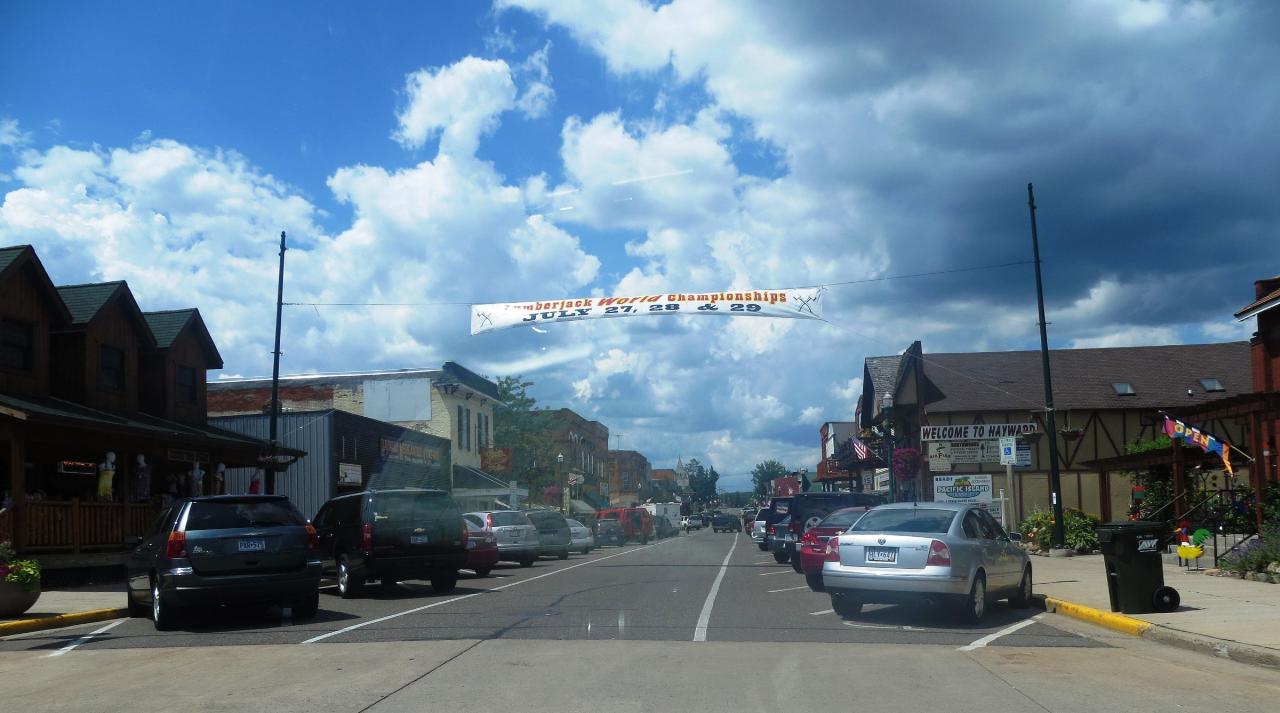
 Hayward, Sawyer County, which brands itself the home of the American Birkebeiner. courtesy of Bjoertvedt↗ (CC BY-SA 3.0↗)
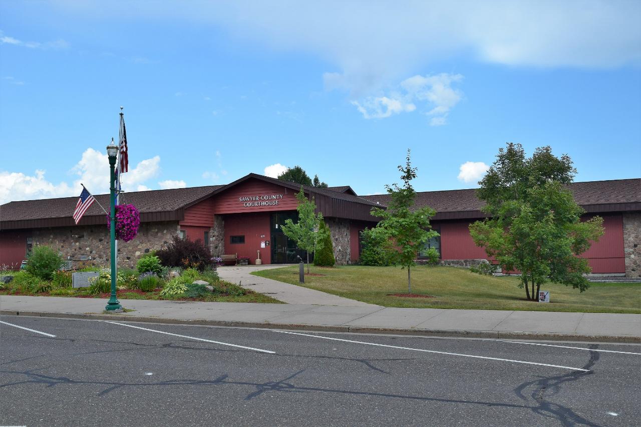
 The Sawyer County Courthouse in Hayward. courtesy of TheCatalyst31↗ (CC0↗)
 National Park Service map of the Namekagon River from Namekagon Dam downstream to Hayward, within th courtesy of U.S. National Park Service, restoration/cleanup by National Park Maps (https://npmaps.com)↗ (Public domain↗)
Other Swimming Holes, Canoeing Areas, and Kayaking Areas Nearby
Amnicon Falls State Park
South Range, Wisconsin
45.7 miles NWFour waterfalls cascade along the Amnicon River in this Wisconsin state park — including a 15-foot upper falls with a swimmable plunge pool and a 15-foot slide falls (swim with care).
Camp, Hike, Swim
Copper Falls State Park
Mellen, Wisconsin
47.1 miles NETwo rivers cut through a deep gorge and tumble over multiple waterfalls in this 3,068-acre Wisconsin state park rich in copper-mining history.
Camp, Canoe, HikeNearby Campsites
Amnicon Falls State Park
South Range, Wisconsin
45.7 miles NWFour waterfalls cascade along the Amnicon River in this Wisconsin state park — including a 15-foot upper falls with a swimmable plunge pool and a 15-foot slide falls (swim with care).
Camp, Hike, Swim
Copper Falls State Park
Mellen, Wisconsin
47.1 miles NETwo rivers cut through a deep gorge and tumble over multiple waterfalls in this 3,068-acre Wisconsin state park rich in copper-mining history.
Camp, Canoe, Hike


