Colorado Trail: South Platte To Buffalo Creek
Conifer, Colorado
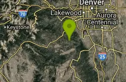
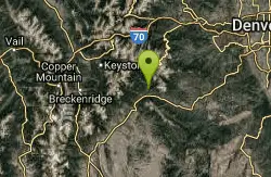
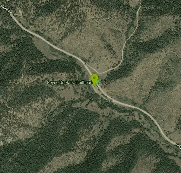
| Address: | ~13649 S Foxton Rd, Conifer, CO 80433, USA |
| GPS: |
39°28'2.2"N 105°14'22.4"W Maps | Directions |
| State: | Colorado |
| Trail Length: | 20.00 miles |
| MTB Difficulty: | Advanced |
| Trail Type: | Out & Back |
| MTB Trail Type: | Singletrack |
Mountain Bike
The initial climb out of the parking lot is by far the hardest part of this section of the Colorado Trail. Within the past several years, a re-routed portion of trail was created and if you carry a map with you, it might show the trail going northwest, instead of the correct southwest. However, the trail is very well marked and easy to follow. Once the initial mile or so of climbing on pea gravel is out of the way, the degree of steepness does ease up somewhat, although this trail continues gradually upward for many more miles. While we were prepared to do some climbing, this section of the CT really kept it coming.Luckily, the grade is never too steep so that you should be able to grind up most of this trail. The first 1/3 of this trail is burned out from a recent forest fire, and is quite interesting to ride through. The second 1/3 of the trail is normal forest, while the last 1/3 is back in the burn zone (you will cross a fire road at one point, and although the trail has no markers on the other side, you DO want to cross the road and continue on the singletrack). The last 1/3 is definitely more level, although you will encounter a variety of ups and downs and at times, some very fast singletrack! The final mile from Hwy 126 to the Little Scraggy Trailhead (where many park for rides into Buffalo Creek area) is nice and flat doubletrack.The trip back from Little Scraggy is where this section of trail really shines. On the return, your first 1/3 is fun ups and downs, the middle 1/3 has one short uphill section which will be the last of the climbing for the day...and the last 1/3 is pure downhill for what seems like forever! This is payback for all the climbing you had to do on the way in... None of this trail is particularly technical, and most of it is well traveled and well worn. Naturally you can get some pretty good speed going since your visibility in the burn zone is fairly distant. You will need to bring as much water as you can, especially in the summer months, as there are no water sources on this section of trail. If all goes wrong, you can bail out on Hwy 126 and head down the hill back to the "town" of Buffalo Creek (and take the gravel road back to your car). If you have a water filter, you can water up at that point. However, all effort should be made to ride this trail in both directions, as the return back down the hill is really worthwhile. Set aside 3-4 hours to do the entire route. More if you like to stop, enjoy the scenery, etc. Courtesy of Singletracks.com
More Information
Colorado Trail: South Platte To Buffalo Creek Mountain Bike Trail in Deckers, Colorado - Directions,
Colorado Trail: South Platte To Buffalo Creek is a singletrack mountain bike trail in Deckers, Colorado. View maps, videos, photos, and reviews of Colorado Trail: South Platte To Buffalo Creek bike trail in Deckers.
http://www.singletracks.com/bike-trails/colorado-trail-south-platte-to-buffalo-creek/Never modify trail features. Ride trails when they're dry enough that you won't leave ruts. Speak up when you see others on the trail and always yield to hikers, horses, and others coming uphill. Always ride on the established trail.
Read More
- Plan Ahead and Prepare
- Travel & camp on durable surfaces
- Dispose of waste properly
- Leave what you find
- Minimize campfire impacts
- Respect wildlife
- Be considerate of other visitors
Directions
From Conifer, Colorado
- Head south on US Hwy 285 S toward Kitty Dr (0.3 mi)
- Take the exit toward Kennedy Gulch Rd (0.1 mi)
- Turn left onto Kennedy Gulch Rd (0.2 mi)
- Turn left onto S Foxton RdDestination will be on the right(5.0 mi)
Other Mountain Bike Trails Nearby
North Fork
Littleton, Colorado
5.4 miles SEA smooth, nearly rock-free machine-made singletrack running along the mountainside from South Platte River — gradual climbing on Hummingbird leads to a flowing North Fork descent.
Mountain Bike
Meyer Ranch Park
Morrison, Colorado
5.7 miles NA short network of singletrack trails climbing roughly 800 vertical feet near Morrison — a solid quick ride when you want a mellow spin on the way back from the mountains.
Mountain Bike
Flying J Ranch
Conifer, Colorado
7.0 miles NWSuper easy singletrack with a clockwise Shadow Pine loop that feels longer on the descent than what you earned on the climb — perfect for true beginners on the Front Range.
Mountain Bike
Colorado Trail
Littleton, Colorado
7.8 miles EEpic Colorado singletrack with killer views and lung-busting elevation — detours around six wilderness areas are required, but day trip routes and connecting trails abound.
Mountain Bike
Blackjack / Raspberry Ridge
Pine, Colorado
7.8 miles SWA gnarly black diamond freeride trail at Buffalo Creek with drops up to five feet, steep chutes, chunky rock gardens, and double-black-diamond features that demand respect.
Mountain Bike
Indian Creek Loop
Littleton, Colorado
8.0 miles E17 miles of off-road trail with significant climbing and route-finding along the Colorado Trail from Waterton Canyon to the Indian Creek Loop — bring a detailed map near Littleton.
Mountain Bike
Colorado Trail: Waterton To South Platte
Littleton, Colorado
8.0 miles ESeventeen miles of the Colorado Trail from Waterton Canyon to South Platte, with sweet singletrack, forested sections, rocky climbs, and only about 460 miles left to Durango.
Mountain Bike
Colorado Trail: Green Mountain
Pine, Colorado
8.5 miles SSweet, smooth singletrack with a great mix of climbs and descents through beautiful scenery — described as the Front Range's answer to the Tsali trails.
Mountain Bike
Colorado Trail: Morrison Creek / Lunar Loop
Pine, Colorado
8.5 miles SA loop through burned-out forest and open terrain climbing about 800 feet, with Morrison Creek singletrack connecting the Shingleman trail — more exposed than the Green Mountain option.
Mountain Bike
Chair Rocks
Pine, Colorado
8.5 miles SA seldom-used trail through the Buffalo Creek burn area with smooth tread, gentle hills, endless singletrack, rock formations, wildlife, and expansive mountain vistas.
Mountain Bike
Colorado Trail: Buffalo Creek To Lost Creek Wilderness Boundary
Pine, Colorado
8.6 miles SA beautiful point-to-point Colorado Trail ride from FR 550 through Buffalo Creek to the Lost Creek Wilderness boundary — bikes must turn back at the wilderness line.
Mountain Bike
Baldy Trail
Pine, Colorado
8.8 miles SWA loop trail that pairs with Gashouse Gulch for a 6-mile ride from the Gashouse trailhead or stretches to 9 miles via Redskin Creek Trail from Meadows Campground.
Mountain Bike
Ken Caryl Valley
Littleton, Colorado
9.3 miles NESingletrack linked together with short road segments through Ken Caryl Valley near Littleton — a natural flow ride in the Colorado foothills.
Mountain Bike
Devil's Head Stretch
Sedalia, Colorado
10.0 miles SEMoto-carved berms, chutes, dips, and rollers on a multi-use trail shared heavily with dirt bikes on weekends — best ridden on a quiet weekday after a good rain firms things up.
Mountain Bike
Buffalo Creek
Pine, Colorado
10.1 miles SWAn epic mountain bike loop near Pine with a steady climb up Buffalo Creek Road, slickrock on Baldy Trail, and screaming singletrack descents on Charlie's Cutoff and Sandy Wash.
Mountain Bike
Maxwell Falls
Evergreen, Colorado
10.2 miles NWA steep, rocky, technical climb that rewards the suffer with a descent that makes it all worthwhile — link with Cub Creek for extra mileage.
Mountain Bike
Dirt Jumps
Littleton, Colorado
10.3 miles NEA set of dirt jumps tucked under the first trees you'll find in Littleton, Colorado — worth the trip if you're nearby.
Mountain Bike
Cub Creek Trail
Evergreen, Colorado
10.3 miles NWWide singletrack through loose gravel that climbs into the Mt. Evans Wilderness boundary — a significant uphill first stretch with a good five miles of riding before the turnaround.
Mountain Bike
Little Scraggy
Sedalia, Colorado
11.3 miles SA new intermediate singletrack south of Sedalia with meandering terrain, technical options, a 100-foot slab rock, and one solid mid-ride climb.
Mountain Bike
Colorado Trail: Redskin Mountain
Bailey, Colorado
12.4 miles SWA mix of Colorado Trail singletrack and forest roads near Bailey — mostly downhill for the first 5 miles, with Gashouse and Miller Gulch trails rounding out a solid if route-complex loop.
Mountain Bike