


73 Hiking Trails near East Horseshoe Mesa Trail
first prev 1 2 3 4 next lastShowing Hiking Trails within 50 miles Distance miles of East Horseshoe Mesa Trail near Williams, Arizona City, Zip, or Address
Grandview Lookout
Grand Canyon Village, Arizona
5.6 miles NWA lookout point at the Grand Canyon in Grand Canyon Village, Arizona — scenic views from the South Rim.
Hike 
Red Butte Trail
Williams, Arizona
6.2 miles SAccessed via a short drive on Forest Roads 320, 340, and a short spur, the Red Butte Trail offers a destination hike off Highway 64/180 near Williams.
Hike 
Arizona Trail
Grand Canyon Village, Arizona
7.4 miles NEThis stretch of the Arizona Trail is its most spectacular and most demanding: the Grand Canyon crossing, where the roughly 800-mile state-long trail steps off the South Rim, descends nearly a...
Hike, Horseback 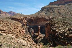
Tonto Trail from Grandview Point to South Kaibab Trailhead
Grand Canyon Village, Arizona
8.0 miles NEA rigorous four-to-five-day point-to-point backpack along the scenic, remote Tonto Trail from Grandview Point to the South Kaibab Trailhead — recommended for experienced Grand Canyon backpackers with careful water planning.
Backpack, Camp, Hike 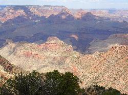
Grandview Trail Loop
Grand Canyon Village, Arizona
8.0 miles NEA scenic Grand Canyon hiking trail — mountain bikes are illegal on Canyon trails, so lace up your boots and enjoy the views on foot.
Backpack, Camp, Cross-country Ski, Hike 
Grandview Point to Horseshoe Mesa Trail
Grand Canyon Village, Arizona
8.1 miles NEA rewarding day hike or backpack below the Grand Canyon's South Rim leading to the wide, woody expanse of Horseshoe Mesa.
Backpack, Hike 
Tonto Trail: New Hance Trail to Grandview Point
Grand Canyon Village, Arizona
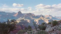
9.1 miles NEA remote Grand Canyon hike connecting New Hance Trail to Grandview Point along the Tonto Trail — spectacular inner canyon scenery and serious backcountry adventure.
Backpack, Camp, Hike 1.1 mi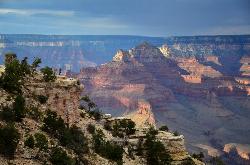
Shoshone Point Trail
Grand Canyon Village, Arizona
9.2 miles NA nearly level 1-mile dirt road through ponderosa pine opens to a stunning canyon overlook at Shoshone Point — a quiet, uncrowded gem with canyon rim views and a cool rock formation.
Hike 5.7 mi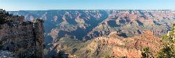
Rim Trail
Grand Canyon Village, Arizona
10.4 miles NA mostly paved 12-mile walking path along the South Rim with spectacular Grand Canyon views, shaded areas, accessible sections for wheelchairs and strollers, and optional shuttle service.
Hike, Mountain Bike 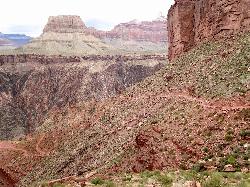
South Kaibab to North Kaibab to Bright Angel Trail
Grand Canyon Village, Arizona
10.4 miles NThe Grand Canyon's legendary Rim-to-Rim-to-Rim route — 44 miles and 20,000 feet of elevation change combining South Kaibab, North Kaibab, and Bright Angel trails for an epic multi-day adventure.
Backpack, Camp, Hike 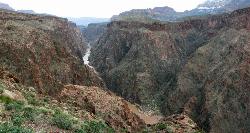
Clear Creek Trail
Grand Canyon Village, Arizona
10.4 miles NA 4–6 day Grand Canyon backpack deep into a fascinating, off-the-beaten-track drainage — bring plenty of water, as Clear Creek is the only reliable source on trail.
Backpack, Camp, Hike 0.6 mi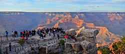
Mather Campground Trail
Grand Canyon Village, Arizona
10.4 miles NA 1-mile connector trail adjacent to Mather Campground on the Grand Canyon South Rim — flat and easy for biking, running, or walking with pets on leash; campground has RV options nearby.
Camp, Hike, Mountain Bike 13.6 mi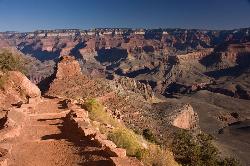
South Kaibab Trails
Grand Canyon Village, Arizona
10.4 miles NSeven miles of ridgeline descent from Yaki Point to the canyon floor — no shade, no water on trail, and the best unobstructed Grand Canyon panoramas you'll find on any hike.
Camp, Hike, Horseback 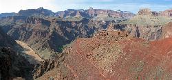
South Kaibab to Phantom Ranch to Bright Angel Trail
Grand Canyon Village, Arizona
10.5 miles NA difficult but spectacular multi-day Grand Canyon hike combining South Kaibab's stunning rim views with Phantom Ranch's riverside oasis and Bright Angel's shaded water stations.
Backpack, Camp, Hike 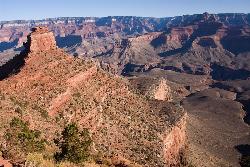
The Grand Canyon: Kaibab to Bright Angel Trail
Grand Canyon Village, Arizona
10.5 miles NAn unforgettable 2-3 day hike combining the South Kaibab's unbeatable views with the shaded, water-rich Bright Angel Trail — staring up at the canyon from the river below.
Backpack, Camp, Hike 9.1 mi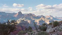
New Hance Trail
Grand Canyon Village, Arizona
10.8 miles NEA 9-mile out-and-back through Red Canyon to the Colorado River — one of the most difficult Grand Canyon trails with a 4,500-ft elevation change and very limited water sources.
Backpack, Camp, Hike 
South Rim Visitor Center Trail
Grand Canyon Village, Arizona
11.3 miles NA short, well-marked connector trail near the South Rim Visitor Center of Grand Canyon National Park, leading to a nearby restaurant with rock and geological timeline markers along the way — great for kids.
Hike 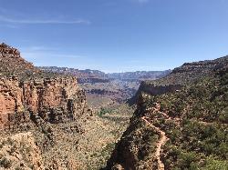
Bright Angel Trail to Three-Mile Rest house
Grand Canyon Village, Arizona
11.5 miles NA steep 5.4-mile out-and-back trail descending into the Grand Canyon with 360-degree canyon views and extreme switchbacks — water and pit toilets at the Three-Mile Resthouse turnaround point.
Backpack, Camp, Hike 4.9 mi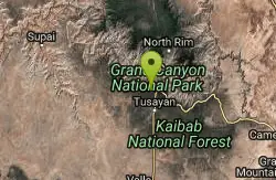
Bright Angel Trail to Tonto Trail
Grand Canyon Village, Arizona
11.5 miles NA rugged 12.4-mile point-to-point through Grand Canyon's inner gorge on the South Kaibab–Tonto Trail corridor, with over 3,000 feet of elevation gain — advanced hikers only.
Backpack, Camp, Hike 8.4 mi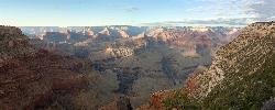
Grand Canyon Rim Village to Hermits Rest
Grand Canyon Village, Arizona
11.5 miles NA bus-accessible, kid-friendly trail from the Grand Canyon Rim Village to the historic 1914 Hermits Rest cabin — featuring stunning river views, wildflowers, wildlife, and a gift shop and snack bar at the end.
Backpack, Hike


