


Arizona Trail
Grand Canyon Village, Arizona

| Address: | ~Coconino Rim Rd, Grand Canyon Village, AZ 86023, USA |
| GPS: |
35°57'26.8"N 111°57'18.2"W Maps | Directions |
| State: | Arizona |
| Trail Length: | 34.10 miles |
| Trail Type: | Out & Back |
| Hike Difficulty: | Advanced |
| Elevation Gain: | 2224 feet |
Pet Friendly National Park
Hike and Horseback
This stretch of the Arizona Trail is its most spectacular and most demanding: the Grand Canyon crossing, where the roughly 800-mile state-long trail steps off the South Rim, descends nearly a vertical mile to the Colorado River, and climbs back out the other side. Near Grand Canyon Village the AZT follows the South Kaibab Trail down from the rim, crosses the river on the Black (Kaibab) Suspension Bridge beside Bright Angel Campground and Phantom Ranch, and returns to the rim by way of the Bright Angel Trail, the route most rim-to-river hikers and Arizona Trail thru-hikers use.
The South Kaibab is a ridgeline trail with nonstop, wide-open views past Ooh Aah Point, Cedar Ridge and Skeleton Point, but it carries no water and almost no shade. Bright Angel is longer and more sheltered, with seasonal water and rest houses along the way and a welcome stop at Havasupai Gardens (formerly Indian Garden). A rim-to-river-and-back outing totals roughly 17 miles with well over 4,000 feet of climbing on the return leg alone.
The National Park Service strongly warns against hiking from rim to river and back in a single day. Heat in the inner gorge regularly tops 100°F in summer, the climb out comes at the end when you are most tired, and there is no easy bail-out once you are below the rim. Most people break the trip with a night at Bright Angel Campground or Phantom Ranch, both of which require a backcountry permit or reservation secured well in advance, and water availability along the corridor shifts with the season and with pipeline repairs.
Spring and fall are the prime seasons; the corridor trails stay open year-round, but the rims turn snowy and icy in winter and mid-summer descents are genuinely dangerous. It is one of the great hikes in North America, and also one of the easiest places in the canyon to get into serious trouble, so it rewards planning, an early start and honest respect for the climb back out.
More Information
Grand Canyon National Park Itinerary
This Grand Canyon National Park Itinerary will help you get started as you plan your vacation to Grand Canyon National Park.
https://www.justgotravelstudios.com/collections/national-park-itineraries/products/grand-canyon-national-park-itinerary?ref=9zpxis0diinArizona Trail - Wikipedia
Left: The Arizona Trail logo. Right: Kentucky Camp, along the Arizona Trail in the Santa Rita Mountains.
https://en.wikipedia.org/wiki/Arizona_TrailBright Angel Trail - Wikipedia
This article is about the hiking trail from the south rim of the Grand Canyon. For the trail at the north rim, see Bright Angel Point Trail.
https://en.wikipedia.org/wiki/Bright_Angel_TrailSouth Kaibab Trail - Wikipedia
This article is about the hiking trail at the south rim of Grand Canyon. For the trail from the north rim, see North Kaibab Trail.
https://en.wikipedia.org/wiki/South_Kaibab_TrailBe courteous, informed, and prepared. Read trailhead guidelines, stay on the trail, and don't feed the wildlife.
Read More
- Plan Ahead and Prepare
- Travel & camp on durable surfaces
- Dispose of waste properly
- Leave what you find
- Minimize campfire impacts
- Respect wildlife
- Be considerate of other visitors
Directions
From Grand Canyon Village, Arizona
- Head west (344 ft)
- Turn right toward Village Loop Drive (141 ft)
- Turn right onto Village Loop Drive (0.2 mi)
- Turn right onto Center Rd (1.6 mi)
- Turn left onto AZ-64 EPartial toll road(1.3 mi)
- Turn right to stay on AZ-64 EToll road(10.7 mi)
- Turn right onto Coconino Rim RdDestination will be on the left(1.3 mi)
Directions from Kaibab National Forest: Trailhead Locations:1. The northern trailhead of the Arizona Trail is located at the intersection of Forest Road 248 and the Forest boundary; about 13 1/2 miles north of US 89A, and 15 1/2 miles from Jacob Lake.2. Junction of US 89A and Forest Road 205: 2.0 miles northeast of North Kaibab Visitor Center.3. Junction FR 205: 9 miles south of Jacob Lake on Highway 67 turn left (east) on FR 205. Go 0.3 miles to trailhead.4. Telephone Hill trailhead: Drive south on Highway 67 to FR 241. Trailhead is located 0.1 mile east of Highway 67.5. East Rim Viewpoint.6. Junction FR 610: Drive south on Highway 67 to FR 611 (just south of DeMotte Park). Continue on FR 611 to FR 610. Go right (south) on FR 610 for 6.0 miles to trailhead. Courtesy of AllTrails.com

Other Hiking Trails and Horseback Trails Nearby
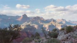
Tonto Trail: New Hance Trail to Grandview Point
Grand Canyon Village, Arizona
2.0 miles NEA remote Grand Canyon hike connecting New Hance Trail to Grandview Point along the Tonto Trail — spectacular inner canyon scenery and serious backcountry adventure.
Backpack, Camp, Hike 
Tonto Trail from Grandview Point to South Kaibab Trailhead
Grand Canyon Village, Arizona
3.3 miles NWA rigorous four-to-five-day point-to-point backpack along the scenic, remote Tonto Trail from Grandview Point to the South Kaibab Trailhead — recommended for experienced Grand Canyon backpackers with careful water planning.
Backpack, Camp, Hike 
Grandview Trail Loop
Grand Canyon Village, Arizona
3.3 miles NWA scenic Grand Canyon hiking trail — mountain bikes are illegal on Canyon trails, so lace up your boots and enjoy the views on foot.
Backpack, Camp, Cross-country Ski, Hike 
Grandview Point to Horseshoe Mesa Trail
Grand Canyon Village, Arizona
3.4 miles NWA rewarding day hike or backpack below the Grand Canyon's South Rim leading to the wide, woody expanse of Horseshoe Mesa.
Backpack, Hike 9.1 mi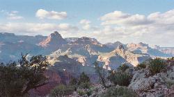
New Hance Trail
Grand Canyon Village, Arizona
3.7 miles NEA 9-mile out-and-back through Red Canyon to the Colorado River — one of the most difficult Grand Canyon trails with a 4,500-ft elevation change and very limited water sources.
Backpack, Camp, Hike 
Tusayan Ruin Walk Trail
Grand Canyon Village, Arizona
6.3 miles NEA short walk to ancient Tusayan Ruin, reached about 4 miles west of the East Entrance Station along East Rim Drive.
Hike 
East Horseshoe Mesa Trail
Williams, Arizona
7.4 miles SWA scenic Grand Canyon hike descending two miles on the Grandview Trail from Grandview Point to reach the East Horseshoe Mesa Trail — accessed from East Rim Drive near Williams, Arizona.
Hike 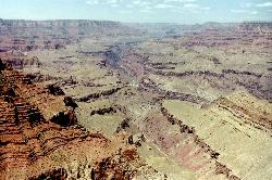
Tanner Trail
Grand Canyon Village, Arizona
7.7 miles NEA rigorous rim-to-river backpacking route recommended only for seasoned hikers — relentlessly steep, rocky, shadeless, and waterless until the Colorado River, with access to one of the canyon's most scenic beach campsites.
Backpack, Camp, Hike 
The Escalante Route Trail
Grand Canyon Village, Arizona
7.8 miles NEA demanding technical route along the Colorado River from Tanner Beach to Escalante Creek — narrow traverses on steep slopes require careful footing and a calm, unhurried pace.
Backpack, Hike 1.1 mi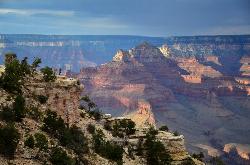
Shoshone Point Trail
Grand Canyon Village, Arizona
8.3 miles NWA nearly level 1-mile dirt road through ponderosa pine opens to a stunning canyon overlook at Shoshone Point — a quiet, uncrowded gem with canyon rim views and a cool rock formation.
Hike 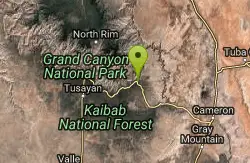
Desert View Visitor Center Trail
Grand Canyon Village, Arizona
9.2 miles NEA short trail starting just west of the Desert View Visitor Center along the East Rim — a convenient walk for those arriving from the East Entrance to the Grand Canyon.
Hike 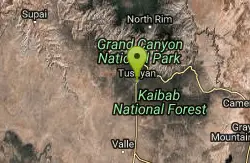
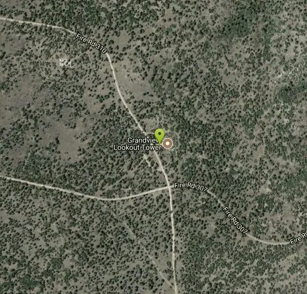
Grandview Lookout
Grand Canyon Village, Arizona
9.7 miles WA lookout point at the Grand Canyon in Grand Canyon Village, Arizona — scenic views from the South Rim.
Hike 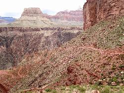
South Kaibab to North Kaibab to Bright Angel Trail
Grand Canyon Village, Arizona
9.8 miles NWThe Grand Canyon's legendary Rim-to-Rim-to-Rim route — 44 miles and 20,000 feet of elevation change combining South Kaibab, North Kaibab, and Bright Angel trails for an epic multi-day adventure.
Backpack, Camp, Hike 5.7 mi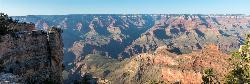
Rim Trail
Grand Canyon Village, Arizona
9.8 miles NWA mostly paved 12-mile walking path along the South Rim with spectacular Grand Canyon views, shaded areas, accessible sections for wheelchairs and strollers, and optional shuttle service.
Hike, Mountain Bike 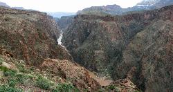
Clear Creek Trail
Grand Canyon Village, Arizona
9.8 miles NWA 4–6 day Grand Canyon backpack deep into a fascinating, off-the-beaten-track drainage — bring plenty of water, as Clear Creek is the only reliable source on trail.
Backpack, Camp, Hike 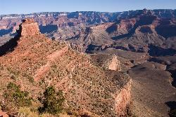
The Grand Canyon: Kaibab to Bright Angel Trail
Grand Canyon Village, Arizona
9.8 miles NWAn unforgettable 2-3 day hike combining the South Kaibab's unbeatable views with the shaded, water-rich Bright Angel Trail — staring up at the canyon from the river below.
Backpack, Camp, Hike 13.6 mi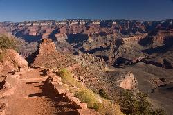
South Kaibab Trails
Grand Canyon Village, Arizona
9.8 miles NWSeven miles of ridgeline descent from Yaki Point to the canyon floor — no shade, no water on trail, and the best unobstructed Grand Canyon panoramas you'll find on any hike.
Camp, Hike, Horseback 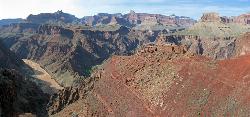
South Kaibab to Phantom Ranch to Bright Angel Trail
Grand Canyon Village, Arizona
9.8 miles NWA difficult but spectacular multi-day Grand Canyon hike combining South Kaibab's stunning rim views with Phantom Ranch's riverside oasis and Bright Angel's shaded water stations.
Backpack, Camp, Hike 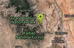
Blue Springs Trail
Grand Canyon Village, Arizona
10.8 miles NEBlue Springs Trail in the Grand Canyon area — check AllTrails for current details and conditions before visiting.
Hike 0.6 mi
Mather Campground Trail
Grand Canyon Village, Arizona
11.0 miles NWA 1-mile connector trail adjacent to Mather Campground on the Grand Canyon South Rim — flat and easy for biking, running, or walking with pets on leash; campground has RV options nearby.
Camp, Hike, Mountain BikeNearby Campsites
Tonto Trail: New Hance Trail to Grandview Point
Grand Canyon Village, Arizona
2.0 miles NEA remote Grand Canyon hike connecting New Hance Trail to Grandview Point along the Tonto Trail — spectacular inner canyon scenery and serious backcountry adventure.
Backpack, Camp, Hike
Tonto Trail from Grandview Point to South Kaibab Trailhead
Grand Canyon Village, Arizona
3.3 miles NWA rigorous four-to-five-day point-to-point backpack along the scenic, remote Tonto Trail from Grandview Point to the South Kaibab Trailhead — recommended for experienced Grand Canyon backpackers with careful water planning.
Backpack, Camp, Hike
Grandview Trail Loop
Grand Canyon Village, Arizona
3.3 miles NWA scenic Grand Canyon hiking trail — mountain bikes are illegal on Canyon trails, so lace up your boots and enjoy the views on foot.
Backpack, Camp, Cross-country Ski, Hike 9.1 mi
New Hance Trail
Grand Canyon Village, Arizona
3.7 miles NEA 9-mile out-and-back through Red Canyon to the Colorado River — one of the most difficult Grand Canyon trails with a 4,500-ft elevation change and very limited water sources.
Backpack, Camp, Hike
Tanner Trail
Grand Canyon Village, Arizona
7.7 miles NEA rigorous rim-to-river backpacking route recommended only for seasoned hikers — relentlessly steep, rocky, shadeless, and waterless until the Colorado River, with access to one of the canyon's most scenic beach campsites.
Backpack, Camp, Hike 
Grand Canyon South Rim Area Campgrounds
Grand Canyon Village, Arizona
9.2 miles WCampgrounds at the Grand Canyon's South Rim, one of the most iconic settings in the American Southwest.
Camp
South Kaibab to North Kaibab to Bright Angel Trail
Grand Canyon Village, Arizona
9.8 miles NWThe Grand Canyon's legendary Rim-to-Rim-to-Rim route — 44 miles and 20,000 feet of elevation change combining South Kaibab, North Kaibab, and Bright Angel trails for an epic multi-day adventure.
Backpack, Camp, Hike
Clear Creek Trail
Grand Canyon Village, Arizona
9.8 miles NWA 4–6 day Grand Canyon backpack deep into a fascinating, off-the-beaten-track drainage — bring plenty of water, as Clear Creek is the only reliable source on trail.
Backpack, Camp, Hike
The Grand Canyon: Kaibab to Bright Angel Trail
Grand Canyon Village, Arizona
9.8 miles NWAn unforgettable 2-3 day hike combining the South Kaibab's unbeatable views with the shaded, water-rich Bright Angel Trail — staring up at the canyon from the river below.
Backpack, Camp, Hike 13.6 mi
South Kaibab Trails
Grand Canyon Village, Arizona
9.8 miles NWSeven miles of ridgeline descent from Yaki Point to the canyon floor — no shade, no water on trail, and the best unobstructed Grand Canyon panoramas you'll find on any hike.
Camp, Hike, Horseback
South Kaibab to Phantom Ranch to Bright Angel Trail
Grand Canyon Village, Arizona
9.8 miles NWA difficult but spectacular multi-day Grand Canyon hike combining South Kaibab's stunning rim views with Phantom Ranch's riverside oasis and Bright Angel's shaded water stations.
Backpack, Camp, Hike 0.6 mi
Mather Campground Trail
Grand Canyon Village, Arizona
11.0 miles NWA 1-mile connector trail adjacent to Mather Campground on the Grand Canyon South Rim — flat and easy for biking, running, or walking with pets on leash; campground has RV options nearby.
Camp, Hike, Mountain Bike 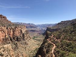
Bright Angel Trail to Three-Mile Rest house
Grand Canyon Village, Arizona
12.6 miles NWA steep 5.4-mile out-and-back trail descending into the Grand Canyon with 360-degree canyon views and extreme switchbacks — water and pit toilets at the Three-Mile Resthouse turnaround point.
Backpack, Camp, Hike 4.5 mi
Bright Angel Trail to Bright Angel Campground and River Trail
Grand Canyon Village, Arizona
12.6 miles NWThe Bright Angel Trail is the Grand Canyon's most storied hike — South Rim to the Colorado River past tunnels, pictographs, Havasupai Gardens, and the Devil's Corkscrew.
Backpack, Camp, Hike, Rock Climb 1.5-9.8 mi
The Bright Angel Trails
Grand Canyon Village, Arizona
12.6 miles NWMultiple Bright Angel Trail routes range from a 5.4-mile out-and-back to the Three-Mile Resthouse to a 19-mile trek to the river, with the 12.4-mile South Kaibab–Tonto–Bright Angel point-to-point offering over 3,000 feet of Grand Canyon grandeur.
Backpack, Camp, Hike, Horseback 4.9 mi
Bright Angel Trail to Tonto Trail
Grand Canyon Village, Arizona
12.6 miles NWA rugged 12.4-mile point-to-point through Grand Canyon's inner gorge on the South Kaibab–Tonto Trail corridor, with over 3,000 feet of elevation gain — advanced hikers only.
Backpack, Camp, Hike 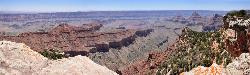
Cape Final
North Rim, Arizona
13.0 miles NA gentle climb through open ponderosa pine forest on the North Rim leads to a dramatic 180-degree canyon panorama at Cape Final — with a designated backcountry campsite right at the rim's edge.
Camp, Hike 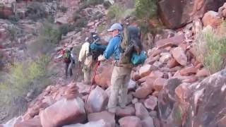
Hermit Trail
Grand Canyon Village, Arizona
16.0 miles NWA strenuous, less-crowded Grand Canyon backpacking trail with 2,000 feet of descent in the first 2.5 miles, Cathedral stairs, Redwall cliffs, and fossilized animal tracks.
Backpack, Camp, Hike 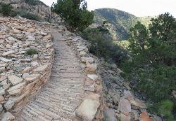
Hermit's Rest Viewpoint to Tonto Trail to Bright Angel Trail
Grand Canyon Village, Arizona
16.0 miles NWA multi-day Grand Canyon backpacking route crossing the Tonto Trail from Hermit's Rest to Bright Angel — spectacular inner canyon views with limited water sources and 3,000-foot rim access by foot only.
Backpack, Camp, Hike 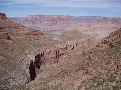
Boucher Trail to Hermit Trail Loop
Grand Canyon Village, Arizona
16.0 miles NWA demanding 3–4 day backpacking loop on the Grand Canyon's South Rim — even seasoned hikers consider the Boucher Trail the most difficult and hazardous South Rim route.
Backpack, Camp, Hike


