


3 Hiking Trails near University of OB
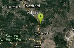
first prev 1 next lastShowing Hiking Trails within 50 miles Distance miles of University of OB near Weed, California City, Zip, or Address
Add Location
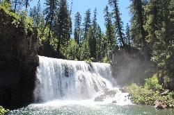

Middle McCloud Falls
McCloud
23.0 miles SEA 50-foot waterfall on the upper McCloud River in Shasta-Trinity National Forest with a big, cold plunge pool. Free to visit, reached by trail from Lower Falls or a short descent from the Middle Falls overlook.
Camp, Hike, Swim
Pilot Rock
Ashland, Oregon
46.9 miles NPilot Rock near Ashland reveals the ancient core of an eroded volcano — its calcite-flecked lava visible from the Shasta Valley and Oregon's Rogue Valley.
Hike 0.3 mi
Burney Falls
Burney, California
47.3 miles SEA 129-foot year-round waterfall draped in green fern curtains in Shasta County — accessible from a parking lot with multiple trail angles, best visited early morning or just before sunset.
Hike


