


Burney Falls
Burney, California

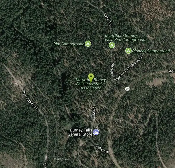
| Address: | McArthur-Burney Falls Interpretive Association, 24898 Volcanic Legacy Scenic Byway, Burney, CA 96013 |
| GPS: |
41°0'53.6"N 121°39'2.2"W Maps | Directions |
| State: | California |
| Trails/Routes: | 0.3 mi |
Lakes Waterfalls Trails Fishing
Hike
Burney Falls has been considered one of the most spectacular waterfalls in the state. It stands at 129 feet tall and is coated by curtains of green fern. The best part about this waterfall, for many hikers and Californians is that it flows year-round. This is one of the very few waterfalls in California that has good water flow throughout the year. The waterfall is loud, but can also be pretty remarkable in how peaceful it can feel.
The main attraction, can be accessed directly from the parking area or through many different trails which lead to higher or lower views of the falls. Each angle is beautiful in their unique ways. The best time of the day to go is earlier in the morning and a little before sunset. If you go in the middle of the day, it could get crowded.
The water temperature never rises over 42 degrees Fahrenheit, but the fisherman never seem to mind because of the great fishing that happens. The fishing that takes place is catch-and-release fly fishing.
There is an $8 day-parking fee at this park. Do not park on the street near the entrance of the park, because your car could be subjected to citations or be towed.
More Information
Burney Falls - California Waterfalls; McArthur Burney Falls State Park, Burney-hike/trail/map/direct
Burney Falls at Burney, McArthur Burney Falls Memorial State Park, CA waterfalls - hiking trails, pictures, maps, and directions. Burney Falls is one of the most spectacular waterfalls in northern California and is very gorgeous. The best part about this waterfall, however, is that it flows year-round, one of the very few waterfalls in California that has good flow throughout the year. So if you are in California and are anxious to see a waterfall and it is the middle of the winter, then Burney Falls is the one to see when all the others have long since stopped flowing.
https://www.waterfallswest.com/waterfall.php?id=burney-falls-shasta-354Experience Burney Falls in California’s Shasta Cascade| Visit California
See Burney Falls, a spectacular waterfall near Redding that’s been called the eighth wonder of the world.
https://www.visitcalifornia.com/experience/burney-falls/McArthur-Burney Falls Memorial State Park
Northern California's Premier Attraction
https://burneyfallspark.org/404Be courteous, informed, and prepared. Read trailhead guidelines, stay on the trail, and don't feed the wildlife.
Read More
- Plan Ahead and Prepare
- Travel & camp on durable surfaces
- Dispose of waste properly
- Leave what you find
- Minimize campfire impacts
- Respect wildlife
- Be considerate of other visitors
Directions
From Burney, California
- Head northeast on CA-299 E/Main St toward Saginaw StContinue to follow CA-299 EPass by McDonald's (on the right in 0.5 mi)(4.8 mi)
- Turn left onto CA-89 N (5.9 mi)
- Turn left onto Lake RdDestination will be on the left(0.3 mi)
Along Hwy #89, at McArthur Burney Falls Memorial State Park, near Burney. From Hwy #299 junction 5 miles east of Burney, turn north on Hwy #89 and drive 5.9 miles to park entrance. Courtesy of waterfallswest.com


Other Hiking Trails Nearby
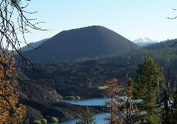
Cinder Cone and the Fantastic Lava Beds
Lassen County, California
36.1 miles SEHike a loose, sand-like 4-mile round trip to the top of a 1600s cinder cone at 6,907 ft in Lassen Volcanic NP, with Painted Dunes and the Fantastic Lava Beds spread out below.
Hike
Lassen Volcanic National Park
Redding, California
36.8 miles SSmoking fumaroles, meadows freckled with wildflowers, clear mountain lakes, and numerous volcanoes — Lassen Volcanic is a geothermal wonderland for explorers willing to look beyond the famous sights.
Backcountry Ski, Camp, Canoe, Hike, Horseback, Hot Springs, Mountain Bike, Snowshoe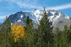
Lassen Peak
Mineral, California
38.1 miles SThe world's largest plug dome volcano rises to 10,457 feet in Lassen Volcanic National Park — a steep 5-mile round trip with 2,000 feet of gain and views of the Devastated Area below.
Backpack, Hike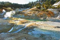
Bumpass Hell
38.6 miles S
A 3-mile round-trip hike through Lassen Volcanic National Park's largest hydrothermal area, where boiling pools, steam vents, and mud pots including a 322°F fumarole make a dramatic — but boardwalk-only — spectacle.
Hike
Kings Creek Falls
Shasta County, California
39.6 miles SA 2.4-to-3-mile round trip waterfall hike in Lassen Volcanic NP with seasonal wildflowers, Mule Deer, and a dramatic cascade through fern-covered volcanic landscape.
Hike, Horseback


