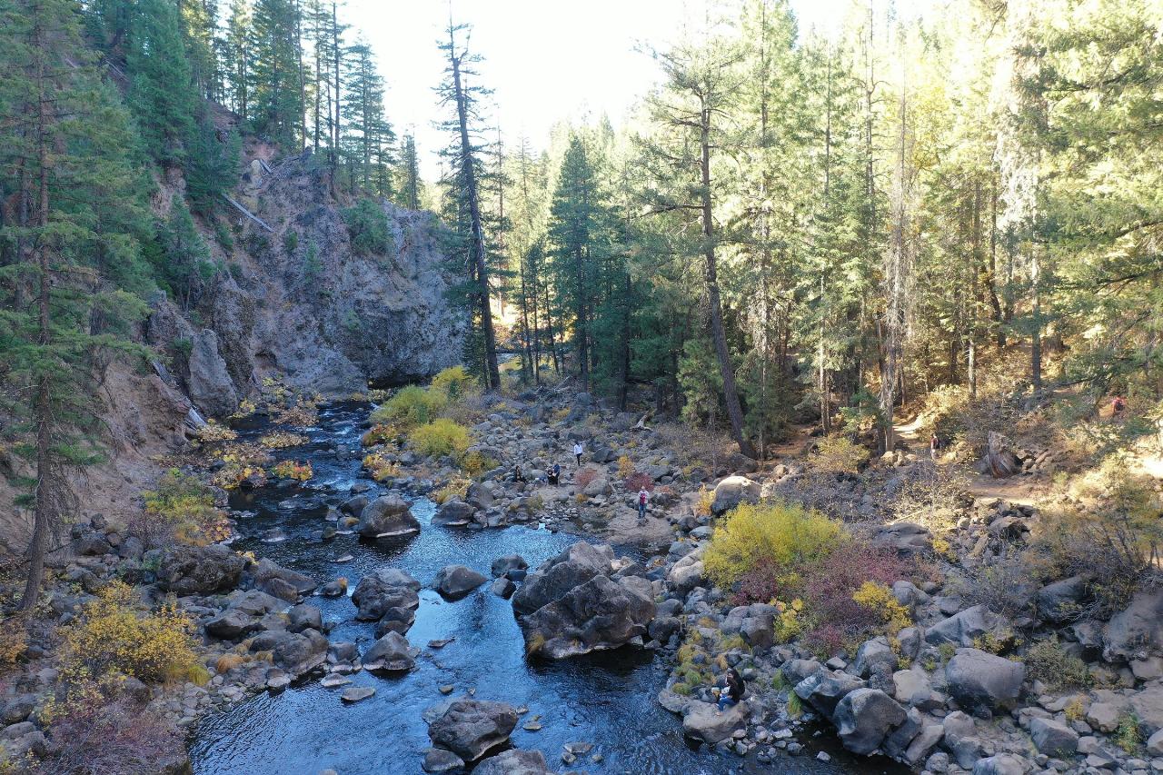
Middle McCloud Falls
McCloud
Camp, Hike, and Swim
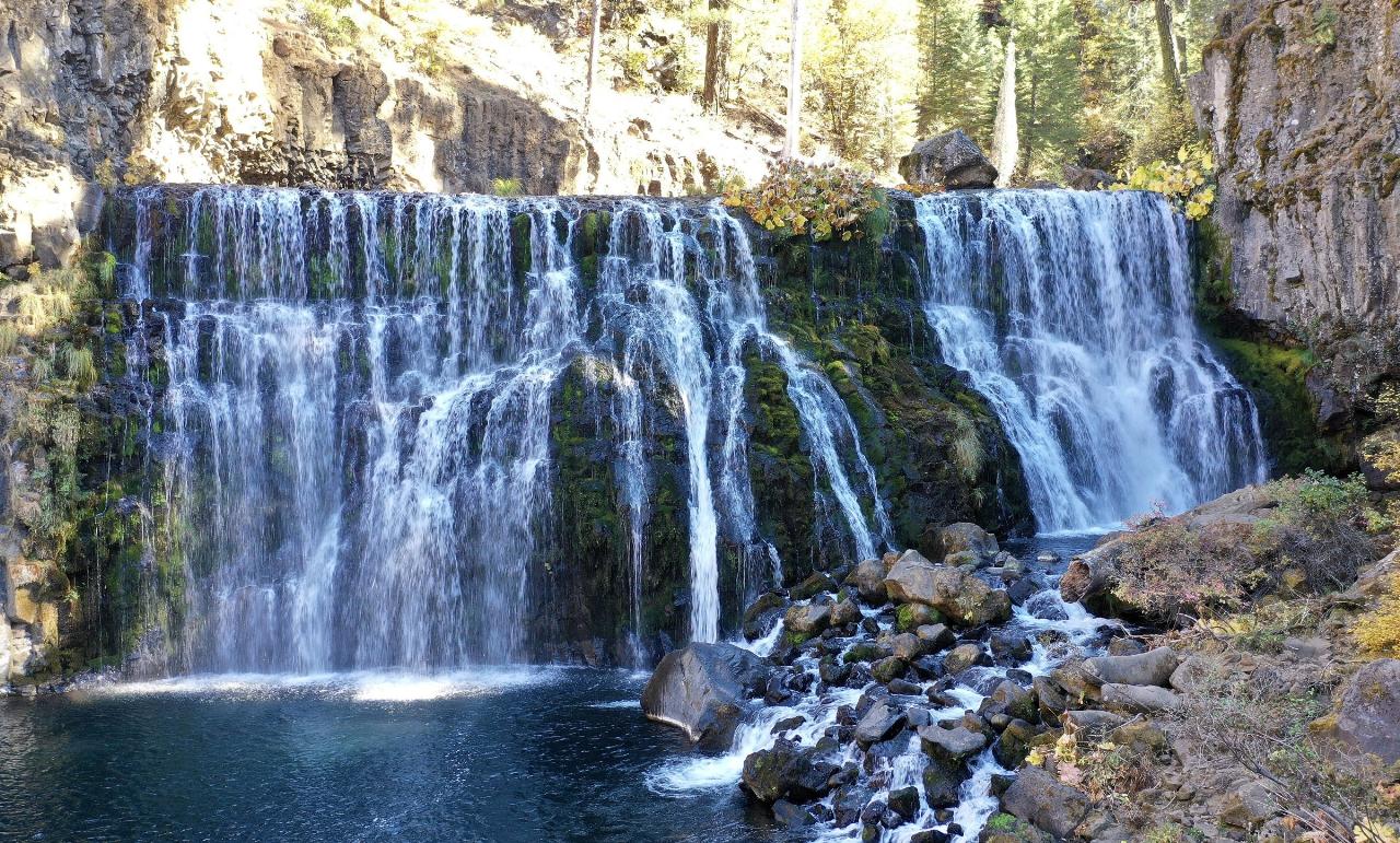
Middle Falls is the tallest of the three waterfalls on the upper McCloud River, a wide curtain of water roughly 50 feet high that pours over a ledge of basalt into a large, round plunge pool. It sits in the Shasta-Trinity National Forest on the McCloud Ranger District, about 7 miles east of the town of McCloud and 1.3 trail miles upstream of Fowlers Campground. The pool below the falls is one of the swimming holes the Forest Service names for this stretch of river, along with Lower Falls and Cattle Camp.
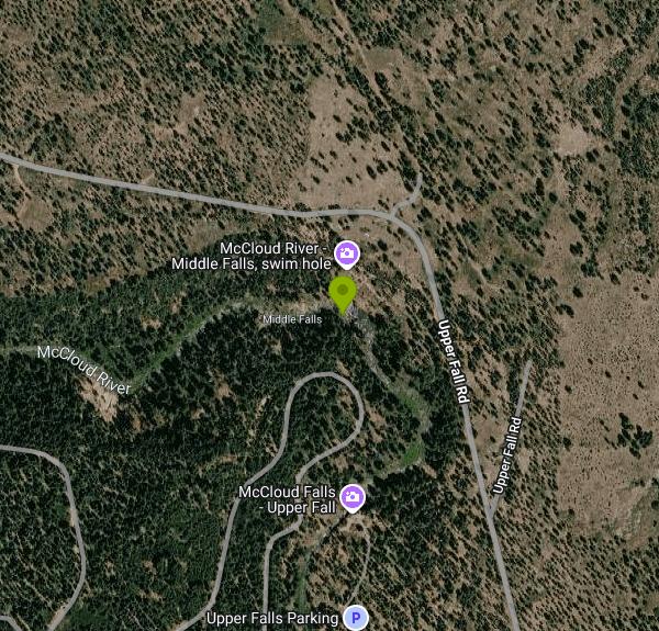
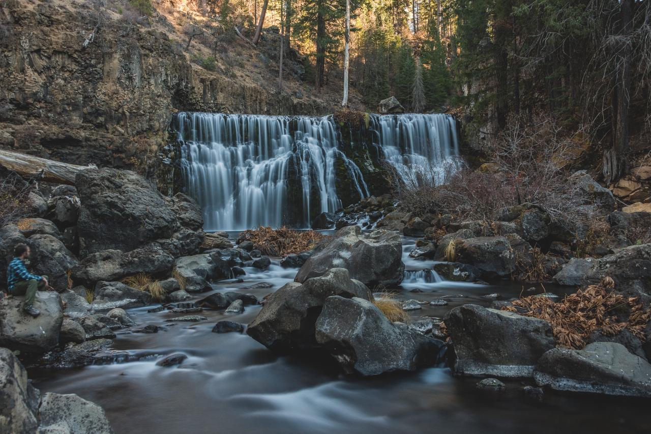
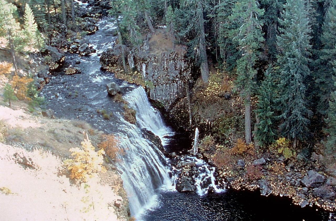
There are two ways in. From the McCloud Ranger Station, drive about 5 miles southeast on Highway 89 and follow the signs for Fowlers Camp and the McCloud River Loop. You can park at Lower Falls Picnic Area and walk upstream on the McCloud River Trail, passing Fowlers Campground, for about 1.8 miles to the base of Middle Falls. The shorter option is the Middle Falls overlook lot on the paved river loop road, which has restrooms. From there a paved path leads to the rim, and a section of switchbacks and stairs drops into the canyon. Expect to scramble over large boulders for the last stretch to the water.
The pool is big, deep near the falls and edged by piles of volcanic rock rather than sand. The river is fed by springs off Mount Shasta, so the water stays cold all summer, and the pool gets the most use in July and August. Spring snowmelt turns the falls into a roaring wall of whitewater with strong currents in the pool, so most people wait for lower summer flows to swim. There are no lifeguards, and the Forest Service warns that there are no exit structures, that the current can be swift and that diving is not recommended.
There is no fee to visit. Lower Falls Picnic Area is a free day-use site open sunrise to sunset, and the overlook lots on the river loop charge nothing. Fowlers Campground nearby costs $15 a night for a single site, with most sites reserved through Recreation.gov, and is usually open May through October. The Forest Service closes gates on Road 40N44 from November 1 through April 1, so winter visitors may have to park at a gate and walk in.
Middle Falls is a well-known cliff-jumping spot, and the rim above the pool is far higher than it looks from the water. People have been badly hurt slipping off the cliffs here. The basalt around the pool is slick when wet, and the stair section of trail between the base and the overlook is steep with loose rock, so keep children and dogs close. Dogs must be leashed in developed sites. The Forest Service posts closures and fire restrictions for the forest on its alerts page, and it listed no closure for the McCloud falls area in early October 2026.
Most visitors pair Middle Falls with the other two. Lower Falls, about 1.8 trail miles downstream, is a short drop into a pool that is easier to reach and better for families, and Upper Falls, a narrow chute in a gorge upstream, is best seen from its overlook. The McCloud River Trail continues about 15 miles past all three to Algoma Campground, and the river above Middle Falls is home to the native McCloud River redband trout.
More Information
Hiking Lower, Middle, And Upper McCloud Falls On The McCloud River
The McCloud River Falls Trail is a 3.8 mile round trip trail connecting 12 ft Lower McCloud Falls, 50 ft Middle McCloud Falls, and 25 ft Upper McCloud Falls
https://inspiredimperfection.com/adventures/hiking-mccloud-falls/McCloud Falls: Visiting all Three Tiers of the Waterfall off Highway 89 - California Through My Lens
A three teir waterfall located near the base of Shasta. McCloud Falls is easy to drive up and view and provides three unique falls.
https://californiathroughmylens.com/mccloud-falls-waterfall-near-shasta/Mount Shasta Area Waterfalls: McCloud River Waterfalls | Hike Mt. Shasta
While it is natural for discussion of waterfalls in the Mount Shasta area to cast its first gaze on the cataracts on the great mountain itself, any further conversation must immediately turn to the three waterfalls on the McCloud River. Middle McCloud Falls is one of California’s top tier falls. Combined with Middle Falls’ upper…
https://hikemtshasta.com/2013/08/27/mount-shasta-area-waterfalls-mccloud-river-waterfalls/Photo #36446: Middle McCloud Falls on the McCloud River | America's Byways
An official website of the United States government
https://fhwaapps.fhwa.dot.gov/bywaysp/photos/36446Shasta-Trinity National Forest | Alerts | Forest Service
Scroll down the page for a listing of all Shasta-Trinity National Forest Alerts (also known as Forest Orders).Be sure to check for additional Alerts c...
https://www.fs.usda.gov/r05/shasta-trinity/alertsShasta-Trinity National Forest | Camp 4 Group Campsite and Day Use Area | Forest Service
This is a group Campsite for parties ranging from 2-30. It is a developed campground with tables, fire pits, restroom with vault toilet and garbage pickup. 15 day-stay limit. Permitted campers at this site must stay within site boundaries and not spill over into the day use area.Behind the group camp site the Camp 4 day use area is open to the public. There is NO camping allowed in this area.Please do not dam up the river, it must flow to remain healthy.
https://www.fs.usda.gov/r05/shasta-trinity/recreation/camp-4-group-campsite-and-day-use-areaShasta-Trinity National Forest | Fowlers Campground | Forest Service
The most popular campground on the unit. Located on the Upper McCloud River at an elevation of 3400 feet, it has 39 sites with tables, fire-rings, vault toilets, and piped drinking water. Suitable for tents and mid-sized RV's or trailers. 14 day limit. The CG has been converted mostly to a reservation system (see below); there are only eight sites that are first come first served.Features: This campground is situated near three waterfalls on the river, which adds to its popularity. The McCloud Falls vary in height from 15 to 50 feet. A river-side trail from the campground provides access to the falls. It is approximately three miles round trip to see all three. Swimming and fishing are other popular activities. This section of river has no special restrictions for fishing. The McCloud River Loop, a paved road approx. 12 miles in length provides access to the Middle Falls and Upper Falls parking lots and overlooks if you do not wish to hike the trail.Double sites: 12 people maximum. No discounts.
https://www.fs.usda.gov/r05/shasta-trinity/recreation/fowlers-campgroundShasta-Trinity National Forest | Lower Falls Picnic Area | Forest Service
Description: Located on the Upper McCloud River about ½ mile below Fowlers Camp. There are nine picnic sites with tables and vault toilet. Drinking water available. No fee. Day use only. Parking suitable for larger vehicles. ADA accessible. Features: This scenic picnic area overlooks Lower Falls on the McCloud River. It is a great destination for a lunch break, and is also the trailhead for adventuresome hikers exploring the McCloud River Trail. A half mile upstream from the picnic area, hikers will pass Fowlers Camp and another 1.3 miles will bring them to the base of Middle Falls, the highest of the three waterfalls. From here, the trail leaves the river and climbs via a short series of switchbacks and stairs to the rim of the canyon. An observation platform offers panoramic views from above the Middle Falls. For non-hikers, this viewpoint is accessible by vehicle and ADA trail from the nearby parking area just north of the falls. The rim trail continues upriver for another half mile to the Upper Falls Overlook and day use area, then eventually all the way to Algoma (15 miles). Round trip to see all three falls and return to the picnic area is approximately three and a half miles.
https://www.fs.usda.gov/r05/shasta-trinity/recreation/lower-falls-picnic-areaShasta-Trinity National Forest | Upper McCloud River Loop | Forest Service
Are you interested in camping, fishing, hunting, hiking, boating, picnicking, snowmobiling, cross country skiing, or sightseeing? The choices for recreation are almost unlimited on the McCloud District.For information on the McCloud River Loop Dispersed Camping Restrictions please select the link below:During the late spring, summer and early fall, the McCloud Area offers fishing, hunting, swimming, camping, hiking, photography opportunities, and spectacular scenery. During the winter months, snowmobiling, cross country skiing, snow- shoeing, hunting, fishing, and downhill skiing are the top-ranking outdoor opportunities. There are a number of developed campgrounds and day use facilities located along the scenic McCloud River, that includes Fowlers, Cattle Camp, and Camp 4. Fowlers CG has 31 reservation-only sites and 8 first come, first served sites. Camp 4 is a reservation only group campground. You can reserve a site at recreation.gov. There is a 14 day stay limit at our campgrounds. Cattle Camp is first come first served. Developed campgrounds begin to open May 15th.The McCloud River parallels Highway 89 from its source near Dead Horse Summit to Fowlers Campground. There it turns south and continues through private property to the McCloud Reservoir. At the "Res" as it is known locally, the river again flows through National Forest lands to a point several miles below AhDiNa Campground, plus several other areas downstream to the Nature Conservancy's McCloud River Preserve. From here, the river passes through mostly private property and public access from the banks is extremely limited until the river enters the McCloud Arm of Shasta Lake.
https://www.fs.usda.gov/r05/shasta-trinity/recreation/upper-mccloud-river-loopBe courteous, informed, and prepared. Read trailhead guidelines, stay on the trail, and don't feed the wildlife.
Read More
- Plan Ahead and Prepare
- Travel & camp on durable surfaces
- Dispose of waste properly
- Leave what you find
- Minimize campfire impacts
- Respect wildlife
- Be considerate of other visitors
Directions
From McCloud
- Head east on W Colombero Dr toward California Ave (0.2 mi)
- Turn right onto Broadway Ave (0.3 mi)
- Turn left onto CA-89 S/
Volcanic Legacy Scenic Byway (10.1 mi) - Turn right onto Tate Creek Rd (0.6 mi)
- Turn left onto FS-39N50 (0.2 mi)
- Slight right onto Tate Creek Rd (2.5 mi)
- Turn left (2.1 mi)
- Keep left (5.2 mi)
- Turn leftDestination will be on the right(2.6 mi)
 Middle McCloud Falls pouring into its plunge pool in June. courtesy of Pacific Southwest Region 5↗ (Public domain↗)
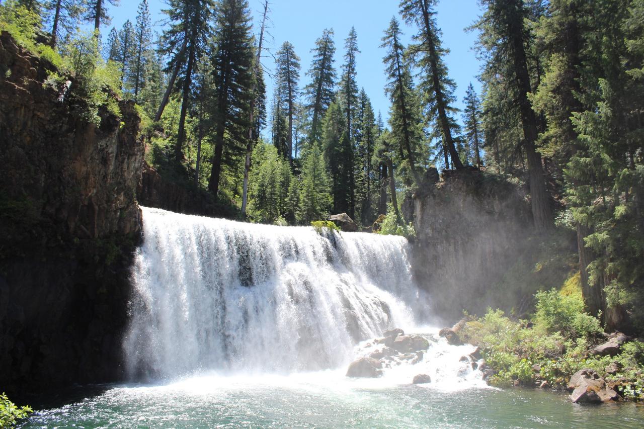
 Middle Falls at lower water, split into several curtains over the basalt ledge. courtesy of Sergey Yarmolyuk↗ (CC BY-SA 4.0↗)
 Middle Falls seen from the boulders at the bottom of the canyon. courtesy of Michael Kahn↗ (CC BY-SA 4.0↗)
 Middle McCloud Falls and its pool seen from above. courtesy of Unknown authorUnknown author or not provided↗ (Public domain↗)
 The McCloud River flowing over boulders just below Middle Falls. courtesy of Sergey Yarmolyuk↗ (CC BY-SA 4.0↗)