


Hood Park
Burbank
Camp, Hike, Kayak, and Swim
Hood Park is a 99-acre U.S. Army Corps of Engineers recreation area on the south bank of the Snake River at Burbank, Washington, about a mile and a half above the point where the Snake empties into the Columbia. The water here is Lake Wallula, the reservoir held back by McNary Lock and Dam, so this last stretch of the Snake is slow and wide rather than free-flowing. The Corps runs the park from its Ice Harbor office as part of its Tri-Rivers parks, and the grounds hold a day-use area with a swim beach, a 67-site campground and a boat ramp, all sitting just upstream of the US 12 bridge and across the river from Sacajawea Historical State Park.
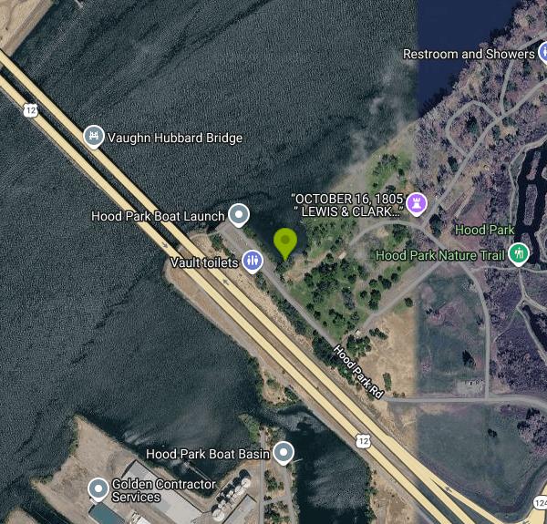
From Pasco, take US 12 south across the Snake River bridge, take the first exit and follow State Route 124 east. The park entrance is on the left just past the roundabout, at 2339 Monument Drive. Day users park in the lots beside the playground and group shelter at the north end of Boat Ramp Road, a short walk from the water. Campers check in at the gatehouse, and the separate boat basin sits at the south end of the same road.
The swim beach is in the day-use area along a small cove on the river side, between the group shelter and the restrooms. Local coverage describes it as a protected sandy beach, and that shelter matters on a reservoir where wind and boat wakes can roll in off the open water. There is no posted depth information, and the river channel beyond the cove is deep, so keep weaker swimmers close to shore. No lifeguards are posted, as is usual at Corps parks, and you swim at your own risk. Early in the season the Snake runs cold and high with snowmelt, and Washington's health department warns that cold river water can bring on hypothermia quickly, so June swims tend to be short ones. By July and August the reservoir warms up and the beach becomes a regular stop for Tri-Cities families looking for something quieter than the city parks.
Day use is free. The Corps charges only for camping, at $30 a night for a standard electric site, $35 for full hookups and $110 for the group shelter, reserved through Recreation.gov. The boat launch has no fee either. The campground and day-use area open in May and run through Labor Day, with summer hours of 6 a.m. to 10 p.m. daily. The flush restrooms in the day-use area are a summer-only service, while the vault toilets at the boat ramp lot stay open year-round. Outside that window the day-use facilities are closed, so call the Ice Harbor office at 509-547-2048 before planning a spring or fall visit.
Corps rules here ban alcohol, require dogs to stay on a leash, and prohibit all wood fires from July through September, when the sagebrush country around Burbank dries out. Boats come and go from the ramp to the south, so stay inside the beach cove and away from the launch. Bugs along the shaded riverbank are a common complaint from summer visitors, especially toward evening.
Beyond the beach, the park has a playground, basketball court, horseshoe pits, picnic tables and grills, an amphitheater, and a nature trail that loops through the fishing ponds on the east side of the park, where a sportsmen's group added accessible fishing docks. Anglers work the river for salmon and steelhead, and the McNary National Wildlife Refuge borders the park with marsh habitat for waterfowl, shorebirds and bald eagles.
More Information
11 ‘backyard’ beaches in Tri-Cities along Columbia and Snake river shorelines - AOL
Summer temperatures are here. How will you keep your family cool?
https://www.aol.com/11-backyard-beaches-tri-cities-120000252.htmlHood Park Boat Basin, Washington boat ramp and access | How's Your River
Public boat ramp and water access at Hood Park Boat Basin on Snake River in Washington. Map, directions, nearby USGS conditions, and amenities.
https://www.howsyourriver.com/access_sites/hood-park-boat-basinHood Park | Northern Pikeminnow Sport-Reward Program
hood park Burbank, WashingtonCLOSED Directions: From Pasco, travel 3 miles south on Hwy 12 towards Burbank. Take exit onto Hwy 124 east towards Waitsburg, then turn right on Hood Park […]
https://www.pikeminnow.org/stations-maps/hood-park/Hood Park, Lake Wallula - Recreation.gov
Explore Hood Park in Lake Wallula, Washington with Recreation.gov. Hood Park is located on Lake Wallula in eastern Washington. The lake is formed by McNary Lock and Dam on the Mid-Columbia River. Lewis and Clark camped two
https://www.recreation.gov/camping/campgrounds/233514Hood Park, Washington boat ramp and access | How's Your River
Public boat ramp and water access at Hood Park on Snake River in Washington. Map, directions, nearby USGS conditions, and amenities.
https://www.howsyourriver.com/access_sites/hood-parkParks | Visit Tri-Cities
The Tri-Cities offers dozens of parks both within and outside the city limits, perfect for locals and visitors alike.
https://www.visittri-cities.com/things-to-do/outdoors/parks/Be courteous, informed, and prepared. Read trailhead guidelines, stay on the trail, and don't feed the wildlife.
Read More
- Plan Ahead and Prepare
- Travel & camp on durable surfaces
- Dispose of waste properly
- Leave what you find
- Minimize campfire impacts
- Respect wildlife
- Be considerate of other visitors
Directions
From Burbank
- Head southwest on E Olive AveParts of this road may be closed at certain times or days(0.2 mi)
- Keep right to continue on N Bonnywood Pl (390 ft)
- Turn right to stay on N Bonnywood Pl (0.2 mi)
- Merge onto I-5 N (15.8 mi)
- Take exit 162 for CA-14 N toward Palmdale/
Lancaster (0.6 mi) - Continue onto CA-14 NParts of this road may be closed at certain times or daysPass by Denny's Restaurant (on the right in 68.3 mi)(68.9 mi)
- Turn right onto CA-14/
Midland Trail (signs for Bishop/ Reno) Continue to follow CA-14(48.8 mi) - Continue onto US-395 N (123 mi)
- Turn right onto US-6 E/
N Main St (signs for Tonopah) Continue to follow US-6 EEntering Nevada(52.4 mi) - Turn left onto NV-360 N (23.2 mi)
- Turn left onto US-95 N (signs for Hawthorne/
Reno) (41.3 mi) - Turn right onto US-95 Truck (signs for Fallon/
Reno) (1.3 mi) - Slight right onto US-95 NPass by Dairy Queen Grill & Chill (on the right in 70.3 mi)(71.0 mi)
- Turn right onto W Williams Ave (0.2 mi)
- Turn left onto US-95 N/
N Maine St (signs for Winnemucca) Continue to follow US-95 N(32.8 mi) - Merge onto I-80 E/
US-95 N via the ramp to Lovelock Continue to follow I-80 E(95.3 mi) - Take exit 178 for NV-289 toward Winnemucca/
Downtown (0.3 mi) - Take the exit toward NV-289 E/
E 2nd St (174 ft) - Turn left onto NV-289 E/
E 2nd St (1.0 mi) - Turn left onto NV-795 W (1.2 mi)
- Turn right onto US-95 NPassing through OregonEntering Idaho(217 mi)
- Turn left to stay on US-95 N (18.7 mi)
- Turn right onto US-20 W/
US-26 W/ US-95 Continue to follow US-95(15.5 mi) - Turn left to merge onto I-84 W toward Ontario/
US-30 Entering Oregon(191 mi) - Take exit 188 to merge onto US-395 N toward Stanfield/
Hermiston (0.8 mi) - Turn right onto County 1201 Rd/
S Edwards Rd Continue to follow S Edwards Rd(6.5 mi) - Turn right onto E Punkin Center Rd (472 ft)
- Turn left onto S Edwards Rd (1.0 mi)
- Turn right onto OR-207 N (2.1 mi)
- Turn right onto US-730 EEntering Washington(17.8 mi)
- Slight left (0.2 mi)
- Turn left onto US-12 W (11.8 mi)
- Take the exit toward WA-124 E/
Burbank/ Waitsburg (0.3 mi) - Slight right onto WA-124 E/
Ice Harbor Dr (0.1 mi) - Turn left onto Hood Park RdDestination will be on the right(0.4 mi)


Other Swimming Holes, Hiking Trails, and Kayaking Areas Nearby
Sacajawea Historical State Park
Pasco, Washington
1.5 miles SWA sandy swim beach at the confluence of the Snake and Columbia rivers in Pasco, on the site where Lewis and Clark camped in October 1805.
Canoe, Hike, Kayak, Swim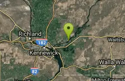
Levey Cliffs
Pasco, Washington
8.7 miles NESet along the Columbia River, this full-hookup RV resort offers 145 sites, a heated pool and spa, event center, and direct access to scenic river bluffs.
Swim
Windust Park
Kahlotus
30.4 miles NEA free Army Corps park on Lake Sacajawea, the Snake River pool below Lower Monumental Dam, with a small unguarded swim beach, free first-come campsites and a boat ramp, about 7 miles south of Kahlotus.
Camp, Canoe, Hike, Kayak, Swim
Walla Walla Area
Cle Elum, Washington
48.8 miles NESwim near Cle Elum, Washington
Swim


