


Keystone Beach
Keystone Heights
Canoe, Kayak, and Swim
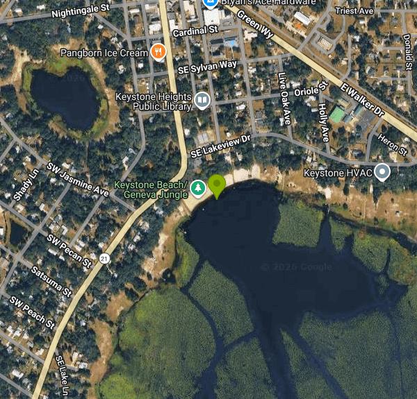
Keystone Beach is the City of Keystone Heights' public park and swim area on the north shore of Lake Geneva, a sandhill lake in the upper Etonia Creek chain that straddles Clay and Bradford counties in north-central Florida. The park sits at 565 S. Lawrence Blvd., right on State Road 21 just south of City Hall, and the city runs it together with the Geneva Jungle playground and the Keystone Heights Historic Pavilion, a lakefront hall first built in 1924. City Public Works staff maintain the grounds.
Getting there is simple. Follow SR 21 (Lawrence Boulevard) into downtown Keystone Heights and look for the pavilion and playground on the lake side of the road near the library and City Hall. A small public lot sits beside the park, and more parking is shared with the library and City Hall complex just to the north. The park is open to the public from 7 a.m. to 10 p.m. The city's pages list no admission or parking fee, so day use is free. Only the pavilion is rented, through City Hall at (352) 473-4807.
The swim area is a designated stretch of shoreline beside the pavilion, with a sandy beach that slopes into the lake. The city lists swimming among the park's uses, and fishing, canoeing and kayaking are allowed outside the designated swim area. No lifeguard service is advertised, so plan on swimming at your own risk and keep a close eye on children. Florida lake water warms quickly; by midsummer it is often in the 80s, and afternoon thunderstorms roll through most days from June into September, so get out of the water at the first thunder.
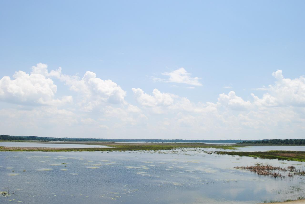
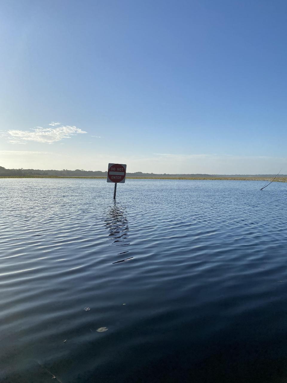
Water level is the big variable here. Lake Geneva rises and falls with rainfall and the Floridan aquifer beneath it, and over the past few decades it has dropped far below its historic shoreline as the aquifer was drawn down. The St. Johns River Water Management District recorded its lowest level, about 81 feet, in 2012, when open water sat well out from the old beach. The district's Black Creek Water Resource Development Project, which pipes water from Black Creek toward the lake region, is meant to help Lakes Brooklyn and Geneva recover, but gains come slowly. Expect the waterline, the walk to it and the depth off the sand to change from year to year, and check conditions before driving in. As in any Florida lake, alligators can be present; swim only in the marked area during daylight and leave the water if you see one.
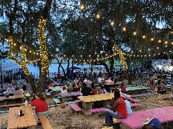
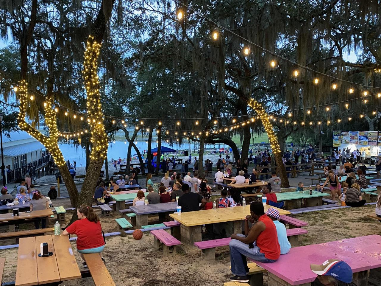
The city put roughly a million dollars into the park in 2022, reopening it that April with a refreshed beach, a renovated pavilion and new play equipment. Today the park has picnic tables under live oaks hung with Spanish moss, a beach volleyball court, swings and slides at Geneva Jungle, and room to launch a kayak. The city lists the park as pet friendly. A short walk away, near City Hall, stands the Keystone Heights Moon Tree, an American sycamore grown from a seed carried to the Moon on Apollo 14 and planted here in 1984. Mike Roess Gold Head Branch State Park is a few miles north on SR 21 if you want trails as well.
More Information
Black Creek Restoration Project of Keystone Heights lakes nears completion
Construction of the Black Creek Restoration Project is nearly finished and promises stable water levels and renewed recreational activities for Keystone Heights. The project, which the St. Johns River Water Management District operates, has cost tens of millions of dollars and aims to recharge the Floridan Aquifer using excess water from Black Creek.
https://www.wuft.org/environment/2025-02-18/black-creek-restoration-project-of-keystone-heights-lakes-nears-completionKeystone Heights, Florida: Small City on Lake Geneva
Keystone Heights is near Gainesville and has a population of about 1,500.
https://www.florida-backroads-travel.com/keystone-heights-florida.htmlNew and improved Keystone Beach | Clay Today
KEYSTONE HEIGHTS – Five days a week between ages 5 and 12, Valerie Alvers took a trip to Keystone Beach. The summer sun, complemented by the glistening water, greeted her as she set up for another …
https://www.claytodayonline.com/stories/new-and-improved-keystone-beach,34577Project to replenish groundwater progresses in Clay County
This regionally beneficial water resource development project of the District in Clay County will recharge the Upper Floridan aquifer.
https://www.sjrwmd.com/streamlines/project-to-replenish-groundwater-progresses-in-clay-county/Residents thrilled by $1 million overhaul of Keystone Beach | Clay Today
KEYSTONE HEIGHTS – Residents were thrilled by the improvements made at Keystone Beach and Lake Geneva during last weekend’s MotoSurf Games. “It’s beautiful, they did a really nice job.” …
https://www.claytodayonline.com/stories/residents-thrilled-by-1million-overhaul-of-keystone-beach,34702
- Plan Ahead and Prepare
- Travel & camp on durable surfaces
- Dispose of waste properly
- Leave what you find
- Minimize campfire impacts
- Respect wildlife
- Be considerate of other visitors
Directions
From Keystone Heights
- Head northwest on W Walker Dr toward Magnolia Ave (381 ft)
- Turn left onto Magnolia Ave (0.2 mi)
- Turn left onto Cardinal St (364 ft)
- Turn right onto S Lawrence Blvd (0.2 mi)
- Turn left onto SE Lakeview Dr (85 ft)
- Turn right (125 ft)
Other Swimming Holes, Canoeing Areas, and Kayaking Areas Nearby

Oleno State Park
High Springs, Florida
34.3 miles WA tannic-water swimming bend in the river with Spanish moss overhead, docks to jump from, and a short hiking trail that follows the river until it plunges underground — alligators in the nearby sinkhole add to the excitement.
Swim
Salt Springs Recreation Area
Salt Springs, Florida
34.5 miles SEBig mineral spring in the Ocala National Forest with a walled swim area over the boils, a 160-site campground, marina and a run to Lake George.
Camp, Canoe, Hike, Kayak, Swim
Poe Springs
High Springs
37.3 miles WA second-magnitude spring in an Alachua County park three miles west of High Springs, where 72-degree water fills a walled pool over a 25-foot vent and runs a short forest channel to the tannic Santa Fe River. The county closed the designated swimming are
Canoe, Hike, Kayak, Swim
Ichetucknee Area
Bell, Florida
39.3 miles WSeveral clear, cool springs clustered northwest of Gainesville in the Ichetucknee area — details available through the linked Florida springs resource.
Swim
Juniper Springs Recreation Area
Astor
45.4 miles SEA Civilian Conservation Corps spring pool in the Ocala National Forest that holds 72 degrees year round over a sand and limestone bottom, with a historic millhouse waterwheel, a seven mile canoe run, and 79 campsites. Day use is $14.50 per person.
Camp, Canoe, Hike, Kayak, Swim
Blue Hole Spring
O'Brien
45.8 miles WA 40 foot deep karst spring at the end of a half mile trail in Ichetucknee Springs State Park, 72 degrees year round with a hard upwelling boil. Swimming and snorkeling are allowed, the park calls it experienced swimmers only, and it is the only spring in
Canoe, Hike, Kayak, Swim
Ichetucknee River
Fort White, Florida
46.2 miles WA pristine 6-mile spring-fed river averaging 20 feet wide and 5 feet deep in North Central Florida, with most of the river flowing through Ichetucknee Springs State Park.
Camp, Canoe, Hike, SwimNearby Campsites
Salt Springs Recreation Area
Salt Springs, Florida
34.5 miles SEBig mineral spring in the Ocala National Forest with a walled swim area over the boils, a 160-site campground, marina and a run to Lake George.
Camp, Canoe, Hike, Kayak, Swim
Juniper Springs Recreation Area
Astor
45.4 miles SEA Civilian Conservation Corps spring pool in the Ocala National Forest that holds 72 degrees year round over a sand and limestone bottom, with a historic millhouse waterwheel, a seven mile canoe run, and 79 campsites. Day use is $14.50 per person.
Camp, Canoe, Hike, Kayak, Swim
Ichetucknee River
Fort White, Florida
46.2 miles WA pristine 6-mile spring-fed river averaging 20 feet wide and 5 feet deep in North Central Florida, with most of the river flowing through Ichetucknee Springs State Park.
Camp, Canoe, Hike, Swim


