Lake Alvin Recreation Area
Harrisburg
Canoe, Kayak, and Swim
Lake Alvin Recreation Area is a 59-acre state recreation area run by South Dakota Game, Fish and Parks in Lincoln County, about 13 miles southeast of Sioux Falls and a few miles east of Harrisburg. It sits on the shore of Lake Alvin, a 105-acre reservoir formed when a dam was built across the lower end of Ninemile Creek. The dam was finished in August 1954 and the lake filled by 1957. It takes its name from Alvin Dempewolf, a Harrisburg soldier who died overseas in World War I. GFP describes the park as small but busy, and the beach is the main reason most people come.
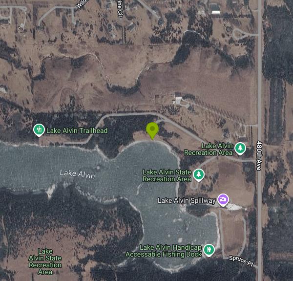
From Harrisburg, head about 4 miles east and then 1 mile north off County Road 135. The park address is 27225 480th Avenue, Harrisburg. It is a day-use park only, with no campground, and it is open year-round. The swim beach is on the north shore of the lake, along the park road, with parking, restrooms and a picnic shelter close by, so it is a short walk from the car to the water.
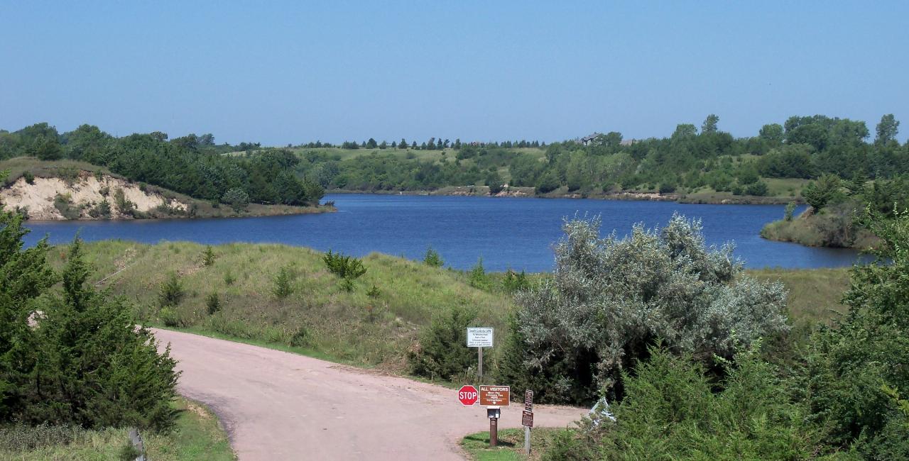
The designated swim beach is a short stretch of shoreline facing south across the lake, with open water out front and wooded bluffs on the far side. The lake is a no-wake zone where boats may not go faster than 5 mph, so the swimming area stays calm even on busy weekends. This is a small reservoir fed by a creek that drains farm country, so expect lake water rather than clear water, and expect it to cloud up after a hard rain. GFP's park page does not list lifeguard service, so watch your own group, especially kids.
Swimming itself costs nothing extra, but every vehicle needs a South Dakota state park entrance license. The daily license is $10 for residents and $15 for nonresidents, and the annual license is $40 for residents and $60 for nonresidents. You can buy one online or at the self-serve kiosk at the park entrance. Between October 1 and April 30, showers, flush toilets and other water systems may be shut off, though the vault toilets stay open.
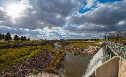
Check conditions before you go. GFP tests the beach water, and the beach has been closed several times after heavy rain washed bacteria into the lake, including in 2009, 2013, 2014, 2020 and 2021. Each time it reopened once follow-up samples came back clean. The beach and boat ramps were also closed from July 2024 while the lake was drawn down more than 10 feet to replace the spillway, which flooding damaged in 2019. That work added two picnic shelters and a vault toilet near the beach, and by June 2026 the lake was back to full pool. Aquatic plants have since spread along parts of the shoreline, and some neighbors say a few edges have turned marshy, so the designated beach is the place to get in. If you have doubts about the current status, call the park at 605-987-2263.
Outside the water, the park has a boat ramp, a fishing pier, shore fishing access, group picnic shelters, picnic tables and a playground. Anglers go after walleye, northern pike, crappie, perch, sunfish, catfish and bullheads, and the no-wake rule makes it a good lake for canoes, kayaks and paddleboards. There is no camping here, but Newton Hills State Park, whose office also handles Lake Alvin, is a short drive south and has a campground if you want to stay overnight.
More Information
Lake Alvin beach and boat ramps to close Monday
The Lake Alvin Recreation Area swim beach and boat ramps will be closed beginning Monday, July 15.
https://digital-release.keloland.com/news/local-news/lake-alvin-beach-and-boat-ramps-to-close-monday/Lake Alvin marsh concerns follow new spillway construction
The new dam is built, the lake is full, and water is draining over the spillway, but residents have questions about the marsh that remains.
https://www.dakotanewsnow.com/2026/06/25/lake-alvin-marsh-concerns-follow-new-spillway-construction/Lake Alvin Recreation Area | South Dakota Game, Fish, and Parks
Hunting, Fishing or Camping in South Dakota? The South Dakota Game, Fish and Parks
https://gfp.sd.gov/parks/detail/lake-alvin-recreation-area/South Dakota lake reopens after runoff causes unhealthy levels of bacteria | SDPB
The swimming beach at Lake Alvin Recreation Area near Harrisburg closed following routine testing that showed unhealthy levels of bacteria in the water.
https://listen.sdpb.org/environment/2021-09-16/south-dakota-lake-reopens-after-runoff-causes-unhealthy-levels-of-bacteriaSpillway replacement at Lake Alvin remains on schedule
The spillway replacement project at the Lake Alvin Recreation Area south of Sioux Falls is nearing its completion.
https://digital-release.keloland.com/news/local-news/spillway-replacement-at-lake-alvin-remains-on-schedule/What remains open during Lake Alvin’s renovation?
As water begins to recede slowly from the lake, there are plenty of activities that Lake Alvin visitors can take part in, such as trails and sunbathing at the beach.
https://www.dakotanewsnow.com/2024/07/17/what-remains-open-during-lake-alvins-renovation/
- Plan Ahead and Prepare
- Travel & camp on durable surfaces
- Dispose of waste properly
- Leave what you find
- Minimize campfire impacts
- Respect wildlife
- Be considerate of other visitors
Directions
From Harrisburg
- Head southwest on Reily St toward N 5th St (0.5 mi)
- Turn left onto N Front St (0.4 mi)
- Turn right onto Forster St/
Harvey Taylor Bridge Bypass Continue to follow Harvey Taylor Bridge Bypass(2.0 mi) - Continue onto Cumberland Blvd (0.9 mi)
- Continue onto US-15 S/
N 32nd St Continue to follow US-15 SPass by Starbucks Coffee Company (on the right in 0.4 mi)(4.1 mi) - Take the exit onto I-76 WToll roadEntering Ohio(259 mi)
- Continue onto I-80 WToll road(215 mi)
- Keep left to continue on I-90 WToll roadEntering Indiana(160 mi)
- Keep left to stay on I-90 WToll roadEntering Illinois(7.8 mi)
- Take the I-94 W/
I-90 W exit on the left toward Ryan Expy Toll road(0.3 mi) - Merge onto I-90Exp W/
I-94Exp W (4.8 mi) - Merge onto I-90 W/
I-94 W (10.7 mi) - Keep left to continue on I-90 W, follow signs for Kennedy Expwy/
O'Hare/ Rockford (4.7 mi) - Keep left to stay on I-90 WToll road(2.8 mi)
- Continue straight to stay on I-90 WToll road(23.1 mi)
- Keep left to stay on I-90 WToll roadEntering Wisconsin(196 mi)
- Slight left to stay on I-90 WEntering Minnesota(319 mi)
- Take exit 1 for MN-23/
County Hwy 17 toward Larchwood/ Pipestone (0.2 mi) - Turn left onto Co Hwy 17/
MN-23 W Continue to follow Co Hwy 17Passing through South Dakota, MinnesotaEntering Iowa(7.6 mi) - Turn right onto 100th StPassing through South DakotaEntering Iowa(3.8 mi)
- Turn left onto IA-9 E (1.6 mi)
- Turn right onto Beech Ave (2.1 mi)
- Turn right onto 140th StEntering South Dakota(4.7 mi)
- Continue onto 272nd St (0.4 mi)
- Turn left onto 480th Ave (0.4 mi)
- Turn right (0.2 mi)
- Slight left (262 ft)