


Little Platte Beach
Smithville
Hike and Swim
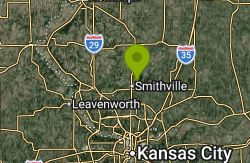
Little Platte Beach is a designated public swim beach inside Little Platte Park, on the west shore of Smithville Lake in Clay County, Missouri. The lake is a U.S. Army Corps of Engineers reservoir of about 7,190 acres on the Little Platte River, built for flood control and water supply and first filled in 1979. Clay County Parks, Recreation and Historic Sites runs the parks around it, including this beach and its counterpart at Camp Branch on the east side. The beach sits about 2 miles northeast of downtown Smithville and roughly 30 minutes north of downtown Kansas City.
To get there, take NE 180th Street east from the Smithville area into Little Platte Park, the same road that serves Paradise Pointe Marina and the golf complex. Several paved lots sit right behind the sand, so the walk from the car to the water is short. The county also points out that the beach can be reached on foot or by bike from the paved Little Platte Trail, which runs through the park.
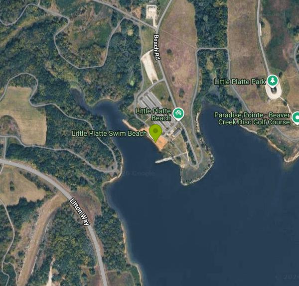
The swim area is a short stretch of sand set in a small cove, with a rock breakwater just off its southern end and a netted swim area in the water in front of it. Once you wade past the sand the bottom turns to ordinary lake bottom, and like most Midwestern reservoirs the water is not clear, so watch children closely and keep them in the shallows. The beach has a shower and changing building, restrooms and a drinking fountain, and a picnic area with tables and a shelter sits a short walk east. There is no lifeguard on duty. Pets, glass containers and alcohol are not allowed on the beach.
The beach is open daily from May 1 through September 15, 8:30 a.m. to sunset. It is not free. Every vehicle entering the Clay County parks at Smithville Lake needs a pass, and the county lists the daily vehicle pass at $7.00 and a season vehicle pass at $55.00, with lower season rates for veterans and some other groups listed on the county fee page. Walk-in or bike-in fees are not spelled out, so plan on the vehicle pass.
Water quality is the main thing to check before you go. Clay County samples both designated beaches every two weeks during the season and posts swimming advisories when E. coli counts run high, then lifts them when the numbers come back down. Advisories here are not rare. Look at the county's beach page the day you plan to swim. Smithville Lake is the largest body of water in the Kansas City area and gets heavy boat traffic in summer, so stay inside the netted area rather than swimming out into the open lake.
Little Platte Park has more to it than the beach. Paradise Pointe Marina and its boat ramps are just north, the Paradise Pointe Golf Complex has two 18-hole courses, and the park has three 18-hole disc golf courses. The Woodhenge and Akers Cemetery historic sites are close by, and the Jerry L. Litton Visitor Center sits near the dam to the south.
More Information
Beaches | Clay County, MO
A swim advisory is in effect for Camp Branch and Little Platte Beaches at Smithville Lake due to elevated E. coli levels. Check more details about the Beaches on this page.
https://www.claycountymo.gov/167/BeachesBest places to swim around Kansas City this summer | KCUR - Kansas City news and NPR
Missouri and Kansas are far from the ocean, but they're home to hundreds of lakes. Kansas City residents can find plenty of great beaches and rocky "shut-ins" to get your swimming fill.
https://www.kcur.org/arts-life/2023-06-24/kansas-city-swimming-beach-pools-summerCorps Lakes Gateway: Missouri - Smithville Lake
An official website of the United States government Here's how you know
https://corpslakes.erdc.dren.mil/visitors/projects.cfm?ID=G516980FAQs - CivicPlus.CMS.FAQ
Create a Website Account - Manage notification subscriptions, save form progress and more.
https://claycountymo.gov/m/faq?cat=16Park Fees | Clay County, MO
Create a Website Account - Manage notification subscriptions, save form progress and more.
https://claycountymo.gov/458/Park-FeesParks & Recreation | Clay County, MO
Discover information about the Parks and Recreation Department events, classes, facilities, and more.
https://www.claycountymo.gov/165/Parks-RecreationRules & Regulations | Clay County, MO
Check the Camping Rules and Regulations on this page for a better understanding.
https://claycountymo.gov/184/Rules-RegulationsBe courteous, informed, and prepared. Read trailhead guidelines, stay on the trail, and don't feed the wildlife.
Read More
- Plan Ahead and Prepare
- Travel & camp on durable surfaces
- Dispose of waste properly
- Leave what you find
- Minimize campfire impacts
- Respect wildlife
- Be considerate of other visitors
Directions
From Smithville
- Head west on E Moss Mill Rd toward Chesapeake Dr (0.3 mi)
- Turn right to stay on E Moss Mill Rd (2.9 mi)
- Turn left onto S Pomona Rd (5.0 mi)
- Continue onto Wrangleboro Rd (2.1 mi)
- Turn right onto the ramp to CamdenToll road(0.2 mi)
- Merge onto Atlantic City Expy WToll road(32.2 mi)
- Merge onto NJ-42 N (7.0 mi)
- Continue onto I-76 W (2.2 mi)
- Continue straight to stay on I-76 W (signs for W Whitman Br/
Philadelphia) Toll roadEntering Pennsylvania(12.1 mi) - Take the I-76 W exit on the left toward Valley ForgeToll road(13.9 mi)
- Take the exit to stay on I-76 W toward HarrisburgToll road(10.3 mi)
- Slight right to stay on I-76 WToll road(242 mi)
- Take exit 75 to merge onto I-70 W toward New Stanton/
Wheeling WV Entering West Virginia(67.1 mi) - Keep left to continue on I-470 W, follow signs for ColumbusEntering Ohio(10.9 mi)
- Merge onto I-70 W (118 mi)
- Take exit 101A for I-71 N toward Cleveland (0.6 mi)
- Continue onto I-71 N (0.4 mi)
- Take exit 109 A for I-670 E toward Airport (1.4 mi)
- Merge onto I-670 W (3.1 mi)
- Take the I-670 W exit toward Dayton (1.0 mi)
- Merge onto I-70 WEntering Indiana(165 mi)
- Keep left to stay on I-70 W (3.4 mi)
- Keep left to stay on I-70 W, follow signs for I-65 S/
Michigan St/ Ohio St/ Fletcher Ave (0.1 mi) - Continue onto I-70 W (0.1 mi)
- Keep left to stay on I-70 W, follow signs for I-65 S/
Michigan St/ Ohio St/ Fletcher Ave (0.5 mi) - Merge onto I-65 S/
I-70 W (1.7 mi) - Keep right to continue on I-70 W, follow signs for St Louis/
Indpls. Int'l Airport Entering Illinois(144 mi) - Keep right to stay on I-70 W, follow signs for St Louis (76.9 mi)
- Slight right onto I-270 (13.3 mi)
- Slight right (0.7 mi)
- Merge onto I-270 WEntering Missouri(1.8 mi)
- Slight right (0.7 mi)
- Merge onto I-270 W (13.1 mi)
- Take exit 20A to merge onto I-70 W toward Kansas City (86.8 mi)
- Keep left to stay on I-70 W (9.7 mi)
- Exit onto Old U.S. 40 (0.3 mi)
- Slight left to merge onto I-70 W (18.6 mi)
- Take exit 117 for MO-O/
MO-J toward Huntsdale/ Harrisburg (0.3 mi) - Merge onto I-70 W (109 mi)
- Take exit 8B to merge onto I-435 N toward Des Moines (10.3 mi)
- Keep left to stay on I-435 N (6.8 mi)
- Take exit 45 for MO-291 (0.5 mi)
- Turn right onto MO-291 S/
NE Cookingham Dr (0.4 mi) - Turn left onto NE Sherman Rd (1.4 mi)
- Continue onto Mt Olivet Rd (4.0 mi)
- Turn left onto State Rte 92 W (0.4 mi)
- Turn right onto DD Hwy (1.7 mi)
- Turn right onto Litton Way (1.4 mi)
- Turn right onto Old Jefferson Hwy (0.9 mi)
- Turn right onto NE 180th St (0.2 mi)
- Keep right to stay on NE 180th StPartial restricted usage road(0.5 mi)
- Turn right onto Beach RdRestricted usage road(0.7 mi)
- Turn rightRestricted usage roadDestination will be on the left(233 ft)
Other Swimming Holes and Hiking Trails Nearby
Watkins Woolen Mill State Park
Kearney, Missouri
15.9 miles EA 100-acre lake with a paved bike path, excellent fishing, whitetail deer, wild turkeys, and a picturesque campground adjacent to the Watkins Woolen Mill National Historic Landmark.
Camp, Hike, Horseback, Swim
Bethany Falls Trail - Burr Oak Woods
Blue Springs, Missouri
28.5 miles SEA 1.33-mile loop through second-growth timber, a limestone glade, a wet-weather creek, restored prairie, and a series of Bethany Falls limestone outcroppings.
Hike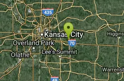
Burr Oak Woods Discovery Trail
Blue Springs, Missouri
28.5 miles SEOver 1,000 acres of forested hillsides, ponds, prairies, and creek in suburban Kansas City — with a nature center, six hiking trails, viewing decks, and limestone mazes to explore.
Hike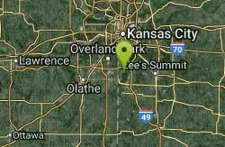
Blue River Parkway
Kansas City, Missouri
34.2 miles SA 2,400-acre multi-use parkland along the Big Blue River with miles of trails popular for mountain biking, fishing ponds, horse riding, polo fields, and more.
Hike, Horseback, Mountain Bike
The Beach at Lake Olathe
Olathe
40.3 miles SWOlathe's lifeguarded city swim beach on 170-acre Lake Olathe, with a sand beach, floating Aquapark and boat rentals. Paid daily admission ($10 residents, $12 non-residents) in summer only.
Canoe, Hike, Kayak, Swim


