


Main Street Beach
Vermilion
Kayak and Swim
Main Street Beach is the City of Vermilion's public swimming beach on Lake Erie, part of Main Street Beach & Park at 479 Main Street. The city's Parks Department runs the park, which covers nearly 4 acres at the north end of Main Street, right beside the mouth of the Vermilion River and its stone breakwaters. The city lists swimming as permitted, and the beach is open to anyone, residents and visitors alike. The sand is a short walk from the shops and restaurants of Vermilion's small downtown harbor district.
To get there, follow Main Street north from US 6 (Liberty Avenue) until it ends at the lake. A small surface lot sits at the foot of Main Street, with street-side parking along the approach and more spaces a couple of blocks south downtown. On summer weekends the close-in spots fill early, so plan to walk a block or two. The city lists the park as accessible, and a paved walkway leads from the street toward the sand.
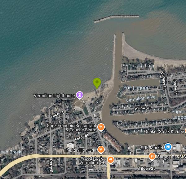
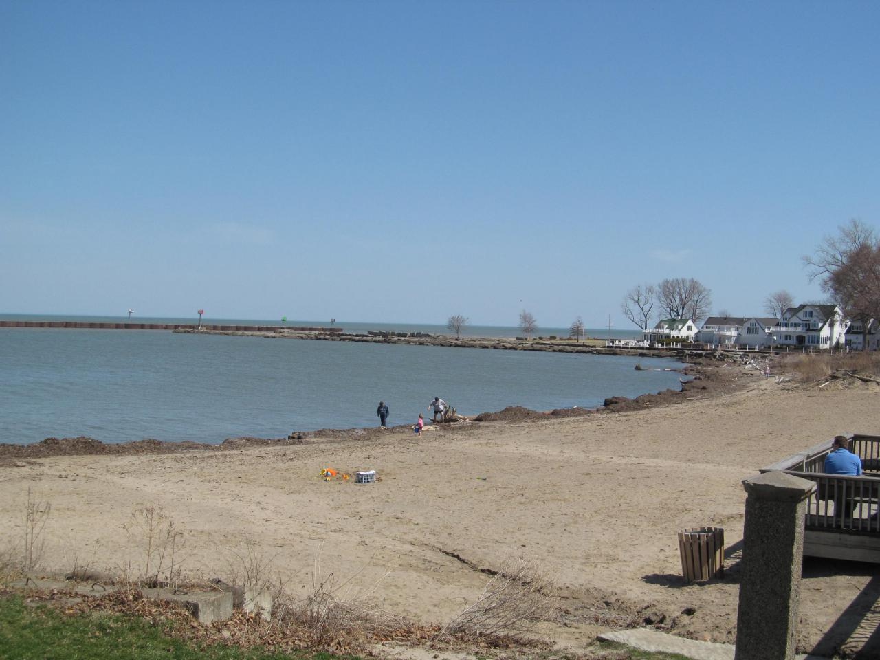
The beach itself is a strip of sand running northeast from the lighthouse toward the harbor breakwater, facing open Lake Erie. It is on the small side, so it feels more like a neighborhood beach than a big state park shoreline. The city publishes no depth figures, but the lake bottom is sand near shore and the water deepens gradually. Lake Erie is the shallowest and warmest of the Great Lakes, and by late July the water near shore is usually comfortable for most swimmers, though early June can still be cold. No lifeguards are listed for this beach, so you swim at your own risk. A city webcam streams the beach, which is a quick way to check waves and crowds before you drive over.
There is no admission charge for the beach or the park, and the city does not post a fee for the lot at the foot of Main Street. The city also posts no set park hours, so check signs at the entrance; questions go to Vermilion City Hall at (440) 204-2400. A recent revitalization project doubled the park's lakefront acreage and added a comfort station with restrooms, changing rooms and showers, picnic tables, shade areas, a loop trail, scenic overlooks and a public kayak launch. Volunteers from Shore Thing Vermilion run a small snack shop in the comfort station selling ice cream and drinks.
Water quality on Ohio's Lake Erie beaches is sampled during the summer season, and E. coli advisories are posted on the Ohio Department of Health BeachGuard site, most often after heavy rain, when runoff from the Vermilion River reaches the beach. Late summer can also bring harmful algal blooms to Lake Erie, so skip the water if it looks green, scummy or smells off. Boats use the river mouth right next to the beach, so stay well clear of the channel and do not climb or swim off the breakwater rocks. Strong north and northeast winds build steep waves here quickly.
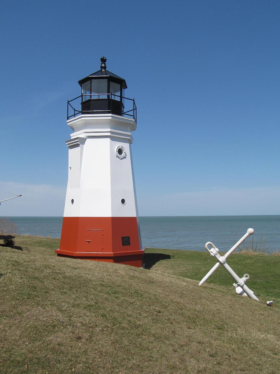
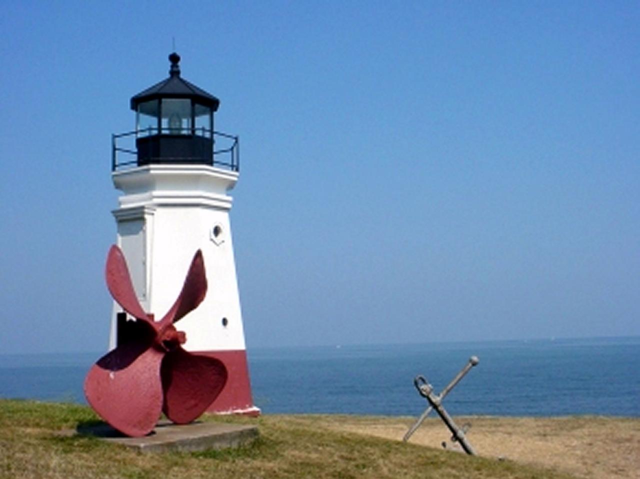
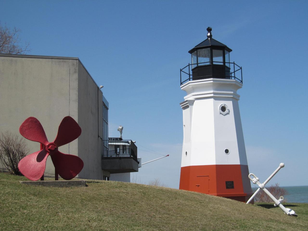
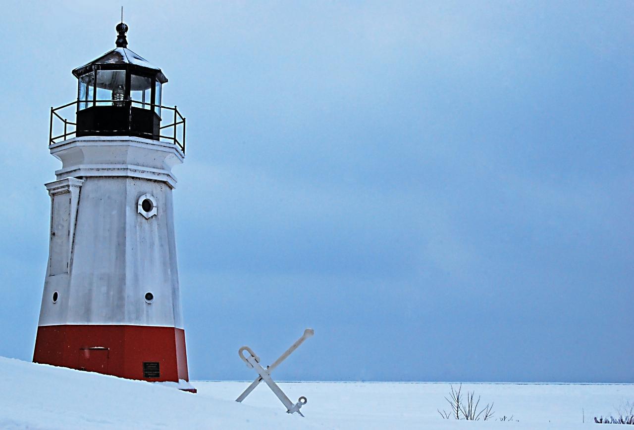
The red and white Vermilion Lighthouse stands at the west end of the beach. It is a 34-foot replica of the harbor light that stood at the river mouth until 1929, built with public donations and dedicated in 1992, and it still shows a steady red light at night. The beach is a popular sunset spot. It also draws birders, and the city's park page links to Ohio DNR information on the birds commonly seen along this stretch of shore.
More Information

- Plan Ahead and Prepare
- Travel & camp on durable surfaces
- Dispose of waste properly
- Leave what you find
- Minimize campfire impacts
- Respect wildlife
- Be considerate of other visitors
Directions
From Vermilion
- Head south on 52 St/
Buffalo Trail/ AB-41 S toward College Dr Continue to follow Buffalo Trail/(2.0 km)AB-41 S - Turn left onto the AB-16 E/
Trans Canada Highway ramp to Lloydminster (0.8 km) - Merge onto Yellowhead Hwy E/
AB-16 Continue to follow Yellowhead Hwy EEntering Saskatchewan(195 km) - Keep right to continue on SK-16 E/
SK-40 E, follow signs for Trans-Canada Highway/ Saskatoon/ Prince Albert Continue to follow SK-16 E(134 km) - Take the Circle Dr ramp to SK-11 S/
Trans Canada Hwy 16 E (0.4 km) - Take the ramp to Circle Dr E/
SK-16 E (22 m) - Turn left onto Circle Dr E/
SK-16 E (11.2 km) - Continue onto SK-11 S (235 km)
- Take the SK-11 S exit toward Global Transportation Hub (1.3 km)
- Merge onto SK-11 (19.1 km)
- Continue onto Trans-Canada Hwy/
SK-1 E (8.0 km) - Take the exit toward SK-6 S (0.6 km)
- Take the ramp onto SK-6 S (38.9 km)
- SK-6 S turns slightly right and becomes SK-39 S (62.9 km)
- At the roundabout, take the 2nd exit and stay on SK-39 S (82.4 km)
- Turn left onto Estevan Bypass/
SK-39A Continue to follow Estevan Bypass(12.9 km) - Turn left onto SK-18 E/
SK-39 S Continue to follow SK-39 SEntering the United States of America (North Dakota)(33.0 km) - SK-39 S turns right and becomes US-52 (0.5 km)
- Turn right onto US-52 E/
Railway Ave Continue to follow US-52 E(11.8 km) - Turn left to stay on US-52 E (144 km)
- Take the US-52 BUS/
US-52 E ramp to Jamestown (0.6 km) - Turn right onto US-52 E (161 km)
- Turn left onto US-52 E/
3rd St NE (38.5 km) - At the traffic circle, take the 1st exit onto US-281 S/
US-52 E/ 4th Ave N/ 67th Ave NE Continue to follow US-281 S/(64.9 km)US-52 E - Turn right onto US-281 BYP/
US-52 BYP (6.0 km) - Turn left to merge onto I-94 EEntering Minnesota(365 km)
- Take exit 131 for MN-4 toward Melre Grv/
Paynesville (0.7 km) - Merge onto I-94 EParts of this road may be closed at certain times or days(43.0 km)
- Keep right to stay on I-94 E (94.9 km)
- Keep left to stay on I-94 E (10.9 km)
- Slight left onto I-694 E (20.8 km)
- Keep right to stay on I-694 E (17.4 km)
- Continue onto I-494 S (0.1 km)
- Take exit 58B for I-94 E toward Madison (0.5 km)
- Take the ramp onto I-94 EEntering Wisconsin(399 km)
- Keep right to continue on I-90 EToll roadEntering Illinois(166 km)
- Keep left to stay on I-90 EToll road(39.4 km)
- Keep left to stay on I-90 EToll road(27.9 km)
- Keep right to continue on I-90 E/
I-94 E (7.7 km) - Keep left to continue on I-90 E, follow signs for Indiana Toll RdToll roadPassing through IndianaEntering Ohio(454 km)
- Take exit 118 to merge onto US-250 WPass by Subway (on the left in 2.5 km)(2.6 km)
- Turn right onto Mason Rd E (3.2 km)
- Turn left onto OH-13 N (4.2 km)
- Turn right to merge onto OH-2 E/
State Rte 2 E toward Cleveland (17.6 km) - Take exit 156 for OH-60 toward Vermillion/
Wakeman (0.5 km) - Turn left onto OH-60 N/
State St (2.6 km) - Turn right onto South St (0.1 km)
- Turn left onto Main St (0.3 km)
- Continue straight to stay on Main St (0.3 km)
- Turn right onto Huron St (15 m)
- Turn left (0.1 km)
 The sand at Main Street Beach curving toward the harbor breakwater on Lake Erie. courtesy of Dougtone↗ (CC BY-SA 2.0↗)
 The Vermilion Lighthouse replica at the west end of Main Street Beach, with Lake Erie behind it. courtesy of Dougtone↗ (CC BY-SA 2.0↗)
 The lighthouse with a ship propeller and anchor on the lawn above the beach. courtesy of Unknown authorUnknown author or not provided↗ (Public domain↗)
 The lighthouse and lakefront lawn at Main Street Beach & Park in early spring. courtesy of Dougtone↗ (CC BY-SA 2.0↗)
 The Vermilion Lighthouse in winter with snow over the beach and frozen lake. courtesy of Rona Proudfoot from Lorain, Ohio↗ (CC BY-SA 2.0↗)
Other Swimming Holes and Kayaking Areas Nearby
Kelley's Island State Park
Kelleys Island, Ohio
21.9 miles NWLake Erie's Emerald Isle offers unique geological, ecological, and archaeological features alongside recreational hiking, beaches, and picturesque landscapes on 677 acres.
Camp, Hike, Mountain Bike, Swim
Clare-Mar Lakes Campground
New London, Ohio
25.2 miles SA 75-acre lake surrounded by 220 acres of rolling terrain, with 1,000 feet of sandy beach, swimming, boating, fishing, and planned activities for the whole family near Wellington, Ohio.
Camp, Canoe, SwimNearby Campsites
Kelley's Island State Park
Kelleys Island, Ohio
21.9 miles NWLake Erie's Emerald Isle offers unique geological, ecological, and archaeological features alongside recreational hiking, beaches, and picturesque landscapes on 677 acres.
Camp, Hike, Mountain Bike, Swim
Clare-Mar Lakes Campground
New London, Ohio
25.2 miles SA 75-acre lake surrounded by 220 acres of rolling terrain, with 1,000 feet of sandy beach, swimming, boating, fishing, and planned activities for the whole family near Wellington, Ohio.
Camp, Canoe, Swim


