


Quarry Rock Falls
Bentleyville
Hike and Swim
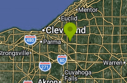
Quarry Rock Falls is a broad, tiered cascade on the Aurora Branch of the Chagrin River inside South Chagrin Reservation, part of the Cleveland Metroparks system, on the edge of the village of Bentleyville in Cuyahoga County. The river bends here beneath sandstone cliffs that still carry the vertical tool scars of a 19th century quarry, the source of the name. A small stone-quarrying settlement called Griffithsburg stood nearby in the early 1800s, and Metroparks notes the area once held the only post office for miles around. The falls drop over stepped ledges of shale that run the full width of the stream.
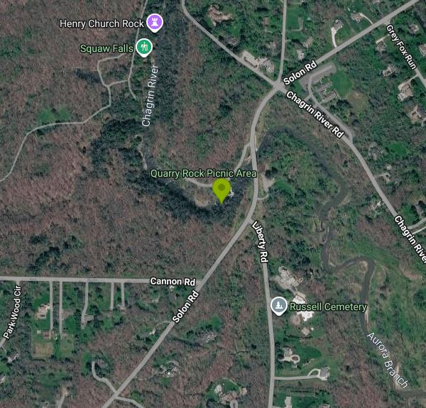
Getting there is short and simple. Drive to the Quarry Rock Picnic Area off Solon Road, just south of Chagrin River Road in Bentleyville, and park in the small lot there. A short walk from the lot leads to a wooden viewing deck above the falls, and the Quarry Rock Loop Trail and Hatchet Ridge Trail follow the south bank of the river past the cascade. The picnic area has tables, grills and non-flush restrooms. The reservation is open daily from 6 a.m. to 11 p.m. Entry and parking are free; Cleveland Metroparks charges no admission at its reservations.
This is a creek spot rather than a beach. Expect wet, flat shale shelves, riffles and ankle to knee deep water over the ledges, with deeper pockets at the base of each step and in the bend below the falls. Depth and current change a lot with rainfall, and there is no posted or measured depth. The water is cool and shaded under hemlock and hardwood cover, and it is at its most comfortable from late June through August when flows drop. Cleveland Metroparks regulations allow swimming and wading in park waters except where an area is designated otherwise, and visitors assume the risk of any water contact. There are no lifeguards at Quarry Rock; the system's guarded swimming is at its six designated beaches and pools, not here.
Treat the Aurora Branch with respect. American Whitewater rates the branch as class III to IV whitewater at high water, and the stream can rise quickly after a storm. Stay out when the water is high or murky. The shale is slick with algae, the cliffs around the gorge are steep and crumbly, and Metroparks allows climbing only in designated areas with a permit. Do not jump or dive from the ledges; the pools are shallow and rocky. Metroparks posts no water quality results for this stream (its monitoring covers the guarded beaches), so avoid swallowing water and skip a dip for a couple of days after heavy rain, when runoff from upstream suburbs is at its worst. Alcohol is prohibited throughout the park district.
The rest of South Chagrin Reservation is worth the trip. A short walk downstream along the Aurora Branch leads to Henry Church, Jr. Rock, a 19th century carving of a serpent and a woman cut into a sandstone boulder by a local blacksmith, with more small falls nearby. The Buckeye Trail runs through the reservation, Shadow Lake is stocked for fishing, and the state-designated scenic Chagrin River forms the park's eastern edge. In winter the Quarry Rock cliffs grow long curtains of ice, and Metroparks lists the falls among its best winter waterfall stops.
More Information
Chagrin River - Wikipedia
The Chagrin River is a 49-mile (79 km) long scenic watercourse located in Northeast Ohio and major tributary of Lake Erie.[1] It comprises two principle tributary branches: the Aurora Branch and the East Branch.[2][3][4] The tributary runs through suburban areas of Greater Cleveland in Cuyahoga, Geauga, and Portage counties, transects two Cleveland Metroparks reservations, and then meanders into nearby Lake County before emptying into the Great Lakes.
https://en.wikipedia.org/wiki/Chagrin_RiverGriffithsburg: A Stone-Quarrying Ghost Town in South Chagrin Reservation | Cleveland Historical
The Quarry Rock Picnic Area in South Chagrin Reservation invites visitors to envision an era when small bands of pioneer men, women, and children forged a new life in the Western Reserve. Situated along the bank of the Chagrin River's Aurora Branch, the peaceful retreat masks a history of industry and commerce. The land that was once home to the town of Griffithsburg has been reclaimed by time and nature. While traces of the ghosted town have all but disappeared, clues to a hidden past...
https://clevelandhistorical.org/items/show/670January
Double Decker Falls, South Chagrin Reservation As you descend the stairs, the sound of rushing water grows louder and louder. Visiting these layered, crescent-shaped falls is very immersive, making a winter visit worth the trek. At times, the water’s mist freezes instantly in the frigid air.
https://www.clevelandmetroparks.com/parks/visit/ten-to-explore/2025/januaryPark Rules & Regulations | Cleveland Metroparks
Discover 100 years of Cleveland Metroparks in Northeast Ohio. Learn more about the parks, zoo, golf and dining in the Cleveland area.
https://www.clevelandmetroparks.com/about/cleveland-metroparks-organization/cleveland-metroparks-police-department-safety/park-rules-regulationsQuarry Rock Picnic Area | Cleveland Metroparks
Picnic at Henry Church Rock or join a program at the Look About Lodge. South Chagrin Reservation offers hiking, horseback riding, picnic areas and more.
https://www.clevelandmetroparks.com/parks/visit/parks/south-chagrin-reservation/quarry-rock-picnic-areaQuarry Rock | Cleveland Metroparks
Picnic at Henry Church Rock or join a program at the Look About Lodge. South Chagrin Reservation offers hiking, horseback riding, picnic areas and more.
https://www.clevelandmetroparks.com/parks/visit/parks/south-chagrin-reservation/quarry-rockSouth Chagrin Reservation | Cleveland Metroparks
Picnic at Henry Church Rock or join a program at the Look About Lodge. South Chagrin Reservation offers hiking, horseback riding, picnic areas and more.
https://www.clevelandmetroparks.com/parks/visit/parks/south-chagrin-reservationSwimming | Cleveland Metroparks
Explore the best parks and hiking trails in Ohio on Cleveland Metroparks 25,000 acres. Visit one of our beautiful reservations today!
https://www.clevelandmetroparks.com/parks/visit/activities/swimming/Be courteous, informed, and prepared. Read trailhead guidelines, stay on the trail, and don't feed the wildlife.
Read More
- Plan Ahead and Prepare
- Travel & camp on durable surfaces
- Dispose of waste properly
- Leave what you find
- Minimize campfire impacts
- Respect wildlife
- Be considerate of other visitors
Directions
From Bentleyville
- Head southwest on Solon Rd toward Chagrin River Rd (0.1 mi)
- Turn rightDestination will be on the left(472 ft)
Other Swimming Holes and Hiking Trails Nearby
Chagrin Falls
Chagrin Falls, Ohio
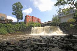
1.9 miles NEA natural waterfall tumbles right through the center of town in a riverside park where you can actually swim — a rare and charming small-city attraction year-round.
Swim
Punderson State Park
Cleveland-Elyria-Mentor, OH, Ohio
10.8 miles ESwim near Cleveland-Elyria-Mentor, OH, Ohio
Swim
Villa Angela Beach
Cleveland
14.5 miles NWA free, lifeguarded 900-foot Lake Erie sand beach in Cleveland Metroparks' Euclid Creek Reservation on Cleveland's east side, beside Euclid Beach Park and the mouth of Euclid Creek.
Hike, Swim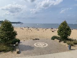
Edgewater Beach
Cleveland
17.8 miles WFree, lifeguarded Lake Erie swimming beach in Cleveland Metroparks' Edgewater Park, about 2.5 miles west of downtown Cleveland, with a 1,000-foot marked swim area and skyline views.
Hike, Kayak, Swim
Nelson Ledges Quarry Park
Garrettsville, Ohio
20.6 miles EA privately owned quarry park with strikingly blue-green water, a swimming beach, cliff jumping, and camping — see the website for current pricing and available events.
Swim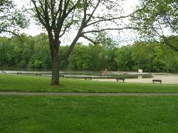
Wallace Lake Beach
Berea
23.4 miles WA free, lifeguarded summer swim beach on Wallace Lake, a flooded 1941 sandstone quarry in Cleveland Metroparks' Mill Stream Run Reservation, a short walk from downtown Berea.
Hike, Kayak, Swim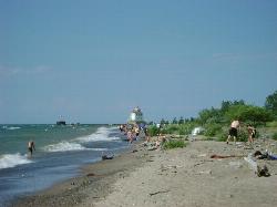
Headlands Beach State Park
Mentor, Ohio
25.0 miles NThe longest natural sand beach in Ohio, a mile of open Lake Erie shoreline east of Mentor with rare dune plants behind it and a lighthouse at the end of the breakwall.
Hike, Kayak, Swim
Fairport Harbor Lakefront Park
Fairport Harbor
25.1 miles NA 21-acre Lake Metroparks beach on Lake Erie at the mouth of the Grand River, with a marked swim area, summer lifeguards 11 am to 7 pm, daily E. coli testing and $2 to $3 gate parking.
Canoe, Kayak, Swim
Huntington Beach
Bay Village
27.5 miles WGuarded Lake Erie swimming beach below the bluff in Cleveland Metroparks' Huntington Reservation in Bay Village, with sand pockets between stone breakwalls and free entry and parking.
Hike, Kayak, Swim
Craig Beach at Lake Milton State Park
Craig Beach, Ohio
30.1 miles SEA 600 foot public swim beach on the east shore of Lake Milton, in the village of Craig Beach, where an amusement park with a roller coaster stood a century ago.
Canoe, Hike, Kayak, Swim
Turkeyfoot Beach
New Franklin
31.3 miles SA free 900-foot sand beach on Turkeyfoot Lake at Portage Lakes State Park in New Franklin, south of Akron. No lifeguards, daylight swimming only, and boats share the lake.
Canoe, Hike, Kayak, Swim
Pheasant Run Loop Portage Lakes State Park
Akron, Ohio
31.4 miles SBoating, swimming, and fishing on several surrounding lakes, plus wetlands that draw waterfowl and shorebirds — Portage Lakes State Park packs a lot into 411 acres near Akron.
Hike
Rabbit Hill Loop Portage Lakes State Park
Akron, Ohio
31.4 miles SA scenic loop at one of Ohio's highest points, where the watershed divides between Lake Erie and the Ohio River, steeped in Native American and settler history.
Hike
Portage Lake State Park- Planet Walk Trail
Akron, Ohio
31.4 miles SA 411-acre Ohio park with boating, swimming, and fishing on several surrounding lakes, plus wetlands that attract waterfowl and shorebirds for hunting and wildlife watching.
Hike
Shoreline Trail Portage Lakes State Park
Akron, Ohio
31.4 miles SA 5-mile trail at Portage Lakes State Park in Akron that winds past Rex Lake, a dog park, the Big Oaks Picnic Area, and Turkeyfoot Beach — accessed via the Planet Walking Trail from the park office lot.
Hike
Mill Creek Day Use Area
Berlin Center
35.2 miles SEFree Army Corps of Engineers picnic area on Berlin Lake near Berlin Center, Ohio, where swimming is allowed from the shoreline. There is no designated beach and no lifeguard.
Swim
Walnut Beach Park
Ashtabula
46.1 miles NEA free city-run sand beach on Lake Erie at Ashtabula Harbor, with summer daytime lifeguards, a concession stand, playgrounds and a birding trail behind the dunes.
Hike, Swim
Pymatuning State Park Main Beach
Andover
47.3 miles EA free 500-foot sand beach on Pymatuning Reservoir just south of the Ohio 85 causeway near Andover, run by Ohio State Parks, with showers, a changing house and volleyball courts.
Camp, Hike, Swim
Jamestown Beach 2
Jamestown
49.3 miles ESmall, free public sand beach on the southwest shore of Pymatuning Reservoir in Pymatuning State Park, just south of the Jamestown Marina. Open late May through Labor Day, no lifeguards, and subject to occasional E. coli closures.
Camp, Canoe, Kayak, Swim
Main Street Beach
Vermilion
49.4 miles WVermilion's free city beach on Lake Erie at the north end of Main Street, with a sandy swim area, a new comfort station with restrooms and showers, a kayak launch and the Vermilion Lighthouse replica.
Kayak, SwimNearby Campsites
Pymatuning State Park Main Beach
Andover
47.3 miles EA free 500-foot sand beach on Pymatuning Reservoir just south of the Ohio 85 causeway near Andover, run by Ohio State Parks, with showers, a changing house and volleyball courts.
Camp, Hike, Swim
Jamestown Beach 2
Jamestown
49.3 miles ESmall, free public sand beach on the southwest shore of Pymatuning Reservoir in Pymatuning State Park, just south of the Jamestown Marina. Open late May through Labor Day, no lifeguards, and subject to occasional E. coli closures.
Camp, Canoe, Kayak, Swim
Clare-Mar Lakes Campground
New London, Ohio
49.7 miles SWA 75-acre lake surrounded by 220 acres of rolling terrain, with 1,000 feet of sandy beach, swimming, boating, fishing, and planned activities for the whole family near Wellington, Ohio.
Camp, Canoe, Swim


