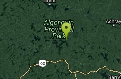
Palmer Rapids
Palmer Rapids, Ontario

| GPS: |
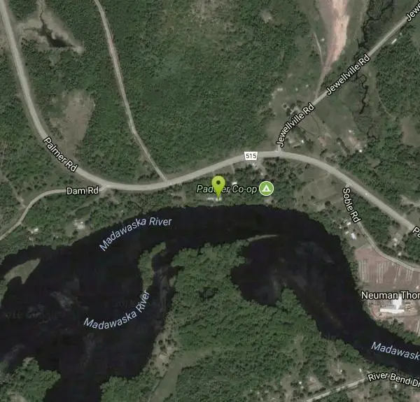
45°19'53.7"N 77°31'33.4"W Maps | Directions |
| State: | Ontario |
Camp, Canoe, and Kayak
Palmer Rapids is one of Ontario's great whitewater classrooms, a friendly, forgiving stretch of the Lower Madawaska River named for the little community alongside it in the Ottawa Valley. Where many whitewater destinations demand skill before they give anything back, Palmer welcomes beginners: its Class I-II rapids are gentle enough to learn on and interesting enough to keep experienced paddlers playing all day. Generations of Ontario kayakers and canoeists have learned to read moving water right here, which has made it something of a spiritual home for the province's paddling community.
The layout is what makes it so good for learning. Two sets of rapids are separated by a slow-moving pool, so a swim or a blown line has an easy, calm recovery below rather than a long, punishing washout. The middle section offers excellent practice water for ferrying and eddy-hopping, the fundamental skills of river paddling, while the bottom features a smooth, river-wide wave that's easy to attain from either bank, making it a superb place to learn to surf whitewater. Just before the run-out the rapid turns sharply left, kicking up choppy waves that have flipped plenty of paddlers, but below that sits a large, friendly lake perfect for swimming, with a sandy beach where kids can play.
The area is home to the Paddler Co-op, a nonprofit paddling school and outdoor community based on the Madawaska that runs whitewater kayaking, canoeing, packrafting and river-rescue courses for all experience levels. Its waterfront campground, set beneath towering old-growth pines, offers tent and trailer sites with access to both calm flatwater and the whitewater just upstream, making a paddling weekend here about as simple as it gets.
Even friendly whitewater is still whitewater. River levels on the Madawaska change with dam releases and rainfall, and rapids that are mellow at one flow can become pushy at another, so it's worth checking conditions and scouting from shore before putting on. Helmets and properly fitted PFDs are standard equipment here, and a swim through the bottom wave is common enough that it's practically a rite of passage.
Summer is the heart of the season, when the water is warm enough to make repeated swims pleasant and the beach below turns into a family basecamp. Bring a PFD and helmet if you're paddling, water shoes for the rocky riverbed, sun protection, and a change of dry clothes. Whether you come to take a first kayak course, surf the wave until your arms give out, or just swim off the sandy beach while others play in the current, Palmer Rapids is one of the most welcoming pieces of moving water in Ontario.
More Information
Madawaska river, Palmer rapids - Eastern Canada rivers guidebook.
Eastern Canada rivers guidebook - Madawaska river, Palmer rapids
http://canadariversguidebook.ca/section/madawaska/palmer-rapids/Whitewater Canoe & Kayak Courses in Ontario | Paddler Co-op
Join Paddler Co-op in Palmer Rapids, ON for expert-led whitewater canoe & kayak courses, youth programs, and outdoor adventure for all ages
https://paddlerco-op.ca/
- Plan Ahead and Prepare
- Travel & camp on durable surfaces
- Dispose of waste properly
- Leave what you find
- Minimize campfire impacts
- Respect wildlife
- Be considerate of other visitors
Directions
From Palmer Rapids, Ontario
- Head south toward Burnt Bridge Rd (0.6 km)
- Turn left onto Burnt Bridge Rd (0.6 km)
- Turn left onto Palmer Rd/Renfrew County Rd 515Destination will be on the left(3.1 km)
There are two different options for putin. One requires more flatwater paddling but a shorter drive while the other requires less flatwater paddling but a longer drive.
Put in
The main putin is at Aumond Bay off Addington Rd/Hyland Creek Road. From Quadeville, follow Addington Rd. 5.1 Km to the end of the paved section. Continue on the logging road 2 Km to a dirt road on the right. Follow this for 2.5km to a small parking lot at Aumond Bay. Bare in mind this is a logging road and is quite potholed and bumpy so vehicles with a high clearance are needed.
You can also putin at Hass Hole. This is private land and there is a putin fee per paddler. From the turn onto Bruceton Road, travel 3.5 km to a fork. Turn left onto Keller Road and continue on for nearly 2km to a small bridge. After the bridge take the next driveway on the left belonging to Clifford Hass (should be on the mailbox). Follow the driveway to the second house. The fee box is here so remember to stop and pay. The road continues on to an old hunting camp where you can park.
Take out
The takeout is at Buck Bay further down Hyland Creek Road. From the putin just go back to the logging road, turn right and follow it for 6.2km to a dirt road on the right. This road ends at a parking lot.
Other Canoeing Areas and Kayaking Areas Nearby
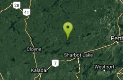
Crotch Lake
Ompah, Ontario
45.0 miles SEOne of the largest and most accessible lakes in North Frontenac Park Lands — 77 campsites, a wetland hiking trail, and virtually entirely undeveloped Crown land shoreline.
Canoe, Hike, Kayak 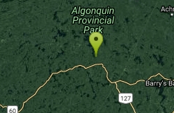
Opeongo Lake
Sproule Township, Ontario
45.4 miles NWThe largest lake in Algonquin Provincial Park and the source of the Opeongo River — a vast and scenic paddling destination in northeastern Ontario.
Canoe