


Patterson Point Preserve
Villa Grande
Canoe, Kayak, and Swim
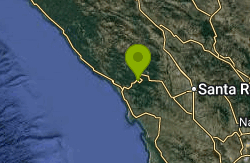
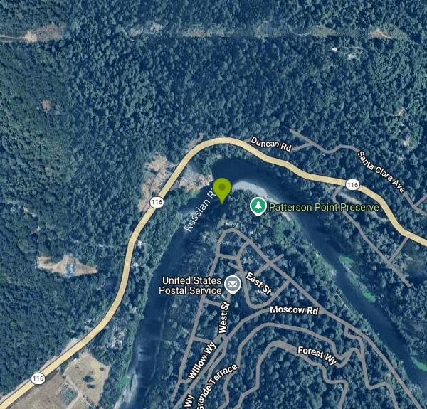
Patterson Point Preserve is a roughly two-acre riverside property on a bend of the Russian River at Villa Grande, a small summer-cabin community just west of Monte Rio in Sonoma County. It is owned and managed by Friends of Villa Grande (FoVG), an all-volunteer 501(c)(3) nonprofit that bought the land in September 2009 with help from a Sonoma County Agricultural Preservation and Open Space District grant. Locals had used the point as a fishing hole and swimming spot for more than a century before that, and the purchase came with a recreation covenant that keeps it open to the public.
The preserve sits at the edge of the Villa Grande flats, a grid of narrow residential lanes between Moscow Road and the river. Visitors walk in on a short trail through the trees to two small beaches at the water: a sandy one and a pebbly, rockier one just beside it. FoVG does not publish parking directions, and the streets here are tight and lined with homes, so park legally, keep driveways clear, and expect to walk a few blocks on busy summer days. There is a bike rack at the preserve, and Sonoma County Transit route 28 stops in Villa Grande.
Swimming is allowed during the day, along with picnicking, sunbathing, fishing and paddling. There are no lifeguards and you swim at your own risk. The river bottom is uneven, and FoVG warns that it drops off steeply in places, so wade in carefully and keep an eye on kids and weaker swimmers. California law requires children under 13 to wear a life jacket on any recreational boat, kayaks and canoes included. Water levels change through the season, and from May 15 for about five months the county's estuary management at Jenner can raise the water level and cover much of the beach with little notice.
Entry is free and the preserve is open to everyone, but only in daylight. Overnight use of the preserve and shoreline is prohibited, and boats and personal belongings have to be gone by nightfall. The one exception is a members-only summer program in which FoVG rents spots on an anchor chain on the gravel beach for kayaks, canoes and paddleboards. FoVG pays for a portable toilet and trash, compost and recycling service, funded by member dues and visitor donations.
Water quality is the main thing to check before you go. Sonoma County Environmental Health samples Patterson Point for bacteria during the summer and posts results on signs at the preserve. Harmful algae is a separate problem here. The county has posted toxic algae alerts for Patterson Point, and algal mats on the river can be toxic, especially to dogs. Stay out of water that looks scummy, foamy or discolored, keep dogs from drinking or chewing on mats, and rinse off after swimming. The state also has a mercury advisory for Russian River fish.
The preserve is worth a walk even when the water is off limits. It holds 33 redwoods, many of them oddly shaped trees between 400 and 600 years old that loggers apparently passed over, plus bay, tanoak and bigleaf maple. FoVG volunteers and STRAW student crews have spent years pulling ivy and planting natives, and signs along the trail cover local fish, birds and plants. FoVG posts monthly bird sightings, and restoration work days run from October through March, outside bird nesting season.
More Information
Fresh Water Quality | Environmental Health | Department of Health Services
Environmental Health monitors bacterial levels in the water at beaches along the Russian River and at Spring Lake Swimming Lagoon by collecting and testing weekly water samples between Memorial Day and Labor Day.
https://sonomacounty.gov/health-and-human-services/health-services/divisions/public-health/environmental-health/programs-and-services/fresh-water-qualityFriends of Villa Grande (FoVG) - About PPP
The two acres at the bend in the Russian River at Villa Grande, originally known as Patterson Point, have been used by locals for more than 110 years as a fishing hole, recreation area and nature preserve. The property was purchased by Friends of Villa Grande in September 2009 with the mission to retain the formula that has worked so well for decades: enjoy the water, the sun and the sand, meet your friends and neighbors for some fun and make sure you don’t spoil it for the next visitors.
https://villagrande.org/about-pppFriends of Villa Grande (FoVG) - Boat Anchorage
Patterson Point Preserve was purchased by Friends of Villa Grande in September 2009. As one of its guiding principles, FoVG is committed to keeping the area open and accessible to Villa Grande and the surrounding community. From May to October each year, FoVG secures a heavy chain on the PPP gravel beach and rents space for human-powered craft to members on a first come, first serve basis.
https://villagrande.org/anchorageFriends of Villa Grande (FoVG) - History of FoVG
For a hundred years residents of Villa Grande were allowed access to 1.7 acres of property owned by a local realtor family. Most residents assumed access was an eternal guarantee, but in 2005 the owners declared their interest in selling the property to the community or adjacent landowners. Community meetings were held in 2006 to discuss if a private “gated” entrance would be preferable to public access with no restrictions. Another big issue was determining how to structure a purchase and accept a deed on behalf of an unincorporated community.
https://villagrande.org/history-of-fovgFriends of Villa Grande (FoVG) - Recreation
For over 100 years, locals and visitors alike have enjoyed Patterson Point both as an access point to the Russian River and for the quiet forest experience it affords. The experience was very different in earlier decades when visitors drove their cars onto the Preserve and wires were strung from the redwoods for lighting.
https://villagrande.org/recreationFriends of Villa Grande (FoVG) - Water Quality & Septic
Managing water quality on the Russian River between Guerneville and the Pacific Ocean is a complex process involving multiple stakeholders. The two primary issues are controlling the flow of the river - through reservoir releases and managing the mouth at Jenner - and limiting discharges into the river with tighter regulation of wastewater systems. Friends of Villa Grande members are engaged in the decision process in both issues.
https://villagrande.org/water-quality-and-septicHarmful Algae Blooms (HABs) | Environmental Health | Department of Health Services
Health facts and information about blue-green algae (aka cyanobacteria), a normal inhabitant of many water environments.
https://sonomacounty.gov/health-and-human-services/health-services/divisions/public-health/environmental-health/programs-and-services/blue-green-algae
- Plan Ahead and Prepare
- Travel & camp on durable surfaces
- Dispose of waste properly
- Leave what you find
- Minimize campfire impacts
- Respect wildlife
- Be considerate of other visitors
Directions
From Villa Grande
- Head northeast toward Shockey Ln (85 ft)
- Turn left toward Shockey Ln (62 ft)
- Turn right onto Shockey Ln (82 ft)
- Turn left onto New Castle Rd (0.1 mi)
- Continue straight to stay on New Castle RdPass by Chili's Grill & Bar (on the right in 1.1 mi)(1.5 mi)
- Turn right onto PA-356 (0.1 mi)
- Take the ramp to New Castle (0.4 mi)
- Merge onto US-422 W (11.5 mi)
- Take the exit on the left onto I-79 N toward Erie (17.6 mi)
- Take exit 116B to merge onto I-80 W toward SharonEntering Ohio(37.1 mi)
- Take the exit to stay on I-80 WToll road(215 mi)
- Keep left to continue on I-80 W/
I-90 W Toll roadEntering Indiana(139 mi) - Take exit 21 for I-80 W/
I-94 W toward IN-51 S (0.9 mi) - Merge onto I-94 W/
I 80 E Continue to follow I-80 WToll roadEntering Illinois(22.8 mi) - Keep right to stay on I-80 W, follow signs for IowaToll road(8.1 mi)
- Keep left to stay on I-80 W (16.2 mi)
- Slight left (4.9 mi)
- Keep left (0.2 mi)
- Continue straight (1.3 mi)
- Merge onto I-80 W (114 mi)
- Take the exit to stay on I-80 W toward DavenportEntering Iowa(180 mi)
- Take exit 136 for US-69 toward E 14th St/
Ankeny (0.4 mi) - Turn left onto US-69 S/
NE 14th St (0.2 mi) - Merge onto I-35 N/
I-80 E via the ramp to Minneapolis/ Davenport (1.0 mi) - Take exit 137A for I-235 W toward Des Moines (0.2 mi)
- Take the ramp onto I-235 W (13.2 mi)
- Take exit 1A for 50th St toward W Des Moines (0.3 mi)
- Turn left onto 50th St (0.6 mi)
- Turn right onto Ashworth Rd (4.4 mi)
- Turn left onto Grand Prairie Pkwy (0.5 mi)
- Take the ramp onto I-80 WPassing through Nebraska, WyomingEntering Utah(1,048 mi)
- Take exit 123B-A for I-15 S/
UT-201 W toward W Valley/ Las Vegas (0.5 mi) - Take the ramp to UT-201 W (0.2 mi)
- Take the UT-201 W ramp (1.1 mi)
- Continue onto UT-201 WParts of this road may be closed at certain times or days(16.8 mi)
- Merge onto I-80 WPassing through NevadaEntering California(682 mi)
- Take exit 33B for CA-37 toward Novato/
San Rafael (0.6 mi) - Continue onto CA-37 W (15.5 mi)
- Turn right onto Lakeville Hwy (11.1 mi)
- Turn right to merge onto US-101 N toward Eureka (15.8 mi)
- Take exit 488B to merge onto CA-12 W toward Sebastopol (3.4 mi)
- Turn right onto Fulton Rd (signs for Occidental Rd) (0.1 mi)
- Turn left onto Occidental Rd (7.2 mi)
- Turn right onto Green Hill Rd (0.8 mi)
- Turn left onto Graton Rd (2.8 mi)
- Turn right onto Bohemian Hwy (4.8 mi)
- Continue straight onto Main St (1.4 mi)
- Turn left onto Moscow Rd (0.9 mi)
- Slight right onto Russian River AveDestination will be on the right(0.2 mi)
Other Swimming Holes, Canoeing Areas, and Kayaking Areas Nearby
Monte Rio Beach
Monte Rio
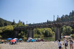
1.1 miles SEFree public gravel beach on the Russian River just east of the Monte Rio Bridge, run by the Monte Rio Recreation and Park District. No lifeguards; loaner life vests on site and summer-only lower parking lot.
Canoe, Kayak, Swim
Willow Creek Environmental Campground
Duncans Mills, California
4.2 miles SWA sandy-banked riverside campground on the Russian River near the California coast — cool and breezy even in summer, with kayak and tube launch access and a mix of shallow and deep swimming spots.
Hike, Kayak, Swim 0.2 mi
Sunset Beach River Park
Forestville, California
5.2 miles EA classic Russian River swimming hole with a pebble beach, shallow and deep sections, Redwood Forest views, paddle boarding, fishing, and picnicking — quieter on weekdays, popular on weekends.
Kayak, Swim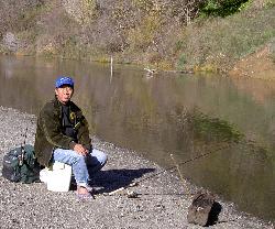
Steelhead Beach Regional Park
Forestville
6.9 miles ESteelhead Beach Regional Park is a Sonoma County Regional Parks day use park on the Russian River north of Forestville, with a gravel bar beach, a year round canoe and kayak put-in, and nearly a mile of trails through riparian woods. There is no lifeguard
Canoe, Hike, Kayak, Swim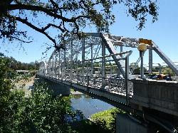
Healdsburg Veterans Memorial Beach
Healdsburg
12.5 miles NEA Sonoma County Regional Parks beach on the Russian River where a seasonal flashboard dam, craned onto a foundation in use since 1955, backs the river into a wide swimming lagoon just below the steel truss Memorial Bridge. The boards go in no earlier than
Canoe, Kayak, Swim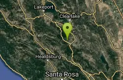
Harbin Hot Springs
Middletown, California
29.3 miles NEA well-established, clothing-optional hot spring retreat in Lake County with multiple pools, overnight lodging, a restaurant, workshops, and conference facilities — fees apply.
Camp, Hot Springs, Swim 0.1 mi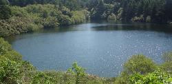
Bass Lake
Bolinas, California
38.9 miles SBass Lake is a beloved hike-in swimming hole in Point Reyes National Seashore, tucked into the coastal hills above the Pacific near Bolinas, California. A small, tree-rimmed freshwater lake reached...
Hike, Swim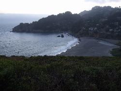
Muir Beach
Muir Beach, California
49.1 miles SEA hidden gem beach north of San Francisco with a 0.2-mile walk to the shore, informational placards for kids, sunset views over the Pacific, and access to the Coastal Trail.
Hike, Swim


