


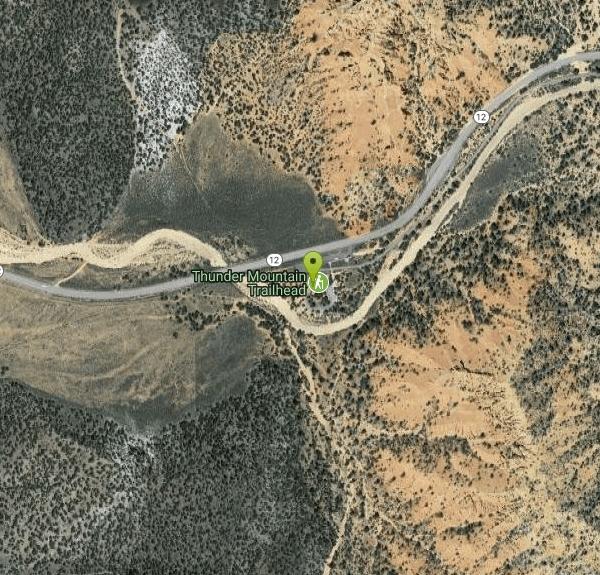
Thunder Mountain Trail
Panguitch, Utah

| Address: | Thunder Mountain Trailhead Rd, Panguitch, UT 84759, USA |
| GPS: |
37°44'36.3"N 112°19'46.5"W Maps | Directions |
| State: | Utah |
| Trail Length: | 15.60 miles |
| MTB Difficulty: | Intermediate |
| Trail Type: | Loop |
| MTB Trail Type: | Singletrack |
Bicycles
Mountain Bike
Nice dry creek run with nice big berms. Courtesy of Singletracks.com
More Information
Red Canyon
Red Canyon is a singletrack mountain bike trail in Cedar City, Utah. View maps, videos, photos, and reviews of Red Canyon bike trail in Cedar City.
http://www.singletracks.com/bike-trails/red-canyon/Never modify trail features. Ride trails when they're dry enough that you won't leave ruts. Speak up when you see others on the trail and always yield to hikers, horses, and others coming uphill. Always ride on the established trail.
Read More
- Plan Ahead and Prepare
- Travel & camp on durable surfaces
- Dispose of waste properly
- Leave what you find
- Minimize campfire impacts
- Respect wildlife
- Be considerate of other visitors
Directions
From Panguitch, Utah
- Head east on W Center St toward S Main St (0.6 mi)
- Continue onto US-89 S (6.2 mi)
- Turn left onto UT-12 E (2.7 mi)
- Turn right onto Thunder Mountain Trailhead Rd (180 ft)
- Turn right to stay on Thunder Mountain Trailhead Rd (66 ft)


Other Mountain Bike Trails Nearby

Nearby Campsites

North Campground
Bryce, Utah
11.6 miles SEOne of Bryce Canyon's main campgrounds, with 99 RV and tent sites, restrooms with flush toilets, picnic tables, fire grates, and a nearby summer General Store with showers and laundry.
Camp 
Sunset Campground
Bryce, Utah
12.0 miles SEA spacious first-come, first-served campground inside Bryce Canyon with 101 sites across three loops, fire grates, drinking water, and flushing restrooms — no hookups.
Camp 
Dixie National Forest
Cedar City, Utah
19.6 miles WOver 2 million acres of red rock canyons, forests, Duck Creek, and a ski resort span Dixie National Forest — with elevations from 2,800 to 11,322 feet and year-round recreation including skiing, snowmobiling, and hiking.
Backpack, Camp, Hike


