


Shoreline Trail Portage Lakes State Park
Akron, Ohio

Hike
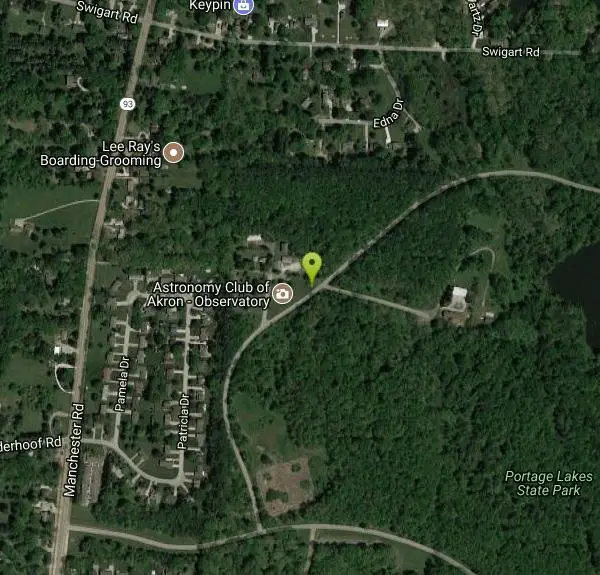
The Shoreline Trail is one of four trails available at Portage Lakes State Park. It is a 5 mile trail that will take you through a good majority of the south end of the park. It can be accessed off Manchester Road and parking is available at the park office parking lot. In order to get onto the Shoreline Trail, you will need to take the Planet Walking Trail first. The Shoreline Trail will take you past the boat launch near Rex Lake and past the dog park. Along the way, you will also be able to make your way around the Big Oaks Picnic Area, the Tudor House, and also the Turkeyfoot Beach and Picnic Area.
More Information
Add ResourceBe courteous, informed, and prepared. Read trailhead guidelines, stay on the trail, and don't feed the wildlife.
Read More- Plan Ahead and Prepare
- Travel & camp on durable surfaces
- Dispose of waste properly
- Leave what you find
- Minimize campfire impacts
- Respect wildlife
- Be considerate of other visitors
Directions
From Akron, Ohio
- Head east on W Bowery St toward King James Way (69 ft)
- Turn left at the 1st cross street onto King James Way (0.1 mi)
- Turn left onto W Mill St (0.3 mi)
- Continue straight to stay on W Mill St (signs for Glendale Ave) (262 ft)
- Turn left onto Rand Ave (10 ft)
- Continue straight to stay on Rand Ave (0.5 mi)
- Merge onto OH-59 W via the ramp on the left to Interstate 76 W/Interstate 77 N (1.8 mi)
- Merge onto I-76 W/I-77 N (1.0 mi)
- Keep right at the fork to continue on I-76 W, follow signs for I-277 W/Barberton (2.1 mi)
- Keep right to continue on I-76, follow signs for US-224 W/Barberton (0.7 mi)
- Take exit 17 for OH-619/Wooster Rd toward Barberton (0.2 mi)
- Keep right at the fork and merge onto OH-619 E/Wooster Road North (0.7 mi)
- Turn left onto W State St (2.7 mi)
- Turn right onto OH-93 S/Manchester Rd (2.2 mi)
- Turn left (0.2 mi)
- Turn leftDestination will be on the left(0.3 mi)
From Columbus:
Take I-71 N towards CLEVELAND.
Merge onto I-76 E/US-224 E via EXIT 209A.
Take the STATE ST exit, EXIT 17A.
Turn RIGHT onto W STATE ST.
Turn SLIGHT RIGHT onto 5TH ST NE/OH-619. Continue to follow OH-619.
Turn RIGHT onto MANCHESTER RD/OH-93.
The park entrance will be on the left.
Other Hiking Trails Nearby

Portage Lake State Park- Planet Walk Trail
Akron, Ohio
0.0 miles E411-acre Portage Lakes State Park offer visitors a variety of outdoor recreational experiences. Boating, swimming and fishing are popular on the several surrounding lakes. The wetlands of the park...
Hike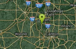
Rabbit Hill Loop Portage Lakes State Park
Akron, Ohio
0.0 miles EPortage Lakes is named after the old Indian portage path which connected the Cuyahoga River flowing north to Lake Erie and the Tuscarawas River which through the Muskingum, flows south to the Ohio...
Hike
Pheasant Run Loop Portage Lakes State Park
Akron, Ohio
0.0 miles E411-acre Portage Lakes State Park offer visitors a variety of outdoor recreational experiences. Boating, swimming and fishing are popular on the several surrounding lakes. The wetlands of the park...
Hike
Mohican State Park
Perrysville, Ohio
44.6 miles SWMohican State Park and the adjacent State Forest are located in the heart of Mohican Country...Ohio's great vacation region. The park is comprised of 1,110 acres with 5 miles of the scenic...
Camp, Hike, Horseback, Mountain BikeNearby Campsites
Clare-Mar Lakes Campground
New London, Ohio
36.8 miles WClare-Mar Lakes Campground is located 7 miles South of Wellington, Ohio off Route 58. There are 220 acres of scenic rolling to level terrain for your camping pleasure. For lots of R & R, we fearure...
Camp, Canoe, Swim
Mohican State Park
Perrysville, Ohio
44.6 miles SWMohican State Park and the adjacent State Forest are located in the heart of Mohican Country...Ohio's great vacation region. The park is comprised of 1,110 acres with 5 miles of the scenic...
Camp, Hike, Horseback, Mountain Bike


