


Rabbit Hill Loop Portage Lakes State Park
Akron, Ohio
Hike
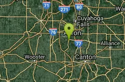
Portage Lakes is named after the old Indian portage path which connected the Cuyahoga River flowing north to Lake Erie and the Tuscarawas River which through the Muskingum, flows south to the Ohio River. This proved advantageous for the Indians and early settlers as navigation from Lake Erie to the Ohio was possible with only one eight-mile portage overland. Portage Lakes State Park lies at one of the highest points of the state and on a major watershed divide in Ohio. Some water from the lakes reaches Lake Erie and some flows to the Ohio River.
More Information
Be courteous, informed, and prepared. Read trailhead guidelines, stay on the trail, and don't feed the wildlife.
Read More
- Plan Ahead and Prepare
- Travel & camp on durable surfaces
- Dispose of waste properly
- Leave what you find
- Minimize campfire impacts
- Respect wildlife
- Be considerate of other visitors
Directions
From Akron, Ohio
- Head east on W Bowery St toward King James Way (69 ft)
- Turn left at the 1st cross street onto King James Way (0.1 mi)
- Turn left onto W Mill St (0.3 mi)
- Continue straight to stay on W Mill St (signs for Glendale Ave) (262 ft)
- Turn left onto Rand Ave (10 ft)
- Continue straight to stay on Rand Ave (0.5 mi)
- Merge onto OH-59 W via the ramp on the left to Interstate 76 W/Interstate 77 N (1.8 mi)
- Merge onto I-76 W/I-77 N (1.0 mi)
- Keep right at the fork to continue on I-76 W, follow signs for I-277 W/Barberton (2.1 mi)
- Keep right to continue on I-76, follow signs for US-224 W/Barberton (0.7 mi)
- Take exit 17 for OH-619/Wooster Rd toward Barberton (0.2 mi)
- Keep right at the fork and merge onto OH-619 E/Wooster Road North (0.7 mi)
- Turn left onto W State St (2.7 mi)
- Turn right onto OH-93 S/Manchester Rd (2.2 mi)
- Turn left (0.2 mi)
- Turn leftDestination will be on the left(0.3 mi)
Located at 5031 Manchester Road, Akron, OH 44319

Other Hiking Trails Nearby
Portage Lake State Park- Planet Walk Trail
Akron, Ohio
0.0 miles SWA 411-acre Ohio park with boating, swimming, and fishing on several surrounding lakes, plus wetlands that attract waterfowl and shorebirds for hunting and wildlife watching.
Hike
Pheasant Run Loop Portage Lakes State Park
Akron, Ohio
0.0 miles NEBoating, swimming, and fishing on several surrounding lakes, plus wetlands that draw waterfowl and shorebirds — Portage Lakes State Park packs a lot into 411 acres near Akron.
Hike
Shoreline Trail Portage Lakes State Park
Akron, Ohio
0.0 miles WA 5-mile trail at Portage Lakes State Park in Akron that winds past Rex Lake, a dog park, the Big Oaks Picnic Area, and Turkeyfoot Beach — accessed via the Planet Walking Trail from the park office lot.
Hike
Turkeyfoot Beach
New Franklin
0.8 miles EA free 900-foot sand beach on Turkeyfoot Lake at Portage Lakes State Park in New Franklin, south of Akron. No lifeguards, daylight swimming only, and boats share the lake.
Canoe, Hike, Kayak, Swim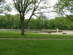
Wallace Lake Beach
Berea
31.1 miles NWA free, lifeguarded summer swim beach on Wallace Lake, a flooded 1941 sandstone quarry in Cleveland Metroparks' Mill Stream Run Reservation, a short walk from downtown Berea.
Hike, Kayak, Swim
Quarry Rock Falls
Bentleyville
31.4 miles NA tiered shale cascade on the Aurora Branch of the Chagrin River at Quarry Rock in Cleveland Metroparks' South Chagrin Reservation, Bentleyville. Free entry, wading at your own risk, no lifeguards.
Hike, Swim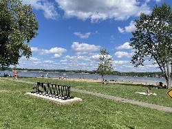
Craig Beach at Lake Milton State Park
Craig Beach, Ohio
32.0 miles EA 600 foot public swim beach on the east shore of Lake Milton, in the village of Craig Beach, where an amusement park with a roller coaster stood a century ago.
Canoe, Hike, Kayak, Swim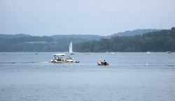
Atwood Lake Park Beach
Mineral City
33.6 miles SEA sand beach on a 1,540 acre flood control lake in eastern Ohio, open to anyone who pays the $5 to $10 gate fee at Atwood Lake Park. MWCD samples the water weekly, and there has not been a bacteria advisory here since July 2022.
Camp, Canoe, Hike, Kayak, Swim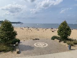
Edgewater Beach
Cleveland
37.1 miles NFree, lifeguarded Lake Erie swimming beach in Cleveland Metroparks' Edgewater Park, about 2.5 miles west of downtown Cleveland, with a 1,000-foot marked swim area and skyline views.
Hike, Kayak, Swim
Guilford Lake State Park Beach
Lisbon, Ohio
37.2 miles EA 600 foot public beach on the northwest side of Guilford Lake, a 396 acre reservoir dug in 1834 to feed the Sandy and Beaver Canal.
Camp, Canoe, Hike, Kayak, Swim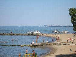
Huntington Beach
Bay Village
40.9 miles NWGuarded Lake Erie swimming beach below the bluff in Cleveland Metroparks' Huntington Reservation in Bay Village, with sand pockets between stone breakwalls and free entry and parking.
Hike, Kayak, Swim
Villa Angela Beach
Cleveland
42.6 miles NA free, lifeguarded 900-foot Lake Erie sand beach in Cleveland Metroparks' Euclid Creek Reservation on Cleveland's east side, beside Euclid Beach Park and the mouth of Euclid Creek.
Hike, Swim
Mohican State Park
Perrysville, Ohio
44.6 miles SWFive miles of scenic Clear Fork river, 1,110 acres of park, and a full slate of fishing, hiking, picnicking, camping, cottages, and lodge stays in the heart of Ohio's Mohican Country.
Camp, Hike, Horseback, Mountain BikeNearby Campsites
Atwood Lake Park Beach
Mineral City
33.6 miles SEA sand beach on a 1,540 acre flood control lake in eastern Ohio, open to anyone who pays the $5 to $10 gate fee at Atwood Lake Park. MWCD samples the water weekly, and there has not been a bacteria advisory here since July 2022.
Camp, Canoe, Hike, Kayak, Swim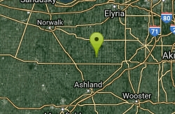
Clare-Mar Lakes Campground
New London, Ohio
36.8 miles WA 75-acre lake surrounded by 220 acres of rolling terrain, with 1,000 feet of sandy beach, swimming, boating, fishing, and planned activities for the whole family near Wellington, Ohio.
Camp, Canoe, Swim
Guilford Lake State Park Beach
Lisbon, Ohio
37.2 miles EA 600 foot public beach on the northwest side of Guilford Lake, a 396 acre reservoir dug in 1834 to feed the Sandy and Beaver Canal.
Camp, Canoe, Hike, Kayak, Swim
Mohican State Park
Perrysville, Ohio
44.6 miles SWFive miles of scenic Clear Fork river, 1,110 acres of park, and a full slate of fishing, hiking, picnicking, camping, cottages, and lodge stays in the heart of Ohio's Mohican Country.
Camp, Hike, Horseback, Mountain Bike


