


Silver Mines Recreation Area
Fredericktown
Camp, Canoe, Hike, Kayak, and Swim
Silver Mines Recreation Area is a U.S. Forest Service site in the Mark Twain National Forest, run by the Potosi/Fredericktown Ranger District, on the upper St. Francis River in Madison County, Missouri. The river here runs through a narrow valley of Precambrian granite and felsite, with low bluffs and boulder fields along both banks. The site takes its name from the Einstein silver mine, worked for silver, tungsten and lead from 1877 until 1946. It sits about 8 miles west of Fredericktown and roughly 11 miles east of Ironton.
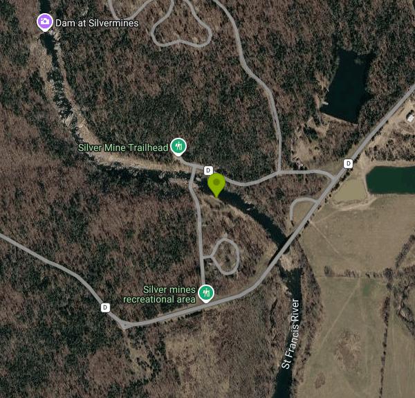
From Fredericktown, take Highway 72 west about 4.3 miles to State Highway D near Oak Grove, turn left, and drive 2.9 miles to the entrance on the right. From Arcadia or Ironton, head east on Highway 72 about 13.6 miles and turn right on Highway D. The main river access is the Riverside day use area just south of the Highway D bridge, where picnic sites sit on the embankment and a short sandy path drops to the water. There is parking for about 20 cars at Riverside, 10 at the paddlers' take-out, 10 at Turkey Creek picnic area, and 15 in day use spaces by the Summit and Prospect loops.
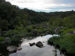
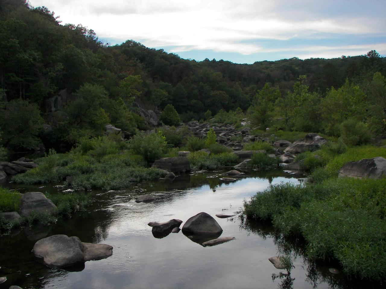
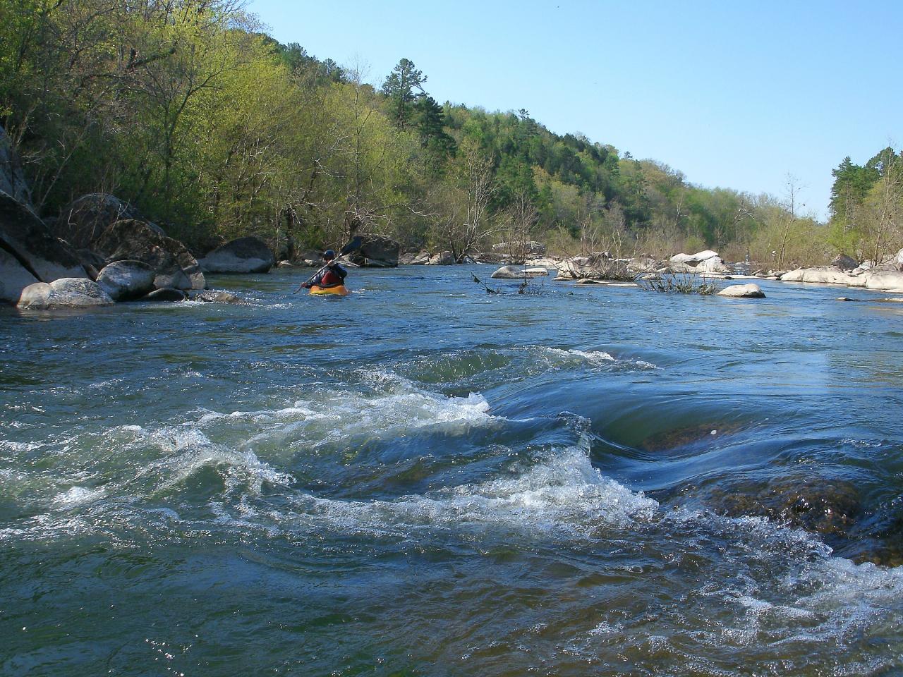
There is no swim beach. The Forest Service says this stretch is popular for wading and cooling off in summer and that visitors are welcome in the river, but it is not managed for swimming: no lifeguards, no depth or hazard markers, and no water testing. The St. Francis is a pool-drop river, so calm pools alternate with fast chutes over rock. In late summer the water is often low and you can pick your way between shallow pools among the boulders. In spring the same channel is Class II to III whitewater that draws kayakers from around the region, and the current is strong enough to pin a swimmer. Rocks and drop-offs are unmarked. Get in at your own risk and stay out when the river is up or brown.
Day use costs $5 per vehicle per day, $10 per bus, or $40 for a season pass. Pay in cash or by check at the fee tubes on site, since there are no card machines. Annual and lifetime federal recreation passes cover the day use fee. River access, picnicking and hiking are allowed from 6 a.m. to 10 p.m., and the day use areas are open all year. Only registered campers may stay overnight. The campground (70 sites plus a group site, open roughly March to November) is reserved through Recreation.gov for electric sites and first come for the rest.
The forest lists Silver Mines among recreation sites where soil sampling found elevated lead, a leftover of the region's mining history. Contaminated campsite and day use soils have been capped with clean material, and the Forest Service rates the risk to occasional visitors as low, though it is sensible to wash hands and rinse off sandy gear. The Einstein mine adit is gated and closed to the public. Bring your own trash bags in winter, when Riverside has no containers.
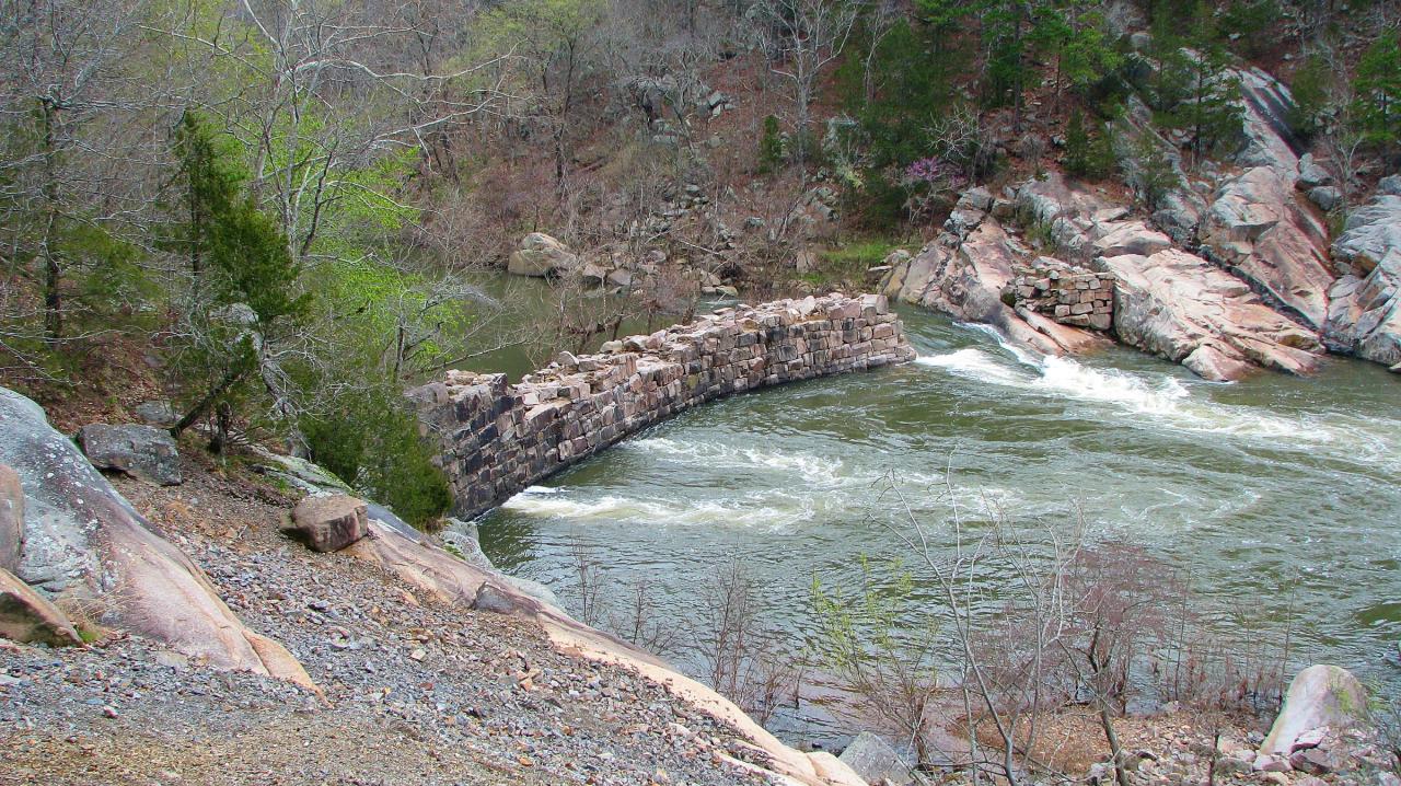
Two 1 mile trails follow the river through the area. The Riverside Trail runs along the east bank from the Riverside pavilion to the old mine, and the Silver Mines Trail runs from the take-out lot past the ruined Silver Mine Dam to Turkey Creek, where a 1.2 mile link continues upstream to Millstream Gardens Conservation Area and Tiemann Shut-ins. Fishing for bass and sunfish is good in the pools, and eagles are often seen along the river.
More Information
Mark Twain National Forest | Reducing Lead Exposure Risk at Campgrounds | Forest Service
In 2012, The Mark Twain National Forest completed soil sampling in many areas of Southeast Missouri lead mining area. A few recreation sites were found to have elevated concentrations of lead, but there was not a clear trend indicating where we would find lead.In Fall 2014, we partnered with the Missouri Department of Natural Resources to sample every campsite and day-use area at in the area for lead (Pb) in surface soil and crushed rock, which led to the current action.
https://www.fs.usda.gov/r09/marktwain/alerts/reducing-lead-exposure-risk-campgroundsMark Twain National Forest | Riverside (Einstein Mine) Trailhead | Forest Service
The 1-mile Riverside Trail leads to the old Einstein Silver Mine from the Riverside Pavilion parking area. This trail follows the east side of the St. Francis River. It is a wooded trail with beautiful bluffs of Precambrian granite and felsite rocks. There are no boardwalks. This is a hilly, well-maintained trail. The Einstein Mine is gated and there is no public access.
https://www.fs.usda.gov/r09/marktwain/recreation/riverside-einstein-mine-trailheadMark Twain National Forest | Silver Mines Recreation Area | Forest Service
Silver Mines offers a variety of recreational opportunities and is abundant with historic and geological wonders. This beautiful area is located along the St. Francis River, the only river in Missouri classified as "white water," and is used for kayaking during the spring high waters. People enjoy hiking and fishing along the river throughout the year.Silver Mines is located at a historic mining operation and is known for its Precambrian granite and felsite rocks. Silver Mines Recreation Area is named for the abandoned “Einstein Mine”, which was mined for Silver, Tungsten and Lead. The Einstein Silver Mining Company began mining in 1877, and mining ceased completely in 1946.Nearby visitors can visit other natural attractions in the area, including Elephant Rocks State Park and Johnsons Shut-ins State Park.Millstream Gardens Conservation Area, located up-river from Silver Mines, is the put-in for those looking to experience the white water on the St. Francis river.This is a large recreation area, and particularly busy during the spring. However, visitors who come during the fall months will be treated to spectacular fall color along the St. Francis River.
https://www.fs.usda.gov/r09/marktwain/recreation/silver-mines-recreation-areaMark Twain National Forest | Summit Loop Trailhead (Silver Mine Rec Area) | Forest Service
A trailhead offering hiking opportunities from Silver Mines Recreation Area for the Riverside Trail.
https://www.fs.usda.gov/r09/marktwain/recreation/summit-loop-trailhead-silver-mine-rec-areaMillstream Gardens Conservation Area | Missouri Department of Conservation
Chapter 11 of the Wildlife Code applies to this area. The information provided reflects regulations for most activities on this conservation area but does not contain regulations for all possible uses. For more information on area regulations consult the Wildlife Code or call the phone number listed for the area in the area details section.
https://mdc.mo.gov/discover-nature/places/millstream-gardens-conservation-areaSearching for Missouri's lost Silver Mine | Missouri Resources Magazine
For nearly 500 years, legends — usually of Spanish colonial origin — of a lost silver mine have spread across Missouri. Many have searched for this mythical site, yet no historical bonanza has been found.
https://missouriresources.mo.gov/searching-for-missouris-lost-silver-mineSilver Mine, Missouri - Wikipedia
Silver Mine is an unincorporated community in northwest Madison County, in the U.S. state of Missouri.[1]
https://en.wikipedia.org/wiki/Silver_Mine,_MissouriSilver Mines
Not far from Fredericktown, Silver Mines is a hidden gem located along the St. Francis River.
https://www.kfvs12.com/story/15126570/silver-mines-a-one-tank-trip/Silver Mines, Mark Twain National Forest - Recreation.gov
Explore Silver Mines in Mark Twain National Forest, Missouri with Recreation.gov. Silver Mines Campground is located on the St. Francis River in the Mark Twain National Forest. It offers a variety of recreational opportunities and abundant hi
https://www.recreation.gov/camping/campgrounds/232392Be courteous, informed, and prepared. Read trailhead guidelines, stay on the trail, and don't feed the wildlife.
Read More
- Plan Ahead and Prepare
- Travel & camp on durable surfaces
- Dispose of waste properly
- Leave what you find
- Minimize campfire impacts
- Respect wildlife
- Be considerate of other visitors
Directions
From Fredericktown
- Head west on W Sandusky St toward S Portland St (0.8 mi)
- Continue onto OH-95 W/
Mt Gilead Rd Continue to follow OH-95 WPass by Wendy's (on the left in 9.1 mi)(9.3 mi) - Turn left to merge onto I-71 S toward Columbus (31.4 mi)
- Take exit 119B to merge onto I-270 W (17.0 mi)
- Take exit 8 to merge onto I-70 W toward DaytonEntering Indiana(162 mi)
- Keep left to stay on I-70 W (3.4 mi)
- Keep left to stay on I-70 W, follow signs for I-65 S/
Michigan St/ Ohio St/ Fletcher Ave (0.1 mi) - Continue onto I-70 W (0.1 mi)
- Keep left to stay on I-70 W, follow signs for I-65 S/
Michigan St/ Ohio St/ Fletcher Ave (0.5 mi) - Merge onto I-65 S/
I-70 W (1.7 mi) - Keep right to continue on I-70 W, follow signs for St Louis/
Indpls. Int'l Airport Entering Illinois(144 mi) - Keep right to stay on I-70 W, follow signs for St Louis (76.9 mi)
- Take the exit onto I-55 S/
I-70 W toward St Louis (16.7 mi) - Keep left to continue on I-55 SEntering Missouri(3.4 mi)
- Take exit 40B to merge onto I-44 W/
I-55 S (1.3 mi) - Keep left to continue on I-55 S (33.3 mi)
- Take exit 174B toward US 67/
Bonne Terre/ Farmington (0.2 mi) - Take the ramp onto US-67 S/
U.S. Hwy 67 S (0.5 mi) - Slight right (0.7 mi)
- Merge onto U.S. Hwy 67 S (49.9 mi)
- Turn right toward Madison 517 (102 ft)
- Turn left onto Madison 517 (0.8 mi)
- Turn right onto MO-72 W (4.0 mi)
- Turn left onto State Hwy D (2.9 mi)
- Continue straight (0.3 mi)
- Turn right onto Riverside Camp RdDestination will be on the right(0.2 mi)




Other Swimming Holes, Hiking Trails, Canoeing Areas, and Kayaking Areas Nearby

Monsanto Lake Beach
Park Hills
18.1 miles NFree sand swim beach on 25-acre Monsanto Lake at St. Joe State Park in Park Hills, with a change house, accessible water-entry ramp and no lifeguards. Open Memorial Day weekend through Labor Day.
Camp, Canoe, Hike, Kayak, Swim
Chapel Hill Beach
Belgrade
28.9 miles NWForest Service sand beach on 440-acre Council Bluff Lake in the Mark Twain National Forest near Belgrade, with a bathhouse and concession stand. Seasonal; day use is $5 per vehicle.
Camp, Canoe, Hike, Kayak, Swim
Peoples Creek
Wappapello
42.8 miles SA maintained Corps of Engineers sand beach in a cove on Wappapello Lake, with a bathhouse, boat ramp and campground, a small day use fee and no lifeguards.
Camp, Canoe, Hike, Kayak, SwimNearby Campsites
Monsanto Lake Beach
Park Hills
18.1 miles NFree sand swim beach on 25-acre Monsanto Lake at St. Joe State Park in Park Hills, with a change house, accessible water-entry ramp and no lifeguards. Open Memorial Day weekend through Labor Day.
Camp, Canoe, Hike, Kayak, Swim
Chapel Hill Beach
Belgrade
28.9 miles NWForest Service sand beach on 440-acre Council Bluff Lake in the Mark Twain National Forest near Belgrade, with a bathhouse and concession stand. Seasonal; day use is $5 per vehicle.
Camp, Canoe, Hike, Kayak, Swim
Peoples Creek
Wappapello
42.8 miles SA maintained Corps of Engineers sand beach in a cove on Wappapello Lake, with a bathhouse, boat ramp and campground, a small day use fee and no lifeguards.
Camp, Canoe, Hike, Kayak, Swim


