Skookumchuck Recreation Site
White Bird
Swim
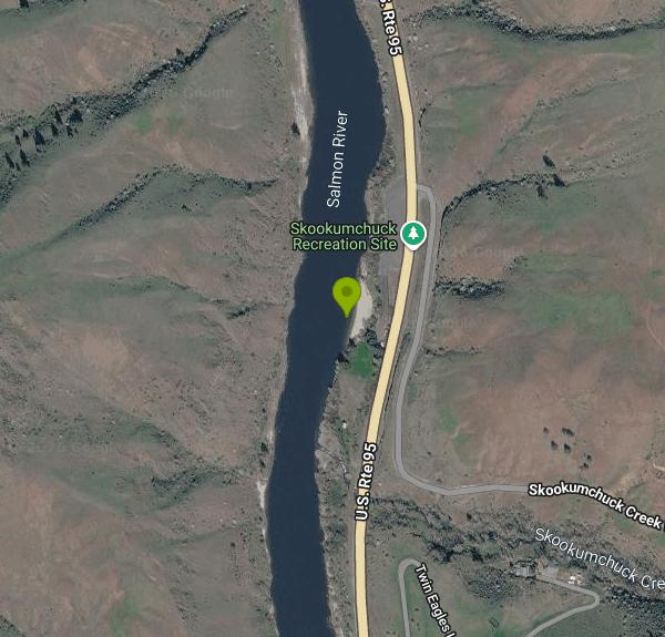
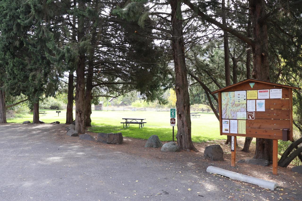
Skookumchuck Recreation Site is a Bureau of Land Management day-use area on the Lower Salmon River in Idaho County, run by the BLM's Cottonwood Field Office. It sits on a bend of the river about 5 miles south of White Bird, right off U.S. Highway 95 at milepost 219, where the road follows the bottom of a steep, dry canyon. The site is a grassy picnic lawn under a stand of tall conifers and cottonwoods, with a broad sand beach just below it on the river. Bare grass and rock slopes rise on both sides of the water, and the shade trees are about the only cover for miles in midsummer.
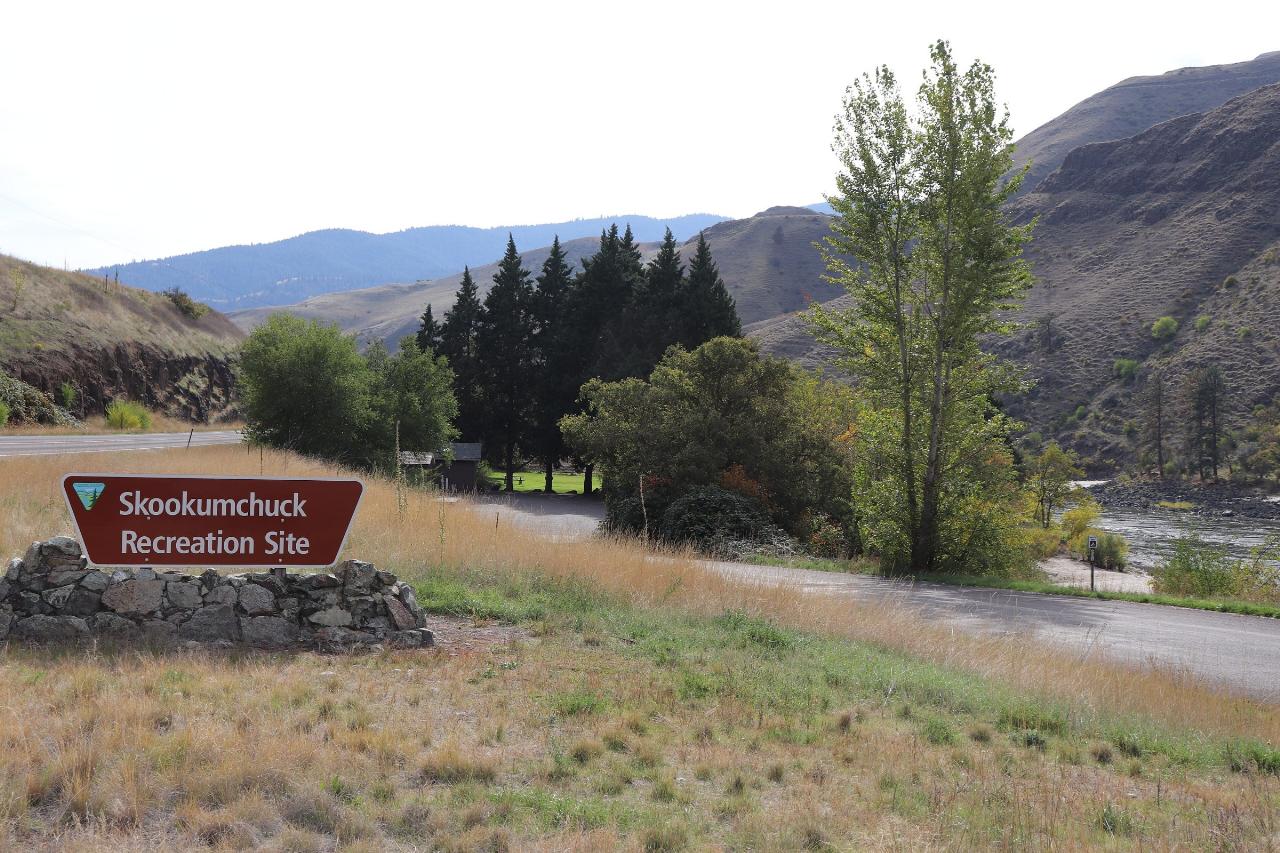
Getting there is simple. Drive US-95 south from White Bird (or north from Riggins and Lucile) and watch for the brown BLM sign at milepost 219 on the river side of the highway. A short paved access road drops to a paved parking area next to the restrooms. From the lot it is a few steps to the lawn and then a short walk down to the sand. No trail or rough road is involved.
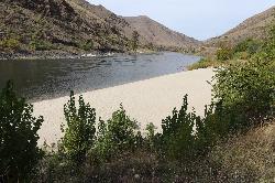
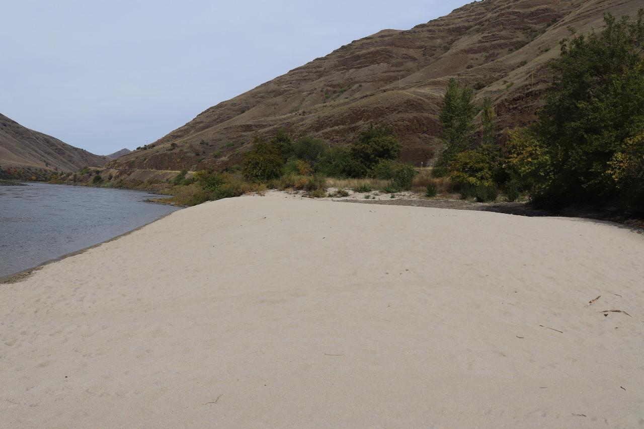
The beach is a wide bank of pale, fine sand along the inside of the bend, with gravel and cobble at its edges. Close to shore the water is shallow over sand, and the river gets deeper and faster as you move out toward the main channel. Nobody manages a swim area here: there are no buoys, no roped section and no lifeguards, so you are swimming in a big free-flowing river on your own judgment. BLM's Lower Salmon boater guide notes that the river runs from below freezing in winter to sometimes over 72 degrees Fahrenheit in late summer, so midsummer and late summer, after the snowmelt has passed, are the comfortable months for wading and swimming.
There is no entrance fee. BLM's Lower Salmon River page states there are no day-use fees at its sites on this stretch, and that overnight fees apply only at the Hammer Creek, Slate Creek and Pine Bar campgrounds. Skookumchuck is day use only, with no camping and no reservations through Recreation.gov. BLM does not post set opening hours for the site, so plan on daylight use.
Treat the current with respect. The Lower Salmon is a whitewater river with Class II to IV rapids along its length, and its flow swings hard through the year. The BLM boater guide lists recorded flows at White Bird from 1,580 cubic feet per second to 130,000, and the big water comes with snowmelt in late spring, when the river is fast, cold and carrying debris. Check the White Bird gauge before you go, keep kids close to shore, and put a life jacket on weak swimmers. The parking area sits right beside a busy highway with fast traffic and long trucks, so watch children in the lot. Posted notices at the kiosk prohibit shooting and fireworks, and BLM lists current Idaho closures on its advisories page.
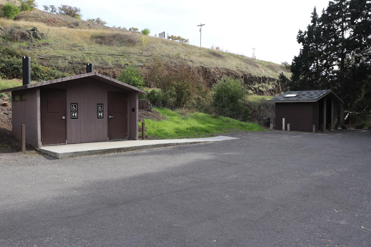
The site has accessible vault toilets, picnic tables spread across a shaded lawn, a grill, trash cans and an information kiosk with a map and posted notices. Rafters and kayakers float past during the summer, and anglers work the river for steelhead, smallmouth bass and trout. If you want a boat ramp or a campsite, BLM points visitors to its other sites on the river, including the White Bird Gravel Pit a couple of miles downstream, Hammer Creek near White Bird and Slate Creek farther south toward Lucile.
More Information
Advisories and Closures | Bureau of Land Management
Idaho Advisories and ClosuresOn this page, you may find the following information (when in effect) for BLM regions listed below:Seasonal Closures: BLM Idaho winter closures implements seasonal closures across the state to reduce disturbance to wintering wildlife during the most stressful time of year. Closing areas to human activity is important to allow deer and elk to conserve energy and survive the winter. When animals flee due to disturbances caused by people, they use calories that are needed to survive through the rest of the winter. Pregnant deer and elk are particularly sensitive to
https://www.blm.gov/idaho/advisories-and-closuresCottonwood Field Office | Bureau of Land Management
The Cottonwood Field Office manages just over 131,000 acres of public lands. Much of the field office lies along the scenic Lower Salmon River corridor. The field office has a robust forestry and fuels management program. In addition, fisheries and wildlife habitat management is a strong focus of the field office. The Clearwater River, located in the northern portion of the field office, is renowned for the “B-Run” steelhead that return from the Pacific Salmon to spawn in the upper reaches of the river. The field office also manages the 112-mile stretch of the Lower Salmon River from Vinegar
https://www.blm.gov/office/cottonwood-field-officeLower Salmon River - Idaho | Bureau of Land Management
OverviewThe 425-mile Salmon River is one of the longest free-flowing river in the lower 48 states. The river begins at not much more than a trickle at an elevation of about 8,000 feet in the Sawtooth and Whitecloud Mountains of central Idaho. It gathers force as it makes its way northeast and then west, fed by snows from the Sawtooth and Salmon River Mountains in the south and the Clearwater and Bitterroot Mountains in the north.About 150 miles further on its westward course, the Salmon River has carved the second deepest canyon in North America, which effectively splits Idaho in half. The
https://www.blm.gov/visit/lower-salmon-riverSalmon River (Idaho) - Wikipedia
The Salmon River, also known as the "River of No Return", is a river located in the U.S. state of Idaho in the western United States. It flows for 425 miles (685 km) through central Idaho, draining a rugged, thinly populated watershed of 14,000 square miles (36,000 km2). The river drops more than 7,000 feet (2,100 m) from its headwaters, near Galena Summit above the Sawtooth Valley in the Sawtooth National Recreation Area, to its confluence with the Snake River. Measured at White Bird, its average discharge is 11,060 cubic feet per second (82,700 US gal/s; 313 m3/s).[5] The Salmon River is the longest undammed river in the contiguous United States.[6]
https://en.wikipedia.org/wiki/Salmon_River_(Idaho)Salmon River at White Bird ID - USGS Water Data for the Nation
Discover water data collected at monitoring location USGS-13317000, located in Idaho County, Idaho and find additional nearby monitoring locations.
https://waterdata.usgs.gov/monitoring-location/USGS-13317000/Skookumchuck Recreation Site - Idaho | Bureau of Land Management
This is a scenic day-use site features swimming beach and shady, grassy picnic area along the Lower Salmon River. BLM recreation sites on this stretch of river are Island Bar, Lucile, Old Lucile, Shorts Bar, Slate Creek, White Bird, Hammer Creek and Pine Bar. Be sure to check those sites for more information and amenities for boat ramps or camping. For river maps, authorized outfitters and shuttle services, see the links below. .
https://www.blm.gov/visit/skookumchuck-recreation-siteSkookumchuck Recreation Site, Lower Salmon River - Recreation.gov
Explore Skookumchuck Recreation Site in Lower Salmon River, Idaho with Recreation.gov. This is a scenic day-use site features swimming beach and shady, grassy picnic area along the Lower Salmon River. BLM recreation sites on this stretch of
https://www.recreation.gov/camping/poi/255246
- Plan Ahead and Prepare
- Travel & camp on durable surfaces
- Dispose of waste properly
- Leave what you find
- Minimize campfire impacts
- Respect wildlife
- Be considerate of other visitors
Directions
From White Bird
- Head southeast on Whitebird Rd toward Baker Crk Rd/
Baker Gulch Rd (0.4 mi) - Turn left onto US-95 SDestination will be on the right(4.3 mi)
 The sand beach at Skookumchuck Recreation Site along the Lower Salmon River. courtesy of BLMIdaho↗ (Public domain↗)
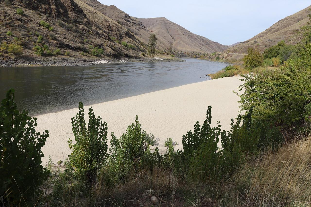
 Wide sand beach on the inside of the river bend at Skookumchuck. courtesy of BLMIdaho↗ (Public domain↗)
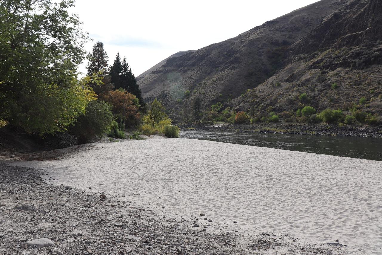 Skookumchuck beach with the Salmon River canyon wall rising across the water. courtesy of BLMIdaho↗ (Public domain↗)
 Shaded picnic lawn and information kiosk at Skookumchuck Recreation Site. courtesy of BLMIdaho↗ (Public domain↗)
 BLM entrance sign for Skookumchuck Recreation Site beside US-95, with the river at right. courtesy of BLMIdaho↗ (Public domain↗)
 Accessible vault toilets and the paved parking area at Skookumchuck. courtesy of BLMIdaho↗ (Public domain↗)