


Spring Creek
La Grande, Oregon
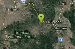
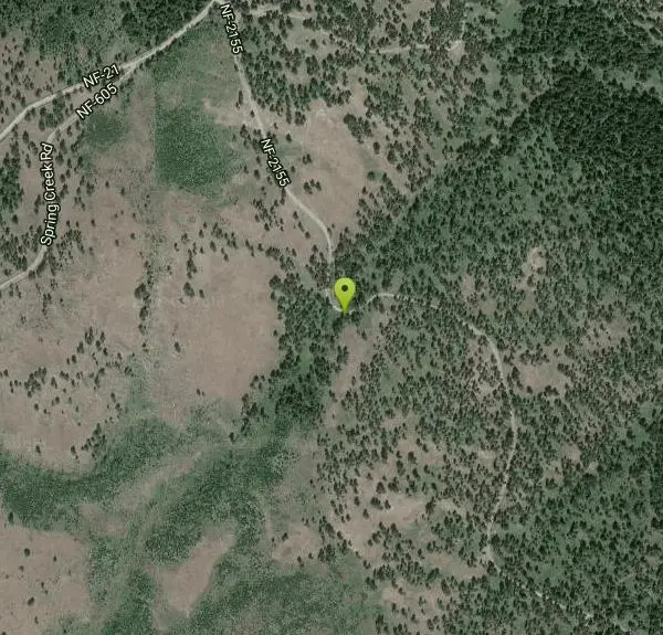
| Address: | ~NF-2155, La Grande, OR 97850, USA |
| GPS: |
45°19'36.3"N 118°19'2.9"W Maps | Directions |
| State: | Oregon |
| Trail Length: | 6.00 miles |
| MTB Difficulty: | Beginner |
| Trail Type: | Network |
| MTB Trail Type: | Singletrack |
Mountain Bike
The Spring Creek Bike Trail Loop A (#B-100) is one of four bike trails in the Springs Creek area. The trail is 7.5 miles long and makes an outer loop through the rolling ponderosa pine forested hills. The trails in the area are on open and closed roads. The trail begins at Forest Road 2155 and 034 junction and loops around using other Forest roads.The Spring Creek Bike Trail B (#B-050) is one of four bike trails in the Springs Creek area. The trail is 1.4 miles long and serves as a cut-off trail for the outer Spring Creek Bike Trail Loop A (#B-100). The trails in the area are on open and closed roads. The trail heads south from the Forest Road 2155 and 034 junction at the B-100 trail.The Spring Creek Bike Trail C (#B-034) is one of four bike trails in the Springs Creek area. The trail is 1.7 miles long and serves as a southern cut-off trail for the outer Spring Creek Bike Trail Loop A (#B-100). The trails in the area are on open and closed roads. The trail heads south off the Spring Creek Bike Trail B #B-050 and connects with the #B-100 trail.The Spring Creek Bike Trail D (#B-060) is one of four bike trails in the Springs Creek area. The trail is 0.8 miles long and serves as a southern cut-off trail off the Spring Creek Bike Trail B #B-050 and connects with the #B-100 trail. The trails in the area are on open and closed roads. va. fs.usda.gov Courtesy of Singletracks.com
More Information
Spring Creek Mountain Bike Trail in La Grande, Oregon - Directions, Maps, Photos, and Reviews
Spring Creek is a singletrack mountain bike trail in La Grande, Oregon. View maps, videos, photos, and reviews of Spring Creek bike trail in La Grande.
http://www.singletracks.com/bike-trails/springs-creek/Never modify trail features. Ride trails when they're dry enough that you won't leave ruts. Speak up when you see others on the trail and always yield to hikers, horses, and others coming uphill. Always ride on the established trail.
Read More
- Plan Ahead and Prepare
- Travel & camp on durable surfaces
- Dispose of waste properly
- Leave what you find
- Minimize campfire impacts
- Respect wildlife
- Be considerate of other visitors
Directions
From La Grande, Oregon
- Head northwest on Adams Ave toward Island Ave (69 ft)
- Turn right at the 1st cross street onto Island Ave (1.0 mi)
- Turn right onto the I-84 W ramp to Pendleton (0.3 mi)
- Merge onto I-84 (12.7 mi)
- Take exit 248 toward Spring Cr Rd/Kamala (0.2 mi)
- Turn left onto NF-21 (3.4 mi)
- Turn left onto NF-2155Destination will be on the right(0.3 mi)
Other Mountain Bike Trails Nearby
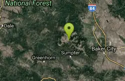
North Powder River / Trail #1632
Baker City, Oregon
31.6 miles SA lightly used mountain bike trail in Baker City open to cyclists — North Powder River Trail #1632 offers a quiet, off-the-beaten-path ride.
Mountain Bike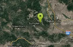
Twin Lakes
Baker City, Oregon
39.5 miles SA trail climbing through old-growth spruce and Douglas-fir to Twin Lakes, with summer wildflower meadows, mountain goats on the ridge, and flat lakeside camping for horses and hikers.
Mountain Bike
Marble Pass Trailhead
Baker City, Oregon
40.4 miles SA rustic, remote trailhead on the southern end of the Elkhorn Crest National Recreation Trail — limited parking and difficult vehicle access add to the adventure.
Mountain Bike
Elkhorn Crest National Recreation Trail #1611
Baker City, Oregon
41.4 miles SThe highest trail in Oregon's Blue Mountains follows the Elkhorn ridgeline through sub-alpine forests, past six mountain lakes, and offers panoramic views of the Baker Valley and Wallowas.
Mountain Bike
Blackeye / Trail #243
45.8 miles S
Singletrack leading to the Vinegar Hill-Indian Rock Scenic Area — sees heavy use in fall during big game hunting seasons near the Oregon backcountry.
Mountain Bike
Social Security Point
Baker City, Oregon
46.0 miles SA ponderosa pine forest trailhead above Phillips Lake's northern shore connects to the Phillips Lake North Shoreline Trail heading west to the upper lake or east toward campground and boat launch.
Mountain Bike
Phillips Lake North Shoreline Trail #1608
Baker City, Oregon
46.4 miles SA network of four mountain bike trails through rolling ponderosa pine hills near Phillips Reservoir, with views of waterfowl, deer, and historic rock dredge piles — usable year-round for hiking, biking, or skiing.
Mountain Bike
Phillips Lake South Shoreline Trail #1610
Baker City, Oregon
47.1 miles SA scenic, easy shoreline trail tracing the southern banks of Phillips Lake through grasslands and ponderosa pine, with lake views, Elkhorn Mountain backdrops, and waterfowl sightings.
Mountain Bike
Dean Creek
Baker City, Oregon
47.2 miles SA small trailhead facility on the south side of Phillips Lake, offering access to the South Shoreline Trail and a network of mountain biking, hiking, and equestrian routes.
Mountain Bike
Phillips Lake Southern Bike & XC Ski Trails
Baker City, Oregon
48.0 miles SSouth of Phillips Lake, these trails open for mountain biking and hiking in spring through fall, and switch to cross-country skiing and snowshoeing in winter through open ponderosa pine and fir forest.
Mountain Bike
Southeast Shore Phillips Lake
Baker City, Oregon
48.5 miles SA year-round southeast shore access point for hiking, mountain biking, cross-country skiing, and snowshoeing on the Phillips Lake South Shoreline Trail system.
Mountain Bike


