


Steelhead Falls Swimming Hole
Terrebonne
Camp, Hike, and Swim
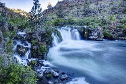
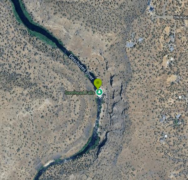
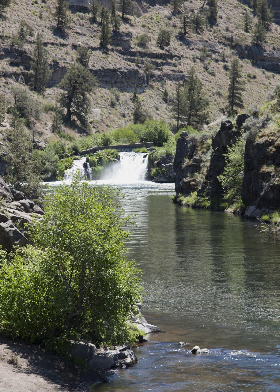
Steelhead Falls drops the Deschutes River about 15 to 20 feet over a basalt lip into a broad green pool, and that pool is the swimming hole. It sits roughly half a mile down the trail from the BLM trailhead, not at the parking area. The Bureau of Land Management's Prineville District Office manages the site as part of the Deschutes Canyon-Steelhead Falls Wilderness Study Area, an 18,402 acre unit shared with the Forest Service, and this reach carries Middle Deschutes Wild and Scenic River protection.
Getting there routes you through a subdivision. From Terrebonne, head west on NE Lower Bridge Way about two miles, turn right on NW 43rd Street, then wind through Crooked River Ranch on Chinook Drive, Badger Road and Quail Road before turning left on SW River Road. The last mile drops downhill on graded gravel and dirt. It washboards badly in stretches but normally handles a passenger car fine, and the campground spurs turn to mud after a storm. There is no entrance fee and no parking pass. Trailer parking is limited.
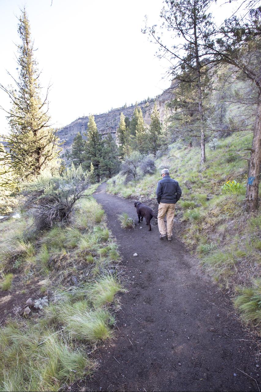
The trail runs a half mile with roughly 140 feet of elevation change and one short steep pitch before it opens onto rock above the falls. Scramble down to reach the water.
The site is open year round and around the clock, but the swim season is short. This water is snowmelt and spring fed and stays cold. The USGS gauge downstream near Culver read about 54 degrees in late September 2026, and the pool tops out in the low sixties during a hot stretch in July or August. Flow behaves strangely on this reach. Irrigation districts pull close to 90 percent of the river at North Canal Dam in Bend through the growing season, then springs below Lower Bridge rebuild much of the volume before it reaches the falls, so the pool can look placid and still carry a hard downstream push.
No lifeguard works here and cell service is unreliable. The basalt ledges above the pool run roughly 25 to 30 feet and people jump from them constantly. Depth under those ledges shifts with flow, and submerged rock is the usual reason someone gets hurt. Below the falls the current moves, and swimmers who drift out of the eddy end up working back upstream. Rattlesnakes use the rocks and brush along the trail. The basalt is sharp underfoot and bakes in afternoon sun.
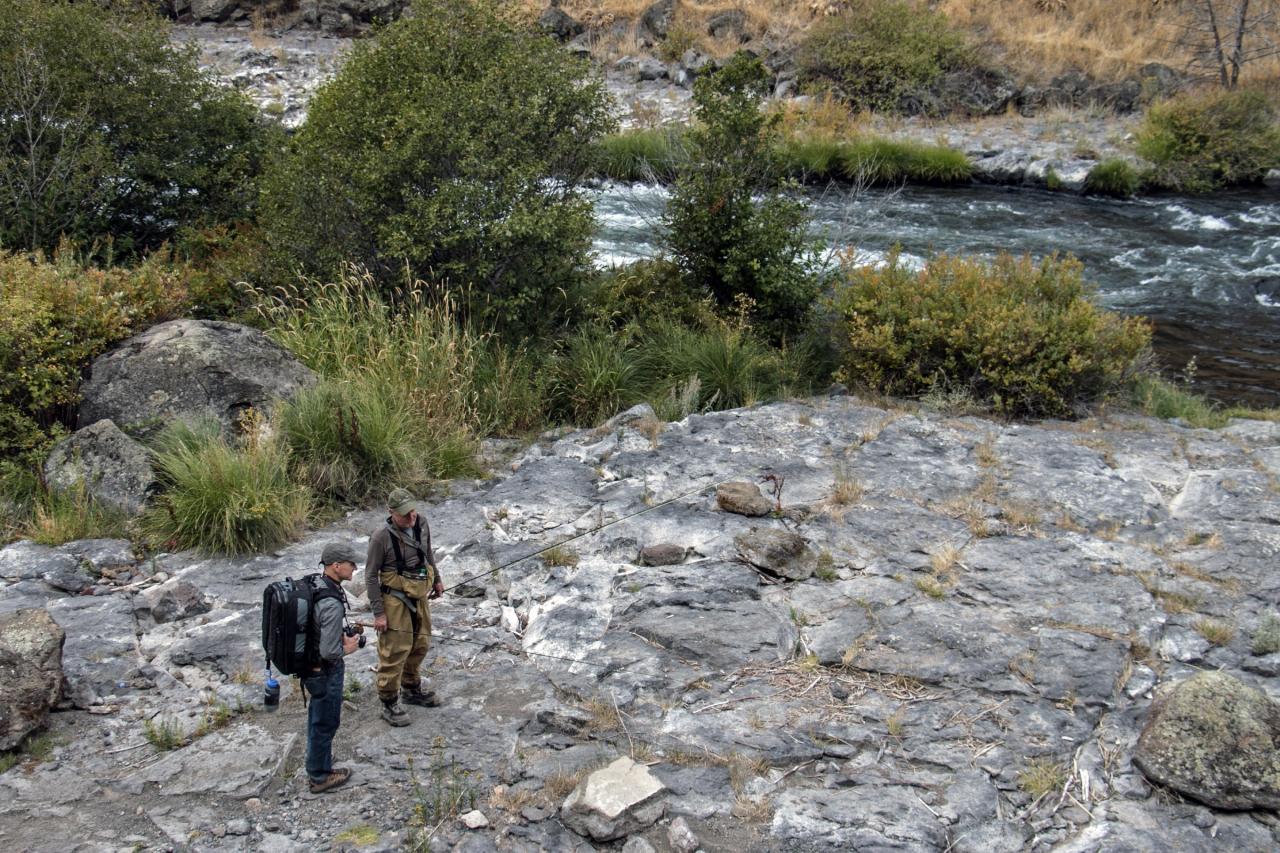
Facilities are thin. There is a vault toilet at the trailhead, no potable water and no trash pickup. Overnight camping is allowed at first come, first served sites near the trailhead with a 14 day stay limit. Campfires are prohibited within half a mile of the river from June 1 through October 15. Pets must be leashed at the trailhead and in the camping area. Trout fishing is open year round on this stretch and restricted to artificial flies and lures. Golden eagles nest in the canyon walls and American dippers work the whitewater below the drop.
Steelhead Falls is currently open. BLM rescinded its summer 2026 emergency wildfire closures across the Prineville District on August 27, and the site stays open through the February to August raptor nesting closures that shut other trails nearby.
More Information
Deschutes Canyon/Steelhead Falls WSA | Bureau of Land Management
The Deschutes Canyon-Steelhead Falls Wilderness Study Area (WSA) (OR-5-14) is part of a larger study area that includes U.S. Forest Service lands. This WSA is located in a triangle formed by the towns of Madras, Redmond and Sisters, in Central Oregon. The Steelhead Falls study area is a long narrow area located along the upper Deschutes River, within and adjacent to the U.S. Forest Service-administered Crooked River National Grasslands. This study area actually consists of two subunits separated by a 40-acre parcel of Forest Service land and a parcel of private land. For purposes of this
https://www.blm.gov/programs/national-conservation-lands/oregon-washington/deschutes-canyon-steelhead-falls-wsaDeschutes River Near Culver, OR - USGS Water Data for the Nation
Discover water data collected at monitoring location USGS-14076500, located in Jefferson County, Oregon and find additional nearby monitoring locations.
https://waterdata.usgs.gov/monitoring-location/14076500/Middle Deschutes Wild and Scenic River - Oregon | Bureau of Land Management
Just minutes northwest of the fast-growing urban environment of Redmond, delight in the trailside pool at Steelhead Falls or challenge yourself to a short but strenuous hike at Scout Camp trail.
https://www.blm.gov/visit/middle-deschutes-wild-and-scenic-riverOregon Health Authority : Current Cyanobacteria Advisories : Cyanobacteria Blooms : State of Oregon
Current cyanobacteria harmful algae bloom advisories for the state of Oregon
https://www.oregon.gov/oha/PH/HEALTHYENVIRONMENTS/RECREATION/HARMFULALGAEBLOOMS/Pages/Blue-GreenAlgaeAdvisories.aspxPrineville District Office | Bureau of Land Management
Join Our Team, Conserve Your Public Lands: Explore a rewarding career with Prineville BLM!Prineville is the largest District in Oregon with 1.65 million acres scattered over 13 million acres. The boundary generally follows county boundaries and stretches from the Columbia River in the north to the edge of the Great Basin in the south, and includes the Cascade crest in the west and the Blue Mountains in the east. It is roughly 180 miles across, both north-south and east-west.Half of this land base (50%) is managed by three federal agencies: US Forest Service (33%), BLM (13%), and Bureau of
https://www.blm.gov/office/prineville-district-officeSeasonal Wildlife Closures in Prineville Area | Bureau of Land Management
Central Ore.—The Bureau of Land Management (BLM) Prineville District has started implementing a series of annual wildlife closures to protect several species of birds of prey during sensitive nesting periods. Harassment by humans—unintentional or deliberate—is a leading cause of nest failure or abandonment. People walking or riding near a nest—or even being within view of an eagle on a nest—can cause an adult bird to abandon the nest. This means eggs can get cold, young don’t get fed, and the nest is open to predation.All public uses will be prohibited in the closure areas including hiking
https://www.blm.gov/press-release/seasonal-wildlife-closures-prineville-areaSteelhead Falls an easy trek near Crooked River Ranch | Redmond Spokesman
After all my jaunts throughout Central Oregon over the past 20 years, I still occasionally venture to special spots that are new to me — even well-known locations. Steelhead Falls […]
https://redmondspokesman.com/2022/04/08/steelhead-falls-an-easy-trek-near-crooked-river-ranch/Steelhead Falls Trail - Oregon | Bureau of Land Management
The trail to the falls is relatively easy, with one small, steep section. Hike down for a picnic, fish in the Deschutes River, explore the rocky shores, or just sit and relax to the sound of the falls
https://www.blm.gov/visit/steelhead-falls-trailSteelhead Falls, Jefferson County, Oregon - Northwest Waterfall Survey
Detailed information about Steelhead Falls in Jefferson County, Oregon
https://www.waterfallsnorthwest.com/waterfall/Steelhead-Falls-4913Be courteous, informed, and prepared. Read trailhead guidelines, stay on the trail, and don't feed the wildlife.
Read More
- Plan Ahead and Prepare
- Travel & camp on durable surfaces
- Dispose of waste properly
- Leave what you find
- Minimize campfire impacts
- Respect wildlife
- Be considerate of other visitors
Directions
From Terrebonne
- Head east on Rue St Pierre toward Rue St Joseph (0.1 km)
- Turn right onto Rue Chapleau/
QC-125 S (0.6 km) - Turn right onto Bd des Mille-Îles (1.9 km)
- Turn left onto the Québec Autoroute 25 S ramp (0.5 km)
- Merge onto Quebec Autoroute 25 S (2.2 km)
- Keep right to continue on Autoroute 440 O (17.9 km)
- Take exit 17-S toward Montréal (1.1 km)
- Merge onto A. Chomedey/
Autoroute 13 S (1.2 km) - Slight left onto the Québec Autoroute 13 S ramp to Montréal (0.2 km)
- Merge onto Autoroute 13 S (7.1 km)
- Take exit 6 toward Québec Autoroute 40 O/
Ottawa/ Gatineau (0.6 km) - Merge onto Rte Transcanadienne/
Voie de Service N (0.1 km) - Slight left onto the Québec Autoroute 40 O ramp to Ottawa/
Gatineau (0.4 km) - Merge onto Route Transcanadienne O/
Autoroute 40 O Parts of this road may be closed at certain times or days(26.8 km) - Take exit 32 on the left for Québec Autoroute 30 toward Québec Autoroute 20/
ON-401/ Sorel-Tracy/ Toronto (1.3 km) - Continue onto Autoroute 30 (2.5 km)
- Take exit 5 for Québec Autoroute 20 O toward ON-401/
Toronto (1.6 km) - Merge onto Autoroute 20 OEntering Ontario(28.5 km)
- Continue onto ON-401 W (427 km)
- Slight left onto ON 401 Express (43.5 km)
- Merge onto ON-401 W (6.6 km)
- Keep left to continue on ON 401 Express, follow signs for ON-401 W/
London (3.6 km) - Keep left to stay on ON 401 Express (4.2 km)
- Keep left to stay on ON 401 Express (8.5 km)
- Merge onto ON-401 W (138 km)
- Take exit 194 for Veterans Memorial Pkwy toward Airport (0.4 km)
- Take the ramp onto Veterans Memorial Pkwy (1.0 km)
- Turn left onto Bradley Ave (5.0 km)
- Turn right onto the Highbury Ave. South ramp (0.5 km)
- Merge onto Highbury Ave S (0.2 km)
- Take the exit onto ON-401 W toward Windsor (5.6 km)
- Keep right to continue on ON-402 W, follow signs for SarniaToll road(102 km)
- Continue onto Blue Water Brg WToll roadEntering the United States of America (Michigan)(1.0 km)
- Continue onto I-69/
Blue Water Brg W Toll road(1.3 km) - Keep left to continue on I-69/
I-94 W, follow signs for Detroit/ Flint/ Lansing Toll road(4.2 km) - Take exit 271 for I-69 toward Flint/
Lansing (1.4 km) - Continue onto I-69 W (201 km)
- Slight right onto I-69 S (signs for Charlotte/
Ft Wayne) (55.2 km) - Take exit 38 to merge onto I-94 W toward ChicagoPassing through IndianaEntering Illinois(249 km)
- Continue onto I-80 WToll road(10.7 km)
- Keep right to stay on I-80 W, follow signs for IowaToll road(39.1 km)
- Slight left (7.9 km)
- Keep left (0.3 km)
- Continue straight (2.0 km)
- Merge onto I-80 W (184 km)
- Take the exit to stay on I-80 W toward DavenportEntering Iowa(309 km)
- Take exit 124 for University Ave toward Clive (0.7 km)
- Turn right onto University Ave (6.2 km)
- Turn left onto Grand Prairie Pkwy (3.3 km)
- Take the ramp onto I-80 WEntering Nebraska(200 km)
- Continue straight to stay on I-80 WEntering Wyoming(918 km)
- Keep left to stay on I-80 WEntering Utah(497 km)
- Take exit 168 for I-84 W toward Ogden (0.5 km)
- Continue onto I-84 W (62.0 km)
- Merge onto I-15 N/
I-84 W (62.3 km) - Keep left to continue on I-84 W, follow signs for BoisePassing through IdahoEntering Oregon(516 km)
- Take exit 374 for OR-201 toward US-20/
US-26/ Weiser/ Vale (0.4 km) - Turn right onto OR-201 S/
State Hwy 201 (8.0 km) - At the traffic circle, take the 1st exit onto US-20/
US-26 Continue to follow US-20(201 km) - Turn right onto US-20 W/
US-395 S/ W Monroe St (signs for Lakeview) Continue to follow US-20 WPass by Subway (on the left in 2.1 km)(202 km) - Turn right onto Erickson Rd (2.5 km)
- Continue onto Dickey Rd (1.6 km)
- Turn left onto NE Butler Market Rd (1.6 km)
- Turn right onto Hamehook Rd (1.9 km)
- At the traffic circle, take the 1st exit onto Deschutes Market Rd (5.9 km)
- Turn right onto Graystone Ln (0.4 km)
- Turn left onto Deschutes Pleasant Ridge Rd (0.2 km)
- Merge onto US-97 NPass by Taco Bell (on the right in 13.5 km)(15.6 km)
- Continue onto US-97 N (6.6 km)
- Turn left onto NW Odem Ave (0.9 km)
- Turn right onto NW 19th St (2.4 km)
- Turn left onto NW Lower Bridge Way/
Lower Bridge Market Rd (2.6 km) - Turn right onto NW 43rd St (2.9 km)
- Turn left onto NW Chinook Dr (3.8 km)
- Turn left onto Mustang Rd (0.4 km)
- Turn right to stay on Mustang Rd (0.8 km)
- Turn right to stay on Mustang Rd (1.8 km)
- Turn left onto Quail Rd (0.2 km)
- Turn right onto SW Robin Dr (1.2 km)
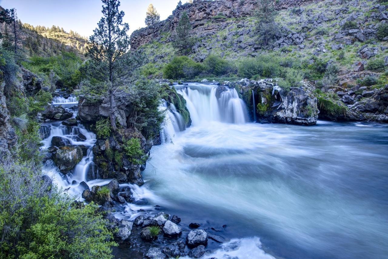
 The Deschutes pours over the basalt lip into the wide plunge pool that is the swimming hole. courtesy of Bob Wick; Bureau of Land Management Oregon and Washington↗ (Public domain↗)
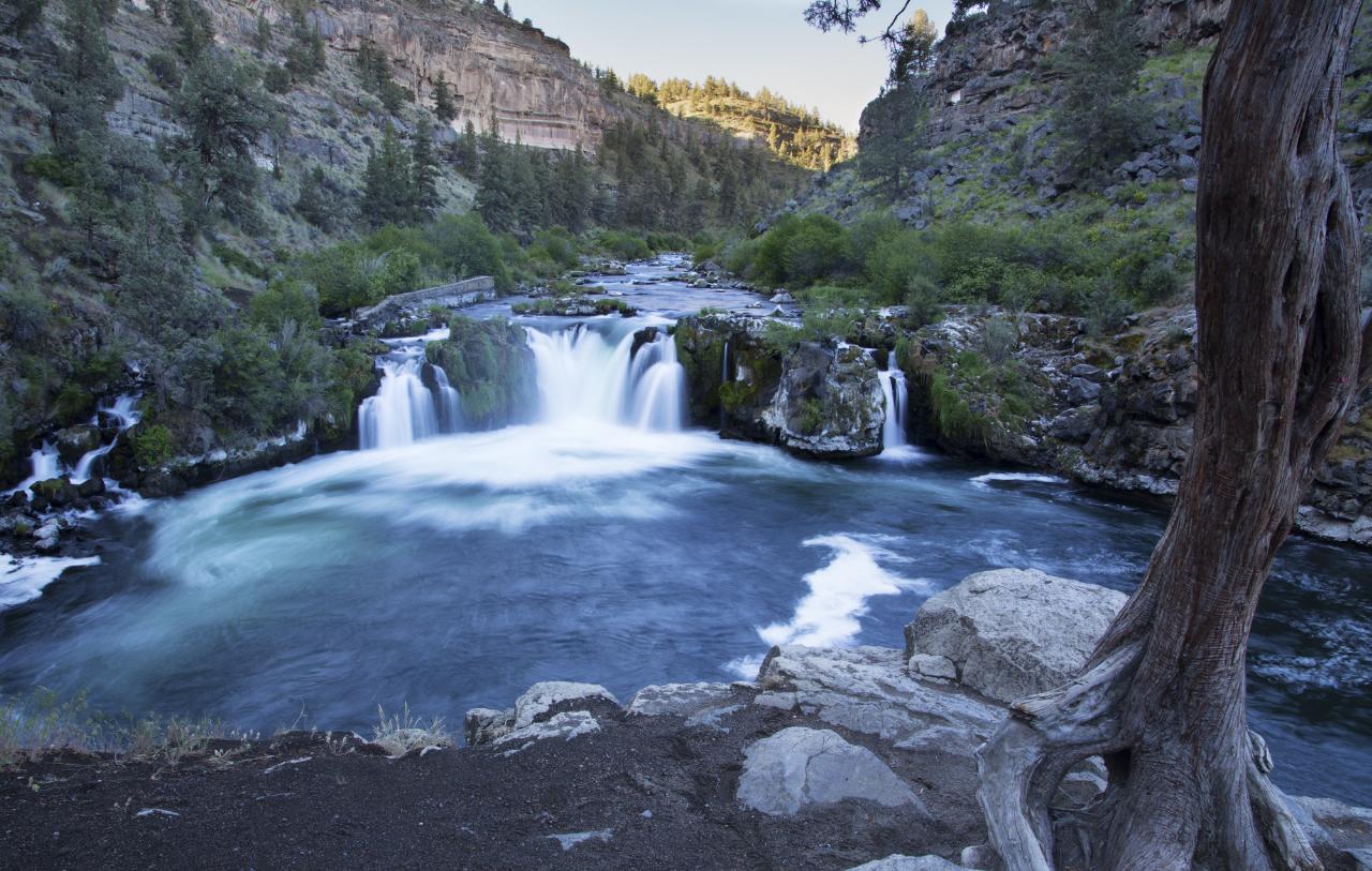
 The pool below the falls from the rock bench on the bank, framed by an old juniper.
 Looking back up at the falls from downstream, across the long calm water below the swimming hole. courtesy of Oregon Department of Fish & Wildlife↗ (Public domain↗)
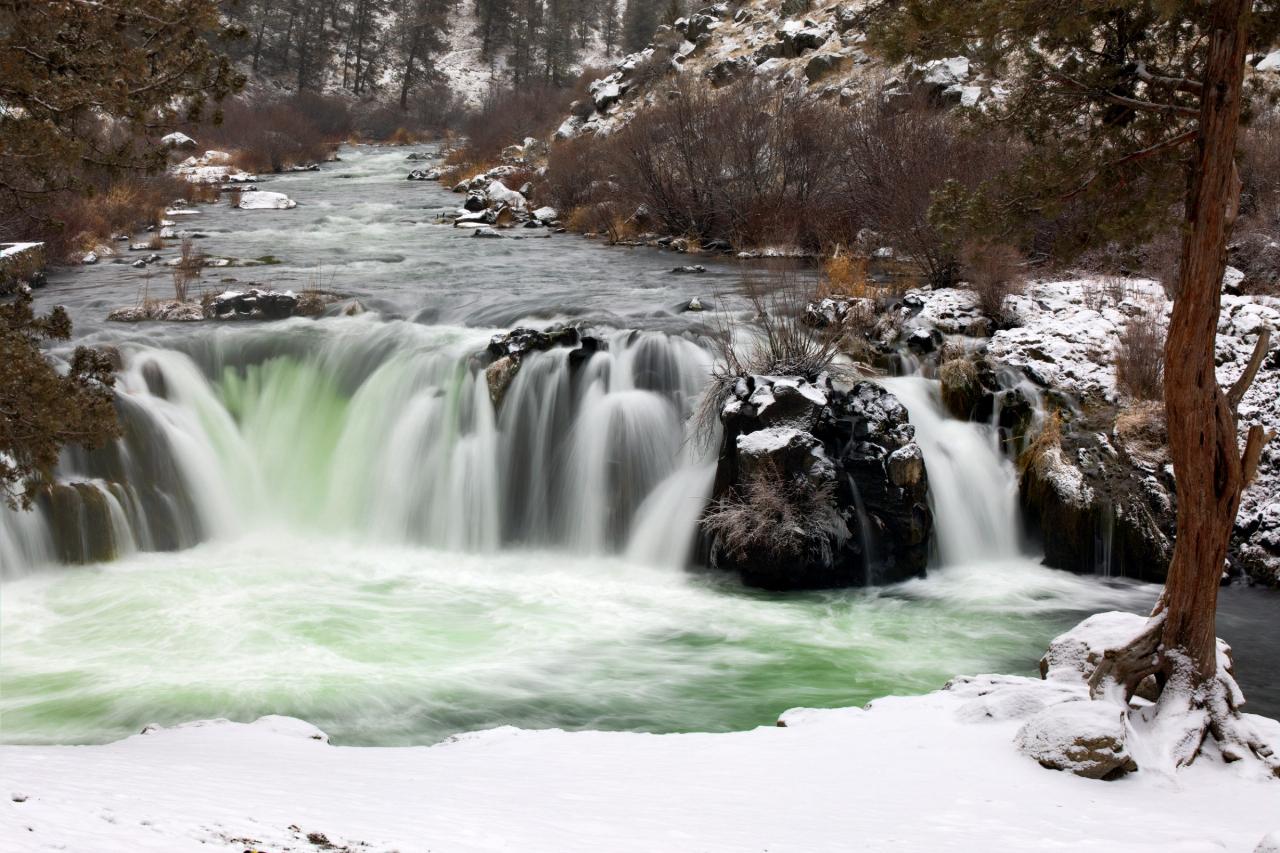
 The same pool under snow, when the Deschutes runs far too cold to get in. courtesy of BLM Oregon & Washington↗ (Public domain↗)
 Anglers on the basalt shelf beside the river near the falls, the same rock swimmers dry off on. courtesy of Megan Harper; Bureau of Land Management Oregon and Washington↗ (Public domain↗)
 The half mile trail from the BLM trailhead down toward the falls through juniper and sagebrush. courtesy of Bob Wick; Bureau of Land Management Oregon and Washington↗ (Public domain↗)
Other Swimming Holes and Hiking Trails Nearby
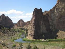
Smith Rock State Park
Terrebonne, Oregon
8.3 miles SEOregon's premier sport climbing destination on tuff and basalt cliffs — from classic beginner routes to cutting-edge testpieces, Smith Rock has something for every climber.
Hike, Mountain Bike, Rock Climb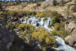
Cline Falls State Scenic Viewpoint
Redmond
10.3 miles SA nine-acre Oregon state day-use park on the Deschutes River four miles west of Redmond, with shaded picnic lawns, shallow wading coves and cold, fast water. Swim above the Highway 126 bridge only. Cline Falls drops half a mile downstream.
Hike, Kayak, Swim
Tamolitch (Blue) Pool
Mount Washington, Oregon
37.2 miles WA turquoise, glass-calm pool in Oregon fed by the McKenzie River emerging from two miles of underground lava fields — stunning for hikers and photographers, and open for cliff jumping at your own extreme caution.
Hike


