


217 Things to do near Dysart Trail
first prev 2 3 4 5 6 7 8 9 10 11 next lastShowing results within 50 miles Distance miles of Toothaker Trail, Goodyear, AZ 85338, USA City, Zip, or Address
Pima Road and Dynamite Blvd
Scottsdale, Arizona
37.9 miles NEThis is desert highlands and a beautiful part of the Sonoran Desert. (not much left with all the development) There are some jeep trails here and this area is also used by ATV and dirt...
Mountain Bike
Sunrise Peak via Sunrise Trail
Scottsdale, Arizona
38.1 miles NEHike near Scottsdale, Arizona
Hike
Pinnacle Peak Trail
Scottsdale, Arizona
38.4 miles NEPinnacle Peak is a 3.5 mile out-and-back, moderate hiking trail, that includes rock climbing routes (for experienced climbers), within the Sonoran Desert. This trail, and park, in...
Hike, Horseback, Rock Climb 5.8 mi
Go John Trail
Cave Creek, Arizona
38.4 miles NEThe Go John Trail is a 5.8 mile loop trail outside of Cave Creek, Arizona, that is moderately trafficked, used by both hikers and mountain bikers. It is an excellent opportunity to view the desert...
Hike, Horseback, Mountain Bike
Marbella Vineyards
Gilbert, Arizona
39.0 miles EShort straight shots over grass with few trees to baskets surrounding a subdivision neighborhood park. Undefined tees. Reverse to make 18. Private (No Fee)
Disc Golf
Sonoran Trail Fountain Hills
Fountain Hills, Arizona
39.3 miles NEHike near Fountain Hills, Arizona
Hike
Thompsons Peak
Fountain Hills, Arizona
39.3 miles NEHike near Fountain Hills, Arizona
Hike
Dixie Mine
Fountain Hills, Arizona
39.3 miles NEMcDowell Mountain Regional Park 16300 McDowell Mountain Park Dr. MMRP Arizona 85255 Ph: 480-471-0173 Fax: 602-372-8507 [email protected] Mailing...
Hike
Desert Trails Bike Park
Mesa, Arizona
39.3 miles EHike and Mountain Bike near Mesa, Arizona
Hike, Mountain Bike
Tom's Thumb, Feldspar, and Marcus Landslide Loop
Scottsdale, Arizona
39.7 miles NEHike near Scottsdale, Arizona
Hike
Tom's Thumb Trail
Scottsdale, Arizona
39.7 miles NETom's Thumb Trail is a popular trail on the McDowell Sonoran Preserve due to its unique thumb-like granite rock formation. This is a 4.7 out-and-back, intermediate trail because of its 1,200...
Hike, Mountain Bike, Rock Climb 2.2 mi
Marcus Landslide Trail
Scottsdale, Arizona
39.8 miles NEThe Marcus Landslide Trail is named after ASU professor Melvin Marcus, a renouned geographer, after the discovery and recognition of the interesting geographical area in 2002. More than 500,000...
Hike, Horseback, Mountain Bike, Rock Climb 21.4 mi
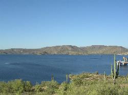
Spur Cross to Lake Pleasant
Cave Creek, Arizona
40.1 miles NEStart at the Flat Tire Bike Shop and head north on Spur Cross Road. You will arrive at the Spur Cross Conservation Ranch in 3.2mi. From there enter the Maricopa Trail system and follow the signs...
Mountain Bike
Cave Creek Park
Cave Creek, Arizona
40.1 miles NEMultiple singletrack loops, just explore and find what works best for you. Watch out for hikers and horses.
Mountain Bike
Pima and Dynamite Trail
Scottsdale, Arizona
40.7 miles NEPima and Dynamite is an area with a network of trails for hiking, but more popularly for mountain biking, in North Scottsdale, Arizona. The area feautures a variety of trails for...
Hike, Mountain Bike
Browns Ranch to Granite Mountain
Scottsdale, Arizona
40.7 miles NEStarts off at a trailhead onto a two track that can be taken to a variety of trails
Mountain Bike
Jane Rau Brown's Canyon Trail
Scottsdale, Arizona
40.7 miles NEThe Jane Rau Brown Canyon Trail was named after Jane Rau Brown, one of the pioneers of the McDowell Sonoran Conservancy, for her determination and passion in preserving the desert and the park....
Hike, Horseback, Mountain Bike 7.5 mi
Hawe's Loop
Mesa, Arizona
40.8 miles EMost of the trails in the Phoenix metropolitan area were originally built by mountain bikers, and the Hawe's loop trail system and trail are no exeptions. This trail features fantastic...
Hike, Mountain Bike
Brown Ranch Trail to Cone Mountain Trail
Scottsdale, Arizona
40.8 miles NEHike near Scottsdale, Arizona
Hike 1.5 mi
The Saddle
Mesa, Arizona
40.8 miles ESaddle trail is an intermediate mountain biking trail that connects to the greater Hawes trail network. The trail is 1.5-2mi long and it offers beautiful views of the neighboring Salt River and Red...
Hike, Mountain Bike


