


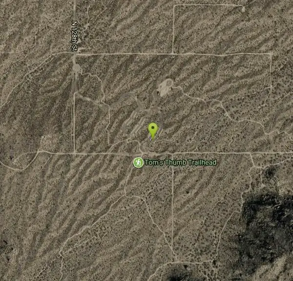
Marcus Landslide Trail
Scottsdale, Arizona

| Address: | ~23010 N 103rd Pl, Scottsdale, AZ 85255, USA |
| GPS: |
33°41'41.8"N 111°48'4.7"W Maps | Directions |
| State: | Arizona |
| Trail Length: | 3.00 miles |
| MTB Difficulty: | Intermediate |
| Trail Type: | Lariat |
| Hike Difficulty: | Intermediate |
| Elevation Gain: | 518 feet |
| Trails/Routes: | 2.2 mi |
Pet Friendly
Hike, Horseback, Mountain Bike, and Rock Climb
The Marcus Landslide Trail is named after ASU professor Melvin Marcus, a renouned geographer, after the discovery and recognition of the interesting geographical area in 2002. More than 500,000 years ago, catastrophic events led to the landslide in the McDowell Mountains that has created beautiful formations for the hikers, bikers, and climbers to behold.
Experts believe some of the native plants and animals of the time are buried underneath the landslide including mammoths, giant sloths, saber-tooth cats, camels, and horses. Courtesy of hikearizona.com
The Tom's Thumb Trailhead is the starting point for the Marcus Landslide Trail, which is heavily marked and worn-down by many hikers and riders over the years. The trail is wide and very smooth, which is great to allow plenty of views at the eye-catching boulder and rock features. On a clear day, one can see the Superstition and Mazatzal mountains on the horizon. There is little elevation gain for the first mile or so of trail, but it eventually climbs up into the landslide areas. Some of these avalanche landmarks include the breakaway scar, the fall zone, and the slide mass edges.
Hiking, mountain biking, and horseback riding
Start at the Tom's Thumb parking area and trailhead and turn left, following the signs for the Marcus Landslide trail. Follow this trail for 1.5 miles until it connects with the Boulder trail. At the fork, turn right and follow the loop around, ending at the fork once again. Follow the trail for the 1.5 miles back to the parking area.
Rock Climbing
Start at the Tom's Thumb parking area and hike along the Marcus Landslide trail. Access trails to the climbing areas are found all along the trail at varying distances with the closest at 0.3 miles in. The nearby climbing in the McDowell Mountains offers 125 total climbing routes, 96 of which are trad. The local climbing ethos celebrates stiff ratings, including run-outs, on varying quality granite depending on the specific crag. The climbing ranges from 5.4 to moderate 5.11, both trad and sport, so there are routes to enjoy by climbers of all skill level and pursuit. Some of the classics include Changes in Longitude at 5.5 trad and 150ft in 2 pitches and Leave it to Beaver at 5.9 trad and 90ft.
Once threatened by house and golf course development, the city of Scottsdale (with the help of it's citizens, who kept voting in tax $$ support to acquire the land!) managed to turn the whole place into the McDowell-Sonoran Preserve, starting in the mid 90's and continuing to this day. The Preserve today sits at almost 22,000 acres with the eventual plan to encompass some 36,000+ acres! Courtesy of mountainproject.com
To keep climbing access, rememeber to stay on developed trails and keep the crags clean.
More Information
Never modify trail features. Ride trails when they're dry enough that you won't leave ruts. Speak up when you see others on the trail and always yield to hikers, horses, and others coming uphill. Always ride on the established trail.
Read MoreBe courteous, informed, and prepared. Read trailhead guidelines, stay on the trail, and don't feed the wildlife.
Read More- Plan Ahead and Prepare
- Travel & camp on durable surfaces
- Dispose of waste properly
- Leave what you find
- Minimize campfire impacts
- Respect wildlife
- Be considerate of other visitors
Directions
From Scottsdale, Arizona
- Head north on N Scottsdale Rd toward E Indian School Rd (276 ft)
- Turn right at the 1st cross street onto E Indian School Rd (2.2 mi)
- Turn left to merge onto AZ-101 Loop N (10.5 mi)
- Take exit 36 to merge onto N Pima Rd toward Princess Dr (0.5 mi)
- Turn right to stay on N Pima Rd (0.7 mi)
- Keep right to stay on N Pima Rd (4.0 mi)
- Turn right onto E Happy Valley Rd (4.2 mi)
- Continue onto N 118th St (0.1 mi)
- Turn right onto Ranch Gate Rd (1.3 mi)
- Turn right onto N 128th St (1.0 mi)
- At the traffic circle, continue straightDestination will be on the right(0.4 mi)


Trails
Distance ?
2.2 milesElevation Gain ?
-131 feetReal Ascent ?
299 feetReal Descent ?
430 feetAvg Grade (-1°)
-1%Grade (-15° to 14°)
-28% to 25%Elevation differences are scaled for emphasis. While the numbers are accurate, the cut-away shown here is not to scale.
Other Rock Climbing Walls, Mountain Bike Trails, Hiking Trails, and Horseback Trails Nearby

Tom's Thumb Trail
Scottsdale, Arizona
0.0 miles SWTom's Thumb Trail is a popular trail on the McDowell Sonoran Preserve due to its unique thumb-like granite rock formation. This is a 4.7 out-and-back, intermediate trail because of its 1,200...
Hike, Mountain Bike, Rock Climb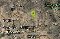
Tom's Thumb, Feldspar, and Marcus Landslide Loop
Scottsdale, Arizona
0.0 miles SWHike near Scottsdale, Arizona
Hike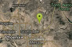
Tonto Pass
Fountain Hills, Arizona
3.9 miles SETrail starts out as Pemberton loop - counterclockwise. Ride approximately 5.25 miles (430ft climb over this distance). No real technical areas on the way up, some sand and small berms....
Mountain Bike
Wagner-Granite-Bluff Trails
Scottsdale, Arizona
4.0 miles EHike and Mountain Bike near Scottsdale, Arizona
Hike, Mountain Bike
Wagner Trail
Scottsdale, Arizona
4.0 miles EWagner Trail is a 2.2 mile, beginner to intermediate loop trail located in the McDowell Sonoran Preserve. The trail is well-marked and easy to follow; this wide, but rugged...
Hike, Horseback, Mountain Bike
Pinnacle Peak Trail
Scottsdale, Arizona
4.1 miles NWPinnacle Peak is a 3.5 mile out-and-back, moderate hiking trail, that includes rock climbing routes (for experienced climbers), within the Sonoran Desert. This trail, and park, in...
Hike, Horseback, Rock Climb
Tortoise and Hilltop Trails
Fort McDowell, Arizona
4.2 miles EBe on the lookout for wildlife like jackrabbits and lizards on the initial stretch of trail (Tortoise Trail) and for mountain bikers as this trail joins the Pemberton Trail for a bit as...
Hike
Hawksnest Stagecoach Loop
Scottsdale, Arizona
4.2 miles NThis is an easy loop, with moderate climbs and fantastic downhill tracks. The trail is well-maintained and for the most part sparsely populated.
Mountain Bike 0.6 mi
Horseshoe Trail
Scottsdale, Arizona
4.3 miles SWHorseshoe trail is a short, fun singletrack with a lot of quick turns created by wash areas and rocks. It's a nice warm-up heading to Gateway Loop Trail. In some areas there are a lot of cactus,...
Hike, Horseback, Mountain Bike
Thompsons Peak
Fountain Hills, Arizona
4.5 miles SEHike near Fountain Hills, Arizona
Hike
Dixie Mine
Fountain Hills, Arizona
4.5 miles SEMcDowell Mountain Regional Park 16300 McDowell Mountain Park Dr. MMRP Arizona 85255 Ph: 480-471-0173 Fax: 602-372-8507 mcdowellpark@mail.maricopa.gov Mailing...
Hike
Sonoran Trail Fountain Hills
Fountain Hills, Arizona
4.5 miles SEHike near Fountain Hills, Arizona
Hike
Inspiration Point
Scottsdale, Arizona
4.6 miles SWInspiration Point is a 5.7, moderate hike located on the McDowell Sonoran Preserve near Scottsdale, Arizona. You'll begin your hike at the Gateway area, where you can find a parking lot...
Hike, Mountain Bike
Gatewa-Prospector-Thompson Peak Road Trail
Scottsdale, Arizona
4.6 miles SWHike near Scottsdale, Arizona
Hike
Gateway and Tom's Thumb Loop Trail
Scottsdale, Arizona
4.6 miles SWStarting at the 104th St trailhead, head toward the Gateway loop trail. Turn right at the Gateway loop. Next take the Bell pass trail and be prepared for a steep climb. Once you hit...
Hike, Horseback, Mountain Bike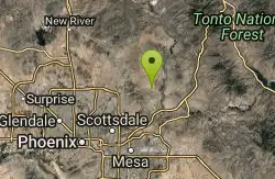
Coachwhip Trail Loop
Fountain Hills, Arizona
4.6 miles SEThe Pemberton Trail is the best known trail in this area and is the arterial backbone connecting other spur trails. Don't just ride Pemberton and feel like you've seen it all. Many...
Mountain Bike
Horseshoe Loop Hike
Scottsdale, Arizona
4.6 miles SWHike near Scottsdale, Arizona
Hike
Tom's Thumb to Bell Pass
Scottsdale, Arizona
4.6 miles SWHike and Mountain Bike near Scottsdale, Arizona
Hike, Mountain Bike
Tom's Thumb Trail South
Scottsdale, Arizona
4.6 miles SWHike near Scottsdale, Arizona
Hike
Saguaro Loop and Nature Trail
Scottsdale, Arizona
4.6 miles SWHike near Scottsdale, Arizona
HikeNearby Campsites

Lower Salt River Nature Trail
Fort McDowell, Arizona
13.1 miles SEThe Lower Salt River Nature Trail is a scenic walk to take at the Tonto National Forest. This trail provides stunning views as you walk alongside the Salt River. This rustic trail is older and less...
Camp, Hike
Buckhorn Campground Nature Trail
Apache Junction, Arizona
18.5 miles SECamp and Hike near Apache Junction, Arizona
Camp, Hike
Verde Hot Springs
Camp Verde, Arizona
45.5 miles NVerde Hot Springs are a few natural hot spring pools located along the Verde River, near Sedona, Arizona. Once a resort, now all that remains are the foundations and the hot pools...
Camp, Hike, Hot Springs


