


209 Things to do near Rigby Wave-45th Wave
first prev 2 3 4 5 6 7 8 9 10 11 next lastShowing results within 50 miles Distance miles of 314 N 4500 E, Rigby, ID 83442, USA City, Zip, or Address
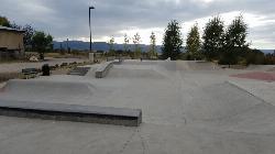
Driggs Bike and Skate Park
Driggs, Idaho
35.3 miles EThis is a great concrete skatepark and small mountain bike park with great features, both natural and wooden. There's a great pavilion right next to the skatepark and parking lot. While...
Mountain Bike, Skateboard
Victor Bike Park
Victor, Idaho
35.4 miles EThe Victor Bike Park is home to a progressive jump line, pumptrack, and more stunts.
Mountain Bike
Teton Springs Trail
Victor, Idaho
35.5 miles ECLOSED. This trail is no longer accessible to the public. There is a new company which owns the resort and the loop land. Teton Springs Loop is a loop for cross-country skiing and snowshoeing. The...
Cross-country Ski, Snowshoe
Pioneer Park Nordic Trail
Victor, Idaho
35.5 miles EDistance: 3 miles (4.5km) Trail Map: Pioneer_Park_2015.pdf Grooming Report: http://tvtap.org/nordic-grooming
Cross-country Ski, Snowshoe
Driggs Nordic Trail
Driggs, Idaho
35.6 miles EDistance: 3.1 miles (5km) Trail Map: Driggs_Nordic_Track_2015.pdf Grooming Report: http://tvtap.org/nordic-grooming
Cross-country Ski, Snowshoe
South Fork Bear Creek Trail
Wayan, Idaho
37.6 miles SEOHV trail. source: fs.usda.gov
Mountain Bike
Rush Hour
Victor, Idaho
37.7 miles ETrail is a fun little out n back. 2 miles one way. Only gain about 340' in elevation throughout the trail. Perfect small workout trail and good intro to singletracks in the area. Trail turns...
Mountain Bike
Mike Harris Campground
Victor, Idaho
37.7 miles EMike Harris Campground is located along scenic Teton Pass, just 5 miles from Victor, Idaho at an elevation of 6,200 feet. Visitors enjoy fishing, exploring local trails and sightseeing in this...
Camp
Blackfoot River Crossing at Trail Creek Road
Firth, Idaho
37.7 miles SIn Soda Springs, ID 34 N for ~11 mi; R (E) on Blackfoot River Rd at mp 69.9; zero odometer; travel 10.4 mi; stay to the L as rd turns to gravel at mi 10.9; mi 13.7 pass Mill Canyon Campground; mi...
Camp
Bitch Creek Trestle
Tetonia, Idaho
37.8 miles NEAs part of the Rails to Trails project, this old railroad bridge has been transformed into a very safe little viewing experience for the whole family. You can drive right up to the bridge where...
Hike
Sand Creek Frenzy
Ashton, Idaho
38.0 miles NThere are some woods back there and it is secluded. There are many places you can play just watch out for campers.
Paintball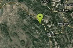
Bear Creek Campground at Palisades
Irwin, Idaho
38.0 miles SEPalisades Reservoir is ideal for water skiing in the summer and features many picnic spots and boat docks. The area forest service hosts nine campgrounds containing 181 family units. Boat launch...
Camp, Hike, Horseback, Mountain Bike
Calamity Campground
Irwin, Idaho
38.1 miles SECalamity Campground is located just 55 miles east of Idaho Falls, Idaho. This is the perfect area to access the Palisades Reservoir and enjoy the water activities available there. The water here is...
Camp, Canoe, Hike, Kayak, Mountain Bike, Swim 3.3-10.0 mi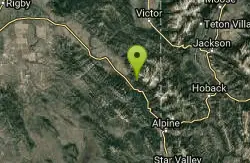
Sheep Creek Trail
Irwin, Idaho
38.1 miles SEHike and Mountain Bike near Irwin, Idaho
Hike, Mountain Bike
Ashton Hill
Ashton, Idaho
38.3 miles NEFairly thick forest. Considerable underbrush. Lots of places in the area to play.
Airsoft, Paintball
Spring Creek Trail
Alta, Wyoming
38.5 miles EThis trail starts at the remains of the historic Rapid Creek Ranger Station. The trail heads east following an old road. After crossing Rapid Creek, the trail climbs up to a ridge...
Mountain Bike 4.5 mi
Aspen Trail
Alta, Wyoming
38.6 miles EAspen Trail (tr 034) is single track trail for 4.35 miles along 6,800 ft contour to Darby Canyon (tr 012). Spring Creek Trail (tr 032) is double track trail for 3.68 miles to end. The trail starts...
Hike, Mountain Bike
Alta Nordic Trail
Alta, Wyoming
38.8 miles EDistance: 6.2 miles (10km) Trail Map: Alta_Nordic_Trail_2015.pdf Grooming Report: http://tvtap.org/nordic-grooming
Cross-country Ski, Snowshoe
Falls River, Lower Run
Ashton, Idaho
38.9 miles NEFall River rises on the Madison and Pitchstone plateaus in the southwest corner of Yellowstone National Park, Wyoming and flows approximately 64 miles (103 km) to its confluence with the Henrys Fork...
Whitewater
Darby Canyon Cliffs
Alta, Wyoming
39.1 miles EAn interesting cave by Darby Canyon is the major draw to this popular west slope hike, closely followed by intermittent waterfalls splashing down the canyon rim along with impressive displays of...
Rock Climb


