


Alta Nordic Trail
Alta, Wyoming
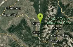
| Address: | ~250 Targhee Towne Rd, Alta, WY 83414, USA |
| GPS: |
43°45'18.7"N 111°2'10.6"W Maps | Directions |
| State: | Wyoming |
Cross Country Ski and Snowshoe
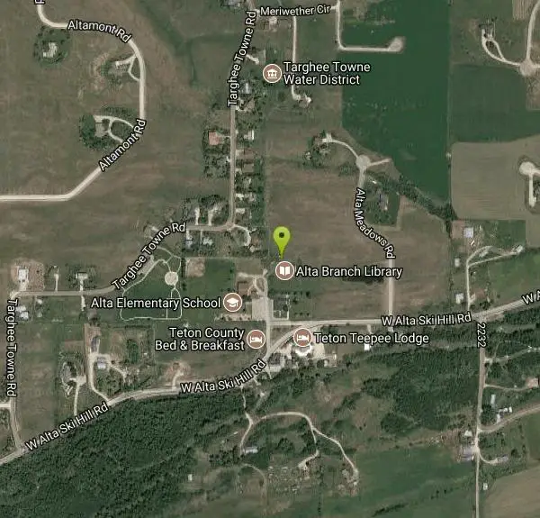
The Alta Nordic Trail is a free, groomed cross-country ski network laid out across the open farm fields and quiet lanes of Alta, Wyoming — the tiny Teton Valley community tucked on the west slope of the Tetons just below Grand Targhee. The trailhead sits right in the heart of town between the Alta church and the Alta branch library, and from there the tracks meander north through rolling hay meadows and a rural neighborhood, with the granite crown of the Grand Teton rising to the east and the ski runs of Grand Targhee visible across the valley. Skied end to end, the full set of loops adds up to about 11 kilometers (roughly 7 miles) of trail.
The terrain is gentle, open and rolling — ideal for both classic and skate skiing, and forgiving enough for beginners and families while still giving stronger skiers room to build a rhythm across the meadows. The wide-open setting means big sky and bigger mountain views from nearly any point on the network, a payoff you don't often get on tree-tunneled Nordic trails. It's an unhurried, uncrowded alternative to the resort just up the hill, and a favorite of Teton Valley locals looking for a quiet mid-week ski.
The trail is groomed by Teton Valley Trails and Pathways (TVTAP), the local non-profit that maintains Nordic and fat-bike trails throughout the valley. Grooming is typically set on Tuesday, Thursday, Saturday and Sunday, so fresh corduroy is most reliable on and just after those days; a mid-week thaw or fresh dump can change conditions, and TVTAP posts current grooming reports so you can check before you drive out. All TVTAP trails are free to use — the organization is donation-supported, and a season trail pass bought through tvtap.org is a good way to give back if you ski the valley often.
Dogs are welcome on the Alta trail, which sets it apart from many groomed Nordic systems; owners are asked to keep them under close voice control and to clean up, since the network runs through a working rural neighborhood on land shared with residents and farms. Staying in the set tracks, yielding thoughtfully and packing out after your dog are what keep this community-groomed trail open and welcoming.
Winter is the season here — the network runs on snow, generally from December through March depending on the year's snowpack, and the valley's cold, dry Teton snow tends to hold a good track. Mornings after a grooming pass are the sweet spot for firm classic tracks and smooth skate lanes. Bring layers for the exposed, often breezy meadows, sun protection for the bright high-country light, and skis waxed for cold snow. There are no services at the trailhead, so fuel up and fill water in Driggs or Victor before heading over; pair a morning on the Alta tracks with a lift day at Grand Targhee or a groomed tour up nearby Teton Canyon, and you have a full Teton Valley winter day without a lift ticket.
More Information
Alta Track | Teton Valley Trails and Pathways
Promoting a trails and pathways connected community
https://tvtap.org/grooming/alta/JH Nordic Alliance : Alta Nordic Track, WY -
The trails start just off the library parking lot, on the east edge of the ice rink. This tail system is a combination of loops with some small hills and excellent views of the Tetons and rolling farm fields. The neighbors of Alta have graciously agreed to let TVTAP groom and the public access the property that make up these loops. Please be excellent visitors …
https://jhnordic.com/trails/alta-nordic-track-wy/
- Plan Ahead and Prepare
- Travel & camp on durable surfaces
- Dispose of waste properly
- Leave what you find
- Minimize campfire impacts
- Respect wildlife
- Be considerate of other visitors
Directions
From Alta, Wyoming
- Head south on Alta School Rd toward W Alta Ski Hill Rd (82 ft)
- Slight right onto W Alta Ski Hill Rd (0.3 mi)
- Turn right onto Targhee Towne Rd (0.5 mi)
- Turn right to stay on Targhee Towne RdDestination will be on the left(187 ft)
Other Cross Country Ski Trails and Snowshoe Trails Nearby

Mill Creek Trail
Moose, Wyoming
2.5 miles EA cross-country downhill mountain bike ride at 7,000–10,000 ft elevation, linking Targhee resort via Lightning Ridge and Colter's Escape down Mill Creek into Teton Canyon — best shuttled for the descent.
Cross-country Ski, Mountain Bike, Snowshoe
Driggs Nordic Trail
Driggs, Idaho
3.4 miles SWA 3.1-mile groomed Nordic track in Driggs, perfect for cross-country skiing — check the online grooming report before heading out.
Cross-country Ski, Snowshoe
Pioneer Park Nordic Trail
Victor, Idaho
11.6 miles SA 3-mile groomed Nordic trail winding through the scenery near Victor, Idaho — check the grooming report before you go and enjoy fresh-tracked snow on a classic winter loop.
Cross-country Ski, Snowshoe
Teton Springs Trail
Victor, Idaho
13.1 miles SCLOSED. This trail is no longer accessible to the public. There is a new company which owns the resort and the loop land. A 5.5-mile free cross-country ski and snowshoe loop around Teton Springs Golf Course with minimal elevation change and elk, moose, and waterfowl sightings along the trail.
Cross-country Ski, Snowshoe 0.6 mi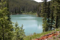
Packsaddle Lake
Tetonia, Idaho
15.2 miles WA secluded, steep-access Teton lake with a 300-foot descent from the trailhead, water that drops off quickly at the edge, and a small camp on the eastern shore.
Dive, Hike, Mountain Bike, Snowshoe, Swim 3.2-47.0 mi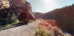
Yellowstone Branch Line Trail
Ashton, Idaho
28.7 miles NWA 39-mile trail from Warm River to the Montana border — open to backpackers, hikers, mountain bikers, horseback riders, and ATVs through the Targhee National Forest.
Backpack, Cross-country Ski, Hike, Horseback, Mountain Bike 5.7-8.1 mi
Space Cruz
Ririe, Idaho
29.0 miles WFlowy singletrack connecting to ATV trails with great berms, small jumps, and a thistle patch best attacked at speed — just watch out for cows at the junctions.
Cross-country Ski, Mountain Bike 3.8 mi
Kelly Mountain Trail
Ririe, Idaho
29.8 miles WA moderate uphill trail open to hikers, mountain bikers, and ATVs, winding through hills with wildflower and mountain views — dogs welcome on leash.
Cross-country Ski, Hike, Mountain Bike, Snowshoe 0.3-0.6 mi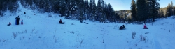
Bear Gulch
Ashton, Idaho
30.0 miles NWAn abandoned ski hill from 1969 with overgrown runs that still deliver great sledding — the lower run is fast and winding all the way down to the old ski lift.
Camp, Cross-country Ski, Hike, Sled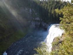
Mesa Falls
Ashton, Idaho
33.2 miles NWUpper Mesa Falls drops 114 feet and spans 300 feet across the Henrys Fork — just 0.2 miles of paved walkway from the parking lot, with platforms, handrails, and morning rainbow mist.
Cross-country Ski, Hike, Kayak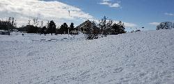
Teton Lakes Golf Course
Rexburg, Idaho
39.4 miles WA year-round golf course that transforms into a free cross-country ski destination in winter, with over two miles of groomed set and skate tracks — plus the community Cupid Cup XC race each season.
Cross-country Ski, Sled 0.6-4.7 mi
Harriman State Park
Island Park, Idaho
44.5 miles NWAn 11,000-acre wildlife refuge 38 miles from Yellowstone along Henry's Fork — world-class fly-fishing, hiking among wildflowers and wildlife, plus 24 miles of Nordic ski trails in winter.
Cross-country Ski, Hike, Horseback, Mountain Bike, SnowshoeNearby Campsites

Reunion Flat Campground
Alta, Wyoming
4.2 miles ECamp near Alta, Wyoming
Camp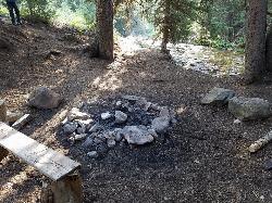
Darby Canyon Camping
Alta, Wyoming
5.6 miles SDispersed campsites with fire lays in scenic Darby Canyon — no official campground, just established spots in Wyoming wilderness. Leave No Trace and use existing rings only.
Camp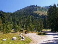
Teton Canyon Campground
Alta, Wyoming
5.9 miles ETeton Canyon Campground is the gateway to Alaska Basin, Table Rock, and the Teton Crest Trail — each site stocked with a picnic table, fire ring, and bear box.
Camp 3.8-6.4 mi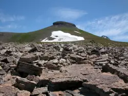
Table Rock / Table Mountain
Driggs, Idaho
5.9 miles EA big climb to 11,300 feet for arguably the finest view of the Grand Tetons — pick the steep Face or the gradual Huckleberry trail.
Camp, Hike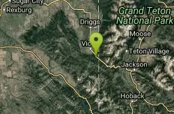
Mike Harris Campground
Victor, Idaho
13.8 miles SA scenic mountain campground at 6,200 feet along Teton Pass just 5 miles from Victor, Idaho — a peaceful base for fishing, trail exploring, and sightseeing in the Teton region.
Camp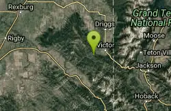
Pine Creek Campground
Victor, Idaho
15.2 miles SWThe Pine Creek Campground has 10 single units and has restrooms.
Camp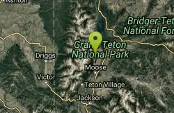
Jenny Lake Campground
Jackson Hole, WY
15.7 miles ETucked right at the base of the Tetons, this tent-only campground fills before 8 AM in summer for good reason — alpine beauty, quiet sites, and unbeatable Teton proximity.
Camp 1.3-4.3 mi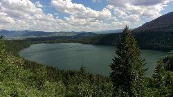
Phelps Lake
Jackson, Wyoming
15.9 miles SEA 5.5-mile loop around beautiful Phelps Lake with mountain scenery, majestic blue water, several Teton waterfalls, and lakeside campsites — plus a popular cliff jumping rock along the trail.
Backpack, Camp, Dive, Hike, Swim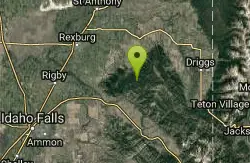
Moody Meadows
Driggs, Idaho
22.0 miles WGood place for kids, they can ride bikes in the meadow, play in the stream, and camping is off of the road. Hiking, motorbiking, and horseback riding trails are abundant in the area.
Camp
Sheep Falls on Fall River
Ashton, Idaho
22.6 miles NA local gem off Cave Falls Road where the river splits into multiple falls tumbling over each other — primitive campsites and beautiful views make it a great picnic stop.
Camp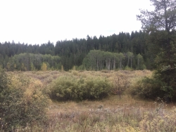
Porcupine Creek
Ashton, Idaho
24.7 miles NA backcountry hunting, fishing, camping, and swimming spot in Targhee National Forest, surrounded by forests, meadows, a creek, and unmarked trails — bear country, so pack and store food carefully.
Camp, Swim
Loon Lake
Ashton, Idaho
25.1 miles NLoon Lake is a small, lively mountain lake tucked into the Caribou-Targhee National Forest just off Ashton's Fish Creek Road, in the timbered high country of eastern Idaho near the gateway to...
Camp, Kayak, Swim 2.8-4.1 mi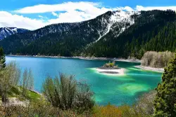
Palisades Creek Trail / Lakes and Waterfall Canyon
Irwin, Idaho
26.2 miles SSpectacular mountain views, two landslide-formed alpine lakes, and mountain goat sightings — all within a 4-to-6-mile hike in the Swan Valley wilderness.
Backpack, Camp, Hike, Horseback, Mountain Bike
Cave Falls of Yellowstone
Ashton, Idaho
26.8 miles NA campground right on the Fall River along Yellowstone's south boundary puts you steps from legendary fishing, with fire rings and bear-proof boxes at each site.
Camp, Hike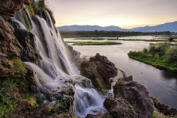
Fall Creek Falls
Swan Valley, Idaho
27.6 miles SWA shaded Snake River campground near Swan Valley with abundant wildlife, great trout fishing, and Fall Creek Falls a quarter-mile away.
Camp, Cave, Hike, Kayak, Swim
Falls Campground
Victor, Idaho
27.7 miles SWA Snake River campground near Swan Valley with cottonwood shade, abundant wildlife — eagles, osprey, moose, and deer — and Fall Creek Falls just a quarter mile away; Palisades Reservoir is 20 miles out.
Camp
Horseshoe Lake
Ashton, Idaho
28.3 miles NA lily-pad-dotted lake hidden in the Targhee National Forest with a gradual beach entry perfect for wading, a floating dock for jumping, and no motorized boats.
Camp, Canoe, Dive, Swim 0.5-3.5 mi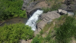
Webster's Dam
Ririe, Idaho
28.4 miles WAn abandoned dam in Moody Creek canyon where sediment split the stream into two beautiful 15-foot waterfalls — stunning in spring runoff and blazing with fall colors.
Camp, Hike, Mountain Bike
Warm River Campground
Ashton, Idaho
28.7 miles NWSlow-moving warm water and willow-lined banks make this campground a perfect spot for tubing, trout fishing, and peaceful mountain biking at 5,200 ft elevation.
Camp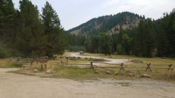
Table Rock Campground
Ririe, Idaho
29.0 miles WA campground in Caribou-Targhee National Forest — part of a 3-million-acre stretch from Montana to the Utah and Wyoming borders — with access to the Curlew National Grassland.
Camp


