


96 Things to do near Soldiers Loop / Fairgrounds trails
first prev 1 2 3 4 5 next lastShowing results within 50 miles Distance miles of Soldiers Loop / Fairgrounds trails near Flagstaff, Arizona City, Zip, or Address
Northern Arizona University Disc Golf Course
Flagstaff, Arizona
3.5 miles NEDense Ponderosa pine forest at 7,000 feet with tight paths, great elevation, tough lies, and a few long holes — beautifully maintained with woodchip trails.
Disc Golf
Fisher Point Trail
Flagstaff, Arizona
3.8 miles NEA mostly downhill 3-mile run from Pine Canyon development to Fisher Point, predominantly doubletrack with singletrack bookending each end.
Mountain Bike
Ridge Line Disc Golf Course
Flagstaff, Arizona
3.8 miles NEA short, technical disc golf course winding through an apartment complex with significant elevation changes and great views of the San Francisco Peaks — water and OB in play.
Disc Golf
Observatory Mesa
Flagstaff, Arizona
4.5 miles NEBeginner-friendly mountain biking on Observatory Mesa in Flagstaff — lots of options ranging from 2 to 20 miles, best ridden April through November.
Mountain Bike
Thorpe Park
Flagstaff, Arizona
4.8 miles NEDisc golf at 7,000 feet through Ponderosa pines, with open shots and tight ones — the city advises playing at your own risk on this rocky terrain.
Disc Golf
Fisher Point Overlook Trail
Flagstaff, Arizona
5.3 miles EA well-marked mix of intermediate, advanced, and expert singletrack and doubletrack leading to the Fisher Point overlook — follow the signs to the viewpoint.
Mountain Bike
McPherson Park
Flagstaff, Arizona
5.8 miles NEModerate rocky terrain through Ponderosa pine and oak with views of the San Francisco Peaks at McPherson Park in Flagstaff — bring a map and note it closes November through March.
Disc Golf
Basin BMX Park
Flagstaff, Arizona
6.2 miles NEA BMX park at the corner of West and 6th Street in Flagstaff — a local outdoor riding spot for those chasing air on two wheels.
Skateboard
Oldham Trail
Flagstaff, Arizona
6.2 miles NEA singletrack descent through towering trees linking to a network of trails and the Oldham Trail climb — about 23 miles total with a serious uphill push near Flagstaff.
Mountain Bike
Foxglenn Skatepark
Flagstaff, Arizona
6.4 miles NEA Flagstaff skatepark set amid Arizona's high-country pines, with features for all skill levels.
Skateboard
Flagstaff Loop Trail
Flagstaff, Arizona
6.8 miles NA 42-mile loop around Flagstaff divided into 8 passages — ranging from beginner to advanced, it incorporates existing trails, forest roads, and new singletrack.
Mountain Bike
Schultz Creek
Flagstaff, Arizona
7.0 miles NA 6–8 mile stretch of smooth mountain bike descending with great mountain views at the end of the Schultz Creek trail system near Flagstaff — a 25-mile total ride to access the goods.
Mountain Bike
Fort Valley Trail System
Flagstaff, Arizona
7.4 miles NPonderosa pines, Gambel oaks, and gradual canyons frame this multi-use connector trail system linking Schultz Creek, Dry Lake Hill, and Mt. Elden trails near Flagstaff.
Mountain Bike
Upper Brookbank Loop
Flagstaff, Arizona
8.8 miles NESeveral miles of amazing Brookbank singletrack connected via Schultz Trail, a meadow, and a Little Elden summit climb with a descent back to the Sunset trailhead.
Mountain Bike
Arizona Trail: Marshall Lake to Fisher Point
Flagstaff, Arizona
9.1 miles NEWildlife-rich mountain biking along the Arizona Trail from Marshall Lake to Fisher Point — elk, mule deer, wild turkey, pronghorn, and striking San Francisco Peaks views across Anderson Mesa.
Mountain Bike
Arizona Trail: Flagstaff
Flagstaff, Arizona
9.3 miles NA network ride from Buffalo Park through the Mount Elden trail system, picking up the Arizona Trail to Fischer Point, then descending into Walnut Canyon and back to town on the FUTS.
Mountain Bike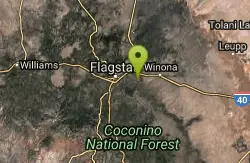
Campbell Mesa Loops
Flagstaff, Arizona
9.4 miles EBeginner-friendly, relatively flat and twisty singletrack through pine forest — popular with trail runners and perfect for a quick after-work spin.
Mountain Bike 1.0 mi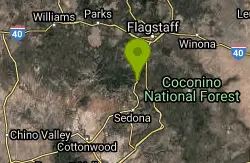
Harding Springs Trail
Sedona, Arizona
10.1 miles SA mostly shaded, gradual climb to Oak Creek Canyon's rim along a historic cattle drive route — with rest stops along the way and the option to continue north or south at the top.
Hike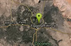
Supermoto
Flagstaff, Arizona
10.4 miles NA fun, shady technical rocky trail through the pines near Flagstaff — typically ridden with Schultz Pass Road as a return for an 8-mile loop.
Mountain Bike 0.1-0.7 mi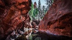
Cave Springs
Sedona, Arizona
10.5 miles SAn 84-site campground on Oak Creek in Sedona's canyon, with picnic tables and natural tree shade, close to Slide Rock, swimming holes, and the Coconino National Forest.
Camp, Hike, Swim


