


Arizona Trail: Marshall Lake to Fisher Point
Flagstaff, Arizona
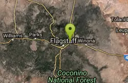
| GPS: |
35°14'7.0"N 111°34'41.8"W Maps | Directions |
| State: | Arizona |
| Trail Length: | 5.00 miles |
| MTB Difficulty: | Intermediate |
| Trail Type: | Out & Back |
Mountain Bike
Plentiful wildlife and great views of the San Francisco Peaks provide the major features of interest on this section of the state-spanning Arizona Trail. For the best views, begin at the Marshall Lake Trailhead. This vital wetland, which is more of a marsh than a lake, is frequented by bald eagles in winter and osprey in summer. Waterfowl and a variety of smaller hawks are generally present year-round.The bulk of the trail winds across Anderson Mesa, a broad grassy upland dotted with widely spaced trees. The open character of the terrain here provides excellent opportunities to view the area's wildlife residents. Anderson Mesa supports a rich and diverse community of wild animals some of the larger and more visible are elk, mule deer, whitetail deer, wild turkey, Abert's squirrels, coyotes, and pronghorn antelope.As you near Fisher Point and drop into Walnut Canyon, have your camera ready for some of the most photogenic views of the San Francisco Peaks available anywhere on the Forest. There are even some red rock cliffs here that are reminiscent of Oak Creek and the Grand Canyon. Courtesy of Singletracks.com
More Information
Never modify trail features. Ride trails when they're dry enough that you won't leave ruts. Speak up when you see others on the trail and always yield to hikers, horses, and others coming uphill. Always ride on the established trail.
Read More- Plan Ahead and Prepare
- Travel & camp on durable surfaces
- Dispose of waste properly
- Leave what you find
- Minimize campfire impacts
- Respect wildlife
- Be considerate of other visitors
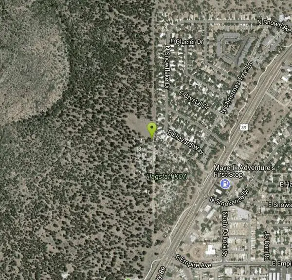
Directions
From Flagstaff, Arizona
- Head west on Historic Rte 66 toward N Humphreys St (20 ft)
- Turn right onto N Humphreys St (361 ft)
- Turn right at the 1st cross street onto W Aspen Ave (358 ft)
- Turn right at the 1st cross street onto N Beaver St (354 ft)
- Turn left at the 1st cross street onto US-180 E/Historic Rte 66Continue to follow US-180 E(4.2 mi)
- Continue onto US-89 N (1.1 mi)
- Turn left onto N Smokerise DrRestricted usage road(328 ft)
- Turn rightRestricted usage road(89 ft)
- Turn leftRestricted usage roadDestination will be on the right(0.1 mi)
Other Mountain Bike Trails Nearby
Upper Brookbank Loop
Flagstaff, Arizona
3.0 miles NWRide up Schultz trail to the log gate. Turn right up the old double track and follow that until you come to the edge of a large meadow. Single track breaks off left across the meadow....
Mountain Bike
Oldham Trail
Flagstaff, Arizona
3.3 miles WThere is a sigletrack here down though the towering trees. Follow this to a network of trails. Then look for the Oldham tr sign and head up hill. Climb all the way up to the fire road...
Mountain Bike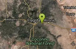
Campbell Mesa Loops
Flagstaff, Arizona
4.6 miles SEThese trails are all pretty much single track, built for beginners or just getting in a quick after work ride, they are also very popular with local trail runners. Relatively flat but...
Mountain Bike
Schultz Creek
Flagstaff, Arizona
4.6 miles WGreat trail, once you get there. I bit of just a bit too much for my self . 25 miles to be exact. It's a network of trails to get there but once you do the actual Shultztrail is about 6-8 miles...
Mountain Bike
Supermoto
Flagstaff, Arizona
4.7 miles NWTech rocky trail thru the pines. One of the best in the area, fun and shady. Return (back) is usually ridden on Schlutz Pass Rd making an 8 mile loop.
Mountain Bike
Observatory Mesa
Flagstaff, Arizona
5.1 miles SWNovice ridingBeginner skill levelRide between apr-novLots of options. Refer to cosmic rays fat tire guide for more info2-20 miles
Mountain Bike
Flagstaff Loop Trail
Flagstaff, Arizona
5.1 miles WThe trail forms a 42 mile loop around the city of Flagstaff. It is nearly completed and consists of various existing trails, forest roads, and newly constructed ST. It is divided into...
Mountain Bike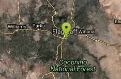
Fisher Point Trail
Flagstaff, Arizona
5.6 miles SWThe trail run approximately 3 miles from Pine Canyon housing development to Fisher Point. It is mostly downhill to Fisher Point. It is predominately doubletrack with some singletrack...
Mountain Bike
Fisher Point Overlook Trail
Flagstaff, Arizona
5.9 miles SThis trail is composed of a lot of technical ST and a short stretch of DT. It is a mix of intermediate, advanced and expert levels of difficulties. The trail is very well marked once...
Mountain Bike
Fort Valley Trail System
Flagstaff, Arizona
6.3 miles WLocated at the base of the San Francisco Peaks, the Fort Valley Trail System was designed primarily for connecting popular mountain biking trails. This system is a multi-use trail to be...
Mountain Bike
Arizona Trail: Flagstaff
Flagstaff, Arizona
7.9 miles WLeaving the back of Buffalo Park, stay right on the MT Elden Trail System. Any combination of this network of trails will get you over to the east side where you pick up the AZT and follow that to...
Mountain Bike
Soldiers Loop / Fairgrounds trails
Flagstaff, Arizona
9.1 miles SWSoldiers Loop makes a loop around the park with moderate ups and downs and not really any tech to worry about. Bridge Trail cuts through the center of the loop and has more more tech...
Mountain Bike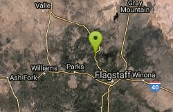
Barn Burner Course
Flagstaff, Arizona
15.0 miles NWNice fast smooth trail with some good climbing and a few technical sections.
Mountain Bike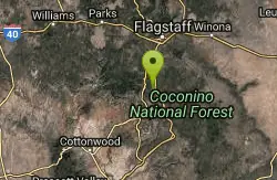
Willard Springs
Sedona, Arizona
18.6 miles SMultiple forest roads that are in poor driving condition. There are about 1' deep ruts and washouts.
Mountain Bike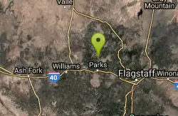
Spring Valley Loop
Williams, Arizona
22.1 miles WThe Spring Valley Loop offers a ride on remote roads and trails with good views and abundant wildlife. Since the route serves as a cross country ski trail in winter, it offers the fat...
Mountain Bike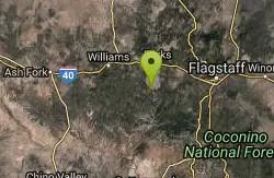
Sycamore Rim Trail
Parks, Arizona
23.5 miles WMost people come to this ride for the view of Sycamore Canyon at the overlook, but the scenery along the way is worth the trip, too. The ride starts out in a ponderosa pine forest where...
Mountain Bike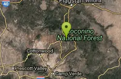
Schnebly Hill Trail
Sedona, Arizona
25.5 miles SThe Schnebly Hill Trail dead ends at the wilderness area, but can be accessed from a road at the top. Essentially this trail functions as the upper half of the Munds Wagon trail,...
Mountain Bike 8.5 mi
Munds Wagon Trail
Sedona, Arizona
25.9 miles SMunds Wagon Trail is different from many of the other more “classic†rides around Sedona. If you come from somewhere else and are missing the feel of loose rocks...
Hike, Mountain Bike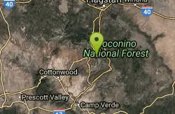
Cow Pies
Sedona, Arizona
26.2 miles SThe Cow Pies trail functions as a climb up to the Hangover trail from the Munds Wagon Trail. Much of this trail is sweet, sweet slickrock, with awesome views.
Mountain Bike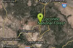
Jim Thompson
Sedona, Arizona
26.6 miles SWThis trail is best ridden west to east unless you like a serious climb. Either way, you'll be treated to some great scenery. Much of the trail is wide and covered with loose rocks....
Mountain BikeNearby Campsites

Cave Springs
Sedona, Arizona
18.9 miles SWCave Springs Campground is a scenic campground that sits in Oak Creek Canyon. Cave Springs is nestled perfectly in the town of Sedona, giving the campground the notorious Sedona red views. Uniquely,...
Camp, Hike, Swim
Chavez Crossing
Sedona, Arizona
29.3 miles SWChavez Crossing is a campground in Sedona, Arizona. It sits perfectly nestled in Arizona's most beautiful red rock attractions along with the grand summer sunsets. If that didn't sound...
Camp, Hike, Swim
Beaver Creek Dispersed Camping
39.8 miles S
Free dispersed camping on the cliffs above Beaver Creek.
Camp
Beaver Creek Campground
Camp Verde, Arizona
39.8 miles SCamp, Canoe, Kayak, and Swim near Camp Verde, Arizona
Camp, Canoe, Kayak, Swim


