


76 Things to do near Tapeats Creek to Deer Creek
first prev 1 2 3 4 next lastShowing results within 50 miles Distance miles of Unnamed Road, North Rim, AZ 86052, USA City, Zip, or Address
Bill Hall Trail
North Rim, Arizona
4.1 miles NEBill Hall Trail offers a rugged North Rim descent into the Grand Canyon — a serious route for experienced hikers seeking solitude on the Arizona strip side.
Hike
Thunder River and Tapeats Creek Trail
North Rim, Arizona
4.9 miles NEA 25-mile out-and-back hike on the North Rim leading to Thunder River and Tapeats Creek — recommended only for very experienced outdoorsmen and primarily used for hiking and rock climbing.
Backpack, Camp, Hike
Deer Creek to Colorado River
North Rim, Arizona
4.9 miles NEA scenic Grand Canyon backcountry route leading to Deer Creek and the Colorado River via the Bill Hall Trail — a rewarding wilderness hike in northern Arizona.
Backpack, Camp, Hike
Bill Hall Trail to Monument Point
North Rim, Arizona
4.9 miles NEBill Hall Trail to Monument Point on the Grand Canyon's North Rim — a scenic hike with views into the canyon. Check AllTrails for current conditions.
Backpack, Hike
Rainbow Rim Trail - North Rim of the Grand Canyon
North Rim, Arizona
6.3 miles ESweet Grand Canyon singletrack through ponderosa and aspen forest with great views — doable for almost any rider on this North Rim gem.
Hike, Mountain Bike
North Rim Loop
North Rim, Arizona
6.5 miles NEA scenic loop along the North Rim of the Grand Canyon in Arizona.
Mountain Bike
North Bass Trail
North Rim, Arizona
7.1 miles EA remote North Rim backcountry trail reached via a network of forest service roads, descending to Swamp Point on the Powell Plateau in Grand Canyon NP.
Backpack, Camp, Hike
North Bass Trail to Muav Cabin
North Rim, Arizona
7.1 miles EA backcountry hike to Muav Cabin on the North Bass Trail in the Grand Canyon's remote North Rim.
Backpack, Hike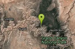
Powell Plateau Trail
North Rim, Arizona
7.1 miles EA rewarding plateau-top day hike or backpack to a remote North Rim plateau, where hikers with enough water can wander for days visiting rim overlooks and hidden draws.
Backpack, Camp, Hike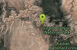
South Bass Trail
Supai, Arizona
14.0 miles SA strenuous 15.6-mile round-trip remote hike in Grand Canyon with no water at the trailhead, 4,400 feet of descent to the Colorado River, and no established campsites below the rim.
Backpack, Camp, Hike
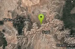
Tuckup Trail
17.3 miles W
A remote Arizona trail in the Grand Canyon area — the Tuckup Trail is a backcountry route for experienced hikers.
Hike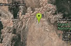
Havasu Falls and Mooney Falls Trail
Supai, Arizona
19.8 miles SWA 12-mile trek into the Havasupai Indian Reservation drops through steep switchbacks and a narrowing canyon to turquoise waterfalls, the Indian town of Supai, and a campground along the creek.
Backpack, Camp, Hike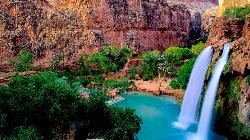
Havasu Falls Trail
Flagstaff, Arizona
19.8 miles SWThe legendary turquoise waterfalls of Havasu Canyon on the Havasupai Reservation — a permit-only, roughly 10-mile hike to one of the Southwest's most unforgettable desert oases.
Backpack, Dive, Horseback, Swim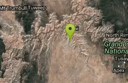
Havasupai Falls
Supai, Arizona
19.8 miles SWAn eight-mile hike or horseback ride through the remote western Grand Canyon to the village of Supai and Havasupai Falls — accessible only by foot, horse, or helicopter.
Backpack, Camp, Hike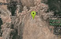
Havasu Canyon Trail
Supai, Arizona
19.8 miles SWA classic hike into Havasu Canyon, home of the stunning turquoise Havasupai waterfalls in the Grand Canyon region of Arizona.
Hike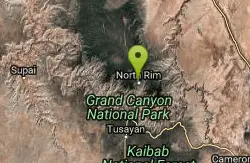
Widforss Trail - Short Option
North Rim, Arizona
24.7 miles SEA short option on the Widforss Trail at the Grand Canyon's North Rim — a scenic rim hike with views into the canyon.
Hike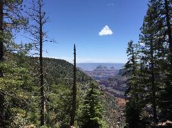
Widforss Trail
North Rim, Arizona
24.7 miles SEA peaceful 10-mile forested hike along the North Rim to Widforss Point, weaving in and out of the woods with stunning Grand Canyon views and rock ledges to rest and soak it all in.
Backpack, Hike 6.3 mi
Tiyo Point Trail
North Rim, Arizona
25.0 miles SEA lightly traveled primitive North Rim trail through encroaching forest with old markers on trees, wildflowers, gentle rolling terrain, and a single picnic area near the end.
Backpack, Camp, Hike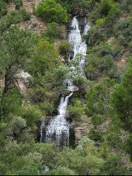
North Kaibab Trail to Roaring Springs
North Rim, Arizona
25.3 miles SEA well-shaded, mule-frequented descent on the North Rim of the Grand Canyon, with incredible views, wildflowers, birdwatching, and water stations — a 6-to-9-hour day hike.
Backpack, Hike
North Kaibab Trail to Colorado River
North Rim, Arizona
25.4 miles SEA steep, well-maintained, and well-marked trail dropping from the North Rim to the Colorado River — perfect for experienced hikers ready for serious elevation change.
Backpack, Camp, Hike


