


Havasu Falls and Mooney Falls Trail
Supai, Arizona
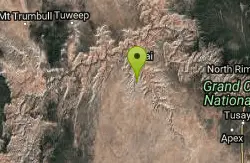
| Address: | ~Havasu Falls Trail, Supai, AZ 86435, USA |
| GPS: |
36°9'35.8"N 112°42'33.1"W Maps | Directions |
| State: | Arizona |
| Trail Length: | 22.10 miles |
| Elevation Gain: | 3448.00 feet |
| Hike Difficulty: | Advanced |
| Trail Type: | Out & Back |
Pet Friendly
Backpack, Camp, and Hike
The Havasupai Indian Reservation is not part of the Grand Canyon National Park, but you cannot tell that from the scenery. From your very first step at the trailhead parking lot until your return at the end of your trip, you will be swiveling your head side to side to take it all in. The water is a turquoise blue/green and the perfect way to refresh the tired legs and back after the 12 mile trek down to the campground. Hitting the trail The parking lot at the trailhead is stunning to say the least. It is perched more than 1000 feet above the valley floor and provides one of the best vistas of the trip. The trail starts with a steep descent down the face of the box canyon to the valley floor by way of a series of switchbacks. If you have creaky knees, you will definitely feel this descent! Be on the lookout for the approaching mules. They have the right-of-way, and won't stop to wait for you to move to the side. Once you reach the valley floor, the trail bends to the north and follows the wash for 8 miles into the Indian town of Supai. Along the way, the canyon walls draw closer and the surroundings become more grand. You get a sense for the true size of the canyon walls when then tower hundreds of feet straight up as you make your way down the canyon. There is more shade in this narrow section of trail. The sun doesn't have the angle to penetrate the canyon and it helps to keep temperatures down. In this slot section ( which starts at about mile 7), you really need to watch for the mule packs. As they approach, move to the canyon wall side and not the cliff side. The wrong move could be disastrous as these animals move through. At the end of the slot section, it opens and the Havasu Creek comes in from the right side. As you cross the open expanse, following the trail as it curves to the left, you will hear the water for the first time. It comes into view as you enter the heavier vegetation. The town of Supai is close. You will follow the irrigation channel into Supai. The two miles following the town of Supai are packed with waterfalls, blue-green water, and tons of photo opportunities. It's just 2 miles to Havasu Falls from Supai. The campground and Mooney Falls are just beyond that. Courtesy of AllTrails.com
More Information
Grand Canyon National Park Itinerary
This Grand Canyon National Park Itinerary will help you get started as you plan your vacation to Grand Canyon National Park.
https://www.justgotravelstudios.com/collections/national-park-itineraries/products/grand-canyon-national-park-itinerary?ref=9zpxis0diinHavasupai Backpacking Guide
Overview People often say ‘Havasupai’, when referring to Havasu Canyon, a tributary of the Grand Canyon. It has been made famous by illustrious images of turquoise waterfalls set in red rock canyons and is a true oasis in the Arizona desert. This sacred land is stewarded by the Havasupai, meaning ‘people of the blue-green waters.’ They have lived here for at least 800 years and operate as an independent, sovereign tribe with their own constitution. The main attractions at Havasupai are as follows: Fiftyfoot Falls, Navajo Falls, Havasu Falls, Mooney Falls, Beaver Falls, and the confluence of Havasu Creek and
https://backobeyond.blog/havasupai-backpacking-guide/Be courteous, informed, and prepared. Read trailhead guidelines, stay on the trail, and don't feed the wildlife.
Read More
- Plan Ahead and Prepare
- Travel & camp on durable surfaces
- Dispose of waste properly
- Leave what you find
- Minimize campfire impacts
- Respect wildlife
- Be considerate of other visitors
Directions
- Get directions on Google Maps
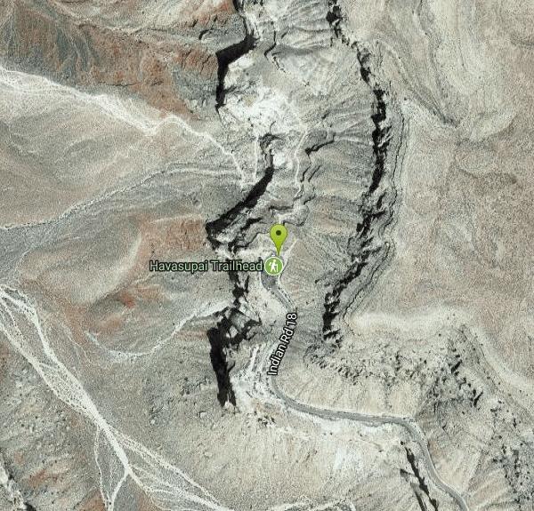
Other Hiking Trails and Backpacking Trails Nearby
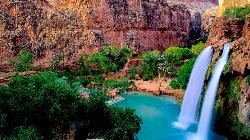
Havasu Falls Trail
Flagstaff, Arizona
0.0 miles SWThe legendary turquoise waterfalls of Havasu Canyon on the Havasupai Reservation — a permit-only, roughly 10-mile hike to one of the Southwest's most unforgettable desert oases.
Backpack, Dive, Horseback, Swim 
Havasupai Falls
Supai, Arizona
0.0 miles SWAn eight-mile hike or horseback ride through the remote western Grand Canyon to the village of Supai and Havasupai Falls — accessible only by foot, horse, or helicopter.
Backpack, Camp, Hike 
Havasu Canyon Trail
Supai, Arizona
0.0 miles SWA classic hike into Havasu Canyon, home of the stunning turquoise Havasupai waterfalls in the Grand Canyon region of Arizona.
Hike 
Tuckup Trail
15.7 miles N
A remote Arizona trail in the Grand Canyon area — the Tuckup Trail is a backcountry route for experienced hikers.
Hike 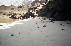
South Bass Trail
Supai, Arizona
18.6 miles EA strenuous 15.6-mile round-trip remote hike in Grand Canyon with no water at the trailhead, 4,400 feet of descent to the Colorado River, and no established campsites below the rim.
Backpack, Camp, Hike 
North Bass Trail
North Rim, Arizona
23.4 miles NEA remote North Rim backcountry trail reached via a network of forest service roads, descending to Swamp Point on the Powell Plateau in Grand Canyon NP.
Backpack, Camp, Hike 
North Bass Trail to Muav Cabin
North Rim, Arizona
23.4 miles NEA backcountry hike to Muav Cabin on the North Bass Trail in the Grand Canyon's remote North Rim.
Backpack, Hike 
Powell Plateau Trail
North Rim, Arizona
23.4 miles NEA rewarding plateau-top day hike or backpack to a remote North Rim plateau, where hikers with enough water can wander for days visiting rim overlooks and hidden draws.
Backpack, Camp, Hike 
Bill Hall Trail
North Rim, Arizona
23.7 miles NEBill Hall Trail offers a rugged North Rim descent into the Grand Canyon — a serious route for experienced hikers seeking solitude on the Arizona strip side.
Hike 
Thunder River and Tapeats Creek Trail
North Rim, Arizona
24.5 miles NEA 25-mile out-and-back hike on the North Rim leading to Thunder River and Tapeats Creek — recommended only for very experienced outdoorsmen and primarily used for hiking and rock climbing.
Backpack, Camp, Hike 
Rainbow Rim Trail - North Rim of the Grand Canyon
North Rim, Arizona
24.9 miles NESweet Grand Canyon singletrack through ponderosa and aspen forest with great views — doable for almost any rider on this North Rim gem.
Hike, Mountain Bike 
Hermits Rest Viewpoint to Dripping Springs Trail
Grand Canyon Village, Arizona
28.6 miles EThe hike to Dripping Springs via the Hermit Trail is a rugged, uncrowded Grand Canyon South Rim trek to a fern-fringed spring overhang.
Backpack, Hike 7.7 mi
Waldron Trail
Grand Canyon Village, Arizona
28.6 miles EA short but demanding 4.9-mile Grand Canyon hike branching off Hermit Trail, packed with views and adventure — bring a water treatment kit and prepare for dehydration, flash flooding, and overexertion.
Hike 
Hermit's Rest Viewpoint to Santa Maria Spring
Grand Canyon Village, Arizona
28.6 miles EThe Hermit Trail to Santa Maria Spring is a rugged, uncrowded Grand Canyon South Rim hike with steep switchbacks and huge views.
Backpack, Hike 
Boucher Trail
Grand Canyon Village, Arizona
28.6 miles EA remote 17.7-mile out-and-back trail to the Colorado River at the base of the Grand Canyon — recommended for very experienced adventurers only, best March through October.
Backpack, Hike 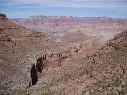
Boucher Trail to Hermit Trail Loop
Grand Canyon Village, Arizona
28.6 miles EA demanding 3–4 day backpacking loop on the Grand Canyon's South Rim — even seasoned hikers consider the Boucher Trail the most difficult and hazardous South Rim route.
Backpack, Camp, Hike 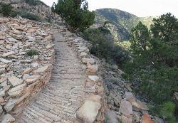
Hermit's Rest Viewpoint to Tonto Trail to Bright Angel Trail
Grand Canyon Village, Arizona
28.6 miles EA multi-day Grand Canyon backpacking route crossing the Tonto Trail from Hermit's Rest to Bright Angel — spectacular inner canyon views with limited water sources and 3,000-foot rim access by foot only.
Backpack, Camp, Hike 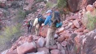
Hermit Trail
Grand Canyon Village, Arizona
28.6 miles EA strenuous, less-crowded Grand Canyon backpacking trail with 2,000 feet of descent in the first 2.5 miles, Cathedral stairs, Redwall cliffs, and fossilized animal tracks.
Backpack, Camp, Hike 8.4 mi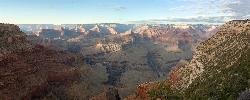
Grand Canyon Rim Village to Hermits Rest
Grand Canyon Village, Arizona
32.3 miles EA bus-accessible, kid-friendly trail from the Grand Canyon Rim Village to the historic 1914 Hermits Rest cabin — featuring stunning river views, wildflowers, wildlife, and a gift shop and snack bar at the end.
Backpack, Hike 4.9 mi
Bright Angel Trail to Tonto Trail
Grand Canyon Village, Arizona
32.3 miles EA rugged 12.4-mile point-to-point through Grand Canyon's inner gorge on the South Kaibab–Tonto Trail corridor, with over 3,000 feet of elevation gain — advanced hikers only.
Backpack, Camp, HikeNearby Campsites
Havasupai Falls
Supai, Arizona
0.0 miles SWAn eight-mile hike or horseback ride through the remote western Grand Canyon to the village of Supai and Havasupai Falls — accessible only by foot, horse, or helicopter.
Backpack, Camp, Hike
South Bass Trail
Supai, Arizona
18.6 miles EA strenuous 15.6-mile round-trip remote hike in Grand Canyon with no water at the trailhead, 4,400 feet of descent to the Colorado River, and no established campsites below the rim.
Backpack, Camp, Hike
North Bass Trail
North Rim, Arizona
23.4 miles NEA remote North Rim backcountry trail reached via a network of forest service roads, descending to Swamp Point on the Powell Plateau in Grand Canyon NP.
Backpack, Camp, Hike
Powell Plateau Trail
North Rim, Arizona
23.4 miles NEA rewarding plateau-top day hike or backpack to a remote North Rim plateau, where hikers with enough water can wander for days visiting rim overlooks and hidden draws.
Backpack, Camp, Hike
Thunder River and Tapeats Creek Trail
North Rim, Arizona
24.5 miles NEA 25-mile out-and-back hike on the North Rim leading to Thunder River and Tapeats Creek — recommended only for very experienced outdoorsmen and primarily used for hiking and rock climbing.
Backpack, Camp, Hike
Boucher Trail to Hermit Trail Loop
Grand Canyon Village, Arizona
28.6 miles EA demanding 3–4 day backpacking loop on the Grand Canyon's South Rim — even seasoned hikers consider the Boucher Trail the most difficult and hazardous South Rim route.
Backpack, Camp, Hike
Hermit's Rest Viewpoint to Tonto Trail to Bright Angel Trail
Grand Canyon Village, Arizona
28.6 miles EA multi-day Grand Canyon backpacking route crossing the Tonto Trail from Hermit's Rest to Bright Angel — spectacular inner canyon views with limited water sources and 3,000-foot rim access by foot only.
Backpack, Camp, Hike
Hermit Trail
Grand Canyon Village, Arizona
28.6 miles EA strenuous, less-crowded Grand Canyon backpacking trail with 2,000 feet of descent in the first 2.5 miles, Cathedral stairs, Redwall cliffs, and fossilized animal tracks.
Backpack, Camp, Hike 4.9 mi
Bright Angel Trail to Tonto Trail
Grand Canyon Village, Arizona
32.3 miles EA rugged 12.4-mile point-to-point through Grand Canyon's inner gorge on the South Kaibab–Tonto Trail corridor, with over 3,000 feet of elevation gain — advanced hikers only.
Backpack, Camp, Hike 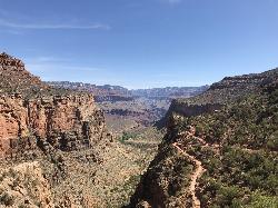
Bright Angel Trail to Three-Mile Rest house
Grand Canyon Village, Arizona
32.4 miles EA steep 5.4-mile out-and-back trail descending into the Grand Canyon with 360-degree canyon views and extreme switchbacks — water and pit toilets at the Three-Mile Resthouse turnaround point.
Backpack, Camp, Hike 4.5 mi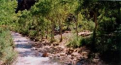
Bright Angel Trail to Bright Angel Campground and River Trail
Grand Canyon Village, Arizona
32.4 miles EThe Bright Angel Trail is the Grand Canyon's most storied hike — South Rim to the Colorado River past tunnels, pictographs, Havasupai Gardens, and the Devil's Corkscrew.
Backpack, Camp, Hike, Rock Climb 1.5-9.8 mi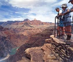
The Bright Angel Trails
Grand Canyon Village, Arizona
32.4 miles EMultiple Bright Angel Trail routes range from a 5.4-mile out-and-back to the Three-Mile Resthouse to a 19-mile trek to the river, with the 12.4-mile South Kaibab–Tonto–Bright Angel point-to-point offering over 3,000 feet of Grand Canyon grandeur.
Backpack, Camp, Hike, Horseback 0.6 mi
Mather Campground Trail
Grand Canyon Village, Arizona
34.0 miles EA 1-mile connector trail adjacent to Mather Campground on the Grand Canyon South Rim — flat and easy for biking, running, or walking with pets on leash; campground has RV options nearby.
Camp, Hike, Mountain Bike 
Grand Canyon South Rim Area Campgrounds
Grand Canyon Village, Arizona
35.5 miles ECampgrounds at the Grand Canyon's South Rim, one of the most iconic settings in the American Southwest.
Camp 
Clear Creek Trail
Grand Canyon Village, Arizona
35.7 miles EA 4–6 day Grand Canyon backpack deep into a fascinating, off-the-beaten-track drainage — bring plenty of water, as Clear Creek is the only reliable source on trail.
Backpack, Camp, Hike 13.6 mi
South Kaibab Trails
Grand Canyon Village, Arizona
35.7 miles ESeven miles of ridgeline descent from Yaki Point to the canyon floor — no shade, no water on trail, and the best unobstructed Grand Canyon panoramas you'll find on any hike.
Camp, Hike, Horseback 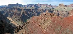
South Kaibab to Phantom Ranch to Bright Angel Trail
Grand Canyon Village, Arizona
35.7 miles EA difficult but spectacular multi-day Grand Canyon hike combining South Kaibab's stunning rim views with Phantom Ranch's riverside oasis and Bright Angel's shaded water stations.
Backpack, Camp, Hike 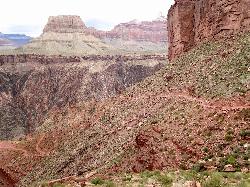
South Kaibab to North Kaibab to Bright Angel Trail
Grand Canyon Village, Arizona
35.7 miles EThe Grand Canyon's legendary Rim-to-Rim-to-Rim route — 44 miles and 20,000 feet of elevation change combining South Kaibab, North Kaibab, and Bright Angel trails for an epic multi-day adventure.
Backpack, Camp, Hike 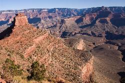
The Grand Canyon: Kaibab to Bright Angel Trail
Grand Canyon Village, Arizona
35.7 miles EAn unforgettable 2-3 day hike combining the South Kaibab's unbeatable views with the shaded, water-rich Bright Angel Trail — staring up at the canyon from the river below.
Backpack, Camp, Hike 6.3 mi
Tiyo Point Trail
North Rim, Arizona
36.4 miles EA lightly traveled primitive North Rim trail through encroaching forest with old markers on trees, wildflowers, gentle rolling terrain, and a single picnic area near the end.
Backpack, Camp, Hike


