


233 Things to do near Trail 1A
first prev 3 4 5 6 7 8 9 10 11 12 next lastShowing results within 50 miles Distance miles of E Dreamy Draw Bikeway, Phoenix, AZ 85028, USA City, Zip, or Address

Hawe's Loop
Mesa, Arizona
20.2 miles EMost of the trails in the Phoenix metropolitan area were originally built by mountain bikers, and the Hawe's loop trail system and trail are no exeptions. This trail features fantastic...
Hike, Mountain Bike 1.3 mi
Ridge Trail
Mesa, Arizona
20.2 miles EThe trails within the Hawes loop system were originally built by mountain bikers for mountain bikers, so the trails feature fantastic singletrack that twist and turn for miles. Be warned,...
Mountain Bike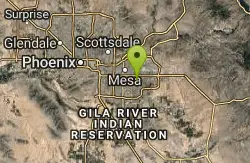
Freestone Park
Gilbert, Arizona
20.4 miles SEMostly flat and open. The last couple of holes play around the Rec Center, making use of OB parking lot and some trees. Practice basket. Public (No Fee)
Disc Golf
East Maricopa Floodway
Mesa, Arizona
20.5 miles SEWith a primary entrance located at the intersection between Main Street and Higley Road, the East Maricopa Floodway provides riding to cyclists and mountain bikers. The surface of the floodway...
Mountain Bike
Freestone Skatepark
Gilbert, Arizona
20.6 miles SEThis 23,000-square-foot Site Design Group-built concrete park is rumored to rival the companys masterpiece in Chandler, Arizona. Freestone features a street plaza and two bowls. As an added bonus,...
Skateboard
Discovery Trail
Peoria, Arizona
20.8 miles NWDiscovery Trail is a path within Peoria, Arizona for residents of Vistancia. This concrete paved, 3.5 mile path meant for walking, running, and biking. Yoga, stargazing, and picnicking are...
Hike 2.1 mi

Lower Salt River Nature Trail
Fort McDowell, Arizona
21.2 miles EThe Lower Salt River Nature Trail is a scenic walk to take at the Tonto National Forest. This trail provides stunning views as you walk alongside the Salt River. This rustic trail is older and less...
Camp, Hike 8.3 mi
Estrella Mountains Competitive Track
Tolleson, Arizona
21.3 miles SWThe third competitive track in the Maricopa County Regional Park system, located in Estrella Mountain Regional Park, was completed in February 2000. The track consists of two loops totaling 13 miles....
Hike, Horseback, Mountain Bike
Whiskey Bottle Trail
Scottsdale, Arizona
21.4 miles NEThe trail starts off with sandy single-track then starts a gradual ascent up the side of Fraesfield mountain. The trail then sharply increases (total of 800' elevation gain) and becomes...
Mountain Bike
Riparian Preserve at Water Ranch Trail
Gilbert, Arizona
21.8 miles SEThe Riparian Preserve is an urban park with a series of loop trails surrounding seven ponds stocked with fish and birds. It is located at 2757 E. Guadalupe Road, Gilbert AZ. Several...
Canoe, Hike
Red Mountain - North
Mesa, Arizona
22.5 miles SEThe North course is the more challenging of the two courses on site. It begins in the desert and works it way back into the park. Bring lots of water and be prepared for desert plant life, as well as...
Disc Golf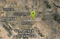
Red Mountain - South
Mesa, Arizona
22.5 miles SEEntirely in desert, this is the easier of the two courses on site. Bring water and be prepared for the desert terrain. There are plenty of big trees to challenge as well. Note: rattlesnakes have been...
Disc Golf
Baseline Trail
Goodyear, Arizona
23.3 miles SWThe Baseline trail is a 2.6 mile loop at Estrella Mountain Regional Park. This listing is based on access from a spur trail (33.378981, -112.371072) off of the Gila trail. Access is...
Hike
Emery Henderson
Phoenix, Arizona
23.6 miles NBct(Black Canyon Trail) trail head features paved parking and restrooms. From here you can head south on relatively flat ground, or North, working into the desert hills, on multiuse...
Mountain Bike 13.8 mi
Butterfield to Gadsen Loop Trail
Goodyear, Arizona
23.7 miles SWAs with other trails in Estrella, the trail is wide and the surface tends to be rather benign, varying from mostly smooth, to occasionally strewn with small rocks, sandy in the washes. Butterfield...
Hike, Horseback, Mountain Bike 2.9 mi
Coldwater Trail
Goodyear, Arizona
23.7 miles SWThe Cold Water Trail #27 is a seldom visited, remote backcountry destination along the backdrop of the rugged Verde Rim with healthy mixed vegetation and unique geology. The trail was originally used...
Hike, Horseback, Mountain Bike 1.0 mi
Quail Trail
Goodyear, Arizona
23.8 miles SWQuail Trail is the access trail from the Nature Center to the main trail system. It is a pretty steep climb, but smooth and steady. Quail Trail is a spur trail in the Estrella Mountain...
Hike, Horseback, Mountain Bike
Estrella Mountain Park
Goodyear, Arizona
23.9 miles SWNice mix of singletrack and doubletrack. One way loops, long loop and tech loop. A few mild climbs and some mild rock gardens, just let it ride. There is a lot of loose rocks on the...
Mountain Bike 3.6 mi
Toothaker Trail
Goodyear, Arizona
23.9 miles SWToothaker is an easy roller coaster of a trail. It crosses numerous washes ranging from small to large and can be a tad loose and/or rocky in some sections. The end reward is a nice view of Rainbow...
Hike, Horseback, Mountain Bike
Dysart Trail
Goodyear, Arizona
23.9 miles SW$6 entry fee per car.
Hike, Horseback, Mountain Bike


