


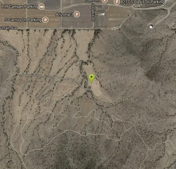
Estrella Mountains Competitive Track
Tolleson, Arizona

| Address: | ~Junior Loop, Tolleson, AZ 85353, USA |
| GPS: |
33°21'59.8"N 112°18'52.0"W Maps | Directions |
| State: | Arizona |
| Trail Length: | 9.90 miles |
| Trail Type: | Loop |
| Hike Difficulty: | Intermediate |
| Trails/Routes: | 8.3 mi |
Pet Friendly
Hike, Horseback, and Mountain Bike
The third competitive track in the Maricopa County Regional Park system, located in Estrella Mountain Regional Park, was completed in February 2000. The track consists of two loops totaling 13 miles. The long loop is 8 miles and is challenging, but may be used by persons of all skill levels. The technical loop is 5 miles and is recommended for experts only. All of the competitive tracks are primarily used by Mountain Bicyclists, but are also used from time-to-time by cross country runners and “endurance” horse riders. The tracks are designed for high speeds, racing events and fun. They feature steep climbs, and drops, fast corners, twists and turns and rugged rocky terrain. Courtesy of mountainbikeaz.com
More Information
Never modify trail features. Ride trails when they're dry enough that you won't leave ruts. Speak up when you see others on the trail and always yield to hikers, horses, and others coming uphill. Always ride on the established trail.
Read MoreBe courteous, informed, and prepared. Read trailhead guidelines, stay on the trail, and don't feed the wildlife.
Read More- Plan Ahead and Prepare
- Travel & camp on durable surfaces
- Dispose of waste properly
- Leave what you find
- Minimize campfire impacts
- Respect wildlife
- Be considerate of other visitors
Directions
From Tolleson, Arizona
- Head west on W Van Buren St toward N 93rd Ave (1.8 mi)
- Turn left onto N 107th Ave (2.0 mi)
- Turn right onto W Lower Buckeye Rd (1.0 mi)
- Turn left onto S Avondale Blvd (3.1 mi)
- Continue onto W Indian Springs Rd (0.7 mi)
- Turn left onto S Coyote LnRestricted usage road(0.3 mi)
- Turn right onto W Stagecoach RdRestricted usage road(210 ft)
- Turn left at the 1st cross street onto S Old Baseline RdRestricted usage road(0.1 mi)
- Turn right onto W South Mountain AveRestricted usage road(0.8 mi)
- Turn leftPartial restricted usage road(0.8 mi)
- Keep left (0.5 mi)
- Continue straight (0.1 mi)
- Turn leftDestination will be on the right(82 ft)


Trails
Distance ?
8.3 milesElevation Gain ?
-35 feetReal Ascent ?
902 feetReal Descent ?
937 feetAvg Grade (0°)
0%Grade (-14° to 12°)
-25% to 22%Elevation differences are scaled for emphasis. While the numbers are accurate, the cut-away shown here is not to scale.
Other Mountain Bike Trails, Hiking Trails, and Horseback Trails Nearby

Coldwater Trail
Goodyear, Arizona
3.1 miles WThe Cold Water Trail #27 is a seldom visited, remote backcountry destination along the backdrop of the rugged Verde Rim with healthy mixed vegetation and unique geology. The trail was originally used...
Hike, Horseback, Mountain Bike 13.8 mi
Butterfield to Gadsen Loop Trail
Goodyear, Arizona
3.1 miles WAs with other trails in Estrella, the trail is wide and the surface tends to be rather benign, varying from mostly smooth, to occasionally strewn with small rocks, sandy in the washes. Butterfield...
Hike, Horseback, Mountain Bike 3.6 mi
Toothaker Trail
Goodyear, Arizona
3.3 miles WToothaker is an easy roller coaster of a trail. It crosses numerous washes ranging from small to large and can be a tad loose and/or rocky in some sections. The end reward is a nice view of Rainbow...
Hike, Horseback, Mountain Bike
Estrella Mountain Park
Goodyear, Arizona
3.3 miles WNice mix of singletrack and doubletrack. One way loops, long loop and tech loop. A few mild climbs and some mild rock gardens, just let it ride. There is a lot of loose rocks on the...
Mountain Bike
Dysart Trail
Goodyear, Arizona
3.4 miles W$6 entry fee per car.
Hike, Horseback, Mountain Bike
Rainbow Valley to Toothaker Loop Trail
Goodyear, Arizona
3.4 miles WEstrella Mountain Regional Park has many trails within it, a great beginner to intermediate friendly trail is the Rainbow Valley to Toothaker Loop Trail. This 6.6 mile hike is mostly flat with a few...
Hike, Horseback, Mountain Bike
Baseline Trail
Goodyear, Arizona
3.4 miles WThe Baseline trail is a 2.6 mile loop at Estrella Mountain Regional Park. This listing is based on access from a spur trail (33.378981, -112.371072) off of the Gila trail. Access is...
Hike 1.0 mi
Quail Trail
Goodyear, Arizona
3.9 miles WQuail Trail is the access trail from the Nature Center to the main trail system. It is a pretty steep climb, but smooth and steady. Quail Trail is a spur trail in the Estrella Mountain...
Hike, Horseback, Mountain Bike
Black jack
Goodyear, Arizona
6.7 miles SWExtreme terrain, advance riders only.
Mountain Bike
South Mountain Park / National Trail
Phoenix, Arizona
9.1 miles ENational trail can be acended or decended. Both require expert skills and fitness. You cannot and will not find a climb this technical, challenging and fun in AZ. It will kick your...
Mountain Bike 12.6 mi
National Trail
Phoenix, Arizona
10.1 miles ENational Trail is the gem of South Mountain and home to the infamous Waterfall. It’s a local favorite as well as a destination trail for MTB snowbirds. Like most trails in the Sonoran...
Hike, Mountain Bike
Alta Trail And Bajada Trail
Phoenix, Arizona
10.2 miles EHike near Phoenix, Arizona
Hike
Quartz Peak Trail
12.4 miles S
Hike near
Hike 1.2 mi
Ma-Ha-Tauk Trail
Phoenix, Arizona
12.4 miles EMa-Ha-Tauk Trail can be found in South Mountain Park in Phoenix. This is a 2.5 mile, out-and-back trail. Aside from a short section of steeper incline in the first part of the hike, this is an...
Hike, Horseback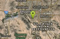
South Mountain Pyramid Trail
Phoenix, Arizona
13.1 miles EHike near Phoenix, Arizona
Hike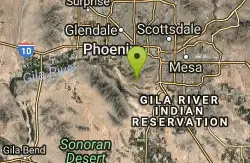
Pyramid Trail
Phoenix, Arizona
13.2 miles EHike near Phoenix, Arizona
Hike
Max Delta
Phoenix, Arizona
13.8 miles EThis trails follows close to San Juan Rd. Part of the trail is rocky while other parts are well just dirt. Max Delta Trail is a 2.7 mile trail within Phoenix, Arizona on the South Mountain...
Hike 0.8-1.0 mi
Kiwanis Trail to Telegraph Pass Lookout
Phoenix, Arizona
13.9 miles EAn ideal hike to take children on as the distance is short and the elevation gain is not extreme. Avid hikers have opportunities to embark on longer hikes into South Mountain. ... This short hike is...
Hike, Mountain Bike 0.2-5.0 mi
Holbert Trail to Dobbins Lookout
Phoenix, Arizona
14.1 miles EStart out at the main entrance to South Mountain and make a left past the vistor's center. Go to the end of the road to the beginning of Holbert Trail. Get to the top and make a right to Dobbins...
Hike
Holbert-Hidden Valley-Mormon Trail Shuttle
Phoenix, Arizona
14.2 miles EHolbert- Hidden Valley- Mormon Trail is a combination trail hike on the north side of South Mountain near Phoenix, Arizona. This trail is approximately 6.5 miles long, and is suitable for...
Hike, Mountain BikeNearby Campsites

Lower Salt River Nature Trail
Fort McDowell, Arizona
39.6 miles EThe Lower Salt River Nature Trail is a scenic walk to take at the Tonto National Forest. This trail provides stunning views as you walk alongside the Salt River. This rustic trail is older and less...
Camp, Hike
Buckhorn Campground Nature Trail
Apache Junction, Arizona
40.7 miles ECamp and Hike near Apache Junction, Arizona
Camp, Hike


