


Baseline Trail
Goodyear, Arizona
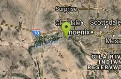
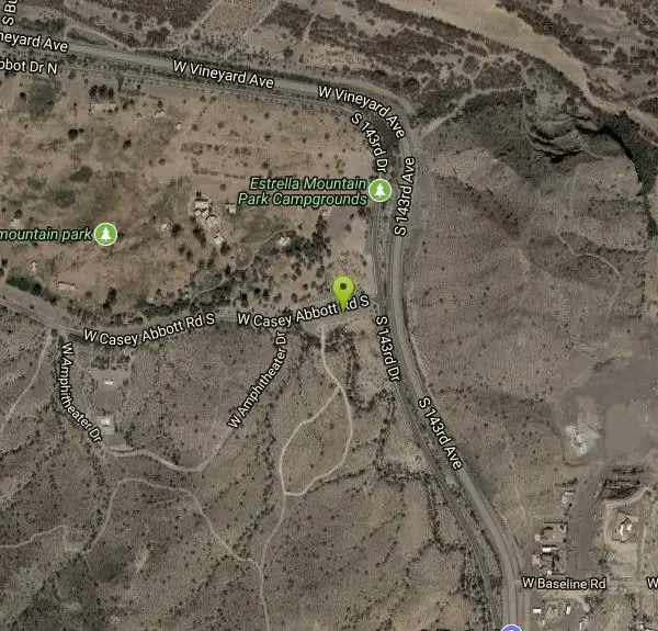
| Address: | ~14327-14379 W Casey Abbott Rd S, Goodyear, AZ 85338, USA |
| GPS: |
33°22'55.0"N 112°22'11.6"W Maps | Directions |
| State: | Arizona |
| Trail Length: | 2.40 miles |
| Elevation Gain: | 259.00 feet |
| Hike Difficulty: | Beginner |
| Trail Type: | Loop |
Pet Friendly
Hike
The Baseline trail is a 2.6 mile loop at Estrella Mountain Regional Park. This listing is based on access from a spur trail (33.378981, -112.371072) off of the Gila trail. Access is also available from the BA Spur Trail, the Toothacher Trail and several other spur trails. The Baseline trail is a pretty easy trail. there are some gravely sections though. If you prefer a steep climb, hike this loop counter clockwise. Other wise you will encounter a steep descent. Either way it will get your heart pumping. $6 entry fee per car. Courtesy of AllTrails.com
More Information
Add ResourceBe courteous, informed, and prepared. Read trailhead guidelines, stay on the trail, and don't feed the wildlife.
Read More- Plan Ahead and Prepare
- Travel & camp on durable surfaces
- Dispose of waste properly
- Leave what you find
- Minimize campfire impacts
- Respect wildlife
- Be considerate of other visitors
Directions
From Goodyear, Arizona
- Head west on W Western Ave toward S Litchfield Rd (157 ft)
- Turn left at the 1st cross street onto S Litchfield Rd (0.7 mi)
- Turn right onto MC 85 (1.2 mi)
- Turn left onto S Bullard Ave (2.0 mi)
- Turn right onto W Vineyard Ave (0.4 mi)
- Turn left onto Casey Abbot Dr N (1.0 mi)
- Continue onto S 143rd Dr (0.2 mi)
- Turn right onto W Casey Abbott Rd S (479 ft)
- Turn leftDestination will be on the left(299 ft)
Other Hiking Trails Nearby

Quail Trail
Goodyear, Arizona
0.6 miles WQuail Trail is the access trail from the Nature Center to the main trail system. It is a pretty steep climb, but smooth and steady. Quail Trail is a spur trail in the Estrella Mountain...
Hike, Horseback, Mountain Bike 13.8 mi
Butterfield to Gadsen Loop Trail
Goodyear, Arizona
0.8 miles SAs with other trails in Estrella, the trail is wide and the surface tends to be rather benign, varying from mostly smooth, to occasionally strewn with small rocks, sandy in the washes. Butterfield...
Hike, Horseback, Mountain Bike
Rainbow Valley to Toothaker Loop Trail
Goodyear, Arizona
0.8 miles SEstrella Mountain Regional Park has many trails within it, a great beginner to intermediate friendly trail is the Rainbow Valley to Toothaker Loop Trail. This 6.6 mile hike is mostly flat with a few...
Hike, Horseback, Mountain Bike 2.9 mi
Coldwater Trail
Goodyear, Arizona
0.8 miles SThe Cold Water Trail #27 is a seldom visited, remote backcountry destination along the backdrop of the rugged Verde Rim with healthy mixed vegetation and unique geology. The trail was originally used...
Hike, Horseback, Mountain Bike
Dysart Trail
Goodyear, Arizona
0.8 miles S$6 entry fee per car.
Hike, Horseback, Mountain Bike 3.6 mi
Toothaker Trail
Goodyear, Arizona
0.8 miles SToothaker is an easy roller coaster of a trail. It crosses numerous washes ranging from small to large and can be a tad loose and/or rocky in some sections. The end reward is a nice view of Rainbow...
Hike, Horseback, Mountain Bike 8.3 mi
Estrella Mountains Competitive Track
Tolleson, Arizona
3.4 miles EThe third competitive track in the Maricopa County Regional Park system, located in Estrella Mountain Regional Park, was completed in February 2000. The track consists of two loops totaling 13 miles....
Hike, Horseback, Mountain Bike 4.8 mi
Lost Creek Petroglyph Trail
Buckeye, Arizona
11.9 miles NWStarting at Verrado's trailhead, the trail heads a short ways to a petroglyph site. While a little rocky at times, the trail is easy. To deter vandals, a very necessary fence with barbed-wire has...
Hike, Mountain Bike 12.6 mi
National Trail
Phoenix, Arizona
13.5 miles ENational Trail is the gem of South Mountain and home to the infamous Waterfall. It’s a local favorite as well as a destination trail for MTB snowbirds. Like most trails in the Sonoran...
Hike, Mountain Bike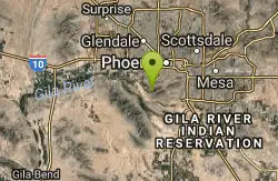
Alta Trail And Bajada Trail
Phoenix, Arizona
13.5 miles EHike near Phoenix, Arizona
Hike
Quartz Peak Trail
14.7 miles SE
Hike near
Hike
South, Bajada, Mule Deer Loop Trail
Waddell, Arizona
14.8 miles NWSouth - Bajada - Mule Deer Loop is a 4.1 mile loop trail located near Waddell, Arizona that offers the chance to see wildlife. The trail is rated as moderate and is accessible from...
Hike, Horseback, Mountain Bike
Goat Camp Trail
Buckeye, Arizona
15.1 miles NWGoat Camp Trail is a well-liked mountain biking and hiking trail in White Tank Mountain Regional Park. This is a 16 mile out-and-back trail that is rated as advanced due to the length, as well as the...
Hike, Mountain Bike 1.2 mi
Ma-Ha-Tauk Trail
Phoenix, Arizona
15.7 miles EMa-Ha-Tauk Trail can be found in South Mountain Park in Phoenix. This is a 2.5 mile, out-and-back trail. Aside from a short section of steeper incline in the first part of the hike, this is an...
Hike, Horseback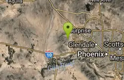
Black Rock Loop Trail
Waddell, Arizona
15.9 miles NWBlack Rock Trail is a 1.3 mile loop trail located near Waddell, Arizona and is good for all skill levels. The trail is primarily used for hiking and is accessible year round. Black...
Hike
Wildlife Trail
Waddell, Arizona
16.0 miles NWA short trail which terminates at a small pond.
Hike, Horseback
Mule Deer Trail (Maricopa Trail)
Waddell, Arizona
16.0 miles NWMule Deer trail is a 3.5 mile out-and-back trail that it part of the Maricopa Trail within White Tank Mountain Regional Park. This is a beginner to moderate friendly trail for both hikers and...
Hike, Horseback, Mountain Bike
South Mountain Pyramid Trail
Phoenix, Arizona
16.5 miles EHike near Phoenix, Arizona
Hike
Pyramid Trail
Phoenix, Arizona
16.5 miles EHike near Phoenix, Arizona
Hike 23.0 mi
Grand Canal Trail
Phoenix, Arizona
16.6 miles NEThe Grand Canal Trail is a 23-mile long system of paved and unpaved trails located in Glendale, Phoenix and Tempe that travels through...
HikeNearby Campsites

Lower Salt River Nature Trail
Fort McDowell, Arizona
42.4 miles EThe Lower Salt River Nature Trail is a scenic walk to take at the Tonto National Forest. This trail provides stunning views as you walk alongside the Salt River. This rustic trail is older and less...
Camp, Hike
Buckhorn Campground Nature Trail
Apache Junction, Arizona
43.7 miles ECamp and Hike near Apache Junction, Arizona
Camp, Hike


